
Quirindi is a small town on the North West Slopes region of New South Wales, Australia, in Liverpool Plains Shire. At the 2011 census, Quirindi had a population of 2,580. It is the nearest link to Gunnedah to the west and Tamworth to the north. The local economy is based on agriculture, with broadacre farming dominant on the black soil plains to the west and livestock grazing in the hilly eastern part of the district.
Foster is a dairying and grazing town 174 kilometres (108 mi) south-east of Melbourne on the South Gippsland Highway in Victoria, Australia. At the 2016 census Foster had an urban population of 1,164. It is about 20 kilometres (12 mi) north of the Gippsland coastline which includes Shallow Inlet, Corner Inlet, Waratah Bay, Yanakie and Wilsons Promontory.

Briagolong is a town in the Australian state of Victoria, located 20 kilometres north of Maffra and some 270 kilometres east of Melbourne, in the Shire of Wellington region of Gippsland. At the 2016 census, Briagolong had a population of 1,081.

Saltwater River is a rural locality in the local government area (LGA) of Tasman in the South-east LGA region of Tasmania. The locality is about 14 kilometres (8.7 mi) north of the town of Nubeena. The 2016 census has a population of 123 for the state suburb of Saltwater River.

Ensay is a small town located between Swifts Creek and Bruthen on the Great Alpine Road in East Gippsland, Victoria, Australia. Ensay is 80 kilometres (50 mi) north of the major town of Bairnsdale and 366 kilometres (227 mi) east of the state capital Melbourne. Other nearby towns include Omeo and Benambra.

Broadford is a small town in central Victoria, Australia. At the 2016 census, Broadford had a population of 4,319. The town is the headquarters of the Shire of Mitchell local government area and is approximately 73 kilometres (50 mi) north of the state capital, Melbourne.

Serpentine is a town in north west Victoria, Australia. Located on the Loddon Valley Highway, the town is 201 kilometres north west of the state capital, Melbourne and 51 kilometres north west of the regional centre, Bendigo. Serpentine is in the Shire of Loddon local government area and, including the surrounding state suburb, had a population of 192 at the 2016 census.

Oaklands is a town in the Riverina district of southern New South Wales, Australia. The town is located 615 kilometres south west of the state capital, Sydney and 105 kilometres north west of Albury. Oaklands is in the Federation Council local government area and at the 2011 census, had a population of 238.
Yerong Creek is a town in the Riverina area of southern New South Wales, Australia. It is about 46 kilometres (29 mi) south-west of Wagga Wagga on the Olympic Highway. At the 2016 census, Yerong Creek had a population of 173.

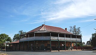
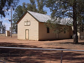
Ganmain is a town in the Riverina region of New South Wales, Australia. Ganmain is located around 55 kilometres (34 mi) north west of Wagga Wagga, and 50 kilometres (31 mi) east of Narrandera. Ganmain is in the Coolamon Shire local government area and had a population at the 2016 census of 779.
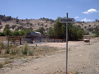
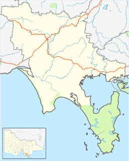
Kyeamba is a farming community in the central east part of the Riverina and situated about 16 kilometres (9.9 mi) north west of Humula and 23 kilometres (14 mi) south west of Tarcutta. At the 2016 census, Kyeamba had a population of 54.

Ournie is a rural community in the far south east part of the Riverina and situated about 15 kilometres north west from Welaregang and 20 kilometres south from Munderoo. Ournie is situated on the banks of the Ournie Creek which flows into the Murray River and the area is only about 4 kilometres from the border of Victoria.

Adjungbilly is a rural community in the central east part of the Riverina and on the north-western edge of the Snowy Mountains. It is situated about 29 kilometres south-east of Gobarralong and 35 kilometres north-east of Tumut.

Mullengandra is a village community in the south east part of the Riverina. It is situated by road, about 7 kilometres north east of Bowna and 8 kilometres south west of Woomargama. The town is on the Hume Highway north of Albury.
Greenvale is a rural community in the central east part of the Riverina. It is situated by road, about 8 kilometres south from Birrego and 12 kilometres north west from Boree Creek.

Birrego is a rural locality in the central part of the Riverina near Boree Creek, New South Wales, Australia. The countryside is flat and used predominantly for grain production. It is situated by road, about 13 kilometres south of Sandigo and 31 kilometres south east of Morundah.

Oberne is a rural community in the eastern part of the Riverina. It is situated about 10 kilometres north east of Humula and 18 kilometres south of Tarcutta.

Sunnynook is a hamlet in southern Alberta, Canada within Special Area No. 2. It is located approximately 10 kilometres (6.2 mi) east of Highway 36 and 86 kilometres (53 mi) northeast of Brooks. The hamlet formerly housed the Berry Creek Community School Division office and area post office until amalgamation of the school division into Prairie Land Regional Division.

The Sandy Creek, a perennial stream of the Richmond River catchment, is located in Northern Rivers region in the state of New South Wales, Australia.
Thomas Lankey is the Mayor of Edison, New Jersey, the state's 5th largest municipality by population, with about 101,000 residents. He won the November 2013 election and was sworn in on January 1, 2014. He was previously a town councilperson. Soon after taking office, Lankey said he would re-write the town's code of ethics. He won reelection in 2017, winning 58.7% of the vote.

