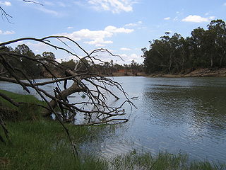
The Murray River is a river in Southeastern Australia. It is Australia's longest river at 2,508 km (1,558 mi) extent. Its tributaries include five of the next six longest rivers of Australia. Together with that of the Murray, the catchments of these rivers form the Murray–Darling basin, which covers about one-seventh the area of Australia. It is widely considered Australia's most important irrigated region.

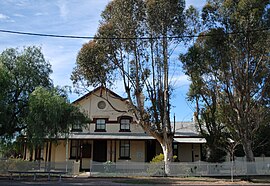
Mildura is a regional city in north-west Victoria, Australia. Located on the Victorian side of the Murray River, Mildura had a population of 34,565 in 2021. When nearby Wentworth, Irymple, Nichols Point, Merbein and Red Cliffs are included, the combined urban area had a population of 58,914 in 2021, having grown marginally at an average annual rate of 1.3% year-on-year over the preceding five years.

Wentworth is a small border town in the far south west of the state of New South Wales, Australia. It lies at the confluence of Australia's two most important rivers, the Darling and the Murray, the latter forming the border with the state of Victoria to the south. The border with the state of South Australia lies approximately 100 kilometres (62 mi) to the west. The town of Wentworth is in the local government area of the same name.

Balranald is a town within the local government area of Balranald Shire, in the Murray region of south-western New South Wales, Australia.

Hay is a town in the western Riverina region of south western New South Wales, Australia. It is the administrative centre of Hay Shire local government area and the centre of a prosperous and productive agricultural district on the wide Hay Plains.
Sunraysia is a region located in northwestern Victoria and southwestern New South Wales in Australia. The region is renowned for its sunshine, intensive horticulture including grapes and oranges. Its main centre is Mildura, Victoria.
Boundary Bend is a small town in the state of Victoria, Australia. It is near the junction of the Murray River and Murrumbidgee River. It is located about 50 kilometres east along the Murray Valley Highway from the twin towns of Robinvale in Victoria and Euston in New South Wales, about 90 km north of Swan Hill. At the 2016 census, Boundary Bend and the surrounding area had a population of 132.

Robinvale is a town on the south bank of the Murray River in north western Victoria, Australia. It is connected by a bridge to Euston on the other side of the river in New South Wales. At the 2021 census, Robinvale had a population of 3,740, however a population study conducted by the Rural City of Swan Hill that was undertaken in 2019 identified Robinvale had an estimated population of between 7,000 in November and 8,800 in March each year.
Murray Valley Highway is a 663-kilometre (412 mi) rural highway located in Victoria, Australia, between Euston, New South Wales and Corryong, Victoria. The popular tourist route mostly follows the southern bank of the Murray River and effectively acts as the northernmost highway in Victoria. For all but the western end's last three kilometres, the highway is allocated route B400.

Barmah is a town in the state of Victoria, Australia.

The Mallee is a sub-region of Loddon Mallee covering the most north-westerly part of Victoria, Australia and is bounded by the South Australian and New South Wales borders. Definitions of the south-eastern boundary vary, however, all are based on the historic Victorian distribution of mallee eucalypts. These trees dominate the surviving vegetation through most of Mallee,. Its biggest settlements are Mildura and Swan Hill.

Guyra is a town situated midway between Armidale and Glen Innes on the Northern Tablelands in the New England region of New South Wales, Australia. It is within Armidale Regional Council and at the 2021 census, it had a population of 2,077.

Swan Hill is a city in the northwest of Victoria, Australia on the Murray Valley Highway and on the south bank of the Murray River, downstream from the junction of the Loddon River. At 2021 census, Swan Hill had a population of 11,508.

Berrigan is a town on the Riverina Highway in the Riverina region of New South Wales, Australia. Berrigan is in the Berrigan Shire local government area and contains the Berrigan Shire Council offices. At the 2016 census, Berrigan had a population of 1,260.

Barham is a town in the western Riverina district of New South Wales, Australia. The town is located 823 kilometres south west of the state capital, Sydney and 303 kilometres north west of Melbourne. Situated on the banks of the Murray River across from Koondrook in the neighbouring state of Victoria, Barham had a population of 1,159 at the 2016 census. The town is in the Murray River Council local government area.
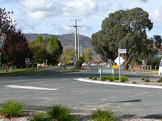
Walwa, is a town in the Shire of Towong in north east Victoria, Australia. The town is located 1 kilometre from the Murray River on the former Murray Valley highway between Wodonga and Corryong. At the 2016 census, the Walwa population had declined to just 177 having been 268 just ten years earlier.
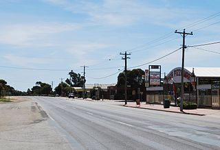
Nyah is a town in northern Victoria, Australia. The town is located on the Murray Valley Highway, in the Rural City of Swan Hill local government area, 365 kilometres (227 mi) north west of the state capital, Melbourne. At the 2021 census, Nyah had a population of 536.
Murray Darling is a wine region and Australian Geographical Indication which spans the Murray River and its confluence with the Darling River in northwestern Victoria and southwestern New South Wales. It was registered as a protected name on 16 June 1997.
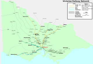
The Robinvale railway line is a freight only country railway line in north-western Victoria, Australia. The line branches from the Mildura line at Dunolly, and at Inglewood the Eaglehawk – Inglewood line connects with the Piangil line outside Bendigo. The parallel Kulwin line junctions from the Robinvale line at Korong Vale then continues northward.
The 1922 Border Railways Acts, were Acts passed by the Parliaments of both Victoria and New South Wales, which authorised the construction of cross border railways in the Riverina region of Australia. Despite being located in New South Wales, the region was closer economically to Victoria and its railway network, operated by Victorian Railways. Another complication was that Victorian Railways used the 1,600 mm broad gauge, while the New South Wales Government Railways used 1,435 mm standard gauge.