Hay Shire

Last updated • 1 min readFrom Wikipedia, The Free Encyclopedia

Hay Shire
New South Wales
Hay LGA NSW.png
Location in New South Wales
Coordinates 34°30′S144°51′E / 34.500°S 144.850°E / -34.500; 144.850
Population2,884 (2021 census) [1]
 • Density0.25464/km2 (0.65951/sq mi)
Established1 January 1965
Area11,325.89 km2 (4,373.0 sq mi) [2]
Mayor Cr. Carol Oataway (Unaligned) [3]
Council seat Hay
Region Riverina
State electorate(s) Murray
Federal division(s) Farrer
Hay Shire Council logo.svg
Website Hay Shire
LGAs around Hay Shire:
Balranald Carrathool Carrathool
Balranald Hay Shire Murrumbidgee
Murray River Edward River Edward River

The Hay Shire is a local government area in the Riverina area of south-western New South Wales, Australia. The Shire comprises 11,326 square kilometres (4,373 sq mi) and is located adjacent to the Sturt, Mid-western and Cobb Highways. The area includes the towns of Hay, Booligal and Maude.

Contents

Hay Shire was established in 1965 by the amalgamation of the Municipality of Hay with the surrounding Waradgery Shire. [4]

The mayor of Hay Shire is Cr. Carol Oataway, an unaligned politician who had previously held the position of Principal of Hay Public School. [3] [5]

Demographics

Selected historical census data for Hay Shire local government area
Census year2001 [6] 2006 [7] 2011 [8] 2016 [9] 2021 [1]
PopulationEstimated residents on census night 3,562Decrease2.svg 3,383Decrease2.svg 2,956Decrease2.svg 2,946Decrease2.svg 2,884
Aboriginal and/or Torres Strait Islanders (%)3.5%Increase2.svg 4.2%Increase2.svg 5.6%Increase2.svg 6.0%Increase2.svg 8.3%
LGA rank in terms of size within New South Wales 123rdIncrease2.svg 121stSteady2.svg 121st
% of New South Wales population0.06%Decrease2.svg 0.05%Decrease2.svg 0.04%Steady2.svg 0.04%Steady2.svg 0.04%
% of Australian population0.02%Steady2.svg 0.02%Decrease2.svg 0.01%Steady2.svg 0.01%Steady2.svg 0.01%
Cultural and linguistic diversity20012006201120162021
Country of birth
(top responses)
Australia 90.4%Increase2.svg 90.5%Decrease2.svg 88.2%Decrease2.svg 80.3%Decrease2.svg 80.0%
India 0.7%Decrease2.svg 0.5%Increase2.svg 1.3%
New Zealand 0.8%Increase2.svg 1.1%Decrease2.svg 0.8%Increase2.svg 1.3%Decrease2.svg 1.1%
England 1.0%Decrease2.svg 0.8%Increase2.svg 1.0%Decrease2.svg 0.9%Steady2.svg 0.9%
Fiji 0.4%Increase2.svg 0.6%
Scotland 0.3%Increase2.svg 0.4%Steady2.svg 0.4%Steady2.svg 0.4%Increase2.svg 0.5%
Language
(top responses,
other than English)
Italian 1.1%Decrease2.svg 0.8%Increase2.svg 1.2%Decrease2.svg 0.8%Decrease2.svg 0.7%
Punjabi Increase2.svg 0.3%Increase2.svg 0.6%
Fijian 0.2%Increase2.svg 0.5%Decrease2.svg 0.4%
Afrikaans 0.4%
Malayalam 0.3%
Religious affiliation20012006201120162021
Religious affiliation
(top responses)
Catholic 36.4%Decrease2.svg 36.1%Decrease2.svg 35.8%Decrease2.svg 31.9%Decrease2.svg 27.6%
No Religion 7.1%Increase2.svg 10.4%Increase2.svg 10.9%Increase2.svg 16.3%Increase2.svg 24.3%
Anglican 31.8%Decrease2.svg 31.1%Steady2.svg 31.1%Decrease2.svg 24.7%Decrease2.svg 21.7%
Not statedn/cn/cn/c12.8%Decrease2.svg 12.3%
Presbyterian and Reformed 9.2%Decrease2.svg 7.9%Steady2.svg 7.9%Decrease2.svg 5.8%Decrease2.svg 4.8%
Median weekly incomes20012006201120162021
Personal incomeMedian weekly personal incomeA$404A$441A$587A$700
% of Australian median income86.7%Decrease2.svg 76.4%Increase2.svg 88.7%Decrease2.svg 86.9%
Family incomeMedian weekly family incomeA$983A$981A$1,344A$1,622
% of Australian median income83.9%Decrease2.svg 66.2%Increase2.svg 77.5%Decrease2.svg 76.5%
Household income Median weekly household incomeA$741A$805A$1,075A$1,236
% of Australian median income72.2%Decrease2.svg 65.2%Increase2.svg 74.8%Decrease2.svg 70.8%

Council

Hay Shire Council office and chambers, Hay HayShireCouncilOffice.JPG
Hay Shire Council office and chambers, Hay

Current composition and election method

Hay Shire Council is composed of eight councillors elected proportionally as a single ward. All councillors are elected for a fixed four-year term of office. The mayor is elected by the councillors at the first meeting of the council. The most recent election was held on 14 September 2024, and the makeup of the council is as follows: [10]

PartyCouncillors
 Unaligned8
Total8

The current Council was elected in September 2024 . The councillors, in order of election, are: [10]

CouncillorPartyNotes
 Carol OatawayUnalignedMayor [3]
 Will MillerUnaligned
 Lionel GarnerUnaligned
 Martyn QuinnUnalignedDeputy Mayor [3]
 Darren TapperUnaligned
 Geoff ChapmanUnaligned
 Paul PorterUnaligned
 John PerryUnaligned

Election results

2024

2024 New South Wales local elections: Hay
PartyCandidateVotes%±%
Independent Carol Oataway (elected)36622.79
Independent Will Miller (elected)34821.67
Independent Lionel Garner (elected)20012.45
Independent Martyn Quinn (elected)19712.27
Independent Darren Tapper (elected)1418.78
Independent Geoff Chapman (elected)976.04
Independent David Townsend825.11
Independent Paul Porter (elected)794.92
Independent John Perry (elected)764.73
Independent Steven Young201.25
Total formal votes1,606100
Informal votes55
Turnout 1,661

2021

2021 New South Wales local elections: Hay [11]
PartyCandidateVotes%±%
Independent Jenny Dwyer (elected)49128.1
Independent Martyn Quinn (elected)26415.1
Independent Peter Handford (elected)19811.3
Independent Peter Dwyer (elected)19010.9
Independent Carol Oataway (elected)1176.7
Independent Lionel Garner (elected)1035.9
Independent Geoff Chapman (elected)905.2
Independent John Perry643.7
Independent Darren Clarke623.5
Independent Paul Porter (elected)573.3
Independent Beverley McRae482.7
Independent David Townsend331.9
Independent Megan Ruska301.7
Total formal votes1,74797.4
Informal votes472.6
Turnout 1,79483.6

Literary reference

Banjo Paterson (1864–1941) wrote a poem called Hay and Hell and Booligal about the district. [12]

Related Research Articles

<span class="mw-page-title-main">Greater Hume Shire</span> Local government area in New South Wales, Australia

Greater Hume Shire is a local government area in the Riverina region of southern New South Wales, Australia. The Shire was formed in 2004 incorporating Culcairn Shire, the majority of Holbrook Shire and part of Hume Shire. The shire had an estimated population of 10,137 as at 2012.

<span class="mw-page-title-main">Leeton Shire</span> Local government area in New South Wales, Australia

Leeton Shire is a local government area in the Riverina region of New South Wales, Australia. The Shire is located adjacent to the Murrumbidgee River and falls within the Murrumbidgee Irrigation Area.

<span class="mw-page-title-main">Narromine Shire</span> Local government area in New South Wales, Australia

Narromine Shire is a local government area in the Orana region of New South Wales, Australia. The Shire is located adjacent to the Mitchell Highway and the Main Western railway line. It was formed on 1 January 1981 from the amalgamation of the Municipality of Narromine and Timbrebongie Shire resulting from the Local Government Areas Amalgamation Act 1980.

<span class="mw-page-title-main">Bland Shire</span> Local government area in New South Wales, Australia

Bland Shire is a local government area in the Riverina region of New South Wales, Australia. it covers an area of 8,560 square kilometres (3,310 sq mi). As at the 2016 census the population was 5,995. It is a member of the League of Extraordinary Communities which was established by Dull, Perth and Kinross, Scotland, UK and Boring, Oregon, US.

<span class="mw-page-title-main">Carrathool Shire</span> Local government area in New South Wales, Australia

The Carrathool Shire is a local government area that borders both the Riverina and Far West regions of New South Wales, Australia. The Shire comprises 18,933 square kilometres (7,310 sq mi) and is located adjacent to the Mid-Western Highway and north of the Sturt Highway.
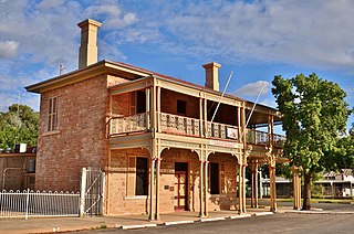
<span class="mw-page-title-main">Central Darling Shire</span> Local government area in New South Wales, Australia

Central Darling Shire is a local government area in the Far West region of New South Wales, Australia. The Shire is located adjacent to the Barrier Highway. Central Darling Shire was constituted in 1959 and at 53,511 square kilometres (20,661 sq mi), it is the largest incorporated local government area in New South Wales.

<span class="mw-page-title-main">Berrigan Shire</span> Local government area in New South Wales, Australia

Berrigan Shire is a local government area in the southern Riverina region of New South Wales, Australia. The Shire lies on the New South Wales State border with Victoria formed by the Murray River. The Shire is adjacent to the Newell and Riverina Highways. The Shire is a mainly agricultural region, with dairying, cattle raising, woolgrowing and cropping the main activities. The vast majority of the Shire is irrigated. Tourism is another major activity, concentrated on the river towns of Tocumwal and Barooga.

<span class="mw-page-title-main">Ballina Shire</span> Local government area in New South Wales, Australia

Ballina Shire is a local government area in the Northern Rivers region of New South Wales, Australia. The Shire was formed on 1 January 1977 by the amalgamation of the Municipality of Ballina and Tintenbar Shire. The Shire is located adjacent to the Tasman Sea and the Pacific Highway. The council seat is located in the town of Ballina. The population of the Ballina Shire area was 46,850 in 2022.

<span class="mw-page-title-main">City of Wagga Wagga</span> Local government area in New South Wales, Australia

City of Wagga Wagga is a local government area in the Riverina region of southern New South Wales, Australia.

<span class="mw-page-title-main">Bellingen Shire</span> Local government area in New South Wales, Australia

Bellingen Shire is a local government area in the Mid North Coast region of New South Wales, Australia. The shire is located adjacent to the Pacific Highway, Waterfall Way and the North Coast railway line.

<span class="mw-page-title-main">Junee Shire</span> Local government area in New South Wales, Australia

The Junee Shire is a local government area in the Riverina region of New South Wales, Australia. The Shire comprises an area of 2,030 square kilometres (780 sq mi) and is located adjacent to the Olympic Highway and the Main South railway line. It was formed on 1 January 1981 from the amalgamation of the Municipality of Junee and Illabo Shire resulting from the Local Government Areas Amalgamation Act 1980.
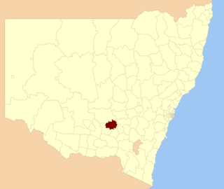
<span class="mw-page-title-main">Temora Shire</span> Local government area in New South Wales, Australia

Temora Shire is a local government area in the Riverina region of New South Wales, Australia. It is on Burley Griffin Way. The Shire was created on 1 January 1981 via the amalgamation of Narraburra Shire and the Municipality of Temora.

<span class="mw-page-title-main">Narrandera Shire</span> Local government area in New South Wales, Australia

Narrandera Shire is a local government area in the Riverina region of south-western New South Wales, Australia. The Shire is located adjacent to the Sturt and Newell Highways.

<span class="mw-page-title-main">Lockhart Shire</span> Local government area in New South Wales, Australia

Lockhart Shire is a local government area in the Riverina region of New South Wales, Australia. The Shire was created in 1906 and is an agricultural and pastoral area.

<span class="mw-page-title-main">Warren Shire</span> Local government area in New South Wales, Australia

Warren Shire is a local government area in the Orana region of New South Wales, Australia. The Shire is located adjacent to the Macquarie River and the Mitchell and Oxley Highways. The use of the area is mainly for wool and cotton growing.

<span class="mw-page-title-main">Brewarrina Shire</span> Local government area in New South Wales, Australia

Brewarrina Shire is a local government area in the Orana region of New South Wales, Australia. The Shire is located adjacent to the Darling River, which is known as the Barwon River upstream from Bourke; and located adjacent to the Kamilaroi Highway. The northern boundary of the Shire is located adjacent to the border between New South Wales and Queensland. The Shire is a wool and cotton growing area.
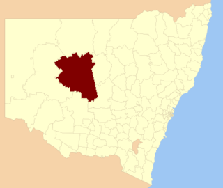
<span class="mw-page-title-main">Cobar Shire</span> Local government area in New South Wales, Australia

Cobar Shire is a local government area in the Orana region of New South Wales, Australia. The Shire is located in an outback area that is centred around the mining town of Cobar. The Shire is traversed by the Barrier Highway and the Kidman Way. With a total area of 44,065 square kilometres (17,014 sq mi), about two-thirds the size of Tasmania, Cobar Shire is larger than Denmark and 99 other countries and self-governing territories, but its population is under 5000.

<span class="mw-page-title-main">Edward River Council</span> Local government area in New South Wales, Australia

The Edward River Council is a local government area in the Murray region of New South Wales, Australia. This area was formed in 2016 from the merger of the Deniliquin Council with the surrounding Conargo Shire.

<span class="mw-page-title-main">Murrumbidgee Council</span> Local government area in New South Wales, Australia

Murrumbidgee Council is a local government area in the Riverina region of New South Wales, Australia. This area was formed in 2016 from the merger of the Murrumbidgee Shire and the Jerilderie Shire.

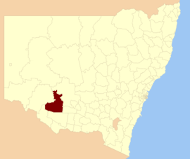
<span class="mw-page-title-main">Cootamundra–Gundagai Regional Council</span> Local government area in New South Wales, Australia

Cootamundra–Gundagai Regional Council (CGRC) is a local government area located in the Riverina region of New South Wales, Australia. The council was formed on 12 May 2016 through a merger of the Cootamundra Shire and Gundagai Shire Councils. Originally named Gundagai Council, the name was changed to Cootamundra–Gundagai Regional Council on 7 September 2016.
References

  1. 1 2 Australian Bureau of Statistics (28 June 2022). "Hay". 2021 Census QuickStats. Retrieved 25 September 2023. OOjs UI icon edit-ltr-progressive.svg
  2. "Hay Regional Profile". Riverina Regional Development Board. Archived from the original on 19 July 2008. Retrieved 28 August 2008.
  3. 1 2 3 4 Councillors, Hay Shire Council website; accessed 22 October 2024.
  4. "Waradgery Shire Council". Search. State Records NSW. Retrieved 21 May 2016.
  5. Ian Beissel (2019), Hay Public School: 150 Years of History 1869-2019, Hay Historical Society, page 175.
  6. Australian Bureau of Statistics (9 March 2006). "Hay (A)". 2001 Census QuickStats. Retrieved 17 November 2020. OOjs UI icon edit-ltr-progressive.svg
  7. Australian Bureau of Statistics (25 October 2007). "Hay (A)". 2006 Census QuickStats. Retrieved 17 November 2020.
  8. Australian Bureau of Statistics (31 October 2012). "Hay (A)". 2011 Census QuickStats. Retrieved 17 November 2020. OOjs UI icon edit-ltr-progressive.svg
  9. Australian Bureau of Statistics (27 June 2017). "Hay (A)". 2016 Census QuickStats. Retrieved 8 December 2017. OOjs UI icon edit-ltr-progressive.svg
  10. 1 2 "Hay Shire Council: Councillor Election". Local Government Elections 2024. Electoral Commission of New South Wales. 14 September 2024. Retrieved 22 October 2024.
  11. "Hay". ABC News.
  12. "Hay and Hell and Booligal". ghostwolf.dyndns.org. Archived from the original on 14 April 2013. Retrieved 6 September 2008.