Narromine Shire

Last updated

Narromine Shire
New South Wales
Narromine LGA NSW.png
Location in New South Wales
Coordinates 32°14′S148°14′E / 32.233°S 148.233°E / -32.233; 148.233
Population
 • Density1.22416/km2 (3.1706/sq mi)
Established1 January 1981 (1981-01-01) [3]
Area5,264 km2 (2,032.4 sq mi)
MayorCraig Davies (Independent)
Council seat Narromine
Region Orana
State electorate(s) Dubbo
Federal division(s) Parkes
Narromine Shire Council.png
Website Narromine Shire
LGAs around Narromine Shire:
Warren Warren Gilgandra
Lachlan Narromine Shire Dubbo
Lachlan Parkes Cabonne

Narromine Shire is a local government area in the Orana region of New South Wales, Australia. The Shire is located adjacent to the Mitchell Highway and the Main Western railway line. It was formed on 1 January 1981 from the amalgamation of the Municipality of Narromine and Timbrebongie Shire resulting from the Local Government Areas Amalgamation Act 1980 . [3]

Contents

Narromine Shire includes the towns of Narromine, Trangie and Tomingley.

The mayor of Narromine Shire Council is Cr. Craig Davies, an independent politician.

Demographics

Selected historical census data for Narromine Shire local government area
Census year2011 [4] 2016 [1]
PopulationEstimated residents on census night 6,585Decrease2.svg 6,444
LGA rank in terms of size within New South Wales 105thIncrease2.svg 103rd
% of New South Wales population
% of Australian population
Cultural and language diversity
Ancestry,
top responses
English
Australian
Italian
Chinese
Irish
Language,
top responses
(other than English)
Italian
Mandarin
Cantonese
Korean
Greek
Religious affiliation
Religious affiliation,
top responses
Catholic
No religion
Anglican
Eastern Orthodox
Buddhism
Median weekly incomes
Personal income Median weekly personal incomeA$
% of Australian median income
Family incomeMedian weekly family income
% of Australian median income
Household incomeMedian weekly household income
% of Australian median income

Council

Current composition and election method

Narromine Shire Council is composed of nine councillors elected proportionally as a single ward. All councillors are elected for a fixed four-year term of office. The mayor is elected by the councillors at the first meeting of the council. The most recent election was held on 10 September 2016, and the makeup of the council is as follows: [5]

PartyCouncillors
  Independents 9
Total9

The current Council, elected in 2016, in order of election, is: [5]

CouncillorPartyNotes
Rob McCutcheon  Independent
Craig Davies IndependentMayor [6]
James Craft Independent
Dawn Collins IndependentDeputy Mayor [6]
Les Lambert Independent
Mark Munro Independent
Colin Hamilton Independent
Lyn Jablonski Independent
Peter Drew Independent

Related Research Articles

<span class="mw-page-title-main">Yass Valley Council</span> Local government area in New South Wales, Australia

Yass Valley Council is a local government area in the Southern Tablelands region of New South Wales, Australia. The area is located adjacent to the Hume and Barton Highways and the Main Southern railway line.

<span class="mw-page-title-main">City of Hawkesbury</span> Local government area in New South Wales, Australia

The City of Hawkesbury is a local government area of New South Wales, Australia, located on the northern and north-western fringe of the Greater Sydney area, about 50 kilometres (31 mi) north-west of the Sydney central business district. Hawkesbury City is named after the Hawkesbury River. Major towns in City of Hawkesbury are Windsor and Richmond.

<span class="mw-page-title-main">Warrumbungle Shire</span> Local government area in New South Wales, Australia

The Warrumbungle Shire is a local government area in the central western region of New South Wales, Australia. The Shire is traversed by the Newell Highway. The Warrumbungle mountain range and Warrumbungles National Park are major tourist attractions for the Shire. Its capital is Coonabarabran, a city in the southwest.

<span class="mw-page-title-main">Bogan Shire</span> Local government area in New South Wales, Australia

Bogan Shire is a local government area in the Orana region of New South Wales, Australia. The Shire is located adjacent to the Mitchell and Barrier highways and its only significant town is Nyngan.

<span class="mw-page-title-main">Cabonne Council</span> Local government area in New South Wales, Australia

Cabonne Council is a local government area in the Central West region of New South Wales, Australia. The Shire is located adjacent to the Mitchell Highway and the Broken Hill railway line, partly surrounding the City of Orange. The administrative centre is located at Molong.

<span class="mw-page-title-main">Berrigan Shire</span> Local government area in New South Wales, Australia

Berrigan Shire is a local government area in the central-western Murray region of New South Wales, Australia. The Shire lies on the New South Wales State border with Victoria formed by the Murray River. The Shire is adjacent to the Newell and Riverina Highways. The Shire is a mainly agricultural region, with dairying, cattle raising, woolgrowing and cropping the main activities. The vast majority of the Shire is irrigated. Tourism is another major activity, concentrated on the river towns of Tocumwal and Barooga.

<span class="mw-page-title-main">Narrabri Shire</span> Local government area in New South Wales, Australia

Narrabri Shire is a local government area in the North West Slopes region of New South Wales, Australia. The Shire is located adjacent to the Namoi River and the Newell and Kamilaroi Highways.

<span class="mw-page-title-main">Ballina Shire</span> Local government area in New South Wales, Australia

Ballina Shire is a local government area in the Northern Rivers region of New South Wales, Australia. The Shire was formed on 1 January 1977 by the amalgamation of the Municipality of Ballina and Tintenbar Shire. The Shire is located adjacent to the Tasman Sea and the Pacific Highway. The council seat is located in the town of Ballina. The population of the Ballina Shire area was 46,850 in 2022.

<span class="mw-page-title-main">Blayney Shire</span> Local government area in New South Wales, Australia

Blayney Shire is a local government area in the Central West region of New South Wales, Australia. The Shire is located adjacent to the Mid-Western Highway and the Main Western railway line, and is centred on the town of Blayney.

<span class="mw-page-title-main">Forbes Shire</span> Local government area in New South Wales, Australia

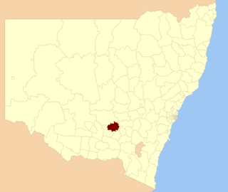
Forbes Shire is a local government area in the central west region of New South Wales, Australia. The Shire was formed in 1981 from the amalgamation of the Municipality of Forbes and the Shire of Jemalong resulting from the Local Government Areas Amalgamation Act 1980.

<span class="mw-page-title-main">Walcha Shire</span> Local government area in New South Wales, Australia

Walcha Shire is a local government area located in the New England region of New South Wales, Australia. The Shire is situated adjacent to the junction of the Oxley Highway and Thunderbolts Way and is 20 kilometres (12 mi) east of the Main North railway line passing through Walcha Road. The shire was formed on 1 June 1955 through the amalgamation of Apsley Shire and the Municipality of Walcha.

<span class="mw-page-title-main">Dungog Shire</span> Local government area in New South Wales, Australia

Dungog Shire is a local government area in the Hunter region of New South Wales, Australia. The Shire is situated adjacent to the Barrington Tops and consists predominantly of very rugged to hilly country which becomes less rugged from north to south.

<span class="mw-page-title-main">Junee Shire</span> Local government area in New South Wales, Australia

The Junee Shire is a local government area in the Riverina region of New South Wales, Australia. The Shire comprises an area of 2,030 square kilometres (780 sq mi) and is located adjacent to the Olympic Highway and the Main South railway line. It was formed on 1 January 1981 from the amalgamation of the Municipality of Junee and Illabo Shire resulting from the Local Government Areas Amalgamation Act 1980.

<span class="mw-page-title-main">Temora Shire</span> Local government area in New South Wales, Australia

Temora Shire is a local government area in the Riverina region of New South Wales, Australia. It is on Burley Griffin Way. The Shire was created on 1 January 1981 via the amalgamation of Narraburra Shire and the Municipality of Temora.

<span class="mw-page-title-main">Lockhart Shire</span> Local government area in New South Wales, Australia

Lockhart Shire is a local government area in the Riverina region of New South Wales, Australia. The Shire was created in 1906 and is an agricultural and pastoral area.

<span class="mw-page-title-main">Hay Shire</span> Local government area in New South Wales, Australia

The Hay Shire is a local government area in the Riverina area of south-western New South Wales, Australia. The Shire comprises 11,326 square kilometres (4,373 sq mi) and is located adjacent to the Sturt, Mid-western and Cobb Highways. The area includes the towns of Hay, Booligal and Maude.

<span class="mw-page-title-main">Coonamble Shire</span> Local government area in New South Wales, Australia

Coonamble Shire is a local government area in the Orana region of New South Wales, Australia. The Shire is located adjacent to the Castlereagh Highway and the Castlereagh River.

<span class="mw-page-title-main">Warren Shire</span> Local government area in New South Wales, Australia

Warren Shire is a local government area in the Orana region of New South Wales, Australia. The Shire is located adjacent to the Macquarie River and the Mitchell and Oxley Highways. The use of the area is mainly for wool and cotton growing.

<span class="mw-page-title-main">Gunnedah Shire</span> Local government area in New South Wales, Australia

Gunnedah Shire is a local government area in the North West Slopes region of New South Wales, Australia. The Shire is located adjacent to the Liverpool Plains in the Namoi River valley and is traversed by the Oxley Highway and the Kamilaroi Highway.

<span class="mw-page-title-main">Murrumbidgee Council</span> Local government area in New South Wales, Australia

Murrumbidgee Council is a local government area in the Murray and Riverina regions of New South Wales, Australia. This area was formed in 2016 from the merger of the Murrumbidgee Shire and the Jerilderie Shire.

References

  1. 1 2 Australian Bureau of Statistics (27 June 2017). "Narromine (A)". 2016 Census QuickStats. Retrieved 7 July 2017. OOjs UI icon edit-ltr-progressive.svg
  2. "3218.0 – Regional Population Growth, Australia, 2017-18". Australian Bureau of Statistics. 27 March 2019. Retrieved 27 March 2019. Estimated resident population (ERP) at 30 June 2018.
  3. 1 2 Local Government Areas Amalgamation Act 1980 (NSW) Schedule 1.
  4. Australian Bureau of Statistics (31 October 2012). "Narromine (A)". 2011 Census QuickStats. Retrieved 25 October 2012. OOjs UI icon edit-ltr-progressive.svg
  5. 1 2 "Narromine Shire Council: Summary of First Preference Votes for each Candidate". Local Government Elections 2016. Electoral Commission of New South Wales. 17 September 2016. Retrieved 17 October 2016.
  6. 1 2 Ryan, Grace (27 September 2016). "New council meets for the first time". Narromine News. Retrieved 17 October 2016.