City of Canterbury-Bankstown

Last updated

{{Infobox Australian place | type = lga | name = City of Canterbury-Bankstown | state = nsw | image = Canterbury-Bankstown lga sydney.png | caption = Location in Metropolitan Sydney | local_map = yes | zoom = 29 | image2 = | caption2 = | pop = 371,006 | pop_year = 2021 census | pop_footnotes = [1] | poprank = 2nd in NSW; 5th in Australia | pop2 = 379,829 | pop2_year = 2023 est. | pop2_footnotes = [2] | est = 12 May 2016 | area = 110.8 | density = | mayor = Bilal El-Hayek | mayortitle = | seat = Bankstown

Contents

| region =

| stategov =

| fedgov = Banks | fedgov2 = Barton | fedgov3 = Blaxland | fedgov4 = Watson | logo = Logo of City of Canterbury-Bankstown.svg | logo_upright = 1.2 | url = http://cbcity.nsw.gov.au/ | near-n = Strathfield | near-ne = Inner West | near-e = Inner West | near-se = Bayside | near-s = Georges River | near-nw = Cumberland | near-sw = Liverpool | near-w = [[City of Liverpool (New South Wales)|Liverpool] }}

Canterbury-Bankstown Council, trading as the City of Canterbury Bankstown, is a local government area in the Canterbury-Bankstown region [lower-alpha 1] of Sydney, New South Wales, Australia. The council was formed on 12 May 2016 from a merger of the City of Canterbury and the City of Bankstown, [3] after a review of local government areas by the NSW Government.

The City of Canterbury Bankstown comprises an area of 110.8 square kilometres (42.8 sq mi) and as per the 2021 census, had a population of 371,006 making it the second most populous local government area in New South Wales.

The current mayor is Bilal El-Hayek, a member of the Labor Party, who was elected on 11 May 2023.

History

Early history

Canterbury Town Hall was opened in 1889. It was demolished in 1963. SLNSW 796187 Town Hall Canterbury.jpg
Canterbury Town Hall was opened in 1889. It was demolished in 1963.

The traditional Aboriginal inhabitants of the land now known as the Canterbury-Bankstown were the Dharug (Darag, Daruk, Dharuk) and Eora peoples. Early indigenous groups relied upon the riparian network of the Georges River and Cooks River catchments towards Botany Bay, with extant reminders of this lifestyle dating back 3,000 years including rock and overhang paintings, stone scrapers, middens and axe grinding grooves. [4] [5]

Following the arrival of Europeans in 1788, the new British settlers in the area burned oyster shells from the middens along Cooks River to produce lime for use in building mortar. The first incursions and eventual land grants in the area by Europeans led to increasing tensions, culminating in a confrontation between Europeans and a group of Aboriginal people led by Tedbury, the son of Pemulwuy, in what is now Punchbowl in 1809. However, following Tedbury's death in 1810, resistance to European settlement generally ended. [6]

In 1793, the eastern Canterbury area's first land grant was made to the chaplain of the First Fleet, the Reverend Richard Johnson, and given the name Canterbury Vale. The District of Bankstown was named by Governor Hunter in 1797 in honour of botanist Sir Joseph Banks. The area remained very rural until residential and suburban development followed the development of the Bankstown Railway Line with the passing of the Marrickville to Burwood Road Railway Act by the NSW Parliament in 1890, extending the rail line from Marrickville Station (later Sydenham Station) to Burwood Road (later Belmore Station) by 1895. [7] With the passing of the Belmore to Chapel Road Railway Act in 1906, the line was extended further to Lakemba, Punchbowl and Bankstown by 1909. [7]

Local government history

Canterbury

The Canterbury Administration Building designed in 1963 by architects Whitehead & Payne, in Campsie, was the seat of Canterbury Council from 1963 to 2016. It is now secondary offices for Canterbury Bankstown. Campsie6.JPG
The Canterbury Administration Building designed in 1963 by architects Whitehead & Payne, in Campsie, was the seat of Canterbury Council from 1963 to 2016. It is now secondary offices for Canterbury Bankstown.

After much petitioning of the NSW Government by local residents, the Municipality of Canterbury was proclaimed on 17 March 1879. The council first met in the home of the first mayor, Alderman John Sproule, and premises were then leased in the St Paul's Church schoolroom at 47-49 Canterbury Road, Canterbury. The Canterbury Town Hall, located on Canterbury Road between Canton and Howard Streets, was opened in 1889 by the Premier of New South Wales, Sir Henry Parkes. However, over time, Campsie became a more important centre, particularly along Beamish Street and Canterbury Council planned a gradual move of civic services there when funds became available. [8] In 1954 a Baby Health Centre by Davey & Brindley opened on Beamish Street, followed by a library next door by Davey, Brindley & Vickery in 1958 at a cost of £30,000, and the municipal administration finally moved in 1963. [8] At the time of its opening by the mayor R. J. Schofield on 26 September 1958, the Campsie Library was reputed to be the largest municipal library in Sydney. [8] [9] The Canterbury Municipal Administration Building designed by architects Whitehead & Payne, built by Rex Building Company Pty Ltd, and completed at a cost of £163,000 was opened adjacent to the Library and Baby Health Centre by the mayor, James S. Scott, on 21 September 1963. [10] [11] [12] The City of Canterbury was proclaimed on 16 November 1993 by the Governor of New South Wales, Rear Admiral Peter Sinclair.

Bankstown

Bankstown Council Chambers, designed in 1963 by Kevin J. Curtin & Partners, adjacent to Paul Keating Park in Bankstown, was the Council seat from 1963 to 2016. It is now the seat of the City of Canterbury Bankstown, and was the location of the first council meeting on 24 May 2016. Council Chambers, Bankstown.jpg
Bankstown Council Chambers, designed in 1963 by Kevin J. Curtin & Partners, adjacent to Paul Keating Park in Bankstown, was the Council seat from 1963 to 2016. It is now the seat of the City of Canterbury Bankstown, and was the location of the first council meeting on 24 May 2016.

In March 1895 a petition was submitted to the NSW Colonial Government by 109 residents of the Bankstown area, requesting the establishment of the "Municipal District of Bankstown" under the Municipalities Act, 1867. [13] The petition was subsequently accepted and the "Municipal District of Bankstown" was proclaimed by Lieutenant Governor Sir Frederick Darley on 7 September 1895. [14] The first six-member council, standing in one at-large constituency, was elected on 4 November 1895. [15] With the passing of the Local Government Act 1906, the council area became known as the "Municipality of Bankstown".

Bankstown's city status was proclaimed in 1980 in the presence of Queen Elizabeth II, becoming the "City of Bankstown". [16]

Establishment of Canterbury-Bankstown Council

A 2015 review of local government boundaries by the NSW Government Independent Pricing and Regulatory Tribunal recommended that the City of Canterbury merge with the City of Bankstown to form a new council with an area of 110 square kilometres (42 sq mi) and support a population of approximately 351,000. [17] Following an independent review, on 12 May 2016 the Minister for Local Government announced, with the release of the Local Government (Council Amalgamations) Proclamation 2016, that the merger with the City of Bankstown would proceed with immediate effect, creating a new council with an area of 72 square kilometres (28 sq mi). [3]

The council was initially under the management of Administrator Richard Colley until elections were held. [18] The first meeting of the council was held at Bankstown Council Chambers on 24 May 2016. [19] The former Bankstown General Manager, Matthew Stewart was proclaimed as the first General Manager of the council. [18] Jim Montague PSM, Canterbury Council General Manager from 1983 to 2016, was initially proclaimed as a Deputy General Manager of the new Council, but retired two weeks after the proclamation. [20]

At the first council meeting on 24 May 2016, the administrator, Richard Colley, resolved to adopt city status and the council name would be known as the "City of Canterbury Bankstown" by way of changing the council's trading name and business registration. [21] However, as this act merely changed the trading name of the council, the legal name as proclaimed in 2016 remains "Canterbury-Bankstown Council", which can only be changed by official proclamation in the NSW Government Gazette under section 206 of the Local Government Act, 1993 . [22]

Proposed de-amalgamation

In 2021, the council began resolving a proposal to de-amalgamate the City of Canterbury Bankstown. The de-amalgamation would restore the former City of Canterbury and City of Bankstown to their original boundaries. In July 2022, the council began preparations to submit a business case to the NSW Government for approval. [23]

At the ordinary council meeting on 28 November 2023, it was resolved that council would halt all work, and financial spending, on preparing its implementation plan to de-amalgamate, until such time the NSW Government gave an iron-clad commitment to fully fund the cost of any de-amalgamation, and all ongoing costs. [24] However, in 2024, it was confirmed that a bill would be passed in parliament by the NSW Government which would indicate that the government would not fit to bill for any council wishing to de-amalgamate. [25]

Suburbs in the local government area

Suburbs in the City of Canterbury Bankstown area are:

Demographics

Selected historical census data for the City of Canterbury Bankstown
Census year2016 [26] 2021 [1]
PopulationEstimated residents on census night 346,302371,006
LGA rank in terms of size within New South Wales1stDecrease2.svg 2nd
% of New South Wales population4.63%Decrease2.svg 4.59%
% of Australian population1.48%Decrease2.svg 1.46%
Cultural and language diversity
Ancestry,
top responses
Lebanese 12.5%Increase2.svg 14.1%
Australian 11.8%Increase2.svg 13.9%
English 10.2%Increase2.svg 11.3%
Chinese 9.4%Increase2.svg 11.6%
Vietnamese 6.0%Increase2.svg 7.3%
Language,
top responses
(other than English)
Arabic 17.2%Steady2.svg 17.2%
Vietnamese 7.2%Increase2.svg 7.5%
Greek 5.4%Decrease2.svg 4.7%
Mandarin 5.0%Increase2.svg 5.1%
Cantonese 3.9%Decrease2.svg 3.7%
Religious affiliation
Religious affiliation,
top responses
Catholic 23.4%Decrease2.svg 21.5%
Islam 20.8%Increase2.svg 23.6%
No religion 15.0%Increase2.svg 17.5%
Eastern Orthodox 8.9%Decrease2.svg 8.5%
Not stated 8.6%Decrease2.svg 8.0%
Median weekly incomes
Personal income Median weekly personal incomeA$502A$625
% of Australian median income75.8%77.6%
Family incomeMedian weekly family incomeA$1,437A$1,786
% of Australian median income82.9%84.2%
Household incomeMedian weekly household incomeA$1,298A$1,556
% of Australian median income90.3%89.1%
Dwelling structure
Dwelling type Separate house 57.1%Decrease2.svg 55.0%
Semi-detached, terrace or townhouse 16.1%Decrease2.svg 15.7%
Flat or apartment 25.9%Increase2.svg 28.5%

Council

The Council comprises fifteen Councillors elected proportionally, with three Councillors elected in five wards. On 9 September 2017 the current Council was elected for a fixed term of office. [3] [18] Although the fixed term of the council is typically four years, due to delays caused by amalgamations and the COVID-19 pandemic, the first term from 9 September 2017 expired on 4 December 2021. [27] The Mayor and Deputy Mayor are elected by the Councillors for two-year and one-year terms, respectively. The City of Canterbury Bankstown was under the management of Administrator Richard Colley and Interim General Manager Matthew Stewart until elections were held on 9 September 2017 and the first meeting of the elected Council on 26 September 2017. [18]

Officeholders

MayorTermNotes
Richard Colley (Administrator)12 May 2016 – 26 September 2017General Manager of Bankstown 2000–2007 and Administrator of Wollongong 2010–2011 [18] [28]
Khal Asfour 26 September 2017 – 11 May 2023Mayor of Bankstown 2011–2014, 2015–2016 [29] [30] [31] [32] [33]
Bilal El-Hayek11 May 2023 – present [34] [35]
Deputy MayorTermNotes
Nadia Saleh26 September 2017 – 25 September 2018 [29]
Clare Raffan25 September 2018 – 19 September 2019 [36]
Bilal El-Hayek19 September 2019 – 28 September 2020 [30]
Rachelle Harika28 September 2020 – 29 September 2021 [37]
Linda Downey29 September 2021 – 24 December 2021Mayor of Bankstown 2014–2015 [31]
Bilal El-Hayek24 December 2021 – 29 September 2022 [32]
Clare Raffan29 September 2022 – 11 September 2023 [38] [34]
Rachelle Harika11 September 2023 – present [35]
General ManagerTermNotes
Matthew Stewart12 May 2016 – presentGeneral Manager of Bankstown 2010–2016 [18]

Current composition

The most recent election was held on 4 December 2021, and the makeup of the council, by order of election, is as follows:

PartyCouncillors
Australian Labor Party 9
Liberal Party of Australia 5
Independent1
Total15
WardCouncillorPartyNotes
Bankstown Ward [39] George ZakhiaLiberalElected 2017.
Khal Asfour LaborElected 2017; Mayor 2017–2023
Bilal El-HayekLaborElected 2017; Deputy Mayor 2019–2020, 2021–2022; Mayor 2023–present.
Bass Hill Ward [40] Charlie IshacLiberalElected 2017.
Rachelle HarikaLaborElected 2017; Deputy Mayor 2020–2021, 2023–present.
Christopher CahillLabor
Canterbury Ward [41] Clare RaffanLaborElected 2017; Deputy Mayor 2018–2019, 2022–2023.
Barbara CooreyIndependentCanterbury West Ward Councillor 1991–1999; Canterbury Deputy Mayor 1995–1996. [42]
Jessie NguyenLiberal
Revesby Ward [43] David WalshLabor
Charbel AbouraadLiberal
Linda DowneyLaborElected 2017; Deputy Mayor 2021; Mayor of Bankstown 2014–2015.
Roselands Ward [44] Sazeda AkterLiberal
Karl SalehLaborCanterbury West Ward Councillor 2004–2016; Canterbury Deputy Mayor 2008–2009, 2012–2013, 2015–2016.
Bhadra WaidaLabor

2021 election results

2021 New South Wales local elections: Canterbury-Bankstown [45]
PartyVotes %SwingSeatsChange
  Labor 8372447.4+0.09Steady2.svg
  Liberal 5296030.0+0.65Steady2.svg
  Greens 6,6083.7−4.80Decrease2.svg 1
  Independent 16,2219.1+4.60Steady2.svg
 Barbara Coorey Independent Group9,0275.1+5.11Increase2.svg 1
  Our Local Community 51052.9−7.20Steady2.svg
  Animal Justice 2,7468.2+8.20Steady2.svg
 Communist League990.10Steady2.svg
 Formal votes176,490

Heritage listings

The City of Canterbury Bankstown has a number of heritage-listed sites, including:

International relations

Sister cities

The City of Canterbury Bankstown has 7 sister cities. [54]

See also

Notes

  1. with a minor portion in the Inner West region
  2. with a minor portion within the Inner West Council
  3. 1 2 3 with parts within Georges River Council
  4. 1 2 3 with parts within Cumberland Council
  5. with parts within the Municipality of Burwood and the Inner West Council
  6. with a minor portion within Bayside Council
  7. with a minor portion within the Municipality of Strathfield
  8. with a minor portion within the Inner West Council
  9. with parts within Georges River Council and Bayside Council
  10. with parts within the City of Fairfield

Related Research Articles

<span class="mw-page-title-main">Ku-ring-gai Council</span> Local government area in New South Wales, Australia

Ku-ring-gai Council is a local government area in Northern Sydney, in the state of New South Wales, Australia. The area is named after a fictional Aboriginal Language Group.

<span class="mw-page-title-main">Municipality of Strathfield</span> Local government area in New South Wales, Australia

The Municipality of Strathfield is a local government area in the West of Sydney, in the state of New South Wales, Australia.

<span class="mw-page-title-main">Hornsby Shire</span> Local government area in New South Wales, Australia

Hornsby Shire is a local government area situated in Northern Sydney, as well as parts of the Hills District, in the state of New South Wales, Australia. The shire stretches from the M2 Hills Motorway in the south to the Hawkesbury River town of Wisemans Ferry, some 53 kilometres (33 mi) to the north, making it the largest local government council in the Greater Sydney Metropolitan region by total area. As of the 2016 census the shire had an estimated population of 142,667.

<span class="mw-page-title-main">City of Willoughby</span> Local government area in New South Wales, Australia

The City of Willoughby is a local government area on the Lower North Shore of Northern Sydney, in the state of New South Wales, Australia. It is located 6 kilometres (3.7 mi) north of the Sydney central business district. It was first proclaimed in October 1865 as the Municipality of North Willoughby.

<span class="mw-page-title-main">Lewisham, New South Wales</span> Suburb of Sydney, New South Wales, Australia

Lewisham is a suburb in the Inner West of Sydney, in the state of New South Wales, Australia. Lewisham is located 7 kilometres south-west of the Sydney central business district, in the local government area of Inner West Council.

<span class="mw-page-title-main">Canterbury, New South Wales</span> Suburb of Sydney, New South Wales, Australia

Canterbury is a suburb of western Sydney, in the state of New South Wales, Australia. Canterbury is located 10.5 kilometres (6.5 mi) south-west of the Sydney central business district in the City of Canterbury-Bankstown.

<span class="mw-page-title-main">Belmore railway station</span> Railway station in Sydney, New South Wales, Australia

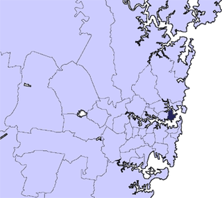
Belmore railway station is a heritage-listed railway station located on the Bankstown line at Burwood Road, Belmore in the City of Canterbury-Bankstown local government area of New South Wales, Australia. It is served by Sydney Trains T3 Bankstown line services. It was designed and built by NSW Government Railways from 1895 to 1937. It is also known as Belmore Railway Station Group and Burwood Road. The property was added to the New South Wales State Heritage Register on 2 April 1999.

<span class="mw-page-title-main">Municipality of Burwood</span> Local government area in New South Wales, Australia

The Municipality of Burwood is a local government area in the inner-west of Sydney, in the state of New South Wales, Australia. The mayor of the Municipality is Cr. John Faker, a member of the Labor Party. The municipality is 7 km2, making it the second smallest Local Government Area in New South Wales, being larger than only Hunter's Hill.

<span class="mw-page-title-main">City of Canterbury (New South Wales)</span> Former local government area in New South Wales, Australia

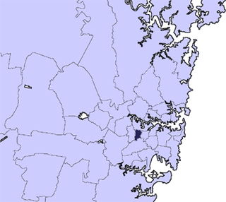
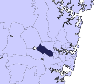
The City of Canterbury was a local government area in the Inner South-West region of Sydney, New South Wales, Australia. The council area was within the northern part of the Parish of St George above Wolli Creek and The M5 but below The Cooks River. The city was primarily residential and light industrial in character, and was home to over 130 nationalities. With a majority of its residents being born overseas, the council marketed itself as the "City of Cultural Diversity." First incorporated as the Municipality of Canterbury in 1879, the council became known as the City of Canterbury in 1993.

<span class="mw-page-title-main">Municipality of Hunter's Hill</span> Local government area in New South Wales, Australia

The Municipality of Hunter's Hill or Hunter's Hill Council is a local government area on the Lower North Shore of Sydney, in the state of New South Wales, Australia. The municipality was first proclaimed in 1861, which includes the suburbs of Hunters Hill, Woolwich, Huntleys Point, Tarban, Henley and part of Gladesville. As at the 2021 census, the Municipality had an estimated population of 13,559. At 5.7 square kilometres (2.2 sq mi), the Municipality is, by area, the smallest local government area in New South Wales and its boundaries remain mostly unaltered since its establishment in 1861. The mayor of Hunters Hill since 4 December 2021 is Clr. Zac Miles.

<span class="mw-page-title-main">Mosman Council</span> Local government area in New South Wales, Australia

Mosman Council is a local government area on the Lower North Shore of Sydney, New South Wales, Australia.

<span class="mw-page-title-main">North Sydney Council</span> Local government area in New South Wales, Australia

North Sydney Council is a local government area on the Lower North Shore of Sydney, New South Wales, Australia, established on 29 July 1890 through the amalgamation of three boroughs.

<span class="mw-page-title-main">City of Penrith</span> Local government area in New South Wales, Australia

The City of Penrith is a local government area in the state of New South Wales, Australia. The seat of the city is located in Penrith, located about 50 kilometres (31 mi) west of Sydney's central business district. It occupies part of the traditional lands of the Darug people. First incorporated as a municipality on 12 May 1871, on 1 January 1949, the municipalities of Penrith, St Marys and Castlereagh and part of the Nepean Shire amalgamated to form a new Municipality of Penrith. Penrith was declared a City on 21 October 1959, and expanded westwards to include Emu Plains and Emu Heights, formerly part of the City of Blue Mountains, on 25 October 1963. As of the 2021 census the City of Penrith had an estimated population of 217,664.

<span class="mw-page-title-main">City of Randwick</span> Local government area in New South Wales, Australia

The City of Randwick is a local government area in the Eastern Suburbs of Sydney, New South Wales, Australia. Established in 1859, Randwick is the second-oldest local government area in New South Wales, after the City of Sydney. It comprises an area of 36 square kilometres (14 sq mi) and as per the 2021 census had a population of 134,252.

<span class="mw-page-title-main">Municipality of Woollahra</span> Local government area in New South Wales, Australia

Woollahra Municipal Council is a local government area in the eastern suburbs of Sydney, in the state of New South Wales, Australia. Woollahra is bounded by Sydney Harbour in the north, Waverley Council in the east, Randwick City in the south and the City of Sydney in the west.

<span class="mw-page-title-main">Belmore, New South Wales</span> Suburb of Sydney, New South Wales, Australia

Belmore is a suburb of Sydney, in the state of New South Wales, Australia. Belmore is located 11 kilometres south-west of the Sydney central business district, in the local government area of the City of Canterbury-Bankstown.

<span class="mw-page-title-main">City of Orange (New South Wales)</span> Local government area in New South Wales, Australia

The City of Orange is a local government area in the Central West region of New South Wales, Australia. Based in Orange, the area is located adjacent to the Mitchell Highway and the Main Western railway line.

<span class="mw-page-title-main">Canterbury-Bankstown</span> Region in New South Wales, Australia

Canterbury-Bankstown is a customary region of Sydney, Australia, in Inner South-Western Sydney. The region is located to the north of the St George region and to the south of the Inner West region. The suburbs of the Canterbury-Bankstown region are not specific to the local government area of the City of Canterbury-Bankstown, but includes many of them. The Bankstown railway line serves many of the suburbs in this region.

<span class="mw-page-title-main">Northern Beaches Council</span> Local government area in New South Wales, Australia

The Northern Beaches Council is a local government area located in the Northern Beaches region of Sydney, in the state of New South Wales, Australia. The council was formed on 12 May 2016 after the amalgamation of Manly, Pittwater, and Warringah councils.

<span class="mw-page-title-main">Georges River Council</span> Local government area in New South Wales, Australia

Georges River Council is a local government area located in the St George region of Sydney located south of the Sydney CBD, in New South Wales, Australia. The Council was formed on 12 May 2016 from the merger of the Hurstville City Council and Kogarah City Council.

References

  1. 1 2 Australian Bureau of Statistics (28 June 2022). "Canterbury-Bankstown (A)". 2021 Census QuickStats. Retrieved 5 April 2024. OOjs UI icon edit-ltr-progressive.svg
  2. "3218.0 – Regional Population Growth, Australia, 2017-18". Australian Bureau of Statistics. 27 March 2019. Retrieved 27 March 2019. Estimated resident population (ERP) at 30 June 2018.
  3. 1 2 3 "Canterbury-Bankstown Council". Stronger Councils. Government of New South Wales. 12 May 2016. Retrieved 14 May 2016.
  4. "Aboriginal history and places of significance". City of Canterbury Bankstown. Retrieved 10 October 2021.
  5. Muir, Lesley (2013). "Aboriginal people of the Cooks River valley". The Dictionary of Sydney. Retrieved 10 October 2021.
  6. Irish, Paul (2017). "Aboriginal History along the Cooks River" (PDF). Cooks River Alliance. Retrieved 10 October 2021.
  7. 1 2 Larcombe, Frederick A. (1979). Change and Challenge: A History of the Municipality of Canterbury. Canterbury: Canterbury Municipal Council. pp. 194–198.
  8. 1 2 3 "Library Added to Canterbury Civic Centre". The Sydney Morning Herald. 30 September 1958. p. 20.
  9. "Library Opened". The Sydney Morning Herald. 27 September 1958. p. 18.
  10. "Civic Centre's Progress". The Sydney Morning Herald. 20 February 1963. p. 17.
  11. "101511 - Council Administration Building & Chambers, official opening, Campsie, 1963". Pictorial Canterbury. City of Canterbury Bankstown. 21 September 1963. Retrieved 30 September 2020.
  12. "100913 - Canterbury City Council building, during construction, Campsie, 1962". Pictorial Canterbury. City of Canterbury Bankstown. 1962. Retrieved 30 September 2020.
  13. "BANKSTOWN.—PETITION FOR A MUNICIPALITY". New South Wales Government Gazette. No. 203. 23 March 1895. p. 2021. Retrieved 19 November 2016 via National Library of Australia.
  14. "Government Gazette Proclamations and Legislation". New South Wales Government Gazette. No. 603. 9 September 1895. p. 5823. Retrieved 19 November 2016 via National Library of Australia.
  15. "MUNICIPAL DISTRICT OF BANKSTOWN". New South Wales Government Gazette. No. 742. 8 November 1895. p. 7231. Retrieved 19 November 2016 via National Library of Australia.
  16. "Development Over Time". Bankstown City Council. Archived from the original on 29 August 2007. Retrieved 20 July 2007.
  17. "Merger proposal: Bankstown City Council, Canterbury City Council" (PDF). Government of New South Wales. January 2016. p. 7. Retrieved 28 February 2016.
  18. 1 2 3 4 5 6 "Local Government (Council Amalgamations) Proclamation 2016 [NSW] - Schedule 2 - Provisions for Canterbury-Bankstown Council" (PDF). Parliament of New South Wales. 12 May 2016. p. 14. Retrieved 8 October 2016.
  19. Taylor, James (29 May 2016). "First Canterbury Bankstown merged council meeting with administrator Richard Colley over in a flash". Canterbury-Bankstown Express. Retrieved 8 October 2016.
  20. Ngo, Cindy (31 May 2016). "Former Canterbury Council general manager Jim Montague steps down and bids farewell to local government after 50 years". Canterbury-Bankstown Express. Retrieved 8 October 2016.
  21. "Minutes of the Extraordinary Meeting of Council - Held on 24 May 2016" (PDF). City of Canterbury Bankstown. 24 May 2016. Retrieved 10 October 2021.
  22. "Local Government Act 1993 No 30 - sec.206". NSW Legislation. NSW Government. Retrieved 29 October 2021.
  23. "Proposed de-amalgamation of the City of Canterbury Bankstown". City of Canterbury Bankstown. Retrieved 3 September 2022.
  24. "Proposed De-amalgamation of the City of Canterbury Bankstown".
  25. Rose, Tamsin; McLeod, Catie (5 February 2024). "NSW mega-councils to foot the bill if they want to reverse forced mergers". The Guardian.
  26. Australian Bureau of Statistics (27 June 2017). "Canterbury-Bankstown (A)". 2016 Census QuickStats. Retrieved 5 July 2017. OOjs UI icon edit-ltr-progressive.svg
  27. Government, NSW. "NSW Gazette Number 347-Local Government" (PDF). Retrieved 4 September 2021.
  28. "Richard Colley" (PDF). City of Canterbury Bankstown. Archived from the original (PDF) on 15 June 2016. Retrieved 10 October 2021.
  29. 1 2 Buckley, Danielle (2 October 2017). "Labor's Khal Asfour elected first mayor of Canterbury-Bankstown". Canterbury-Bankstown Express. Retrieved 13 October 2017.
  30. 1 2 "Mayor and Deputy Mayor elected". City of Canterbury Bankstown. 19 September 2019. Archived from the original on 20 June 2020. Retrieved 7 October 2021.
  31. 1 2 "Mayor and Deputy Mayor elected". CBCity News. 29 September 2021. Retrieved 7 October 2021.
  32. 1 2 "inutes of the Ordinary Meeting of Council Held on 24 December 2021" (PDF). www.cbcity.nsw.gov.au. City of Canterbury Bankstown. 24 December 2021. Retrieved 29 December 2021.
  33. "Khal re-elected as Mayor" (Media Release). City of Canterbury Bankstown. 24 December 2021. Retrieved 29 December 2021.
  34. 1 2 "New Mayor to Lead our City" (Media Release). City of Canterbury Bankstown. 11 May 2023. Retrieved 20 September 2023.
  35. 1 2 "Canterbury-Bankstown Mayor and Deputy Mayor Election" (Media Release). City of Canterbury Bankstown. 12 September 2023. Retrieved 20 September 2023.
  36. "Minutes of the Extraordinary Meeting of Council Held on 25 September 2018" (PDF). City of Canterbury Bankstown. 25 September 2018. Retrieved 7 October 2021.
  37. "Minutes of the Extraordinary Meeting of Council Held on 28 September 2020" (PDF). City of Canterbury Bankstown. 28 September 2020. Retrieved 7 October 2021.
  38. "Minutes of the Ordinary Meeting of Council Held on 29 September 2022" (PDF). City of Canterbury Bankstown. 29 September 2022. Retrieved 7 October 2022.
  39. "Canterbury-Bankstown - Bankstown Ward". NSW Local Council Elections 2021. NSW Electoral Commission. Retrieved 21 December 2021.
  40. "Canterbury-Bankstown - Bass Hill Ward". NSW Local Council Elections 2021. NSW Electoral Commission. Retrieved 21 December 2021.
  41. "Canterbury-Bankstown - Canterbury Ward". NSW Local Council Elections 2021. NSW Electoral Commission. Retrieved 21 December 2021.
  42. Wainwright, Robert (13 October 1995). "Mayoral Elections: The Results - Local councils, global issues". The Sydney Morning Herald. p. 9.
  43. "Canterbury-Bankstown - Revesby Ward". NSW Local Council Elections 2021. NSW Electoral Commission. Retrieved 21 December 2021.
  44. "Canterbury-Bankstown - Roselands Ward". NSW Local Council Elections 2021. NSW Electoral Commission. Retrieved 21 December 2021.
  45. "Canterbury-Bankstown". ABC News.
  46. "Ashfield Reservoir (Elevated) (WS 0003)". New South Wales State Heritage Register . Department of Planning & Environment. H01622. Retrieved 18 May 2018. CC BY icon.svg Text is licensed by State of New South Wales (Department of Planning and Environment) under CC-BY 4.0 licence .
  47. "Belmore Railway Station Group". New South Wales State Heritage Register . Department of Planning & Environment. H01081. Retrieved 18 May 2018. CC BY icon.svg Text is licensed by State of New South Wales (Department of Planning and Environment) under CC-BY 4.0 licence .
  48. "Canterbury Railway Station group". New South Wales State Heritage Register . Department of Planning & Environment. H01109. Retrieved 18 May 2018. CC BY icon.svg Text is licensed by State of New South Wales (Department of Planning and Environment) under CC-BY 4.0 licence .
  49. "Bethungra". New South Wales State Heritage Register . Department of Planning & Environment. H00224. Retrieved 18 May 2018. CC BY icon.svg Text is licensed by State of New South Wales (Department of Planning and Environment) under CC-BY 4.0 licence .
  50. "Old Sugarmill". New South Wales State Heritage Register . Department of Planning & Environment. H00290. Retrieved 18 May 2018. CC BY icon.svg Text is licensed by State of New South Wales (Department of Planning and Environment) under CC-BY 4.0 licence .
  51. "Air Defence Headquarters Ruin Sydney (former)". New South Wales State Heritage Register . Department of Planning & Environment. H01857. Retrieved 18 February 2020. CC BY icon.svg Text is licensed by State of New South Wales (Department of Planning and Environment) under CC-BY 4.0 licence .
  52. "Cooks River Sewage Aqueduct". New South Wales State Heritage Register . Department of Planning & Environment. H01322. Retrieved 18 May 2018. CC BY icon.svg Text is licensed by State of New South Wales (Department of Planning and Environment) under CC-BY 4.0 licence .
  53. "Wolli Creek Aqueduct". New South Wales State Heritage Register . Department of Planning & Environment. H01355. Retrieved 18 May 2018. CC BY icon.svg Text is licensed by State of New South Wales (Department of Planning and Environment) under CC-BY 4.0 licence .
  54. "Sister city relationships". City of Canterbury Bankstown. Retrieved 10 March 2023.