Ballina Shire

Last updated

Ballina Shire
New South Wales
Ballina LGA NSW.png
Location in New South Wales
Coordinates 28°50′S153°32′E / 28.833°S 153.533°E / -28.833; 153.533
Population46,850 (2022) [1]
 • Density96.60/km2 (250.19/sq mi)
Established1 January 1977 (1977-01-01) [2]
Area485 km2 (187.3 sq mi) [1]
MayorSharon Cadwallader
Council seat Ballina [3]
Region Northern Rivers
State electorate(s) Ballina
Federal division(s)
Balline Shire Council Logo.png
Website Ballina Shire
LGAs around Ballina Shire:
Lismore Byron Tasman Sea
Lismore Ballina Shire Tasman Sea
Richmond Valley Richmond Valley Tasman Sea

Ballina Shire is a local government area in the Northern Rivers region of New South Wales, Australia. The Shire was formed on 1 January 1977 by the amalgamation of the Municipality of Ballina and Tintenbar Shire. [2] The Shire is located adjacent to the Tasman Sea and the Pacific Highway. The council seat is located in the town of Ballina. The population of the Ballina Shire area was 46,850 [1] in 2022.

Contents

The mayor of Ballina Shire Council is Sharon Cadwallader. [4]

Towns and localities

Other localities

Heritage listings

The Ballina Shire has a number of heritage-listed sites, including:

Demographics

At the 2016 census, there were 41,790 people in the Ballina local government area; of these 48.2 per cent were male and 51.8 per cent were female. Aboriginal and Torres Strait Islander people made up 3.3 per cent of the population, which was higher than the national (2.9%) and state averages (2.8%). The median age of people in the Ballina Shire area was 48 years, which was significantly higher than the national median of 38 years. Children aged 0–14 years made up 16.7 per cent of the population and people aged 65 years and over made up 25.0 per cent of the population. Of people in the area aged 15 years and over, 48.9 per cent were married and 14.4 per cent were either divorced or separated. [6]

Population growth in the Ballina Shire area between the 2001 census and the 2006 census was 3.89 per cent; and in the subsequent five years to the 2011 census, population growth was 2.11 per cent. When compared with total population growth of Australia for the same periods, being 5.78 per cent and 8.32 per cent respectively, population growth in the Ballina local government area was significantly lower than the national average. [7] [8] Growth increased to a 9.2% increase between 2011 and 2016, compared to a national average of 8.8%. The median weekly income for residents within the Ballina Shire area was significantly lower than the national average. [6]

At the 2016 census, the proportion of residents in the Ballina local government area who stated their ancestry as Australian or English exceeded 60 per cent of all residents (national average was 48.3 per cent). Nearly 60% of all residents in the Ballina nominated a religious affiliation with Christianity at the 2011 census. Ballina Shire had a significantly higher proportion of households (89.1 per cent) where English only was spoken at home (national average was 72.7 per cent). [6]

Selected historical census data for the Ballina Shire local government area
Census year2001 [7] 2006 [8] 2011 [9] 2016 [10]
PopulationEstimated residents on census night 37,017Increase2.svg 38,461Increase2.svg 39,274Increase2.svg 41,790
LGA rank in terms of size within New South Wales 50thSteady2.svg 50th
% of New South Wales population0.56%
% of Australian population0.20%Steady2.svg 0.19%Steady2.svg 0.18%
Cultural and language diversity
Ancestry,
top responses
English 32.0%31.5%
Australian 31.2%28.8%
Irish 10.5%10.5%
Scottish 8.1%8.7%
German 3.1%3.2%
Language,
top responses
(other than English)
Italian 0.3%Increase2.svg 0.4%Steady2.svg 0.4%Decrease2.svg 0.3%
German 0.3%Steady2.svg 0.3%Steady2.svg 0.3%Steady2.svg 0.3%
Dutch 0.2%Steady2.svg 0.2%Steady2.svg 0.2%Steady2.svg 0.2%
Spanish n/cn/cIncrease2.svg 0.2%Steady2.svg 0.2%
Japanese n/cn/cIncrease2.svg 0.2%n/c
French 0.2%
Religious affiliation
Religious affiliation,
top responses
Catholic 25.1%Increase2.svg 25.5%Decrease2.svg 25.1%Decrease2.svg 21.9%
Anglican 28.4%Decrease2.svg 26.1%Decrease2.svg 24.2%Decrease2.svg 19.1%
No Religion 13.4%Increase2.svg 17.4%Increase2.svg 21.4%Increase2.svg 30.2%
Uniting Church 7.4%Decrease2.svg 6.3%Decrease2.svg 5.6%Decrease2.svg 4.3%
Presbyterian and Reformed 6.4%Decrease2.svg 5.6%Decrease2.svg 5.2%
Median weekly incomes
Personal incomeMedian weekly personal incomeA$397A$496A$601
% of Australian median income85.2%Increase2.svg 86.0%Increase2.svg 90.8%
Family incomeMedian weekly family incomeA$1,017A$1,153A$1426
% of Australian median income86.8%Decrease2.svg 77.9%Increase2.svg 82.2%
Household income Median weekly household incomeA$779A$930A$1156
% of Australian median income75.9%Decrease2.svg 75.4%Increase2.svg 80.4%

Council

Current composition and election method

Ballina Shire Council is composed of ten councillors, including the mayor, for a fixed four-year term of office. The mayor is directly elected while the nine other councillors are elected proportionally as three separate wards, each electing three councillors. The most recent election was held on 4 December 2021, and the makeup of the council, including the mayor, is as follows: [11] [12] [13] [14]

PartyCouncillors
 Sharon Cadwallader Team4
  Independents 3
  Greens 2
  Nationals 1
Total10

The current Council, elected in 2021, in order of election by ward, is:

WardCouncillorPartyNotes
Mayor Sharon CadwalladerSharon Cadwallader Team [15] [11]
Ward A Phil Meehan Independent [12]
 Rod BruemSharon Cadwallader Team [15]
 Stephen McCarthy Nationals [16]
Ward B Jeff JohnsonIndependent [13]
 Eva RamseySharon Cadwallader Team [15]
 Kiri Dicker Greens
Ward C Eoin JohnstonIndependent [14]
 Simon ChateGreens
 Nigel BuchananSharon Cadwallader Team [15]

Election results

2021

2021 New South Wales local elections: Ballina [17] [18]
PartyVotes %SwingSeatsChange
  Independent 1,019540.44Increase2.svg 1
 Sharon Cadwallader Team7,22728.63
  Greens 4,17316.5+16.52Increase2.svg 2
  Labor 3,67614.5+14.50Steady2.svg
 Formal votes25,27190.94
 Informal votes2,5179.06
 Total27,788100.009
 Registered voters / turnout32,83084.64

Related Research Articles

<span class="mw-page-title-main">The Hills Shire</span> Local government area in New South Wales, Australia

The Hills Shire is a local government area in the Greater Sydney region of Sydney, New South Wales, Australia. The area is north-west of the Sydney central business district, and encompasses 401 square kilometres (155 sq mi) stretching from the M2 Hills Motorway in the south to Wisemans Ferry on the Hawkesbury River in the north. The Hills Shire had a population of 191,876 as of the 2021 census.

<span class="mw-page-title-main">City of Cessnock</span> Local government area in New South Wales, Australia

City of Cessnock is a local government area in the Hunter region of New South Wales, Australia. The area under administration is located to the west of Newcastle. The largest population centre and council seat is the city of Cessnock.

<span class="mw-page-title-main">Gwydir Shire</span> Local government area in New South Wales, Australia

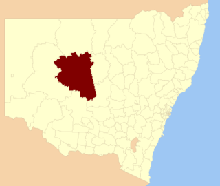
Gwydir Shire is a local government area located in the New England region of New South Wales, Australia. The northern boundary of the Shire is located adjacent to the border between New South Wales and Queensland.

<span class="mw-page-title-main">Lane Cove Council</span> Local government area in New South Wales, Australia

The Lane Cove Council is a local government area located on the Lower North Shore of Sydney, New South Wales, Australia. The administrative seat of Lane Cove is located 10 kilometres (6.2 mi) north-west of the Sydney central business district.

<span class="mw-page-title-main">City of Liverpool (New South Wales)</span> Local government area in New South Wales, Australia

The City of Liverpool is a local government area, administered by Liverpool City Council, located in the south-west of Sydney, in the state of New South Wales, Australia. The area encompasses 305.5 square kilometres (118.0 sq mi) and its administrative centre is located in the suburb of Liverpool.

<span class="mw-page-title-main">Bogan Shire</span> Local government area in New South Wales, Australia

Bogan Shire is a local government area in the Orana region of New South Wales, Australia. The Shire is located adjacent to the Mitchell and Barrier highways and its only significant town is Nyngan.

<span class="mw-page-title-main">Port Stephens Council</span> Local government area in New South Wales, Australia

Port Stephens Council is a local government area in the Hunter Region of New South Wales, Australia. The area is just north of Newcastle and is adjacent to the Pacific Highway which runs through Raymond Terrace, the largest town and Council seat. The area is named after Port Stephens, which is the major geographical feature of the area. It extends generally from the Hunter River in the south, to near Clarence Town in the north, and from the Tasman Sea in the east, to just south of Paterson in the west. The mayor of Port Stephens Council is Ryan Palmer. Palmer was caught in a major scandal in 2022 following the purchase of an $86,000 Ford Ranger for mayoral and personal use. Port Stephens is about two and a half hours north of Sydney.

<span class="mw-page-title-main">Byron Shire</span> Local government area in New South Wales, Australia

Byron Shire is a local government area located in the Northern Rivers region of New South Wales, Australia. The shire is located adjacent to the Coral Sea about 50 kilometres (31 mi) south of the Queensland border. The shire, administered from the town of Mullumbimby, covers an area of 566.7 square kilometres (218.8 sq mi), and has existed as a local government entity since 1906. The shire was named for Cape Byron, itself named by Captain James Cook in May 1770 in honour of Vice-Admiral John Byron.

<span class="mw-page-title-main">Gloucester Shire</span> Former local government area in New South Wales, Australia

Gloucester Shire was a local government area in the Mid North Coast and Upper Hunter regions of New South Wales, Australia. The Shire was situated adjacent to the Bucketts Way and the North Coast railway line.

<span class="mw-page-title-main">Narrabri Shire</span> Local government area in New South Wales, Australia

Narrabri Shire is a local government area in the North West Slopes region of New South Wales, Australia. The Shire is located adjacent to the Namoi River and the Newell and Kamilaroi Highways.

<span class="mw-page-title-main">City of Maitland</span> Local government area in New South Wales, Australia

The City of Maitland is a local government area in the lower Hunter region of New South Wales, Australia. The area is situated adjacent to the New England Highway and the Hunter railway line.

<span class="mw-page-title-main">City of Newcastle</span> Local government area in New South Wales, Australia

The City of Newcastle is a local government area in the Hunter region of New South Wales, Australia. The City of Newcastle incorporates much of the area of the Newcastle metropolitan area.

<span class="mw-page-title-main">City of Wagga Wagga</span> Local government area in New South Wales, Australia

City of Wagga Wagga is a local government area in the Riverina region of southern New South Wales, Australia.

<span class="mw-page-title-main">Bellingen Shire</span> Local government area in New South Wales, Australia

Bellingen Shire is a local government area in the Mid North Coast region of New South Wales, Australia. The shire is located adjacent to the Pacific Highway, Waterfall Way and the North Coast railway line.

<span class="mw-page-title-main">Singleton Council</span> Local government area in New South Wales, Australia

Singleton Council is a local government area in the Hunter Region of New South Wales, Australia. It is situated adjacent to the New England Highway and the Main North railway line.

<span class="mw-page-title-main">Muswellbrook Shire</span> Local government area in New South Wales, Australia

Muswellbrook Shire is a local government area in the Upper Hunter region of New South Wales, Australia. The Shire is situated adjacent to the New England Highway and the Hunter railway line.

<span class="mw-page-title-main">Guyra Shire</span> Former local government area in New South Wales, Australia

Guyra Shire was a local government area located in the New England region of New South Wales, Australia. The shire was abolished on 12 May 2016, where the council merged with the Armidale Dumaresq Shire, was subsumed into the Armidale Regional Council with immediate effect.

<span class="mw-page-title-main">Glen Innes Severn</span> Local government area in New South Wales, Australia

Glen Innes Severn is a local government area in the New England region of New South Wales, Australia. The council serves an area of 5,487 square kilometres (2,119 sq mi) and is located adjacent to the New England Highway. The council was formed by the amalgamation of Severn Shire and Glen Innes City Council.

<span class="mw-page-title-main">Dungog Shire</span> Local government area in New South Wales, Australia

Dungog Shire is a local government area in the Hunter region of New South Wales, Australia. The Shire is situated adjacent to the Barrington Tops and consists predominantly of very rugged to hilly country which becomes less rugged from north to south.

<span class="mw-page-title-main">Cobar Shire</span> Local government area in New South Wales, Australia

Cobar Shire is a local government area in the Orana region of New South Wales, Australia. The Shire is located in an outback area that is centred around the mining town of Cobar. The Shire is traversed by the Barrier Highway and the Kidman Way. With a total area of 44,065 square kilometres (17,014 sq mi), about two-thirds the size of Tasmania, Cobar Shire is larger than Denmark and 99 other countries and self-governing territories, but its population is under 5000.

References

  1. 1 2 3 "3218.0 – Regional Population Growth, Australia 2021-2022: Population Estimates by Local Government Area (ASGS 2023), 2021 to 2022". Australian Bureau of Statistics. April 2023. Retrieved 16 January 2024. Estimated resident population, 2022.
  2. 1 2 "Local Government Act 1919. Proclamation (138)". Government Gazette of the State of New South Wales . 22 October 1976. p. 4526. Retrieved 15 January 2020 via National Library of Australia.
  3. "Ballina Shire Council". New South Wales Division of Local Government . Retrieved 22 November 2006.
  4. "Ballina Shire election results". ABC News. Retrieved 22 September 2022.
  5. "High Conservation Value Old Growth forest". New South Wales State Heritage Register . Department of Planning & Environment. H01487. Retrieved 18 May 2018. CC BY icon.svg Text is licensed by State of New South Wales (Department of Planning and Environment) under CC-BY 4.0 licence .
  6. 1 2 3 Australian Bureau of Statistics (27 June 2017). "Ballina (A)". 2016 Census QuickStats. Retrieved 22 November 2021. OOjs UI icon edit-ltr-progressive.svg
  7. 1 2 Australian Bureau of Statistics (9 March 2006). "Ballina (A)". 2001 Census QuickStats. Retrieved 22 May 2016. OOjs UI icon edit-ltr-progressive.svg
  8. 1 2 Australian Bureau of Statistics (25 October 2007). "Ballina (A)". 2006 Census QuickStats. Retrieved 22 May 2016.
  9. Australian Bureau of Statistics (31 October 2012). "Ballina (A)". 2011 Census QuickStats. Retrieved 22 May 2016. OOjs UI icon edit-ltr-progressive.svg
  10. Australian Bureau of Statistics (27 June 2017). "Ballina (A)". 2016 Census QuickStats. Retrieved 7 July 2017. OOjs UI icon edit-ltr-progressive.svg
  11. 1 2 "Ballina – Mayoral Election results". NSW Electoral Commission. 22 December 2021. Retrieved 18 March 2022.
  12. 1 2 "Ballina A Ward – Councillor Election results". NSW Electoral Commission. 23 December 2021. Retrieved 18 March 2022.
  13. 1 2 "Ballina B Ward – Councillor Election results". NSW Electoral Commission. 23 December 2021. Retrieved 18 March 2022.
  14. 1 2 "Ballina C Ward – Councillor Election results". NSW Electoral Commission. 23 December 2021. Retrieved 18 March 2022.
  15. 1 2 3 4 "Eva Ramsey says she will be her own woman on Ballina Council".
  16. "Platforms or objectives of registered candidates".
  17. "Ballina". ABC News.
  18. "Ballina's new mayor 'humbled and honoured'". echo.net.au.