Inverell Shire New South Wales | |||||||||||||||
---|---|---|---|---|---|---|---|---|---|---|---|---|---|---|---|
Coordinates | 29°46′S151°07′E / 29.767°S 151.117°E | ||||||||||||||
Population |
| ||||||||||||||
• Density | 2.07448/km2 (5.3729/sq mi) | ||||||||||||||
Established | 1 July 1979 | ||||||||||||||
Area | 8,606 km2 (3,322.8 sq mi) | ||||||||||||||
Mayor | Paul Harmon (Unaligned) | ||||||||||||||
Council seat | Inverell [3] | ||||||||||||||
Region | North West Slopes | ||||||||||||||
State electorate(s) | Northern Tablelands | ||||||||||||||
Federal division(s) | New England | ||||||||||||||
Website | Inverell Shire | ||||||||||||||
|
Inverell Shire is a local government area in the North West Slopes region of New South Wales, Australia adjacent to the Macintyre River and the Gwydir Highway.
The mayor of Inverell Shire Council is Cr. Paul Harmon, who is unaligned with any political party.
Inverell Shire was created on 1 July 1979 from the amalgamation of the Municipality of Inverell with Ashford Shire and Macintyre Shire. [4]
Formerly part of the Armidale Region, on 1 July 2019, Tingha was transferred to the Inverell Shire. [5] [6]
The shire includes the town of Inverell and small towns and villages including Gilgai, Stannifer, Elsmore, Bukkulla, Ashford, Bonshaw, Yetman, Wallangra, Graman, Oakwood, Delungra, Mount Russell and Tingha. The locality of Myall Creek is split being Inverell Shire and Gwydir Shire.
At the 2011 census, there were 16,075 people in the Inverell local government area, of these 49.1 per cent were male, and 50.9 per cent were female. Aboriginal and Torres Strait Islander people made up 6.5 per cent of the population which is approximately two-and-a-half times above both the national and state averages of 2.5 per cent. The median age of people in the Inverell Shire was 41 years; slightly higher than the national median of 37 years. Children aged 0 – 14 years made up 21.3 per cent of the population and people aged 65 years and over made up 19.2 per cent of the population. Of people in the area aged 15 years and over, 51.3 per cent were married and 11.8 per cent were either divorced or separated. [7]
Between the 2001 census and the 2011 census, the Inverell Shire experienced nominal population growth in both absolute and real terms. When compared with the total population growth of Australia for the same periods, being 5.78 per cent and 8.32 per cent respectively, population growth in the Inverell local government area was significantly lower than the national average. [8] The median weekly income for residents within the Inverell Shire was significantly below the national average. [7] [9]
At the 2011 census, the proportion of residents in the Inverell local government area who stated their ancestry as Australian or Anglo-Saxon exceeded 88 per cent of all residents (the national average was 65.2 per cent). In excess of 68 per cent of all residents in the Inverell Shire nominated a religious affiliation with Christianity at the 2011 census, which was higher than the national average of 50.2 per cent. Meanwhile, as at the census date, compared to the national average, households in the Inverell local government area had a significantly lower than average proportion (3.2 per cent) where two or more languages are spoken (the national average was 20.4 per cent); and a significantly higher proportion (94.5 per cent) where English only was spoken at home (national average was 76.8 per cent). [7]
Selected historical census data for Inverell Shire local government area | |||||
---|---|---|---|---|---|
Census year | 2001 [8] | 2006 [9] | 2011 [7] | ||
Population | Estimated residents on Census night | 15,020 | 15,510 | 16,075 | |
LGA rank in terms of size within New South Wales | 82nd | 74th | |||
% of New South Wales population | 0.23% | ||||
% of Australian population | 0.08% | 0.08% | 0.07% | ||
Cultural and language diversity | |||||
Ancestry, top responses | Australian | 36.8% | |||
English | 31.7% | ||||
Irish | 8.2% | ||||
Scottish | 7.4% | ||||
German | 3.9% | ||||
Language, top responses (other than English) | Italian | 0.4% | 0.4% | 0.3% | |
Portuguese | n/c | n/c | 0.3% | ||
Tagalog | n/c | n/c | 0.2% | ||
German | 0.1% | 0.2% | 0.1% | ||
Filipino | n/c | n/c | 0.1% | ||
Religious affiliation | |||||
Religious affiliation, top responses | Anglican | 37.0% | 34.0% | 32.8% | |
Catholic | 23.7% | 23.8% | 22.8% | ||
No Religion | 7.1% | 10.7% | 13.7% | ||
Presbyterian and Reformed | 9.0% | 8.2% | 7.5% | ||
Uniting Church | 4.7% | 6.1% | 5.8% | ||
Median weekly incomes | |||||
Personal income | Median weekly personal income | A$352 | A$430 | ||
% of Australian median personal income | 75.5% | 74.5% | |||
Family income | Median weekly family income | A$840 | A$963 | ||
% of Australian median family income | 71.7% | 65.0% | |||
Household income | Median weekly household income | A$642 | A$792 | ||
% of Australian median household income | 62.5% | 64.2% | |||
Inverell Shire Council is composed of nine councillors elected proportionally as a single ward. All councillors are elected for a fixed four-year term of office. The mayor is elected by the councillors at the first meeting of the council. The most recent election was held on 4 December 2021, and the makeup of the council is as follows:
Party | Councillors | |
---|---|---|
Independents and unaligned | 9 | |
Total | 9 |
Party | Candidate | Votes | % | ±% | |
---|---|---|---|---|---|
Independent | 1. Paul Harmon (elected) 2. Kate Dight (elected) | 3,271 | 33.1 | ||
Di Baker & Jo Williams | 1. Di Baker (elected) 2. Jo Williams (elected) | 2,947 | 29.8 | ||
Independent | 1. Paul King (elected) 2. Wendy Wilks (elected) | 1,264 | 12.8 | ||
Independent | Nicky Lavender (elected) | 665 | 6.7 | ||
Independent | Stewart Berryman (elected) | 592 | 6.0 | ||
Independent | John (Jacko) Ross (elected) | 481 | 4.9 | ||
Independent | Phil Girle | 347 | 3.5 | ||
Independent | Jacki Watts | 320 | 3.2 | ||
Total formal votes | 9,887 | 93.3 | |||
Informal votes | 705 | 6.7 | |||
Turnout | 10,592 | 82.3 |
Clarence Valley Council is a local government area in the Northern Rivers region of New South Wales, Australia.
Nambucca Valley Council is a local government area in the Mid North Coast region of New South Wales, Australia.
The City of Cessnock is a local government area in the Hunter region of New South Wales, Australia. The area under administration is located to the west of Newcastle. The largest population centre and council seat is the city of Cessnock.
Richmond Valley Council (RVC) is a local government area on the Northern Rivers region of north-eastern New South Wales, Australia. RVC services an area of 3,051 square kilometres (1,178 sq mi) and draws its name from the Richmond River, which flows through most of the council area. The area under management is located adjacent to the Bruxner Highway, Pacific Highway, and the North Coast railway line.
Gwydir Shire is a local government area located in the New England region of New South Wales, Australia. The northern boundary of the Shire is located adjacent to the border between New South Wales and Queensland.
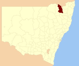
Moree Plains Shire is a local government area in the North West Slopes region of New South Wales, Australia. The northern boundary of the Shire is located adjacent to the border between New South Wales and Queensland. The Shire is located adjacent to the Newell and Gwydir Highways and the North West railway line.
Tweed Shire is a local government area located in the Northern Rivers region of New South Wales, Australia. It is adjacent to the border with Queensland, where that meets the Coral Sea. Administered from the town of Murwillumbah, Tweed Shire covers an area of 1,321 square kilometres (510 sq mi), and has existed as a local government entity since 1947. It was named for the Tweed River.
Gloucester Shire was a local government area in the Mid North Coast and Upper Hunter regions of New South Wales, Australia. The Shire was situated adjacent to the Bucketts Way and the North Coast railway line.
Narrabri Shire is a local government area in the North West Slopes region of New South Wales, Australia. The Shire is located adjacent to the Namoi River and the Newell and Kamilaroi Highways.
Ballina Shire is a local government area in the Northern Rivers region of New South Wales, Australia. The Shire was formed on 1 January 1977 by the amalgamation of the Municipality of Ballina and Tintenbar Shire. The Shire is located adjacent to the Tasman Sea and the Pacific Highway. The council seat is located in the town of Ballina. The population of the Ballina Shire area was 46,850 in 2022.
The Armidale Dumaresq Council was a local government area in the New England and Northern Tablelands regions of New South Wales, Australia. This area was formed in 2000 from the merger of the original City of Armidale with the surrounding Dumaresq Shire and abolished on 12 May 2016, where the council, together with Guyra Shire, was subsumed into the Armidale Regional Council with immediate effect.
Bellingen Shire is a local government area in the Mid North Coast region of New South Wales, Australia. The shire is located adjacent to the Pacific Highway, Waterfall Way and the North Coast railway line.
Kempsey Shire is a local government area in the Mid North Coast region of New South Wales, Australia.
Singleton Council is a local government area in the Hunter Region of New South Wales, Australia. It is situated adjacent to the New England Highway and the Main North railway line.
Muswellbrook Shire is a local government area in the Upper Hunter region of New South Wales, Australia. The Shire is situated adjacent to the New England Highway and the Hunter railway line.
Guyra Shire was a local government area located in the New England region of New South Wales, Australia. The shire was abolished on 12 May 2016, where the council merged with the Armidale Dumaresq Shire, was subsumed into the Armidale Regional Council with immediate effect.
Glen Innes Severn is a local government area in the New England region of New South Wales, Australia. The council serves an area of 5,487 square kilometres (2,119 sq mi) and is located adjacent to the New England Highway. The council was formed by the amalgamation of Severn Shire and Glen Innes City Council.
Tenterfield Shire is a local government area located in the New England region of New South Wales, Australia. The Shire is situated adjacent to the New England Highway.
Dungog Shire is a local government area in the Hunter region of New South Wales, Australia. The Shire is situated adjacent to the Barrington Tops and consists predominantly of very rugged to hilly country which becomes less rugged from north to south.
The Armidale Region is a local government area in the New England and Northern Tablelands regions of New South Wales, Australia. This area was formed in 2016 from the merger of the Armidale Dumaresq Shire with the surrounding Guyra Shire.