
The Border Ranges National Park is a protected national park that is located in the Northern Rivers region of New South Wales, Australia. A small portion of the national park is also located in South East Queensland. The 31,729-hectare (78,400-acre) park is situated approximately 150 kilometres (93 mi) south of Brisbane, north of Kyogle.

Cottan-Bimbang is a national park in New South Wales, Australia, 443 km north of Sydney and 65 km south east of Walcha and was formerly a state forest. The Oxley Highway crosses the park south of Werrikimbe National Park. Myrtle Scrub Road is a 15 kilometre circuit in the west of the park that connects with the Oxley Highway.

Heathcote National Park is a protected national park that is located in the southern region of Sydney, New South Wales in eastern Australia. The 2,679-hectare (6,620-acre) national park is situated approximately 35 kilometres (22 mi) southwest of the Sydney central business district, west of the South Coast railway line, the Princes Highway and Motorway, and the suburbs of Heathcote and Waterfall.

Macquarie Pass National Park is a national park in New South Wales, Australia, 90 km southwest of Sydney. It is located around the pass of the same name, which is on the Illawarra Highway and part of the Illawarra escarpment.

Mummel Gulf is a national park located in New South Wales, Australia, approximately 487 kilometres (303 mi) by road north of Sydney. It is situated approximately 50 kilometres (31 mi) southeast of Walcha on the unsealed Enfield Forest Road and 12 kilometres (7.5 mi) south of the Oxley Highway.

The Oxley Wild Rivers National Park is a protected national park that is located in the Northern Tablelands region of New South Wales, Australia. The 145,223-hectare (358,850-acre) park is situated 445 kilometres (277 mi) north of Sydney and is named in memory of the Australian explorer John Oxley, who passed through the area in 1818 and is one of the largest national parks in New South Wales.

Tapin Tops National Park is an 110 km2 (42 sq mi) national park that is located in the Upper Hunter and Mid North Coast regions of New South Wales, Australia.

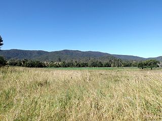
The Werrikimbe National Park is a protected national park located in the catchment zone of the Upper Hastings River in New South Wales, Australia. Gazetted in 1975, the 33,309-hectare (82,310-acre) park is situated approximately 486 kilometres (302 mi) north of Sydney and 65 kilometres (40 mi) from Wauchope, and 90 kilometres (56 mi) east of Walcha on the eastern escarpment of the Great Dividing Range.

D'Aguilar is a national park in Queensland, Australia, 31 km northwest of Brisbane. The southern part of the park was formerly known as Brisbane Forest Park, while the northern part of the park is at Mount Mee.

Kondalilla is a national park in the Blackall Range of South East Queensland, Australia, 91 km north of Brisbane. William Skene founded this area on his property while searching for lost cattle. He named it Bon Accord before giving it to the Queensland Government who, during the fifties, renamed it Kondalilla which is an Aboriginal word for running water. The area was first officially protected in 1906 as a recreational area, becoming a national park in 1945.

The Lamington National Park is a national park, lying on the Lamington Plateau of the McPherson Range on the Queensland/New South Wales border in Australia. From Southport on the Gold Coast the park is 85 kilometres (53 mi) to the southwest and Brisbane is 110 kilometres (68 mi) north. The 20,600 hectares Lamington National Park is known for its natural environment, rainforests, birdlife, ancient trees, waterfalls, walking tracks and mountain views.

This article is about Ravensbourne National Park, Australia. For other places named Ravensbourne, see Ravensbourne.

The Springbrook National Park is a protected national park that is located in the Gold Coast hinterland of Queensland, Australia. The 6,197-hectare (15,310-acre) park is situated on the McPherson Range, near Springbrook, approximately 100 kilometres (62 mi) south of Brisbane. The park is part of the Shield Volcano Group of the UNESCO World Heritage–listed Gondwana Rainforests of Australia.

Tamborine is a national park in the Gold Coast hinterland and is a part of the Scenic Rim Regional Council of South East Queensland, Australia, 45 km (28 mi) south of Brisbane.

Cloudland Canyon State Park is a 3,485 acres (14.10 km2) Georgia state park located near Trenton and Cooper Heights on the western edge of Lookout Mountain. One of the largest and most scenic parks in Georgia, it contains rugged geology, and offers visitors a range of vistas across the deep gorge cut through the mountain by Sitton Gulch Creek, where the elevation varies from 800 to over 1,800 feet. Views of the canyon can be seen from the picnic area parking lot, in addition to additional views located along the rim trail. At the bottom of the gorge, two waterfalls cascade across layers of sandstone and shale, ending in small pools below.

The Waterfall Way is a road in New South Wales, Australia. It runs east-west from the Pacific Highway to the New England Highway at Armidale. The route passes through some of New South Wales' most scenic countryside and has become well known as New South Wales best and Australia's third most beautiful tourist drive. Seven national parks, of which three are listed as World Heritage Areas by UNESCO and form part of the Gondwana Rainforests of Australia, are located on or close to the route. Dorrigo National Park encompasses the waterfalls that give the route its name. It also provides one of the few road links between coastal and inland New South Wales, and is therefore more heavily trafficked than its condition might otherwise suggest.
The Tops to Myall Heritage Trail is a 220 km walking track in the Hunter Region of New South Wales, Australia. The track starts on the sub-alpine plateau of the Barrington Tops National Park and gradually descends to the coast through the Myall Lakes National Park and ends at the seaside town of Tea Gardens.

Tamborine Mountain is a 28 km2 (11 sq mi) plateau and locality in the Scenic Rim local government area of South East Queensland, Australia. In the 2011 census, Tamborine Mountain had a population of 7,030 people. The name is of Aboriginal origin and has nothing to do with the musical instrument. It is considered part of the Gold Coast hinterland and has a strong tourist industry.
Bellthorpe National Park is a national park located in Bellthorpe, Booroobin and Sandy Creek in both the Moreton Bay Region and Somerset Region of South East Queensland, Australia. The park preserves eucalypt forest and rainforest of the southern Conondale Range. Parts of the national park were previously known as Bellthor.

The Matilija Wilderness is a 29,207-acre (11,820 ha) wilderness area in Ventura and Santa Barbara Counties, Southern California. It is managed by the U.S. Forest Service, being situated within the Ojai Ranger District of the Los Padres National Forest. It is located adjacent to the Dick Smith Wilderness to the northwest and the Sespe Wilderness to the northeast, although it is much smaller than either one. The Matilija Wilderness was established in 1992 in part to protect California condor habitat.


