The Border Ranges National Park is a protected national park that is located in the Northern Rivers region of New South Wales, Australia. A small portion of the national park is also located in South East Queensland. The 31,729-hectare (78,400-acre) park is situated approximately 150 kilometres (93 mi) south of Brisbane, north of Kyogle.

Cunnawarra is a national park located in New South Wales, Australia, 80 kilometres (50 mi) east of Armidale, 10 kilometres (6.2 mi) off the Waterfall Way and 565 kilometres (351 mi) north of Sydney. The 25-kilometre (16 mi) Styx River Forest Way runs from the Point Lookout Road through Cunnawarra National Park to the Kempsey Road. The New England National Park adjoins the Cunnawarra National Park on the north-eastern boundary and the Oxley Wild Rivers National Park joins it on the southern corner.

The Ku-ring-gai Chase National Park is a protected national park that is located in New South Wales, Australia. The 14,977-hectare (37,010-acre) national park is situated 25 kilometres (16 mi) north of Sydney located largely within the Ku-ring-gai, Hornsby, and the Northern Beaches Council local government areas. The villages of Cottage Point, Appletree Bay, and Bobbin Head are located within park boundaries. An isolated portion of the park, Barrenjoey Headland, is located to the north of Palm Beach east of the primary park body and is home to Barrenjoey Lighthouse.

Macquarie Pass National Park is a national park in New South Wales, Australia, 90 km southwest of Sydney. It is located around the pass of the same name, which is on the Illawarra Highway and part of the Illawarra escarpment.

Mummel Gulf is a national park located in New South Wales, Australia, approximately 487 kilometres (303 mi) by road north of Sydney. It is situated approximately 50 kilometres (31 mi) southeast of Walcha on the unsealed Enfield Forest Road and 12 kilometres (7.5 mi) south of the Oxley Highway.

The Oxley Wild Rivers National Park is a protected national park that is located in the Northern Tablelands region of New South Wales, Australia. The 145,223-hectare (358,850-acre) park is situated 445 kilometres (277 mi) north of Sydney and is named in memory of the Australian explorer John Oxley, who passed through the area in 1818 and is one of the largest national parks in New South Wales.

Tapin Tops National Park is an 110 km2 (42 sq mi) national park that is located in the Upper Hunter and Mid North Coast regions of New South Wales, Australia.
The Toonumbar National Park is a protected national park located in the Northern Rivers region of New South Wales, Australia. The 14,910-hectare (36,800-acre) park is situated approximately 620 kilometres (390 mi) north of Sydney, near the town of Woodenbong.

The Werrikimbe National Park is a protected national park located in the catchment zone of the Upper Hastings River in New South Wales, Australia. Gazetted in 1975, the 33,309-hectare (82,310-acre) park is situated approximately 486 kilometres (302 mi) north of Sydney and 65 kilometres (40 mi) from Wauchope, and 90 kilometres (56 mi) east of Walcha on the eastern escarpment of the Great Dividing Range.

Walcha is a town at the south-eastern edge of the Northern Tablelands, New South Wales, Australia.

The Waterfall Way is a road in New South Wales, Australia. It runs east-west from the Pacific Highway to the New England Highway at Armidale. The route passes through some of New South Wales' most scenic countryside and has become well known as New South Wales best and Australia's third most beautiful tourist drive. Seven national parks, of which three are listed as World Heritage Areas by UNESCO and form part of the Gondwana Rainforests of Australia, are located on or close to the route. Dorrigo National Park encompasses the waterfalls that give the route its name. It also provides one of the few road links between coastal and inland New South Wales, and is therefore more heavily trafficked than its condition might otherwise suggest.

The Hacking River is a watercourse that is located in the Southern Sydney region of New South Wales in Australia. The river is named in honour of Henry Hacking, a pilot at Port Jackson in colonial New South Wales.

Thunderbolts Way is a 290-kilometre (180 mi) country road located in the Northern Tablelands region of New South Wales, Australia. The road links Gloucester to Walcha, Uralla, where it very briefly joins the New England Highway and, to Copes Creek, 16 km (10 mi) south of the Gwydir Highway intersection at Inverell. The road is fully sealed and passes through thickly forested mountain areas with many nearby national parks and nature reserves.

The Apsley Falls are two waterfalls on the Apsley River in the Northern Tablelands region of New South Wales, Australia. The falls are located about 20 kilometres (12 mi) east of Walcha, and 1 kilometre off the Oxley Highway in a deep gorge, that is part of the Oxley Wild Rivers National Park. They are the first falls in a succession of dramatic drops in an area that has some of the most remarkable scenery in Eastern Australia. The first drop of the falls is about 65 metres (213 ft) in depth, and the second, which is about 800 metres (2,625 ft) further on, plummets 58 metres (190 ft) metres to the bottom of the gorge.
The Boorganna Nature Reserve is a protected nature reserve located northwest of Taree on the Comboyne Plateau in New South Wales, Australia. The 396-hectare (980-acre) reserve, managed by the NSW National Parks & Wildlife Service, was gazetted in 1904 and is the second oldest nature reserve in the state. The reserve features various forest types, including stands of sub tropical rainforest of which the large rosewood, yellow carabeen and small leaf fig are particularly noteworthy. The reserve is a remnant of the former extensive rainforest on the Comboyne Plateau. The plateau was cleared between 1900 and 1925. Australian red cedar was logged in the area in the nineteenth century. Originally proposed to be part of the world heritage rainforest group. The exploration, knowledge, uses and history of this area by Indigenous Australians is not well known in the present day.
Tobins River, a perennial stream of the Hastings River catchment, is located in the Northern Tablelands and Mid North Coast districts of New South Wales, Australia.

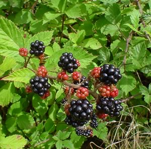
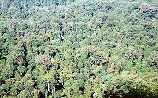
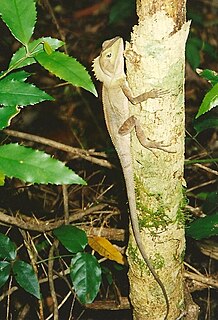
The Eastern Australian temperate forests, or temperate eucalypt forests, are an ecoregion of open forest on uplands starting from the east coast of New South Wales in the South Coast to southern Queensland, Australia. Four distinguishable communities are found within this ecoregion: subtropical rainforest, subtropical dry rainforest, warm temperate rainforest, and cool temperate rainforest, where they may also grade to other biomes, depending on the location.

The Wilsons Peak Flora Reserve is a protected nature reserve that is located in the Northern Rivers region in the state of New South Wales, in eastern Australia. The reserve is bounded to the north by the border between New South Wales and the state of Queensland. The nearest town is the Queensland settlement of Killarney.

The Victoria Park Nature Reserve is a protected nature reserve that is located in the Northern Rivers region in the state of New South Wales, in eastern Australia. The sub-tropical jungle remnant is located an undulating high rainfall plain near Alstonville. The red-brown soil is derived from a basaltic flow from the nearby Mount Warning. Of the total land in the reserve, 8 hectares is original rainforest; and the other areas are being re-vegetated.

Prospect Nature Reserve is a nature reserve and recreational area that is situated in the western suburbs of Sydney, New South Wales, Australia, which incorporates the Prospect Reservoir, and also features picnic spots, walking tracks and BBQ areas within the Australian bush. It is located within the Blacktown City local government area, but is also close to the boundaries of Cumberland Council and the City of Fairfield.