
Gulaga National Park is a national park on the south coast of New South Wales, Australia, about 10 kilometres (6.2 mi) north of Bermagui. The park is dominated by Gulaga, also known as Mount Gulaga. The former Wallaga Lake National Park, Goura Nature Reserve, and Mount Dromedary Flora Reserve were combined to form this park in 2001.

Weddin Mountains is a national park located in New South Wales, Australia, 291 kilometres (181 mi) west of Sydney. It is a small, crescent-shaped range, with a high point some 750 metres (2,460 ft) AHD , running roughly north south with steep cliffs on the eastern side sloping more gradually down to the plane in the west. Weddin mountains is a small patch of remnant vegetation which escaped clearing due to its ruggedness. Many aircraft pass overhead on their way from Sydney to Adelaide, is part of the Lachlan Fold system and is Wiradjuri country.

New England is a vaguely defined region in the north of the state of New South Wales, Australia, about 60 km inland from the Tasman Sea. The area includes the Northern Tablelands and the North West Slopes regions. As of 2006, New England had a population of 202,160, with over a quarter of the people living in the area of Tamworth Regional Council.

The Macquarie Marshes Nature Reserve is a protected natural wetland reserve that is located within the Macquarie Marshes, in the region along the lower Macquarie River in northwestern New South Wales, Australia. The 19,824-hectare (48,990-acre) reserve is situated approximately 600 kilometres (370 mi) northwest of Sydney and 100 kilometres (62 mi) north of Warren.
Tumbarumba is a small town in New South Wales, Australia, about 480 kilometres (300 mi) southwest of the state capital, Sydney. Tumbarumba is located on the periphery of the Riverina and South West Slopes regions at the western edge of the Snowy Mountains. The 2016 census showed the population of the town and surrounding area to be 1,862 people. Locals refer to the town as 'Tumba'.

The Riverina is an agricultural region of south-western New South Wales, Australia. The Riverina is distinguished from other Australian regions by the combination of flat plains, warm to hot climate and an ample supply of water for irrigation. This combination has allowed the Riverina to develop into one of the most productive and agriculturally diverse areas of Australia. Bordered on the south by the state of Victoria and on the east by the Great Dividing Range, the Riverina covers those areas of New South Wales in the Murray and Murrumbidgee drainage zones to their confluence in the west.
Tarcutta is a town in south-western New South Wales, Australia. The town is 438 kilometres (272 mi) south-west of Sydney, 3 kilometres (1.9 mi) east of the Hume Highway, It was proclaimed as a village on 28 October 1890. As of 2016, the town had a population of 446.

The Main Southern Railway is a major railway in New South Wales, Australia. It runs from Sydney to Albury, near the Victorian border. The line passes through the Southern Highlands, Southern Tablelands, South West Slopes and Riverina regions.

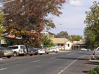
Rosewood is a village community and locality in the south east part of the Riverina, New South Wales, Australia. It is situated about 16 kilometres (9.9 mi) south east from Carabost and 19 kilometres (12 mi) north west from Tumbarumba. At the 2016 census, Rosewood had a population of 214. The village is administered by two local governments; the northern part of the locality by the Greater Hume Shire and the southern part of the locality by the Snowy Valleys Council. The village of Rosewood is within the Snowy Valleys Council area.

Cootamundra is an electoral district of the Legislative Assembly in the Australian state of New South Wales.

The Ulandra Nature Reserve is a protected nature reserve that is located in the west hills of the Southern Tablelands and eastern Riverina regions of New South Wales in eastern Australia. The 3,930-hectare (9,700-acre) reserve is situated approximately 25 kilometres (16 mi) south-west of Cootamundra and 4 kilometres (2.5 mi) south-east of the village of Bethungra.
In the state of New South Wales, Australia, there are many areas which are commonly known by regional names. Regions are areas that share similar characteristics. These characteristics may be natural such as the Murray River, the coastline, or the Snowy Mountains. Alternatively, the characteristics may be cultural, such as a viticulture land use. New South Wales is divided by numerous regional boundaries, based on different characteristics. In many cases boundaries defined by different agencies are coterminous.
The Strike-a-Light River, a perennial stream that is part of the Murrumbidgee catchment within the Murray–Darling basin, is located in the Snowy Monaro Regional Council area of New South Wales, Australia.
Livingstone is a national park and state conservation area located 30 kilometres (19 mi) south of Wagga Wagga and 10 kilometres (6.2 mi) east of Mangoplah, in the South West Slopes region of south western New South Wales.
Woomargama National Park is a national park situated 20 kilometres (12 mi) south east of Holbrook and 30 kilometres (19 mi) north east of Albury, in the South West Slopes region of southern New South Wales. Southern extremities of the park are within one kilometre of Lake Hume which is formed on the Murray River. The park extends over approximately 30 km from eastern to western boundaries and 15 km in a north to south direction. In 2006, the park covered an area of 23,577 hectares and at the same time an area of associated reserve covered 7,120 hectares. In 2010 the park alone covered 24,185 ha.

The Yanga National Park is a newly formed national park, located near the township of Balranald in south- western New South Wales. It covers an area of 66,734 hectares which includes 1,932 hectares of Yanga Nature Reserve, and has a frontage of 170 kilometres (110 mi) on the Murrumbidgee River. It is largely located in the Lower Murrumbidgee Floodplain, which is included on A Directory of Important Wetlands in Australia because of its importance as a breeding site for waterbirds when flooded.

The Yathong Nature Reserve is a protected nature reserve that is also a nationally and internationally recognized biosphere situated in the central-western region of New South Wales, in eastern Australia. The 107,240-hectare (265,000-acre) reserve was listed by UNESCO in 1977 as a Biosphere Reserve under the Man and the Biosphere Programme (MAB). The reserve is significant for its biodiversity in both native plant and animal species. Cultural heritage and historical grazing activities add to the significance of this site as a conservation area.

The Charcoal Tank Nature Reserve is a protected nature reserve in the central western region of New South Wales, Australia. The 86.4-hectare (213-acre) reserve is situated 10 kilometres (6.2 mi) south of West Wyalong and may be accessed via the Newell Highway and The Charcoal Tank Road. The reserve is an important refuge for native flora and fauna in a highly fragmented landscape, one in which the majority of the original vegetation has been removed.

The Murrumbidgee Valley National Park is a protected national park that is located in the Riverina region of New South Wales, in eastern Australia. The 47,703-hectare (117,880-acre) national park is located approximately 6 kilometres (3.7 mi) east of Hay, and approximately 15 kilometres (9.3 mi) west of Narrandera. The park protects part of what is now the largest continuous tract of river red gum forest in the world.

Limeburners Creek National Park is a protected national park on the Mid North Coast of New South Wales, Australia. The 91.2 km national park is located 5 km (3.1 mi) to the north of Port Macquarie and exists across both the Kempsey Shire and Port Macquarie-Hastings Council local government areas, but is chiefly managed by National Parks and Wildlife Service. The area was originally erected as a nature reserve but this reservation was revoked when it became formally recognised as a national park in 2010 under the National Parks and Wildlife Act (1974). Many threatened ecological habitats and species of fauna and flora are found within this park, alongside several heritage sites of cultural significance, particularly to the local Birpai and Dunghutti people upon whose land the park exists. The protected status of this national park is largely owing to the ecological and cultural value of the area, in addition to the value of the ecosystems to further scientific research.
