Wagga Wagga was first incorporated as the Borough of Wagga Wagga on 15 March 1870.[8] It received city status and became the City of Wagga Wagga on 17 April 1946. The municipality enlarged substantially on 1 January 1981 when the adjoining Shire of Kyeamba and Shire of Mitchell were amalgamated into the City.[9]
Heritage listings
The City of Wagga Wagga has a number of heritage-listed sites, including:
At the 2021 census, there were 69,047 people in the City of Wagga Wagga local government area, of these 48.6% were male and 51.4% were female. Aboriginal and Torres Strait Islander people made up 6.6% of the population, close to twice the national average of 3.2%. The median age of people in the City of Wagga Wagga was 35 years, which was lower than the national median of 38 years. Children aged 0 – 14 years made up 20.3% of the population and people aged 65 years and over made up 15.2% of the population. Of people in the area aged 15 years and over, 44.8% were married and 11.3% were either divorced or separated.[14]
At the 2021 Census, 40.0% of residents stated their ancestry as Australian. Excluding not stated responses, 60.9% of residents in the City of Wagga Wagga nominated a religious affiliation with Christianity, which was higher than the national average of 47.1%. 85.3% of households only speak English at home, higher than the national average of 72%.[14]
Selected historical census data for the City of Wagga Wagga local government area
Mayor of the City of Wagga Wagga Cr Dallas Tout and Deputy Mayor Cr Jenny McKinnon
Current composition and election method
Wagga Wagga City Council (WWCC) is composed of nine councillors elected proportionally as a single ward. All councillors are elected for a fixed four-year term of office. The mayor is elected by the councillors at the first meeting of the council. The most recent election was held on 4 December 2021, and the makeup of the council is as follows:[21]
A referendum was held on 8 September 2012 and an absolute majority of voters resolved in favour to reduce the number of councillors from eleven to nine.[23] The change came into effect at the September 2016 elections.
Administration staff
In December 2009, Wagga Wagga City Council announced that it had appointed Phil Pinyon as the general manager of the Wagga Wagga City Council replacing Lyn Russell, who suddenly announced her resignation in October 2009, after completing 18 months of her five-year contract.[24][25][26]
Cutting ties with China's Sister City
In April 2020, The Wagga council voted to cut ties with China's Kunming city; a week later they would vote again joining Kunming as a sister city.[27][28][29]
Crows are considered a symbol of the city of Wagga Wagga, appearing in the council's logo, coat of arms, and throughout local business logos and public artworks. This is due to the debated interpretation of 'Wagga Wagga' being derived from a Wiradjuri term meaning 'place of many crows'. The floral emblem for the city is the Silver Banksia.[36]
Out of a Mural Crown in front of a Caduceus Or, winged Sable, eight leaves of the River Red Gum Tree (Eucalyptus camaldulensis) conjoined and in the form of two letters W proper.
Helm
A closed helmet.
Escutcheon
Vert, on a Fess between in chief eight stalks of Wheat, each four in the form of the letter W, and in base a Merino Ram's head caboshed, all Or, a Bar wavy Azure.
Supporters
On either side a Crow wings addorsed proper, gorged with a Collar dancetty Or, and perched on a forked twig.
Compartment
A compartment of grass divided by Water Barry wavy Argent and Azure.
Motto
Forward in Faith
Other elements
Mantling Vert doubled Or.
Symbolism
The colours of green and gold, and the gold band on green in the escutcheon are taken from the arms of Captain Charles Sturt, the first European explorer of the area. The wavy blue line represents the Murrumbidgee River. The wheat (arranged as two "W" letters for the city name), and the Merino Ram head are for the principal industries of the city. The eight River Red Gum leaves in the crest are also arranged as two "W" letters and are placed in front of the Caduceus, the symbol of Mercury, the Roman god of commerce. The crow supporters with "W" collars are taken from the former Council seal and allude to the meaning of Wagga Wagga ("the place of many crows"). The compartment of grass divided by water represents the building of the city on both sides of the river.[37]
Gallery
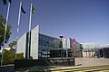
Wagga Wagga Civic Centre
City Council Mayoral gong. Stolen 2 January 2009, remains unfound
↑ The Australian Bureau of Statistics has stated that most who nominate "Australian" as their ancestry are part of the Anglo-Celtic group.
↑ Those who nominated their ancestry as "Australian Aboriginal". Does not include Torres Strait Islanders. This relates to nomination of ancestry and is distinct from persons who identify as Indigenous (Aboriginal or Torres Strait Islander) which is a separate question.
↑ "LOCAL GOVERNMENT ACT, 1919.—PROCLAMATION". Government Gazette of the State of New South Wales. No.43. New South Wales, Australia. 26 April 1946. p.997. Retrieved 9 September 2018– via National Library of Australia.
This page is based on this Wikipedia article Text is available under the CC BY-SA 4.0 license; additional terms may apply. Images, videos and audio are available under their respective licenses.