Municipality of Alexandria Sydney, New South Wales | |||||||||||||||
---|---|---|---|---|---|---|---|---|---|---|---|---|---|---|---|
Coordinates | 33°54′36″S151°11′35″E / 33.910°S 151.193°E | ||||||||||||||
Population | 8,060 (1947 census) [1] | ||||||||||||||
• Density | 1,919/km2 (4,970/sq mi) | ||||||||||||||
Established | 27 August 1868 | ||||||||||||||
Abolished | 31 December 1948 | ||||||||||||||
Area | 4.2 km2 (1.6 sq mi) | ||||||||||||||
Council seat | Alexandria Town Hall | ||||||||||||||
Parish | Alexandria | ||||||||||||||
|
The Municipality of Alexandria was a local government area of Sydney, New South Wales, Australia. Originally part of the municipalities of Redfern from 1859 and Waterloo from 1860, the Borough of Alexandria was proclaimed on 27 August 1868. With an area of 4.2 square kilometres, it included the modern suburbs of Alexandria, Beaconsfield and parts of Eveleigh, St Peters and Erskineville. After a minor boundary change with the Municipality of Erskineville in 1908, the council was amalgamated with the City of Sydney, along with most of its neighbours, with the passing of the Local Government (Areas) Act 1948 , although the former council area was later transferred in 1968–1982 and 1989–2004 to the South Sydney councils.
The area that would constitute the municipality of Alexandria was first incorporated as the Waterloo Ward of the Municipality of Redfern in August 1859. [2] Under the provisions of the Municipalities Act, 1858, 250 residents of the area including Alexandria signed a petition which was published in the Government Gazette on 17 January 1860, noting that "they have every reason for believing that their interests, as part of the said Municipality of Redfern, will be seriously injured by their incorporation with such Municipality, and are, therefore, desirous to be separated therefrom, and be and become a separate and distinct Municipality". [3] The area was subsequently proclaimed as the Municipality of Waterloo on 16 May 1860 by Governor Sir William Denison. [4]
In March 1868, a petition of 257 electors (including the first chairman of the Waterloo municipality, Edward Hawkesley) in the Western Ward of Waterloo was published in the Government Gazette arguing for the establishment of a "Borough of Alexandria", noting that "the rates received from the Western Ward have never been wholly expended in that Ward, and that no improvements of a permanent nature are in progress in the said Ward; nor has any sum been voted for that purpose during the past half-year [...] they believe that justice has not been done to them; nor can they hope that their interests will be consulted by the Council as at present constituted." [5] The petition was subsequently accepted by the Government and the Governor Lord Belmore proclaimed the separation of the Borough of Alexandria and the reconstitution of Waterloo on 27 August 1868. [6] [7]
It was bounded by the Eveleigh railway yards and Boundary Street to the north, Botany Road in the east, Canal and Gardeners roads to the south and crossing through the suburbs of St Peters and Erskineville in the west. [8] The first nine-member council was elected on 3 October 1868. [9] [10]
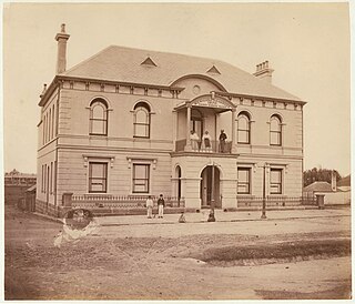
The first chairman of the Waterloo Municipality, Edward John Hawksley, was elected as the first mayor on 7 October 1868 and laid the foundation stone for the first Town Hall, built by local builder Thomas Shirley, on 8 December. [11] However, Hawksley's term proved short-lived when the mayor of Waterloo, William Moon, disputed his election as an alderman for Alexandria in the Supreme Court. The case, based on electoral roll irregularities, was successful and Hawksley was disqualified from public office, leaving the council without a mayor until the election of Alderman Samuel Sparks on 7 January 1869. [12] [13] In a snap election called in February 1869 because of the vacancy, Hawksley was re-elected and was subsequently elected mayor once more. [14]
Over the next sixty years there were few alterations to municipal boundaries centred on the suburb of Alexandria. Rapid industrial and residential development occurred from the 1880s, with the population of the municipality recorded as 7499 in 1705 dwellings by April 1891. [15] It was this development that was noted in an 1887 profile of the municipality in The Sydney Morning Herald :
"Like its immediate neighbours, Alexandria is a working man's borough, nearly all the dwellings being of a humble description. A large humber of industrial occupations are carried on, some being of a slightly unpleasant nature, so far as the olfactory nerves are concerned. Among others, may be mentioned-boiling-down establishments, tanneries, soap and candle works, and a varnish factory, the whole employing a considerable number of hands." [16]
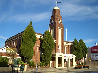
The Alexandria Town Hall in Garden Street was designed and completed by Ferdinand Reuss Snr in 1881, with major alterations completed by architects D. T. Morrow and Gordon in 1928. [17] [18] [19] [20] In February 1883 a petition was submitted to the Government for the division of the borough into three wards. [21] The division of the borough into East Ward, West Ward and South Ward was subsequently proclaimed on 22 June 1883. [22] In January 1886, owing to the growth in population in the South Ward, a further petition was submitted for the division of the ward into two, adding "Beaconsfield Ward". [23] This was accepted and proclaimed on 16 June 1886. [24]
By 1891, the tramline along Botany road was constructed, the road itself the major thoroughfare in the municipality being laid out in 1821. From 28 December 1906, following the passing of the Local Government Act, 1906, the council was renamed as the "Municipality of Alexandria". By 1943, when the municipality celebrated 75 years of existence, Alexandria was the largest industrial district in Australia, and known as the "Birmingham of Australia", a term coined by the long-serving alderman and mayor of Alexandria, Michael O'Riordan. [25] [26]
By the end of the Second World War, the NSW Government had come to the conclusion that its ideas of infrastructure expansion could not be realised by the present system of the mostly-poor inner-city municipal councils and the Minister for Local Government, Joseph Cahill, passed a bill in 1948 that abolished a significant number of those councils. Under the Local Government (Areas) Act 1948, Alexandria Municipal Council was merged, along with most of its neighbours, with the larger neighbouring City of Sydney which was located to the North.
Mayors | Party | Term start | Term end | Notes | |
---|---|---|---|---|---|
Edward John Hawksley | None | 7 October 1868 | 11 December 1868 | [27] [28] | |
Samuel Sparks | 7 January 1869 | 10 February 1869 | [29] | ||
Edward John Hawksley | 10 February 1869 | 10 February 1870 | [30] | ||
William Bryant | 10 February 1870 | 17 February 1872 | [31] [32] [33] | ||
George Bretnall | 17 February 1872 | 13 February 1874 | [34] [35] | ||
George E. Wood | 13 February 1874 | February 1875 | [36] | ||
Stephen John Foskett | February 1875 | 12 February 1878 | [37] [38] [39] | ||
Charles Brandling Henderson | 12 February 1878 | 12 February 1884 | [40] [41] [42] [43] [44] [45] [46] | ||
Charles Jesson | 12 February 1884 | 8 February 1887 | [47] [48] [49] | ||
Stephen John Foskett | 8 February 1887 | 15 February 1888 | [50] | ||
John Dacey | 15 February 1888 | 14 February 1890 | [51] [52] [53] | ||
John Turner | 14 February 1890 | 11 February 1891 | [54] | ||
James Ralph | 11 February 1891 | 10 February 1892 | [55] | ||
William Marr | 10 February 1892 | 23 February 1893 | [56] | ||
John Harden | 23 February 1893 | 14 February 1895 | [57] | ||
James Christie Horne | 14 February 1895 | 13 February 1896 | [58] | ||
Ernest Banner | 13 February 1896 | 11 February 1897 | [59] | ||
John Harden | 11 February 1897 | 9 February 1898 | [60] | ||
Michael O'Riordan | 9 February 1898 | 15 February 1899 | [61] | ||
Alfred Moles | 15 February 1899 | 13 February 1900 | [62] | ||
Ernest Banner | 13 February 1900 | February 1901 | [63] [64] [65] | ||
Michael O'Riordan | February 1901 | February 1902 | [66] | ||
David Turnbull Brown | 13 February 1902 | 12 February 1903 | [67] | ||
James Ralph | 12 February 1903 | February 1904 | [68] | ||
Frederick Charles Loveridge | February 1904 | 16 February 1905 | [69] | ||
Michael O'Riordan | 16 February 1905 | 15 February 1906 | [70] | ||
Samuel Alexander McCauley | 15 February 1906 | February 1912 | [71] [72] [73] [74] [75] [76] | ||
Michael O'Riordan | February 1912 | February 1914 | [77] | ||
James Ralph | February 1914 | 3 February 1915 | [78] | ||
Edward F. Lawson | 3 February 1915 | February 1917 | [79] [80] | ||
William Henry Wassall | February 1917 | February 1918 | [81] | ||
John Joseph Collins | February 1918 | February 1920 | [82] [83] | ||
William Henry Wassall | February 1920 | 7 December 1922 | [84] [85] [86] | ||
George James Stokes | 7 December 1922 | December 1923 | [87] | ||
Joseph Rogers | December 1923 | December 1924 | [88] | ||
William Henry Smith | Labor | December 1924 | December 1925 | [89] | |
William Charles Ellis | Progressive | December 1925 | December 1926 | [90] | |
John Joseph Collins | December 1926 | December 1928 | [91] [92] | ||
Joseph Bowden | Labor / Labor (NSW) | December 1928 | December 1931 | [93] [94] [95] | |
Richard Power | Labor (NSW) | December 1931 | December 1932 | [96] | |
Charles Humphries | December 1932 | December 1933 | [97] | ||
Samuel Chenhall | December 1933 | December 1934 | [98] | ||
Arthur Reginald Horatio Perry | December 1934 | December 1935 | [99] | ||
Richard Power | Labor (NSW) / Labor | December 1935 | December 1936 | [100] | |
Samuel Chenhall | Labor | December 1936 | December 1937 | [101] | |
Fred Green | December 1937 | December 1938 | [102] | ||
Arthur Reginald Horatio Perry | December 1938 | December 1939 | [103] | ||
Sydney Henry Gordon Alexander | December 1939 | December 1940 | [104] | ||
William Henry Smith | December 1940 | December 1942 | [105] [106] | ||
Samuel Chenhall | December 1942 | December 1943 | [107] | ||
Hugh Vincent McConville | December 1943 | December 1944 | [108] | ||
Fred Green | December 1944 | December 1945 | |||
Arthur Reginald Horatio Perry | December 1945 | December 1946 | [109] | ||
John Joseph Collins | December 1946 | December 1947 | [110] | ||
Kevin Dwyer | December 1947 | 31 December 1948 | [111] [112] |
The City of Canterbury was a local government area in the Inner South-West region of Sydney, New South Wales, Australia. The council area was within the northern part of the Parish of St George above Wolli Creek and The M5 but below The Cooks River. The city was primarily residential and light industrial in character, and was home to over 130 nationalities. With a majority of its residents being born overseas, the council marketed itself as the "City of Cultural Diversity." First incorporated as the Municipality of Canterbury in 1879, the council became known as the City of Canterbury in 1993.
Marrickville Council was a local government area located in the Inner West region of Sydney, Australia. It was originally created on 1 November 1861 as the "Municipality of Marrickville". On 12 May 2016, Marrickville Council was forcibly merged with Ashfield and Leichhardt councils into the newly formed Inner West Council.
Waverley Council is a Local government area in the eastern suburbs of Sydney, in the state of New South Wales, Australia. First incorporated on 16 June 1859 as the Municipality of Waverley, it is one of the oldest-surviving local government areas in New South Wales. Waverley is bounded by the Tasman Sea to the east, the Municipality of Woollahra to the north, and the City of Randwick in the south and west. The administrative centre of Waverley Council is located on Bondi Road in Bondi Junction in the Council Chambers on the corner of Waverley Park.
The Municipality of Petersham was a local government area of Sydney, New South Wales, Australia. The small municipality was proclaimed as a borough in 1871 and was centred on the suburbs of Lewisham, Petersham and Stanmore. It was bounded by Parramatta Road in the north, Cardigan and Liberty Streets in the east, Stanmore and New Canterbury Roads in the south, and Old Canterbury Road in the west. The municipality was divided into three wards: South Kingston, Annadale and Sydenham, all the names of early farms. The boundaries remained fairly stable, with only minor changes on the east and western sides. The borough became a municipality in 1906. In 1949 under the Local Government (Areas) Act 1948, Petersham council was merged with the larger neighbouring Marrickville Council which was located immediately to the south.
The Municipality of Newtown was a local government area of Sydney, New South Wales, Australia. The municipality was proclaimed as a borough in 1862 and, with an area of 1.9 square kilometres, was centred on the suburb of Newtown, including parts of Erskineville and Enmore. The municipality was divided into four wards: Kingston, Enmore, O'Connell and Camden. In 1949 under the Local Government (Areas) Act 1948, Newtown Municipal Council was merged with the larger neighbouring City of Sydney which was located immediately to the North, although parts were subsequently, from 1968, moved into Marrickville Council. Mayors included Lilian Fowler (1938–1939), the first female mayor in Australia.
The Municipality of Redfern was a local government area of Sydney, New South Wales, Australia. The small municipality was proclaimed in 1859 as one of the first municipalities proclaimed under the new provisions of the Municipalities Act, 1858, and was centred on the suburbs of Redfern, Eveleigh, Darlington and Surry Hills. The council was amalgamated, along with most of its neighbours, with the City of Sydney to the north with the passing of the Local Government (Areas) Act 1948. From 1968 to 1982 and from 1989 to 2004, the area was part of the South Sydney councils.
(James) Peter Howe was an Australian politician and convict.
The Municipality of Darlington was a local government area of Sydney, New South Wales, Australia. The municipality was proclaimed in 1864 and, with an area of 0.2 square kilometres, was the smallest municipal council in Sydney. It included the entire suburb of Darlington, excepting a small block between Golden Grove and Forbes streets, which was administered by the Municipality of Redfern in Golden Grove Ward. The council was amalgamated, along with most of its neighbours, with the City of Sydney to the north with the passing of the Local Government (Areas) Act 1948. From 1968 to 1982 and from 1989 to 2004, the area was part of the South Sydney councils.
The Municipality of Camperdown was a local government area of Sydney, New South Wales, Australia. The municipality was proclaimed in 1862 and, with an area of 1.6 square kilometres, covered the entire suburb of Camperdown, as well as small parts of Annandale, Newtown and Stanmore. The municipality unified in February 1870 with the Municipality of Cook, which had also been established in 1862 to the north. After years of financial difficulties, the Camperdown council was formally amalgamated with the City of Sydney on 22 December 1908.
The Municipality of Waterloo was a local government area of Sydney, New South Wales, Australia. The municipality was proclaimed on 16 May 1860 and, with an area of 3.4 square kilometres, included the modern suburbs of Waterloo, Zetland and Rosebery. The suburb of Alexandria was originally included as the Western Ward of the council but seceded as a separate municipality in 1868. After several attempts to amalgamate with various neighbours in the mid-1920s, the council was amalgamated with the City of Sydney, along with most of its neighbours, with the passing of the Local Government (Areas) Act 1948, although parts of the former council area were transferred in 1967 to the City of South Sydney.
The Municipality of Enfield was a local government area of Sydney, New South Wales, Australia. The municipality was proclaimed as the Borough of Enfield on 17 January 1889 and, with an area of 3.6 square kilometres, included the modern suburbs of Croydon, Croydon Park and Strathfield South, with parts of Enfield, Belfield and Greenacre included in the West Ward. In 1949, the council was split into two, with Central and East Wards being added to the Municipality of Burwood and the West Ward being added into the Municipality of Strathfield, with the passing of the Local Government (Areas) Act 1948.
The Municipality of Paddington was a local government area of Sydney, New South Wales, Australia. The municipality was proclaimed on 17 April 1860 and, with an area of 1.7 square kilometres, included the entire suburb of Paddington and parts of Edgecliff. The council was amalgamated with the City of Sydney to the east with the passing of the Local Government (Areas) Act 1948, although the former council area was transferred in 1968 to the Municipality of Woollahra, transferred to the City of South Sydney in 1989 and was then split in 2003 between the City of Sydney and the Municipality of Woollahra.
The Municipality of Mascot was a local government area in the inner south of Sydney, New South Wales, Australia. The municipality was proclaimed as the Borough of North Botany on 29 March 1888 and was renamed to the Municipality of Mascot, in order to differentiate itself from their southern neighbour, from 31 October 1911. It included the modern suburbs of Eastlakes and Daceyville, with parts of Mascot and Pagewood. From 1 January 1949, the council was amalgamated into the Municipality of Botany, with the passing of the Local Government (Areas) Act 1948.
The Borough of East St Leonards was a local government area in the Lower North Shore region of Sydney, New South Wales, Australia. First proclaimed as the "Municipality of East St Leonards" in 1860, following the passing of a new Municipalities Act became a Borough in 1867. It included the modern suburbs of Kirribilli, Milsons Point, Lavender Bay (part), North Sydney (part), Neutral Bay (part), Cremorne (part), Cremorne Point and Kurraba Point. The borough lasted until 29 July 1890 when it merged with the neighbouring boroughs of St Leonards and Victoria to form the Borough of North Sydney.