Related Research Articles

Brecknockshire, also known as the County of Brecknock, Breconshire, or the County of Brecon is one of thirteen historic counties of Wales, and a former administrative county. Named after its county town of Brecon, the county is mountainous and primarily rural.

Radnorshire is one of the thirteen historic counties of Wales and a former administrative county. It covers a sparsely populated area in mid Wales. The historic county was bounded to the north by Montgomeryshire and Shropshire, to the east by Herefordshire, to the south by Brecknockshire and to the west by Cardiganshire.

Warringah Council was a local government area in the northern beaches region of Sydney, in the state of New South Wales, Australia. It was proclaimed on 7 March 1906 as the Warringah Shire Council, and became "Warringah Council" in 1993. In 1992, Pittwater Council was formed when the former A Riding of Warringah Shire voted to secede. From this point on until amalgamation, Warringah Council administered 152 square kilometres (59 sq mi) of land, including nine beaches and 14 kilometres (9 mi) of coastline. Prior to its abolition it contained 6,000 hectares of natural bushland and open space, with Narrabeen Lagoon marking Warringah's northern boundary and Manly Lagoon marking the southern boundary.

Hay is a town in the western Riverina region of south western New South Wales, Australia. It is the administrative centre of Hay Shire local government area and the centre of a prosperous and productive agricultural district on the wide Hay Plains.

Jerilderie Shire was a local government area in the Riverina region of southern New South Wales, Australia. The Shire was located adjacent to the Newell Highway. The Shire was declared in 1918 after the amalgamation of the former Municipality of Jerilderie and Wunnamurra Shire. It was dissolved in 2016 after its amalgamation with Murrumbidgee Shire to create Murrumbidgee Council

Grong Grong is a small town that is located in the Riverina region of New South Wales, Australia. The town is situated on the Newell Highway, 23 kilometres (14 mi) east of Narrandera in the Shire of Narrandera.

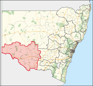
Barwon is an electoral district of the Legislative Assembly in the Australian state of New South Wales. It is represented by Roy Butler a former the Shooters Fishers and Farmers Party MP, but now an Independent MP.

Murray-Darling is a former electoral district of the Legislative Assembly in the Australian state of New South Wales.

Wollondilly Shire is a periurban local government area, located on the south west fringe of the Greater Sydney area in New South Wales, Australia, parts of which fall into the Macarthur, Blue Mountains and Central Tablelands regions in the state of New South Wales, Australia. Wollondilly is seen as the transition between Regional NSW and the Greater Sydney Region, and is variously categorised as part of both. Wollondilly Shire was created by proclamation in the NSW Government Gazette on 7 March 1906, following the passing of the Local Government (Shires) Act 1905, and amalgamated with the Municipality of Picton on 1 May 1940.

The Wentworth Gaol is a heritage-listed former gaol and school building and now museum and old wares shop located at 112 Beverley Street, Wentworth, in the Wentworth Shire, New South Wales, Australia. It was designed by James Barnet and built from 1879 to 1881 by Whitcombe Brothers, Hay. It is also known as the Old Wentworth Gaol. The property is owned by Department of Primary Industries - Western Lands Commissioner, an agency of the Government of New South Wales. The property was added to the New South Wales State Heritage Register on 21 October 2016.

Goolgowi is a small town located in western New South Wales, Australia, around 650 kilometres (400 mi) west of Sydney via the Mid-Western Highway and is the administrative centre of Carrathool Shire. At the 2016 census, Goolgowi had a population of 402.

The Hay Shire is a local government area in the Riverina area of south-western New South Wales, Australia. The Shire comprises 11,326 square kilometres (4,373 sq mi) and is located adjacent to the Sturt, Mid-western and Cobb Highways. The area includes the towns of Hay, Booligal and Maude.

Carrathool is a village in the western Riverina region of New South Wales, Australia, in Carrathool Shire. In 2011 census, Carrathool had a population of 296 people. It is about 5 kilometres (3 mi) north of the Sturt Highway between Darlington Point and Hay. The village is situated on the plain a few kilometres north of the river, clustered around the now-disused railway station.

Ganmain is a town in the Riverina region of New South Wales, Australia. Ganmain is located around 55 kilometres (34 mi) north west of Wagga Wagga, and 50 kilometres (31 mi) east of Narrandera. Ganmain is in the Coolamon Shire local government area and had a population at the 2016 census of 779.

Waradgery County is one of the 141 Cadastral divisions of New South Wales. It contains the town of Hay. It includes the area between the Lachlan River and the Murrumbidgee River where they meet. The Lachlan River is the northern boundary of the county, and the Murrumbidgee for a small section is the southern boundary, but the county also includes some of the land to the south of the Murrumbidgee near Hay.

The Central Division of New South Wales is one of the three divisions of New South Wales along with the Eastern and Western divisions, established under the Crown Lands Act of 1884 for the purposes of land management. In 1907, it included the Hay, Forbes and Moree land boards, as well as the western parts of the Wagga Wagga, Dubbo and Tamworth land boards. Part of its western boundary is the Lachlan River, and it includes a large part of the Riverina. Shires it included were parts of the Narrabri Shire, Goulburn Mulwaree Council, Walgett Shire, Cobar Shire and almost the entire Lachlan Shire, Bland Shire and the Bogan Shire. The Bogan Shire and the Bland Shire are the most west parts of the division.
Hay Airport is an airport serving Hay, a town in the western Riverina region of southwestern New South Wales in Australia. The airport is operated by the Hay Shire Council.
Murray is an electoral district in the Australian state of New South Wales.

Hay railway station is a heritage-listed railway station and the terminus of the partly-closed Hay railway line at Hay, Hay Shire, New South Wales, Australia. The property was added to the New South Wales State Heritage Register on 2 April 1999.

Hay Parish is a civil parish of Killara County, located in Central Darling Shire at Latitude 31°06′35″S and Longitude144°08′50″E.
References
- ↑ "Waradgery Shire Council". State Records of New South Wales. Retrieved 22 September 2017.
| | This New South Wales geography article is a stub. You can help Wikipedia by expanding it. |