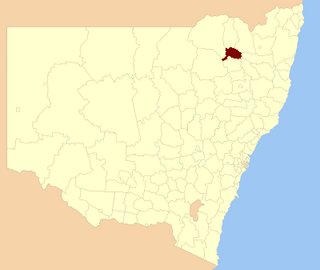
Tamworth is a city and administrative centre of the north-western region of New South Wales, Australia. Situated on the Peel River within the local government area of the Tamworth Regional Council, it is the largest and most populated city in the region, with a population of 63,920 in 2021, making it the second largest inland city in New South Wales. Tamworth is 318 km (198 mi) from the Queensland border and is located almost midway between Brisbane and Sydney.

Manilla is a small town in New South Wales, Australia, located on Fossickers Way 45 kilometres northwest of the regional city of Tamworth and 27 kilometres northeast of the historic village Somerton. Manilla is famous for its setting as a fishing and paragliding area. The name Manilla comes from the Gamilaraay language, and is said to mean 'winding river'.

Gwydir Shire is a local government area located in the New England region of New South Wales, Australia. The northern boundary of the Shire is located adjacent to the border between New South Wales and Queensland.

Cabonne Council is a local government area in the Central West region of New South Wales, Australia. The Shire is located adjacent to the Mitchell Highway and the Broken Hill railway line, partly surrounding the City of Orange. The administrative centre is located at Molong.

The City of Toowoomba was a local government area in the Darling Downs region of Queensland, Australia, encompassing the centre and inner suburbs of the regional city of Toowoomba. The City covered an area of 116.5 square kilometres (45.0 sq mi), and existed as a local government entity in various forms from 1860 until 2008, when it amalgamated with several other councils in the surrounding area to form the Toowoomba Region.

The Armidale Dumaresq Council is a former local government area in the New England and Northern Tablelands regions of New South Wales, Australia. This area was formed in 2000 from the merger of the original City of Armidale with the surrounding Dumaresq Shire and abolished on 12 May 2016, where the council, together with Guyra Shire, was subsumed into the Armidale Regional Council with immediate effect.

Tamworth Regional Council is a local government area in the New England region of New South Wales, Australia. The area under administration is located adjacent to the New England Highway and the Main North railway line. It was established in March 2004 through the amalgamation of the former City of Tamworth with surrounding shires of Barraba, Manilla, Nundle and Parry.

The Shire of Mount Morgan was a local government area located in the Capricornia region of Central Queensland, Queensland, Australia, about 20 kilometres (12 mi) south of the regional city of Rockhampton. The shire, roughly the region surrounding the former gold mining town of Mount Morgan, covered an area of 492.0 square kilometres (190.0 sq mi), and existed as a local government entity from 1890 until 2008, when it amalgamated with several other councils to become the Rockhampton Region.

The Shire of Sarina was a local government area located in the Central Queensland region of Queensland, Australia. The shire, administered from the town of Sarina, covered an area of 1,444.3 square kilometres (557.6 sq mi), and existed as a local government entity from 1912 until 2008, when it amalgamated with the City of Mackay and the Shire of Mirani to form the Mackay Region.

The Shire of Mirani was a local government area located in the North Queensland region of Queensland, Australia. The shire, administered from the town of Mirani, covered an area of 3,280.2 square kilometres (1,266.5 sq mi), and existed as a local government entity from 1916 until 2008, when it amalgamated with the City of Mackay and the Shire of Sarina to form the Mackay Region.

Marong is a town in Victoria, Australia. At the 2016 census, Marong and the surrounding area had a population of 1,416. It is 17 kilometres (11 mi) to the west of Bendigo. Its local government area is the City of Greater Bendigo. The town is at the junction of the Calder Highway (A79) and the Calder Alternate Highway (A790).

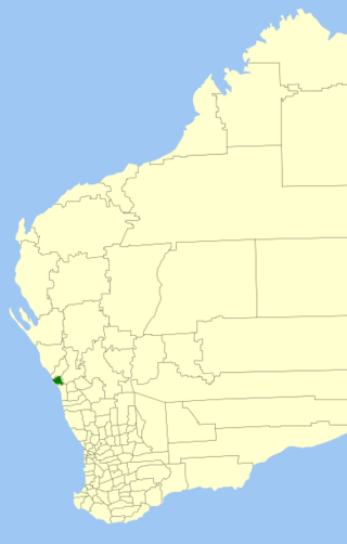
The Shire of Greenough was a local government area in the Mid West region of Western Australia, 420 kilometres (261 mi) north of the state capital, Perth surrounding the city of Geraldton. The Shire covered an area of 1,752 square kilometres (676.5 sq mi), and its seat of government was the outer Geraldton suburb of Utakarra.

Niangala is a village located on the south-eastern edge of the Northern Tablelands area of New South Wales, Australia. It is on the Moonbi Range which is part of the Great Dividing Range, at approximately 1,300 metres (4,265 ft) above sea level. The village is in Walcha parish in Parry County. At the 2011 census, Niangala and the surrounding area had a population of 142.

Barraba Shire was a local government area located in the New England region of New South Wales, Australia, about 90 kilometres (56 mi) north of Tamworth via Fossickers Way. The Shire, administered from the town of Barraba covered an area of 3,068.7 square kilometres (1,184.8 sq mi), and existed as a local government entity from 1906 until 2004, when it was split between two new LGAs, Gwydir Shire and Tamworth Regional Council.

Bingara Shire was a local government area located in the New England region of New South Wales, Australia, about 150 kilometres (93 mi) north of Tamworth via Fossickers Way. The Shire, administered from the town of Bingara covered an area of 2,853.7 square kilometres (1,101.8 sq mi), and existed as a local government entity from 1906 until 2004, when it was amalgamated with Yallaroi Shire and part of Barraba to form the Gwydir Shire.
Parry Shire was a local government area in New South Wales, Australia.
Cockburn Shire was a local government area in the Australia state of New South Wales.
Nundle Shire was a local government area in the New England region of New South Wales, Australia.

Manilla Shire was a local government area in the New England region of New South Wales, Australia.

Quirindi Shire was a local government area in the New England region of New South Wales, Australia.