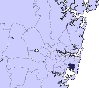
Municipality of Mascot New South Wales | |||||||||||||||
---|---|---|---|---|---|---|---|---|---|---|---|---|---|---|---|
Population | 17,984 (1947 census) [1] | ||||||||||||||
• Density | 2,000/km2 (5,180/sq mi) | ||||||||||||||
Established | 29 March 1888 (Nth Botany) 31 October 1911 (Mascot) | ||||||||||||||
Abolished | 31 December 1948 | ||||||||||||||
Area | 9 km2 (3.5 sq mi) | ||||||||||||||
Council seat | Mascot Town Hall | ||||||||||||||
Region | South-Eastern Sydney | ||||||||||||||
Parish | Botany | ||||||||||||||
|
The Municipality of Mascot was a local government area in the inner south of Sydney, New South Wales, Australia. The municipality was proclaimed as the Borough of North Botany on 29 March 1888 and was renamed to the Municipality of Mascot, in order to differentiate itself from their southern neighbour, from 31 October 1911. It included the modern suburbs of Eastlakes and Daceyville, with parts of Mascot and Pagewood. From 1 January 1949, the council was amalgamated into the Municipality of Botany, with the passing of the Local Government (Areas) Act 1948 .
The North Botany area was first incorporated on 29 March 1888, when the Governor of New South Wales, Lord Carrington, proclaimed the "Borough of North Botany", the same day the Municipality of Botany was proclaimed immediately to the south. [2] The first council was elected on 4 June 1888, with nine aldermen elected at-large: [3] [4]
Alderman | Notes |
---|---|
James Coward | Dairyman, North Botany. |
John Moloney | Teacher, South Waterloo. |
George Henry Baily | Grocer, North Botany. |
Aaron Laycock | Dairyman, North Botany. |
Stephen Tancred | Tallow refiner, North Botany. |
Alfred Webber Sparks | Cabinet-maker, North Botany. |
William Parker | Gardener, North Botany. |
Edward Hicks | Boot manufacturer, North Botany. |
Henry Ramsay | Bus proprietor, North Botany. |
The Council first met on 7 June 1888 at "Eurimbla" , the house of the first returning officer John Pottie, and James Coward was elected the first mayor, with William Coleman appointed first Town Clerk in July 1888. [5] [6] [7] In February 1889 council petitioned for the division of the area into Wards: North Ward, South Ward and Central Ward. This was accepted and proclaimed on 10 June 1889. [8] [9] On 31 January 1908, these wards were abolished. [10] From 28 December 1906, following the passing of the Local Government Act, 1906, the council was renamed as the "Municipality of North Botany". Aldermen at this time included Henry Punter (1894–1901), later Mayor of The Glebe. [11]
At the July 1888 meeting, council resolved to purchase a block of land at the corner of Botany Road and Ricketty Street (Later Edward Street, then Coward Street, after the first mayor) at the cost of £600. [12] On 21 December 1889, the foundation stone was laid for the new Town Hall, designed in the Victorian Italianate style by C. Hawkins and built by Edward Christie. [13] The Town Hall was officially opened by the Mayor, James Coward, on 2 August 1890. [14] [15] However, within a few years, it had become apparent that this town hall was inadequate for the purposes of a growing council and area, along with the need for a modern function hall compliant with the Theatres and Public Halls Act. [16] [17] Council resolved in 1910, to commission expansions along the Edward Street frontage. This expansion, designed in a similar style by Buchanan & McKay, Architects, and built by Peter Doulan, was named "Coronation Hall" to commemorate the coronation of George V and opened on 8 July 1911. [18] [19] [20]
Following incorporation, the council area developed a strong industrial character similar to its northern neighbours of Alexandria, Waterloo and St Peters. A Sydney Morning Herald profile of the council in 1914 expressed this change: "During the first year of its existence, the council had less than £1000 to work upon. This year the revenue will reach £6000. The district now carries a population of 8500, which is housed in 1750 buildings. [...] Like its neighbour, Botany, Mascot has developed into an industrial centre, and in this respect is making splendid progress. In fact, the whole district will in time become the Birmingham of Australia." [21]
With these changes in the local area, the "North Botany" name of the council however raised negative connotations and it was felt in council that it was too similar in name to their southern neighbour; As a result, in early 1911, council conducted a referendum of ratepayers to decide on a new name, with "Ascot" being chosen, which referenced the nearby racecourse. [22] However, when council submitted this request to the state Minister for Public Works, Arthur Griffith, and the Commonwealth Postmaster General, Josiah Thomas, it was rejected based on the view that "Ascot" was a term already well-used for place names. Council then debated on several other options, including "Boronia" and "Booralee", before "Mascot" was chosen, accepted and proclaimed on 31 October 1911. [23] [24]
The council established a reputation for its probity and prudent financial management, at a time when the small Sydney municipalities were often struggling to keep up with infrastructure demands, population growth and political infighting. The Construction & Local Government Journal praised Mascot council in this vein in a March 1920 editorial, noting "Mascot is essentially a working man's suburb, but the fashionable socialism of Labor Government does not appear to find favor with the sturdy, thrifty working men and intelligent women who have votes in this Municipality, and the reason is not very far to seek, for it is a remarkable circumstance that nearly all the residents own their own homes." [25] At the same time, planning had begun for the construction of a larger public airfield at Mascot, with the Commonwealth Government purchasing 65 hectares for this purpose in 1921. Indeed, the Mayor in 1920, Thomas Hicks, declared: "The year has marked a new era for the Municipality of Mascot in the establishment of an aerodrome by Australian Aircraft & Engineering, on the area between Cook's River and Old Botany Road. This site has been pronounced as the favored-by-nature of any other in the County of Cumberland, and the establishment of the air-service undertaking must bring Mascot very prominently before the world." [25] Such was the pride the council took in its growing recognition with aviation, that they changed the council seal in the 1930s to depict an aircraft in flight. [24] Aldermen during this time included Thomas Mutch (1923–1930), MLA for Botany (1917–1930).
In 1929, Mascot council inaugurated a new Council Chambers building, designed in the Inter-war Georgian Revival style by R. S. Hamilton and built by J. Figures of Randwick, located on Coward Street next to the 1890 Town Hall and 1911 Coronation Hall. [26] This building remained the council seat until amalgamation in 1948 and was demolished in the 1970s to be replaced by the Botany Administration Centre.
By the end of the Second World War, the NSW Government had realised that its ideas of infrastructure expansion could not be effected by the present system of the patchwork of small municipal councils across Sydney and the Minister for Local Government, Joseph Cahill, following the recommendations of the 1945–46 Clancy Royal Commission on Local Government Boundaries, passed a bill in 1948 that abolished a significant number of those councils. [27] Under the Local Government (Areas) Act 1948 , Mascot Municipal Council became the First Ward of the Municipality of Botany, which was located immediately to the south. The serving Mascot Town Clerk, T. G. Barber, became Town Clerk of the re-formed Municipality of Botany.
Years | Mayor | Notes |
---|---|---|
7 June 1888 – 11 February 1891 | James Coward | [5] [28] [29] |
11 February 1891 – 17 February 1893 | Alfred Webber Sparks | [30] [31] |
17 February 1893 – 16 February 1894 | Aaron Laycock | [32] |
16 February 1894 – 16 February 1895 | James Pallett | [33] |
16 February 1895 – 10 February 1896 | James Thornton | [34] |
10 February 1896 – 11 February 1897 | Benjamin Farrar Reeve | [35] |
11 February 1897 – February 1898 | James Coward | [36] |
February 1898 – 11 February 1899 | James Thornton | [37] |
11 February 1899 – 16 February 1900 | Daniel Lee | [38] |
16 February 1900 – 18 February 1901 | Benjamin Farrar Reeve | [39] |
18 February 1901 – 15 February 1902 | Michael Gearin | [40] |
15 February 1902 – 11 February 1904 | James Coward | [41] |
11 February 1904 – 18 February 1905 | Aaron Laycock | [42] |
18 February 1905 – 9 May 1905 | Alfred Webber Sparks | [43] |
9 May 1905 – 14 February 1908 | Alfred James King | [44] [45] [46] |
14 February 1908 – February 1909 | Aaron Laycock | [47] |
February 1909 – May 1910 | James Thornton | [48] [49] |
May 1910 – February 1911 | Thomas Henry Hicks | [50] |
February 1911 – 8 February 1912 | Francis James Chipman | [51] |
8 February 1912 – February 1913 | Charles Munger | [52] [53] |
February 1913 – February 1914 | Francis James Chipman | [54] |
February 1914 – February 1916 | Thomas Henry Hicks | [55] [56] |
February 1916 – 9 February 1918 | Clarence Edgar Felton Hughes | [57] |
9 February 1918 – 11 February 1919 | John Ingram | [58] |
11 February 1919 – 10 February 1920 | Clarence Edgar Felton Hughes | [59] |
10 February 1920 – December 1920 | Thomas Henry Hicks | [60] [61] |
December 1920 – December 1921 | Francis James Chipman | [62] |
December 1921 – 11 December 1922 | Clarence Edgar Felton Hughes | [63] |
11 December 1922 – December 1925 | Richard Stephen King | [64] [65] |
December 1925 – 18 December 1929 | Michael Joseph L'Estrange | [66] [67] [68] [69] |
18 December 1929 – December 1931 | David Allen Alexander | [70] [71] |
December 1931 – December 1932 | Arthur Henry Loveridge | [72] |
December 1932 – December 1935 | Cyril Joseph Dransfield | [73] [74] [75] |
December 1935 – December 1936 | Francis James Chipman | [76] |
December 1936 – December 1937 | John Elder Galloway | [77] |
December 1937 – 6 December 1941 | Clifford John Sweeney | [78] [79] [80] |
December 1941 – December 1942 | Gladstone Sparks | [81] |
December 1942 – December 1943 | Arthur Benjamin Finney | [82] |
December 1943 – December 1944 | Spencer John Middlemiss | [83] |
December 1944 – December 1945 | Alfred Phillip Price Lever | [84] |
December 1945 – December 1946 | William Todd | [85] |
December 1946 – December 1947 | Charles Leslie Gray | [86] |
December 1947 – 31 December 1948 | Alexander Finlayson | [87] |
Years | Town Clerk | Notes |
---|---|---|
4 July 1888 – 5 May 1891 | William Allen Coleman | [7] [88] [89] |
5 May 1891 – December 1905 | Thomas Alexander Watson | [90] [91] [92] [93] |
25 January 1906 – 14 May 1908 | Alfred Webber Sparks | [94] |
14 May 1908 – 24 May 1909 | Thomas Arthur Tester | [95] |
24 May 1909 – 22 December 1909 | Charles Arthur Cork | [96] |
22 December 1909 – 20 May 1912 | Henry Dunstan | [97] |
20 May 1912 – 20 January 1933 | William Hughes | [98] [99] [100] |
January 1933 – September 1934 | Edgar Jay | [101] |
September 1934 – 31 December 1948 | T. G. Barber | [102] [103] |
The City of Botany Bay was a local government area in the Inner South and South-Eastern region of Sydney, in the state of New South Wales, Australia. The area encompassed the suburbs to the north of Botany Bay, such as Botany. First proclaimed in 1888 as the "Borough of Botany", the council became the "Municipality of Botany" from 1906 to 1996, when it was proclaimed a city as the "City of Botany Bay".
Marrickville Council was a local government area located in the Inner West region of Sydney, Australia. It was originally created on 1 November 1861 as the "Municipality of Marrickville". On 12 May 2016, Marrickville Council was forcibly merged with Ashfield and Leichhardt councils into the newly formed Inner West Council.
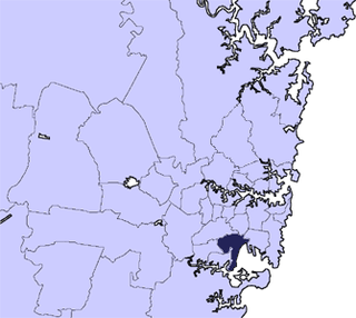
The City of Rockdale was a local government area in southern and St George regions of Sydney, in the state of New South Wales, Australia. The city centre was located 12 kilometres (7.5 mi) south-west of the Sydney central business district, on the western shores of Botany Bay. First proclaimed on 13 January 1871, Rockdale was formerly known as the Municipality of West Botany until 1887 and the Municipality of Rockdale before being proclaimed as a City in 1995. Rockdale was amalgamated with the neighbouring City of Botany Bay on 9 September 2016 to form the new municipality of Bayside Council.
Waverley Council is a Local government area in the eastern suburbs of Sydney, in the state of New South Wales, Australia. First incorporated on 16 June 1859 as the Municipality of Waverley, it is one of the oldest-surviving local government areas in New South Wales. Waverley is bounded by the Tasman Sea to the east, the Municipality of Woollahra to the north, and the City of Randwick in the south and west. The administrative centre of Waverley Council is located on Bondi Road in Bondi Junction in the Council Chambers on the corner of Waverley Park.
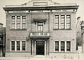
The Municipality of Alexandria was a local government area of Sydney, New South Wales, Australia. Originally part of the municipalities of Redfern from 1859 and Waterloo from 1860, the Borough of Alexandria was proclaimed on 27 August 1868. With an area of 4.2 square kilometres, it included the modern suburbs of Alexandria, Beaconsfield and parts of Eveleigh, St Peters and Erskineville. After a minor boundary change with the Municipality of Erskineville in 1908, the council was amalgamated with the City of Sydney, along with most of its neighbours, with the passing of the Local Government (Areas) Act 1948, although the former council area was later transferred in 1968–1982 and 1989–2004 to the South Sydney councils.
The Municipality of Newtown was a local government area of Sydney, New South Wales, Australia. The municipality was proclaimed as a borough in 1862 and, with an area of 1.9 square kilometres, was centred on the suburb of Newtown, including parts of Erskineville and Enmore. The municipality was divided into four wards: Kingston, Enmore, O'Connell and Camden. In 1949 under the Local Government (Areas) Act 1948, Newtown Municipal Council was merged with the larger neighbouring City of Sydney which was located immediately to the North, although parts were subsequently, from 1968, moved into Marrickville Council. Mayors included Lilian Fowler (1938–1939), the first female mayor in Australia.
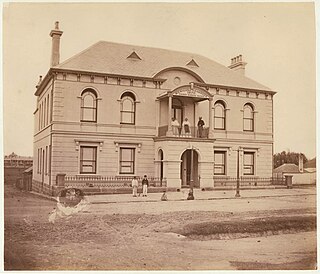
The Municipality of Redfern was a local government area of Sydney, New South Wales, Australia. The small municipality was proclaimed in 1859 as one of the first municipalities proclaimed under the new provisions of the Municipalities Act, 1858, and was centred on the suburbs of Redfern, Eveleigh, Darlington and Surry Hills. The council was amalgamated, along with most of its neighbours, with the City of Sydney to the north with the passing of the Local Government (Areas) Act 1948. From 1968 to 1982 and from 1989 to 2004, the area was part of the South Sydney councils.
The Municipality of Darlington was a local government area of Sydney, New South Wales, Australia. The municipality was proclaimed in 1864 and, with an area of 0.2 square kilometres, was the smallest municipal council in Sydney. It included the entire suburb of Darlington, excepting a small block between Golden Grove and Forbes streets, which was administered by the Municipality of Redfern in Golden Grove Ward. The council was amalgamated, along with most of its neighbours, with the City of Sydney to the north with the passing of the Local Government (Areas) Act 1948. From 1968 to 1982 and from 1989 to 2004, the area was part of the South Sydney councils.
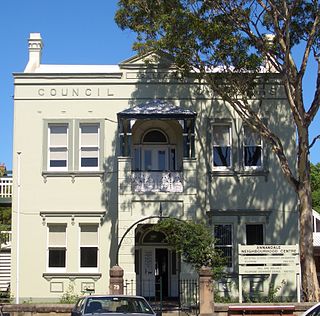
The Municipality of Annandale was a local government area of Sydney, New South Wales, Australia. The municipality was proclaimed on 29 December 1893 as the Borough of Annandale when the East Ward of Leichhardt Council separated, and, with an area of 1.4 square kilometres, covered the entire suburb of Annandale, excepting a small block between Johnstons Creek, Booth Street and Parramatta Road. The council was amalgamated with the Municipality of Leichhardt to the west with the passing of the Local Government (Areas) Act 1948.
The Municipality of Balmain was a local government area of Sydney, New South Wales, Australia. The municipality was proclaimed in February 1860 and, with an area of 3.8 square kilometres, covered the entire peninsula of Balmain north of Callan Park and Foucart Street, including the present suburbs of Balmain, Balmain East, Birchgrove and Rozelle. The council was amalgamated with the municipalities of Leichhardt and Annandale to the south with the passing of the Local Government (Areas) Act 1948.
Bayside Council is a local government area in Sydney, New South Wales, Australia. It is located around part of Botany Bay, 7 kilometres (4.3 mi) to 12 kilometres (7.5 mi) south of the Sydney CBD. It includes suburbs of Southern Sydney as well as a portion in the Eastern Suburbs. It comprises an area of 50 square kilometres (19 sq mi) and as at the 2016 census had a population of 156,058.
The Municipality of The Glebe was a local government area of Sydney, New South Wales, Australia. The municipality was proclaimed on 1 August 1859 and, with an area of 2 square kilometres, included the modern suburbs of Glebe and Forest Lodge. The council was amalgamated with the City of Sydney to the east with the passing of the Local Government (Areas) Act 1948, although parts of the former council area were transferred in 1967 to the Municipality of Leichhardt to the west.
The Municipality of Erskineville was a local government area of Sydney, New South Wales, Australia. The municipality was proclaimed as the "Municipal District of Macdonald Town" on 23 May 1872 and, with an area of 0.8 square kilometres, was one of the smallest local government areas in Sydney and included the modern suburb of Erskineville, part of Eveleigh and the locality of Macdonaldtown. The council was amalgamated, along with most of its neighbours, with the City of Sydney to the north with the passing of the Local Government (Areas) Act 1948. From 1968 to 1982 and from 1989 to 2004, the area was part of the South Sydney councils, with the former Town Hall serving as its council chambers.
The Municipality of Enfield was a local government area of Sydney, New South Wales, Australia. The municipality was proclaimed as the Borough of Enfield on 17 January 1889 and, with an area of 3.6 square kilometres, included the modern suburbs of Croydon, Croydon Park and Strathfield South, with parts of Enfield, Belfield and Greenacre included in the West Ward. In 1949, the council was split into two, with Central and East Wards being added to the Municipality of Burwood and the West Ward being added into the Municipality of Strathfield, with the passing of the Local Government (Areas) Act 1948.
The Municipality of Paddington was a local government area of Sydney, New South Wales, Australia. The municipality was proclaimed on 17 April 1860 and, with an area of 1.7 square kilometres, included the entire suburb of Paddington and parts of Edgecliff. The council was amalgamated with the City of Sydney to the east with the passing of the Local Government (Areas) Act 1948, although the former council area was transferred in 1968 to the Municipality of Woollahra, transferred to the City of South Sydney in 1989 and was then split in 2003 between the City of Sydney and the Municipality of Woollahra.
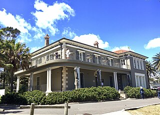
The Municipality of Vaucluse was a local government area of Sydney, New South Wales, Australia. The municipality was proclaimed as the "Borough of Vaucluse" on 1 May 1895, seceding from the Municipality of Woollahra, and included the modern suburbs of Vaucluse and Watsons Bay. The council was re-amalgamated with Woollahra to the south with the passing of the Local Government (Areas) Act 1948.