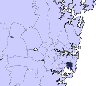
The City of Botany Bay was a local government area in the Inner South and South-Eastern region of Sydney, in the state of New South Wales, Australia. The area encompassed the suburbs to the north of Botany Bay, such as Botany. First proclaimed in 1888 as the "Borough of Botany", the council became the "Municipality of Botany" from 1906 to 1996, when it was proclaimed a city as the "City of Botany Bay".

The City of Canterbury was a local government area in the Inner South-West region of Sydney, New South Wales, Australia. The council area was within the northern part of the Parish of St George above Wolli Creek and The M5 but below The Cooks River. The city was primarily residential and light industrial in character, and was home to over 130 nationalities. With a majority of its residents being born overseas, the council marketed itself as the "City of Cultural Diversity." First incorporated as the Municipality of Canterbury in 1879, the council became known as the City of Canterbury in 1993.

The Fairfield City Council is a local government area in the west of Sydney, in the state of New South Wales, Australia. The council was first incorporated as the "Municipal District of Smithfield and Fairfield" on 8 December 1888, and the council's name was changed to the "Municipality of Fairfield" in 1920, before being proclaimed a city in 1979. The City of Fairfield comprises an area of 102 square kilometres (39 sq mi) and as of the 2021 census had a population of 208,475. The mayor of the City of Fairfield is Cr. Frank Carbone, the first popularly-elected independent mayor of Fairfield.
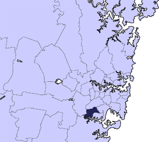
The City of Hurstville was a local government area in the St George and southern region of Sydney, New South Wales, Australia. The city seat of Hurstville is located 17 kilometres (11 mi) south–west of Sydney and west of Botany Bay. Hurstville was incorporated as a municipality in 1887, declared a city in 1988, and abolished in 2016, forming with Kogarah City Council the new Georges River Council.

Marrickville Council was a local government area located in the Inner West region of Sydney, Australia. It was originally created on 1 November 1861 as the "Municipality of Marrickville". On 12 May 2016, Marrickville Council was forcibly merged with Ashfield and Leichhardt councils into the newly formed Inner West Council.
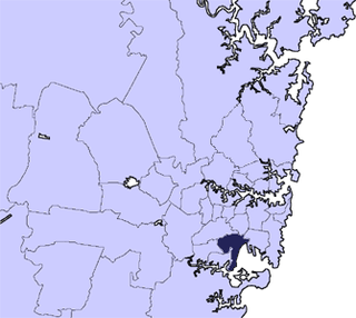
The City of Rockdale was a local government area in southern and St George regions of Sydney, in the state of New South Wales, Australia. The city centre was located 12 kilometres (7.5 mi) south-west of the Sydney central business district, on the western shores of Botany Bay. First proclaimed on 13 January 1871, Rockdale was formerly known as the Municipality of West Botany until 1887 and the Municipality of Rockdale before being proclaimed as a City in 1995. Rockdale was amalgamated with the neighbouring City of Botany Bay on 9 September 2016 to form the new municipality of Bayside Council.

The City of Ryde is a local government area in the Northern Sydney region, in New South Wales, Australia. It was first established as the Municipal District of Ryde in 1870, became a municipality in 1906 and was proclaimed as the City of Ryde in 1992.

Waverley Council is a Local government area in the eastern suburbs of Sydney, in the state of New South Wales, Australia. First incorporated on 16 June 1859 as the Municipality of Waverley, it is one of the oldest-surviving local government areas in New South Wales. Waverley is bounded by the Tasman Sea to the east, the Municipality of Woollahra to the north, and the City of Randwick in the south and west. The administrative centre of Waverley Council is located on Bondi Road in Bondi Junction in the Council Chambers on the corner of Waverley Park.
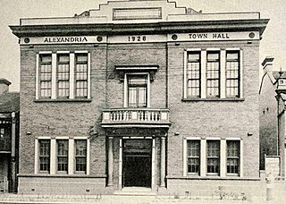
The Municipality of Alexandria was a local government area of Sydney, New South Wales, Australia. Originally part of the municipalities of Redfern from 1859 and Waterloo from 1860, the Borough of Alexandria was proclaimed on 27 August 1868. With an area of 4.2 square kilometres, it included the modern suburbs of Alexandria, Beaconsfield and parts of Eveleigh, St Peters and Erskineville. After a minor boundary change with the Municipality of Erskineville in 1908, the council was amalgamated with the City of Sydney, along with most of its neighbours, with the passing of the Local Government (Areas) Act 1948, although the former council area was later transferred in 1968–1982 and 1989–2004 to the South Sydney councils.

The Municipality of Newtown was a local government area of Sydney, New South Wales, Australia. The municipality was proclaimed as a borough in 1862 and, with an area of 1.9 square kilometres, was centred on the suburb of Newtown, including parts of Erskineville and Enmore. The municipality was divided into four wards: Kingston, Enmore, O'Connell and Camden. In 1949 under the Local Government (Areas) Act 1948, Newtown Municipal Council was merged with the larger neighbouring City of Sydney which was located immediately to the North, although parts were subsequently, from 1968, moved into Marrickville Council. Mayors included Lilian Fowler (1938–1939), the first female mayor in Australia.
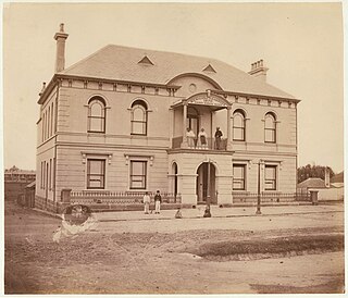
The Municipality of Redfern was a local government area of Sydney, New South Wales, Australia. The small municipality was proclaimed in 1859 as one of the first municipalities proclaimed under the new provisions of the Municipalities Act, 1858, and was centred on the suburbs of Redfern, Eveleigh, Darlington and Surry Hills. The council was amalgamated, along with most of its neighbours, with the City of Sydney to the north with the passing of the Local Government (Areas) Act 1948. From 1968 to 1982 and from 1989 to 2004, the area was part of the South Sydney councils.

The Municipality of Darlington was a local government area of Sydney, New South Wales, Australia. The municipality was proclaimed in 1864 and, with an area of 0.2 square kilometres, was the smallest municipal council in Sydney. It included the entire suburb of Darlington, excepting a small block between Golden Grove and Forbes streets, which was administered by the Municipality of Redfern in Golden Grove Ward. The council was amalgamated, along with most of its neighbours, with the City of Sydney to the north with the passing of the Local Government (Areas) Act 1948. From 1968 to 1982 and from 1989 to 2004, the area was part of the South Sydney councils.
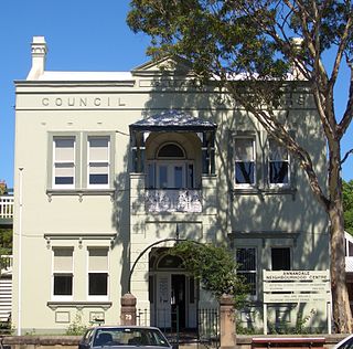
The Municipality of Annandale was a local government area of Sydney, New South Wales, Australia. The municipality was proclaimed on 29 December 1893 as the Borough of Annandale when the East Ward of Leichhardt Council separated, and, with an area of 1.4 square kilometres, covered the entire suburb of Annandale, excepting a small block between Johnstons Creek, Booth Street and Parramatta Road. The council was amalgamated with the Municipality of Leichhardt to the west with the passing of the Local Government (Areas) Act 1948.

The Municipality of Erskineville was a local government area of Sydney, New South Wales, Australia. The municipality was proclaimed as the "Municipal District of Macdonald Town" on 23 May 1872 and, with an area of 0.8 square kilometres, was one of the smallest local government areas in Sydney and included the modern suburb of Erskineville, part of Eveleigh and the locality of Macdonaldtown. The council was amalgamated, along with most of its neighbours, with the City of Sydney to the north with the passing of the Local Government (Areas) Act 1948. From 1968 to 1982 and from 1989 to 2004, the area was part of the South Sydney councils, with the former Town Hall serving as its council chambers.

The Municipality of Enfield was a local government area of Sydney, New South Wales, Australia. The municipality was proclaimed as the Borough of Enfield on 17 January 1889 and, with an area of 3.6 square kilometres, included the modern suburbs of Croydon, Croydon Park and Strathfield South, with parts of Enfield, Belfield and Greenacre included in the West Ward. In 1949, the council was split into two, with Central and East Wards being added to the Municipality of Burwood and the West Ward being added into the Municipality of Strathfield, with the passing of the Local Government (Areas) Act 1948.

The Municipality of Paddington was a local government area of Sydney, New South Wales, Australia. The municipality was proclaimed on 17 April 1860 and, with an area of 1.7 square kilometres, included the entire suburb of Paddington and parts of Edgecliff. The council was amalgamated with the City of Sydney to the east with the passing of the Local Government (Areas) Act 1948, although the former council area was transferred in 1968 to the Municipality of Woollahra, transferred to the City of South Sydney in 1989 and was then split in 2003 between the City of Sydney and the Municipality of Woollahra.

The Municipality of Bexley was a local government area in the St George region of Sydney, New South Wales, Australia. The municipality was proclaimed as the Borough of Bexley on 28 June 1900 when it formally separated from the Municipal District of Hurstville, and included the modern suburbs of Bexley, Bexley North and Kingsgrove, with parts of Carlton, Bardwell Park, Bardwell Valley, Rockdale and Kogarah. From 1 January 1949, the council was amalgamated into the Municipality of Rockdale, with the passing of the Local Government (Areas) Act 1948.

The Municipality of Mascot was a local government area in the inner south of Sydney, New South Wales, Australia. The municipality was proclaimed as the Borough of North Botany on 29 March 1888 and was renamed to the Municipality of Mascot, in order to differentiate itself from their southern neighbour, from 31 October 1911. It included the modern suburbs of Eastlakes and Daceyville, with parts of Mascot and Pagewood. From 1 January 1949, the council was amalgamated into the Municipality of Botany, with the passing of the Local Government (Areas) Act 1948.
The Municipality of Windsor was a local government area of Greater Western Sydney, New South Wales, Australia. The municipality was proclaimed as the Borough of Windsor on 4 March 1871 and was centred on the Town of Windsor. In 1949, with the passing of the Local Government (Areas) Act 1948, the council doubled in size with the amalgamation of the Municipality of Richmond to the west. On 1 January 1981, Windsor merged with the Colo Shire Council to the north, forming the Hawkesbury Shire.


