Related Research Articles

Braidwood is a town in the Southern Tablelands of New South Wales, Australia, in Queanbeyan–Palerang Regional Council. It is located on the Kings Highway linking Canberra with Batemans Bay. It is approximately 200 kilometres south west of Sydney, 60 kilometres inland from the coast, and 55 kilometres east of Canberra. Braidwood is a service town for the surrounding district which is based on sheep and cattle grazing, and forestry operations.
Local government is the second-level of government in Australia, administered with limited autonomy under the states and territories, and in turn beneath the federal government. Local government is not mentioned in the Constitution of Australia, and two referendums in 1974 and 1988 to alter the Constitution relating to local government were unsuccessful. Every state/territory government recognises local government in its own respective constitution. Unlike the two-tier local government system in Canada or the United States, there is only one tier of local government in each Australian state/territory, with no distinction between counties and cities.

Hornsby Shire is a local government area situated on the Upper North Shore as well as parts of the Hills District, of Sydney in the state of New South Wales, Australia. The shire stretches from the M2 Hills Motorway in the south to the Hawkesbury River town of Wisemans Ferry, some 53 kilometres (33 mi) to the north, making it the largest local government council in the Greater Sydney Metropolitan region by total area. As of the 2016 census the shire had an estimated population of 142,667.
Queanbeyan City was a local government area located in south eastern New South Wales, Australia. The former area is located adjacent to Canberra and the Australian Capital Territory, the Queanbeyan River, the Molonglo River, the Kings Highway and the Sydney-Canberra railway.

Moree Plains Shire is a local government area in the North West Slopes region of New South Wales, Australia. The northern boundary of the Shire is located adjacent to the border between New South Wales and Queensland. The Shire is located adjacent to the Newell and Gwydir Highways and the North West railway line.
Back Creek may refer to:

Sutton is a small village in the Southern Tablelands of New South Wales, Australia in Yass Valley Shire. It is situated on the west bank of the Yass River, about 17 kilometres south of Gundaroo, near the Federal Highway, not far from Canberra. It has a primary school, an Anglican church, a general store, an estate agent, an artists gallery, and a baker. Sutton has its own volunteer Bush Fire Brigade located in the village.

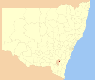
The Palerang Council was a local government area located in the Southern Tablelands region of New South Wales, Australia. On 12 May 2016 the Minister for Local Government announced dissolution of the Palerang Council with immediate effect. Together with Queanbeyan City the combined council areas were merged to establish the Queanbeyan-Palerang Regional Council. Both councils had opposed the amalgamation. Elections for the new Council area were held in September 2017. The former mayor of Queanbeyan City Council was appointed by the New South Wales Government as administrator until that date.

Cooma-Monaro Shire was a local government area located in the Monaro region of southern New South Wales, Australia. The area was named after the former Cooma Municipality and the former Monaro Shire, that were amalgamated to create it. The Municipality of Cooma was established in 1879, and the Monaro Shire was one of several shires established in 1906. The Monaro Shire and Cooma Municipal Council amalgamated in 1981. On 11 February 2004, Cooma-Monaro Shire absorbed a small part of the former Yarrowlumla Shire, near Michelago.

Gundagai Shire was a local government area in the Riverina region of New South Wales, Australia. On 12 May 2016, Gundagai Shire was abolished and merged with the neighbouring Cootamundra Shire to establish Cootamundra-Gundagai Regional Council.

Boorowa Council was a local government area in the South West Slopes region of New South Wales, Australia. The LGA was located adjacent to the Lachlan Valley Way and included Boorowa and the small towns of Rye Park, Rugby, Frogmore and Reids Flat. Burrowa LGA was formed on 1 September 1944 through the amalgamation of Murrungal Shire and the Municipality of Burrowa.

Young Shire was a local government area in the South West Slopes region of New South Wales, Australia. The Shire was located adjacent to the Olympic Highway.

Tumut Shire was a local government area in the South West Slopes region of New South Wales, Australia.
Yarrowlumla Shire was a local government area in New South Wales, which surrounded the Australian Capital Territory until February 2004, when it was divided between Palerang Council, Yass Valley Council, Queanbeyan City Council, Tumut Shire and a small part going to the Cooma-Monaro Shire. It had a population of 9,654 and an area of 2,971 square kilometres (1,147 sq mi) in 1999. The council was based in the municipality of Queanbeyan, outside its own territory as was common for rural shires at the time. Most of the area which became the ACT was in Yarrowlumla Shire before it was transferred to the Commonwealth in 1909. This included Yarralumla homestead, which it was named after, although using an alternative spelling.
Queanbeyan–Palerang Regional Council is a local government area (LGA) located in the Southern Tablelands region of New South Wales, Australia. The council was formed on 12 May 2016 through a merger of the City of Queanbeyan and Palerang Council.
Gunning Shire was a local government area in New South Wales centered on Gunning, New South Wales north of the Australian Capital Territory until February 2004, when the local government organisation was absorbed into newly created Palerang Council and Upper Lachlan Shire.

Forbes Creek is a locality in Queanbeyan-Palerang Regional Council, New South Wales, Australia. The town lies 45 km east of Canberra. At the 2021 census, it had a population of 62. The Tallaganda National Park includes part of its eastern edge.

Palerang is a locality in Queanbeyan-Palerang Regional Council, New South Wales, Australia. The town lies 55 km east of Canberra on the Palerang range. At the 2016 census, it had a population of none. It includes part of the Tallaganda National Park and State Conservation Area.

Half Moon Farm House is a heritage-listed house at Half Moon Road, Mongarlowe, Queanbeyan-Palerang Region, New South Wales, Australia. It was added to the New South Wales State Heritage Register on 2 April 1999.
Mulwaree Shire was a local government area in the Southern Tablelands region of New South Wales, Australia.
References
- ↑ Tallaganda Shire, Council.
- ↑ "Welcome to Palerang Council". Archived from the original on 10 May 2011. Retrieved 29 July 2016..
- ↑ Tallaganda Shire Economic and Social Profile (April 2001) p1.
| | This New South Wales geography article is a stub. You can help Wikipedia by expanding it. |