Related Research Articles

Singleton is a town on the banks of the Hunter River in New South Wales, Australia. Singleton is 202km (89 mi) north-north-west of Sydney, and 70 km (43 mi) north-west of Newcastle. At June 2018, Singleton had an urban population of 16,346.

The City of Gosford was a local government area that was located in the Central Coast region in the state of New South Wales, Australia. The incorporation of Gosford dates back to 1886 when the Town of Gosford was proclaimed as the Borough of Gosford, becoming the Municipality of Gosford from 1906. In 1908, the Gosford Municipality merged into Erina Shire which covered the remaining Central Coast area outside of Gosford, but regained its independence in 1936. From 1 January 1947, local government in the Central Coast region was reorganised, creating Gosford Shire and Wyong Shire, and the final boundaries of Gosford City Council date from this period. From 1 January 1980, Gosford Shire was granted city status, becoming the City of Gosford. On 12 May 2016 the Minister for Local Government amalgamated the City of Gosford and Wyong Shire Councils. The Central Coast Council was established on the same day, covering the combined areas.

Hornsby Shire is a local government area situated in Northern Sydney, as well as parts of the Hills District, in the state of New South Wales, Australia. The shire stretches from the M2 Hills Motorway in the south to the Hawkesbury River town of Wisemans Ferry, some 53 kilometres (33 mi) to the north, making it the largest local government council in the Greater Sydney Metropolitan region by total area. As of the 2016 census the shire had an estimated population of 142,667.

Jerilderie Shire was a local government area in the Murray region of southern New South Wales, Australia. The Shire was located adjacent to the Newell Highway. The Shire was declared in 1918 after the amalgamation of the former Municipality of Jerilderie and Wunnamurra Shire. It was dissolved in 2016 after its amalgamation with Murrumbidgee Shire to create Murrumbidgee Council
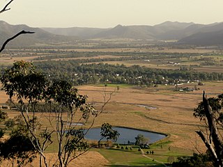
Broke is a village of approximately 292 people in the Hunter Region of New South Wales, Australia in Singleton Shire. It is located 157 kilometres (98 mi) to the north of Sydney on the original early colonial road from Sydney to Singleton.

Kempsey Shire is a local government area in the Mid North Coast region of New South Wales, Australia.

Singleton Council is a local government area in the Hunter Region of New South Wales, Australia. It is situated adjacent to the New England Highway and the Main North railway line.

The Shire of Erina was a local government area covering the majority of the Central Coast region of New South Wales, Australia. The shire was proclaimed on 7 March 1906 as a result of the passing of the Local Government (Shires) Act 1905 and covered most of the Central Coast region with the exception of the Town of Gosford, which had been incorporated in 1886.
Coolah Shire was a local government area in New South Wales, Australia from 1906 to 1994.

The Central Coast Council is a local government area in the Central Coast region of New South Wales, Australia. It is adjacent to the Pacific Highway, Central Coast Highway, the Northern railway line and the Pacific Ocean. The council was formed on 12 May 2016 following the merger of the Gosford City and Wyong Shire Councils.
Jindalee Shire was a local government area in the Riverina region of New South Wales, Australia.
Terania Shire was a local government area in the Northern Rivers region of New South Wales, Australia.
Imlay Shire was a local government area in the South Coast region of New South Wales, Australia.
Upper Hunter Shire was a local government area in the Hunter region of New South Wales, Australia.

Scone Shire was a local government area in the Hunter region of New South Wales, Australia. The shire offices were located in the town of Scone.
Patrick Plains Shire was a local government area in the Hunter region of New South Wales, Australia.
Harwood Shire was a local government area in the Northern Rivers region of New South Wales, Australia.
Lyndhurst Shire was a local government area in the Central West region of New South Wales, Australia.
Norma Male BEM (1916–2017) was an Australian local government administrator, the first woman to be appointed permanently to the senior role of Town Clerk in New South Wales.
The Shire of Woy Woy was a local government area on the Central Coast region of New South Wales, Australia, centred on the town of Woy Woy. The shire was proclaimed on 1 August 1928 as a result of the proclamation of the separation of the D Riding of Erina Shire and had its council seat at Woy Woy, but covered the majority of the Woy Woy peninsula including Woy Woy Bay, Umina, Blackwall, Kariong, Pearl Beach, and Patonga. Woy Woy Shire was abolished on 1 January 1947 with the reorganisation of local government in the Central Coast region following the end of the Second World War, with the council area amalgamated into Gosford Shire.
References
- ↑ "Local Government Election Results". Trove. Sydney Morning Herald.
- ↑ "Local Government Act 1919. Proclamation (147)". Government Gazette of the State of New South Wales . 14 November 1975. p. 4711. Retrieved 10 January 2020– via National Library of Australia.
| | This Singleton Council geography article is a stub. You can help Wikipedia by expanding it. |