Related Research Articles

The City of Gosford was a local government area that was located in the Central Coast region in the state of New South Wales, Australia. The incorporation of Gosford dates back to 1886 when the Town of Gosford was proclaimed as the Borough of Gosford, becoming the Municipality of Gosford from 1906. In 1908, the Gosford Municipality merged into Erina Shire which covered the remaining Central Coast area outside of Gosford, but regained its independence in 1936. From 1 January 1947, local government in the Central Coast region was reorganised, creating Gosford Shire and Wyong Shire, and the final boundaries of Gosford City Council date from this period. From 1 January 1980, Gosford Shire was granted city status, becoming the City of Gosford. On 12 May 2016 the Minister for Local Government amalgamated the City of Gosford and Wyong Shire Councils to form the new Central Coast Council.

Tumut is a town in the Riverina region of New South Wales, Australia, situated on the banks of the Tumut River.

Wollondilly Shire is a periurban local government area, located on the south west fringe of the Greater Sydney area in New South Wales, Australia, parts of which fall into the Macarthur, Blue Mountains and Central Tablelands regions in the state of New South Wales, Australia. Wollondilly is seen as the transition between Regional NSW and the Greater Sydney Region, and is variously categorised as part of both. Wollondilly Shire was created by proclamation in the NSW Government Gazette on 7 March 1906, following the passing of the Local Government (Shires) Act 1905, and amalgamated with the Municipality of Picton on 1 May 1940.

Tumut Shire was a local government area in the South West Slopes region of New South Wales, Australia.

The Shire of Erina was a local government area covering the majority of the Central Coast region of New South Wales, Australia. The shire was proclaimed on 7 March 1906 as a result of the passing of the Local Government (Shires) Act 1905 and covered most of the Central Coast region with the exception of the Town of Gosford, which had been incorporated in 1886.
Coolah Shire was a local government area in New South Wales, Australia from 1906 to 1994.

The Tumut and Adelong Times and Batlow District News is an English language newspaper currently published in Tumut, New South Wales. It was first published as The Tumut and Adelong Times and has absorbed Adelong and Tumut Express and Batlow District News, Tumut-Batlow-Adelong District News, The Tumut Advocate and Farmers & Settlers' Adviser and The Adelong Argus, Tumut and Gundagai Advertiser.
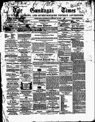
The Gundagai Times and Tumut, Adelong, and Murrumbidgee District Advertiser, often referred to as simply the Gundagai Times, was a newspaper published in Gundagai, New South Wales, Australia from 1868 to 1931. It was a direct successor of The Wynyard Times and Tumut and Adelong Advertiser and The Tumut and Adelong Times, published in Tumut, New South Wales, and was absorbed into The Gundagai Independent in 1931.

The Central Coast Council is a local government area in the Central Coast region of New South Wales, Australia. It is adjacent to the Pacific Highway, Central Coast Highway, the Northern railway line and the Pacific Ocean. The council was formed on 12 May 2016 following the merger of the City of Gosford and Wyong Shire Councils.
Bibbenluke Shire was a local government area in the Monaro region of New South Wales, Australia.

Boree Shire was a local government area in the Central West region of New South Wales, Australia.
Jindalee Shire was a local government area in the Riverina region of New South Wales, Australia.
Upper Hunter Shire was a local government area in the Hunter region of New South Wales, Australia.
Gostwyck Shire was a local government area in the New England region of New South Wales, Australia.
Cobbora Shire was a local government area in the Orana region of New South Wales, Australia.
Bolwarra Shire was a local government area in the Hunter region of New South Wales, Australia.
Kearsley Shire was a local government area in the Hunter region of New South Wales, Australia.
Tarro Shire was a local government area in the Hunter region of New South Wales, Australia.
Denman Shire was a local government area in the Hunter region of New South Wales, Australia.
Little River is a rural locality in the Snowy Valleys Council local government area of New South Wales, Australia. It lies is 6 km east of Tumut, in the southern side of the valley of the Goobarragandra River, just to the east of the confluence of that river with the Tumut River. The Goobarragandra River was once also known as 'Tumut Little River' or just as 'Little River', giving rise to the locality's name. At the 2021 census, it had a population of 38.
References
- ↑ "Proclamation (121)". Government Gazette of the State of New South Wales . 7 March 1906. p. 1593. Retrieved 23 December 2019– via National Library of Australia.
- ↑ "Proclamation (19)". Government Gazette of the State of New South Wales . 13 February 1907. p. 816. Retrieved 6 January 2020– via National Library of Australia.
- 1 2 "Gadara Shire Council". Adelong and Tumut Express . New South Wales, Australia. 13 September 1921. p. 2. Retrieved 6 January 2020– via Trove.
- ↑ "Gadara Shire Council". Adelong and Tumut Express . New South Wales, Australia. 16 February 1923. p. 1. Retrieved 6 January 2020– via Trove.
- ↑ "Local Government Act 1919: Proclamation (75)". Government Gazette of the State of New South Wales . 7 March 1906. p. 2677. Retrieved 6 January 2020– via National Library of Australia.