Palerang Council

Last updated

Palerang
New South Wales
Palerang LGA NSW.png
Location in New South Wales
Coordinates 35°15′S149°27′E / 35.250°S 149.450°E / -35.250; 149.450 Coordinates: 35°15′S149°27′E / 35.250°S 149.450°E / -35.250; 149.450
Population15,306 (2013 est) [1]
 • Density2.9813/km2 (7.7215/sq mi)
Established11 February 2004 (2004-02-11)
Abolished12 May 2016 (2016-05-12)
Area5,134 km2 (1,982.2 sq mi)
Last MayorPete Harrison
Council seat Bungendore [2]
Region Southern Tablelands
State electorate(s)
Federal division(s) Eden-Monaro
Website Palerang
LGAs around Palerang:
Yass Valley Upper Lachlan Goulburn Mulwaree
Queanbeyan Palerang Shoalhaven
ACT Cooma-Monaro Eurobodalla

The Palerang Council was a local government area located in the Southern Tablelands region of New South Wales, Australia. On 12 May 2016 the Minister for Local Government announced dissolution of the Palerang Council with immediate effect. Together with Queanbeyan City the combined council areas were merged to establish the Queanbeyan-Palerang Regional Council. [3] Both councils had opposed the amalgamation. Elections for the new Council area were held in September 2017. The former mayor of Queanbeyan City Council was appointed by the New South Wales Government as administrator until that date.

Contents

The last mayor of the Palerang Council was Cr. Pete Harrison, an independent politician.

Municipal history

Originally known as the Eastern Capital City Regional Council, Palerang was proclaimed on 11 February 2004 when Tallaganda Shire was amalgamated with most of Yarrowlumla Shire and small parts of Cooma-Monaro Shire, Gunning Shire and Mulwaree Shire.

A 2015 review of local government boundaries recommended that the Palerang Council merge with adjoining councils. The New South Wales Government considered three options. The first two options were to merge parts of the Palerang Council with the Goulburn Mulwaree Council to form a new council with an area of 4,748 square kilometres (1,833 sq mi) and support a population of approximately 31,000; [4] and to merge the remaining parts of Palerang with the City of Queanbeyan to form a new council with an area of 3,791 square kilometres (1,464 sq mi) and support a population of approximately 55,000. [5] The alternative, proposed by Palerang Council on 29 January 2016, was for an amalgamation of the whole of Palerang with Queanbeyan City Council. [6] On 12 May 2016 the Minister for Local Government announced dissolution of the Palerang Council with immediate effect. Together with Queanbeyan City the combined council areas were merged to establish the Queanbeyan-Palerang Regional Council. [3]

Towns and localities

The former area was named after Mount Palerang, located close to the geographical centre, and one of the highest points in the former council's area. The area that was covered under administration extended to Lake George in the north, the Tallaganda State Forest in the south, Queanbeyan to the west and the Morton and Budawang National Parks to the east. The Kings Highway and the Sydney-Canberra railway pass through the former Palerang Council area.

Predominantly rural in nature, the Palerang Council area comprised the towns of Bungendore, Braidwood and Captains Flat, and the villages of Araluen, Majors Creek, Mongarlowe and Nerriga. It also encompasses the rural residential areas of Wamboin, Bywong, Burra, Urila, Hoskinstown, Rossi and parts of Carwoola, Royalla, and Sutton.

Around two-thirds of the Palerang population was concentrated in Bungendore and the rural residential areas adjacent to the Australian Capital Territory border, with many residents commuting daily to Canberra or Queanbeyan. Cattle grazing is the primary agricultural pursuit in the former area, with more recent development of niche rural industries such as vineyards, olive groves and alpaca breeding. About one quarter of the former Palerang Council area is managed for conservation, with significant areas of national park.[ citation needed ]

Council

Current composition and election method

Until its dissolution, Palerang Council was composed of nine councillors elected proportionally as one entire ward. All councillors were elected for a fixed four-year term of office. The mayor was elected by the councillors at the first meeting of the council. The most recent and last election was held on 8 September 2012, and the makeup of the former council was as follows: [7]

PartyCouncillors
  Independents and Unaligned8
  Country Labor 1
Total9

The last council, elected in 2012 and dissolved in 2016, in order of election, was: [7]

CouncillorPartyNotes
 Pete Harrison Independent Mayor [8]
 Mark SchweikertIndependent
 Belinda Hogarth-BoydUnalignedDeputy Mayor
 Garth Morrison Country Labor
 Keith FranceIndependent
 Trevor HicksIndependent
 Paul CockramIndependent
 Peter MarshallUnalignedMember of The Greens
 Richard GrahamIndependent

Related Research Articles

<span class="mw-page-title-main">Braidwood, New South Wales</span> Town in New South Wales, Australia

Braidwood is a town in the Southern Tablelands of New South Wales, Australia, in Queanbeyan–Palerang Regional Council. It is located on the Kings Highway linking Canberra with Batemans Bay. It is approximately 200 kilometres south west of Sydney, 60 kilometres inland from the coast, and 55 kilometres east of Canberra. Braidwood is a service town for the surrounding district which is based on sheep and cattle grazing, and forestry operations.

<span class="mw-page-title-main">Kings Highway (Australia)</span> Highway in the Australian Capital Territory and New South Wales

Kings Highway is an interstate highway located within the Australian Capital Territory and New South Wales, Australia. The highway connects Canberra with Batemans Bay on the South Coast. It is designated route B52.

<span class="mw-page-title-main">City of Queanbeyan</span> Former local government area in New South Wales, Australia

Queanbeyan City was a local government area located in south eastern New South Wales, Australia. The former area is located adjacent to Canberra and the Australian Capital Territory, the Queanbeyan River, the Molonglo River, the Kings Highway and the Sydney-Canberra railway.

<span class="mw-page-title-main">Jerilderie Shire</span> Former local government area in New South Wales, Australia

Jerilderie Shire was a local government area in the Riverina region of southern New South Wales, Australia. The Shire was located adjacent to the Newell Highway. The Shire was declared in 1918 after the amalgamation of the former Municipality of Jerilderie and Wunnamurra Shire. It was dissolved in 2016 after its amalgamation with Murrumbidgee Shire to create Murrumbidgee Council

<span class="mw-page-title-main">Electoral district of Monaro</span> State electoral district of New South Wales, Australia

Monaro, also known as Maneroo (1856–1858), Monara (1858–1879) and Manaro (1894–1904) is an electoral district of the Legislative Assembly in the Australian state of New South Wales. It is currently represented by Steve Whan of the Labor party since the 2023 New South Wales state election.

<span class="mw-page-title-main">Tarago, New South Wales</span> Town in New South Wales, Australia

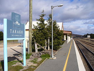
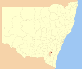
Tarago is a town in the Southern Tablelands of New South Wales, Australia in Goulburn Mulwaree Council. Part of the defined locality, which includes a large area of grazing country, is on the eastern shore of Lake George in the area of the Queanbeyan–Palerang Regional Council. The town is situated 39 kilometres south of the city of Goulburn and 69 kilometres northeast of Canberra, the capital city of Australia. It is located on the Goulburn-Braidwood road. The town is notable for recent renewable energy projects in the surrounding districts.

<span class="mw-page-title-main">Bungendore</span> Town in New South Wales, Australia

Bungendore is a town in the Queanbeyan Region of New South Wales, Australia, in Queanbeyan-Palerang Regional Council. It is on the Kings Highway near Lake George, the Molonglo River Valley and the Australian Capital Territory border. It has become a major tourist centre in recent years, popular with visitors from Canberra and some of it has heritage protection. It has expanded rapidly in recent years as a dormitory town of Canberra.

<span class="mw-page-title-main">Cooma-Monaro Shire</span> Former local government area in New South Wales, Australia

Cooma-Monaro Shire was a local government area located in the Monaro region of southern New South Wales, Australia. The area was named after the former Cooma Municipality and the former Monaro Shire, that were amalgamated to create it. The Municipality of Cooma was established in 1879, and the Monaro Shire was one of several shires established in 1906. The Monaro Shire and Cooma Municipal Council amalgamated in 1981. On 11 February 2004, Cooma-Monaro Shire absorbed a small part of the former Yarrowlumla Shire, near Michelago.

<span class="mw-page-title-main">Snowy River Shire</span> Former local government area in New South Wales, Australia

The Snowy River Shire was a local government area in the Australian Alps region of New South Wales, Australia from 1939 until May 2016. It was named after the Snowy River that runs through it. Prior to 1936, it had been named as Dalgety Shire since establishment in 1906.

<span class="mw-page-title-main">Gundagai Shire</span> Former local government area in New South Wales, Australia

Gundagai Shire was a local government area in the Riverina region of New South Wales, Australia. On 12 May 2016, Gundagai Shire was abolished and merged with the neighbouring Cootamundra Shire to establish Cootamundra-Gundagai Regional Council.

<span class="mw-page-title-main">Bombala Shire</span> Local government area in New South Wales, Australia

The Bombala Shire was a local government area in the Monaro region of south-eastern New South Wales, Australia. The Shire includes the town of Bombala, the villages of Delegate, Cathcart, Bibbenluke and the localities of Ando, Bungarby, Craigie, Mila, Rockton and Creewah. Bombala Shire was formed on 1 October 1977 by the amalgamation of the Municipality of Bombala and Bibbenluke Shire.

<span class="mw-page-title-main">City of Dubbo</span> Former local government area in New South Wales, Australia

The City of Dubbo was a local government area in the Orana region of New South Wales, Australia. The former area is located adjacent to the Mitchell, Newell, and the Golden highways, the Main Western railway line, and the Macquarie River.

<span class="mw-page-title-main">Harden Shire</span> Former local government area in New South Wales, Australia

Harden Shire was a local government area in the South West Slopes region of New South Wales, Australia. The Shire included the twin towns of Harden and Murrumburrah and the small towns of Galong, Jugiong, Wombat and Kingsvale.

<span class="mw-page-title-main">Tumut Shire</span> Former local government area in New South Wales, Australia

Tumut Shire was a local government area in the South West Slopes region of New South Wales, Australia.

<span class="mw-page-title-main">Goulburn Mulwaree Council</span> Local government area in New South Wales, Australia

Goulburn Mulwaree Council is a local government area located in the Southern Tablelands region of New South Wales, Australia. The area is located adjacent to the Hume Highway and the Southern Highlands railway line. The estimated resident population of the area stood at 32,053 on 2021 census.

<span class="mw-page-title-main">Hoskinstown</span> Town in New South Wales, Australia

Hoskinstown is a locality in Queanbeyan-Palerang Regional Council, New South Wales, Australia. The locality, and what remains of the cluster of settlement of the same name, is 38 km southeast of Canberra the Capital city of Australia, and 299 km southwest of Sydney. At the 2021 census, it had a population of 191.

<span class="mw-page-title-main">Queanbeyan–Palerang Regional Council</span> Local government area in New South Wales, Australia

Queanbeyan–Palerang Regional Council is a local government area located in the Southern Tablelands region of New South Wales, Australia. The council was formed on 12 May 2016 through a merger of the City of Queanbeyan and Palerang Council.

Tallaganda Shire, was a local government area in New South Wales centered on Braidwood, New South Wales It lasted from colonial times until February 2004, when the local government organisation was absorbed into newly created Palerang Council.

<span class="mw-page-title-main">Wollogorang, New South Wales</span> Town in New South Wales, Australia

Wollogorang is a locality in the Upper Lachlan Shire and Goulburn Mulwaree Council, New South Wales, Australia. A small part of the locality is in Queanbeyan–Palerang Regional Council. It is located about 35 km southwest of Goulburn and 61 km northeast of Canberra. It lies on both sides of the Federal Highway and on the southern side of the Hume Highway. They intersect nearby to the northeast in the locality of Yarra. At the 2016 census, it had a population of 67.

Mulwaree Shire was a local government area in the Southern Tablelands region of New South Wales, Australia.

References

  1. "3218.0 Regional Population Growth, Australia. Table 1. Estimated Resident Population, Local Government Areas, New South Wales". 3 April 2014. Retrieved 11 September 2014.
  2. "Palerang Council". Department of Local Government . Retrieved 12 November 2006.
  3. 1 2 "Queanbeyan-Palerang Regional Council". Stronger Councils. Government of New South Wales. 12 May 2016. Retrieved 20 May 2016.
  4. "Merger proposal: Goulburn Mulwaree Council, Palerang Council (part)" (PDF). Government of New South Wales. January 2016. p. 7. Retrieved 10 March 2016.
  5. "Merger proposal:Palerang Council (part), Queanbeyan City Council" (PDF). Government of New South Wales. January 2016. p. 7. Retrieved 10 March 2016.
  6. Palerang Council (29 January 2016). "Palerang and Queanbeyan City councils Proposal" (PDF). Government of New South Wales . Retrieved 10 March 2016.
  7. 1 2 "Palerang Council: Summary of First Preference Votes for each Candidate". Local Government Elections 2012. Electoral Commission of New South Wales. 13 September 2012. Retrieved 7 October 2012.
  8. Mosley, Lisa (26 September 2012). "New Palerang mayor to target roads". Australia: ABC News. Retrieved 7 October 2012.