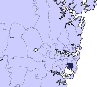
The City of Botany Bay was a local government area in the Inner South and South-Eastern region of Sydney, in the state of New South Wales, Australia. The area encompassed the suburbs to the north of Botany Bay, such as Botany. First proclaimed in 1888 as the "Borough of Botany", the council became the "Municipality of Botany" from 1906 to 1996, when it was proclaimed a city as the "City of Botany Bay".

Marrickville Council was a local government area located in the Inner West region of Sydney, Australia. It was originally created on 1 November 1861 as the "Municipality of Marrickville". On 12 May 2016, Marrickville Council was forcibly merged with Ashfield and Leichhardt councils into the newly formed Inner West Council.

The City of Randwick is a local government area in the Eastern Suburbs of Sydney, New South Wales, Australia. Established in 1859, Randwick is the second-oldest local government area in New South Wales, after the City of Sydney. It comprises an area of 36 square kilometres (14 sq mi) and as per the 2021 census had a population of 134,252.

Waverley Council is a Local government area in the eastern suburbs of Sydney, in the state of New South Wales, Australia. First incorporated on 16 June 1859 as the Municipality of Waverley, it is one of the oldest-surviving local government areas in New South Wales. Waverley is bounded by the Tasman Sea to the east, the Municipality of Woollahra to the north, and the City of Randwick in the south and west. The administrative centre of Waverley Council is located on Bondi Road in Bondi Junction in the Council Chambers on the corner of Waverley Park.

The Sydney County Council (SCC) was formed in 1935 to produce electricity and operate the electricity network in a number of municipalities in metropolitan Sydney. Unlike other New South Wales county councils, which were voluntary associations of local councils to undertake local government activities permitted or required of them by the Local Government Act 1919, Sydney County Council was established under a separate piece of legislation by the state government to perform the electricity distribution and streetlighting operations of the local government areas concerned. On its establishment it assumed control of the Electricity Department of the Sydney City Council, which was already supplying electricity to other municipalities. In 1952, the SCC lost most its electricity generation functions to the Electricity Commission of New South Wales and retained only its distribution functions. The SCC was merged with other municipal county councils in 1990 to form Sydney Electricity.

The Municipality of Newtown was a local government area of Sydney, New South Wales, Australia. The municipality was proclaimed as a borough in 1862 and, with an area of 1.9 square kilometres, was centred on the suburb of Newtown, including parts of Erskineville and Enmore. The municipality was divided into four wards: Kingston, Enmore, O'Connell and Camden. In 1949 under the Local Government (Areas) Act 1948, Newtown Municipal Council was merged with the larger neighbouring City of Sydney which was located immediately to the North, although parts were subsequently, from 1968, moved into Marrickville Council. Mayors included Lilian Fowler (1938–1939), the first female mayor in Australia.

The Municipality of Redfern was a local government area of Sydney, New South Wales, Australia. The small municipality was proclaimed in 1859 as one of the first municipalities proclaimed under the new provisions of the Municipalities Act, 1858, and was centred on the suburbs of Redfern, Eveleigh, Darlington and Surry Hills. The council was amalgamated, along with most of its neighbours, with the City of Sydney to the north with the passing of the Local Government (Areas) Act 1948. From 1968 to 1982 and from 1989 to 2004, the area was part of the South Sydney councils.

The Municipality of Darlington was a local government area of Sydney, New South Wales, Australia. The municipality was proclaimed in 1864 and, with an area of 0.2 square kilometres, was the smallest municipal council in Sydney. It included the entire suburb of Darlington, excepting a small block between Golden Grove and Forbes streets, which was administered by the Municipality of Redfern in Golden Grove Ward. The council was amalgamated, along with most of its neighbours, with the City of Sydney to the north with the passing of the Local Government (Areas) Act 1948. From 1968 to 1982 and from 1989 to 2004, the area was part of the South Sydney councils.

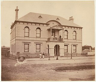
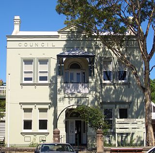
The Municipality of Annandale was a local government area of Sydney, New South Wales, Australia. The municipality was proclaimed on 29 December 1893 as the Borough of Annandale when the East Ward of Leichhardt Council separated, and, with an area of 1.4 square kilometres, covered the entire suburb of Annandale, excepting a small block between Johnstons Creek, Booth Street and Parramatta Road. The council was amalgamated with the Municipality of Leichhardt to the west with the passing of the Local Government (Areas) Act 1948.
The Municipality of Balmain was a local government area of Sydney, New South Wales, Australia. The municipality was proclaimed in February 1860 and, with an area of 3.8 square kilometres, covered the entire peninsula of Balmain north of Callan Park and Foucart Street, including the present suburbs of Balmain, Balmain East, Birchgrove and Rozelle. The council was amalgamated with the municipalities of Leichhardt and Annandale to the south with the passing of the Local Government (Areas) Act 1948.

The Municipality of Erskineville was a local government area of Sydney, New South Wales, Australia. The municipality was proclaimed as the "Municipal District of Macdonald Town" on 23 May 1872 and, with an area of 0.8 square kilometres, was one of the smallest local government areas in Sydney and included the modern suburb of Erskineville, part of Eveleigh and the locality of Macdonaldtown. The council was amalgamated, along with most of its neighbours, with the City of Sydney to the north with the passing of the Local Government (Areas) Act 1948. From 1968 to 1982 and from 1989 to 2004, the area was part of the South Sydney councils, with the former Town Hall serving as its council chambers.

The Municipality of Enfield was a local government area of Sydney, New South Wales, Australia. The municipality was proclaimed as the Borough of Enfield on 17 January 1889 and, with an area of 3.6 square kilometres, included the modern suburbs of Croydon, Croydon Park and Strathfield South, with parts of Enfield, Belfield and Greenacre included in the West Ward. In 1949, the council was split into two, with Central and East Wards being added to the Municipality of Burwood and the West Ward being added into the Municipality of Strathfield, with the passing of the Local Government (Areas) Act 1948.

The Municipality of Paddington was a local government area of Sydney, New South Wales, Australia. The municipality was proclaimed on 17 April 1860 and, with an area of 1.7 square kilometres, included the entire suburb of Paddington and parts of Edgecliff. The council was amalgamated with the City of Sydney to the east with the passing of the Local Government (Areas) Act 1948, although the former council area was transferred in 1968 to the Municipality of Woollahra, transferred to the City of South Sydney in 1989 and was then split in 2003 between the City of Sydney and the Municipality of Woollahra.

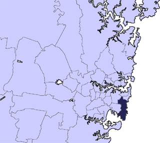
The Municipality of Mascot was a local government area in the inner south of Sydney, New South Wales, Australia. The municipality was proclaimed as the Borough of North Botany on 29 March 1888 and was renamed to the Municipality of Mascot, in order to differentiate itself from their southern neighbour, from 31 October 1911. It included the modern suburbs of Eastlakes and Daceyville, with parts of Mascot and Pagewood. From 1 January 1949, the council was amalgamated into the Municipality of Botany, with the passing of the Local Government (Areas) Act 1948.


