Gundagai Shire

Last updated

Gundagai Shire
New South Wales
Gundagai LGA NSW.png
Location in New South Wales
Coordinates 35°04′S148°07′E / 35.067°S 148.117°E / -35.067; 148.117
Population3,747 (2013 est) [1]
 • Density1.5250/km2 (3.9498/sq mi)
Established1 January 1924 (1924-01-01)
Abolished12 May 2016 (2016-05-12)
Area2,457 km2 (948.7 sq mi)
Mayor Cr. Abb McAlister (Unaligned) [2]
Council seat Gundagai [3]
Region Riverina
State electorate(s) Cootamundra
Federal division(s) Riverina
Website Gundagai Shire
LGAs around Gundagai Shire:
Junee Cootamundra Harden
Wagga Wagga Gundagai Shire Yass Valley
Wagga Wagga Tumut Tumut

Gundagai Shire was a local government area in the Riverina region of New South Wales, Australia. On 12 May 2016, Gundagai Shire was abolished and merged with the neighbouring Cootamundra Shire to establish Cootamundra-Gundagai Regional Council. [4]

Contents

The Shire was located adjacent to the Hume Highway. Gundagai Shire is primarily rural, with a small population. 80% of the Shire's population live in the town of Gundagai. The four villages in the Shire were Coolac, Tumblong, Muttama and Nangus, with populations ranging from 40 to 90 people.

The last Mayor of Gundagai Shire was Cr. Abb McAlister, an unaligned politician. [2]

History

Gundagai was declared a Municipality in 1889, and Adjungbilly Shire Council created in 1906 to administer the district. The Municipality of Gundagai and the Adjungbilly Shire were amalgamated on 1 January 1924 to form the Gundagai Shire Council, which was the administrative body of the area. [5]

A 2015 review of local government boundaries recommended that Gundagai Shire merge with adjoining councils. The NSW Government considered two proposals. The first proposed a merger between the Gundagai and Cootamundra shires to form a new council with an area of 3,981 square kilometres (1,537 sq mi) and support a population of approximately 11,500. [6] The alternative, proposed by Harden Shire on 28 February 2016, was for an amalgamation of the Cootamundra, Gundagai and Harden shires. [7] Following an independent review, on 12 May 2016 the Minister for Local Government announced the dissolution of the Cootamunda and Gundagai shires, with their area merging to establish the Gundagai Council. [4] After the merger was gazetted, opposition continued through a Facebook page. [8]

Council

Gundagai Shire Council Chambers Gundagai Shire Council Chambers.jpg
Gundagai Shire Council Chambers

In 1952 Gundagai Shire Council won a coveted A.R. Bluett Memorial Award for progress. [9]

During 2011 Gundagai Shire Council was one of 110 state and local council authorities where employees were under investigation by the Independent Commission Against Corruption as part of Operation Jarek. It was claimed that employees of some state and local authorities had accepted benefits including gift cards and other items from companies in return for placing orders and continuing business relationships with these companies. [10]

Composition and election method

Gundagai Shire Council was composed of eight councillors elected proportionally from a single ward. All councillors were elected for fixed four-year terms of office. The mayor was elected by the councillors at the first meeting of the council. The last election was held on 8 September 2012, and the makeup of the council was as follows: [11]

PartyCouncillors
  Independents and Unaligned8
Total8

The last Council, elected in 2012, in order of election, was: [11]

CouncillorPartyNotes
 Abb McAlisterUnalignedMayor [2]
 Ron MosesUnaligned
 Mike Kingwill Independent
 Peter GainIndependent
 David GrahamUnalignedDeputy Mayor [2]
 Mason CraneUnaligned
 Ronnie MagnoneUnaligned
 Peter BateyIndependent

Related Research Articles

<span class="mw-page-title-main">Warringah Council</span> Former local government area in New South Wales, Australia

Warringah Council was a local government area in the northern beaches region of Sydney, in the state of New South Wales, Australia. It was proclaimed on 7 March 1906 as the Warringah Shire Council, and became "Warringah Council" in 1993. In 1992, Pittwater Council was formed when the former A Riding of Warringah Shire voted to secede. From this point on until amalgamation, Warringah Council administered 152 square kilometres (59 sq mi) of land, including nine beaches and 14 kilometres (9 mi) of coastline. Prior to its abolition it contained 6,000 hectares of natural bushland and open space, with Narrabeen Lagoon marking Warringah's northern boundary and Manly Lagoon marking the southern boundary.

<span class="mw-page-title-main">Jerilderie Shire</span> Former local government area in New South Wales, Australia

Jerilderie Shire was a local government area in the Riverina region of southern New South Wales, Australia. The Shire was located adjacent to the Newell Highway. The Shire was declared in 1918 after the amalgamation of the former Municipality of Jerilderie and Wunnamurra Shire. It was dissolved in 2016 after its amalgamation with Murrumbidgee Shire to create Murrumbidgee Council

<span class="mw-page-title-main">Murrumbidgee Shire</span> Former local government area in New South Wales, Australia

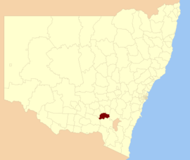
Murrumbidgee Shire was a local government area in the Riverina region of south western New South Wales, Australia. The Shire was located adjacent to the Murrumbidgee River and the Newell Highway.

<span class="mw-page-title-main">Palerang Council</span> Former local government area in New South Wales, Australia

The Palerang Council was a local government area located in the Southern Tablelands region of New South Wales, Australia. On 12 May 2016 the Minister for Local Government announced dissolution of the Palerang Council with immediate effect. Together with Queanbeyan City the combined council areas were merged to establish the Queanbeyan-Palerang Regional Council. Both councils had opposed the amalgamation. Elections for the new Council area were held in September 2017. The former mayor of Queanbeyan City Council was appointed by the New South Wales Government as administrator until that date.

<span class="mw-page-title-main">Cooma-Monaro Shire</span> Former local government area in New South Wales, Australia

Cooma-Monaro Shire was a local government area located in the Monaro region of southern New South Wales, Australia. The area was named after the former Cooma Municipality and the former Monaro Shire, that were amalgamated to create it. The Municipality of Cooma was established in 1879, and the Monaro Shire was one of several shires established in 1906. The Monaro Shire and Cooma Municipal Council amalgamated in 1981. On 11 February 2004, Cooma-Monaro Shire absorbed a small part of the former Yarrowlumla Shire, near Michelago.

<span class="mw-page-title-main">Snowy River Shire</span> Former local government area in New South Wales, Australia

The Snowy River Shire was a local government area in the Australian Alps region of New South Wales, Australia from 1939 until May 2016. It was named after the Snowy River that runs through it. Prior to 1936, it had been named as Dalgety Shire since establishment in 1906.

<span class="mw-page-title-main">Murray Shire</span> Former local government area in New South Wales, Australia

Murray Shire was a local government area in the Riverina region of south western New South Wales, Australia. It included the towns of Moama and Mathoura. It was abolished on 12 May 2016 and its area merged with the Wakool Shire to establish the Murray River Council.

<span class="mw-page-title-main">Wakool Shire</span> Former local government area in New South Wales, Australia

Wakool Shire was a local government area in the Riverina region of New South Wales, Australia. The Shire was located between the Murray River and the Murrumbidgee River and adjacent to the Sturt Highway. Towns in the Shire are Barham, Moulamein, Tooleybuc, Wakool and Koraleigh.

<span class="mw-page-title-main">Bombala Shire</span> Former local government area in New South Wales, Australia

The Bombala Shire was a local government area in the Monaro region of south-eastern New South Wales, Australia. The Shire includes the town of Bombala, the villages of Delegate, Cathcart, Bibbenluke and the localities of Ando, Bungarby, Craigie, Mila, Rockton and Creewah. Bombala Shire was formed on 1 October 1977 by the amalgamation of the Municipality of Bombala and Bibbenluke Shire.

<span class="mw-page-title-main">Dungog Shire</span> Local government area in New South Wales, Australia

Dungog Shire is a local government area in the Hunter region of New South Wales, Australia. The Shire is situated adjacent to the Barrington Tops and consists predominantly of very rugged to hilly country which becomes less rugged from north to south.

<span class="mw-page-title-main">Boorowa Shire</span> Former local government area in New South Wales, Australia

Boorowa Council was a local government area in the South West Slopes region of New South Wales, Australia. The LGA was located adjacent to the Lachlan Valley Way and included Boorowa and the small towns of Rye Park, Rugby, Frogmore and Reids Flat. Burrowa LGA was formed on 1 September 1944 through the amalgamation of Murrungal Shire and the Municipality of Burrowa.

<span class="mw-page-title-main">Young Shire</span> Former local government area in New South Wales, Australia

Young Shire was a local government area in the South West Slopes region of New South Wales, Australia. The Shire was located adjacent to the Olympic Highway.

<span class="mw-page-title-main">Harden Shire</span> Former local government area in New South Wales, Australia

Harden Shire was a local government area in the South West Slopes region of New South Wales, Australia. The Shire included the twin towns of Harden and Murrumburrah and the small towns of Galong, Jugiong, Wombat and Kingsvale.

<span class="mw-page-title-main">Cootamundra Shire</span> Former local government area in New South Wales, Australia

Cootamundra Shire was a local government area in the Riverina region of New South Wales, Australia. The Shire was located adjacent to the Olympic Highway, the Burley Griffin Way and the Main South railway line. The Shire included the town of Cootamundra and the small towns of Stockinbingal, Brawlin and Wallendbeen and the locality of Frampton. The Shire was created on 1 April 1975 by the amalgamation of Jindalee Shire and the Municipality of Cootamundra.

<span class="mw-page-title-main">Tumbarumba Shire</span> Former local government area in New South Wales, Australia

Tumbarumba Shire was a local government area in the eastern Riverina region, located in the foothills of the Snowy Mountains, on the upper reaches of the Murray River in New South Wales, Australia. It came into existence in 1906. Prior to this the area covered by the shire was unincorporated. It included the town of Tumbarumba and the small towns of Rosewood, Tooma, Khancoban and Jingellic.

<span class="mw-page-title-main">Lockhart Shire</span> Local government area in New South Wales, Australia

Lockhart Shire is a local government area in the Riverina region of New South Wales, Australia. The Shire was created in 1906 and is an agricultural and pastoral area.

<span class="mw-page-title-main">Urana Shire</span> Former local government area in New South Wales, Australia

Urana Shire was a local government area in the Riverina region of New South Wales, Australia. The Newell Highway crosses its north-west corner. The Shire included the town of Urana and the small towns of Boree Creek, Morundah, Oaklands and Rand.

<span class="mw-page-title-main">Corowa Shire</span> Former local government area in New South Wales, Australia

Corowa Shire was a local government area in the Riverina region in southern New South Wales, Australia. The area was located adjacent to the Murray River and the Riverina Highway.

<span class="mw-page-title-main">Federation Council, New South Wales</span> Local government area in New South Wales, Australia

The Federation Council is a local government area located in the Riverina region of New South Wales, Australia. This area was formed in 2016 from the merger of the Corowa Shire with its neighbouring Urana Shire.

<span class="mw-page-title-main">Cootamundra–Gundagai Regional Council</span> Local government area in New South Wales, Australia

Cootamundra–Gundagai Regional Council (CGRC) is a local government area located in the South West Slopes and Riverina regions of New South Wales, Australia. The council was formed on 12 May 2016 through a merger of the Cootamundra and Gundagai shires. Originally named Gundagai Council, the name was changed to Cootamundra–Gundagai Regional Council on 7 September 2016.

References

  1. "3218.0 Regional Population Growth, Australia. Table 1. Estimated Resident Population, Local Government Areas, New South Wales". 3 April 2014. Retrieved 11 September 2014.
  2. 1 2 3 4 "Councillors". Council. Gundagai Shire Council. 18 September 2012. Archived from the original on 9 April 2013. Retrieved 30 September 2012.
  3. "Gundagai Shire Council". Department of Local Government . Retrieved 9 November 2006.
  4. 1 2 "Gundagai Council". New South Wales Government. Archived from the original on 11 June 2016. Retrieved 20 May 2016.
  5. "Local Government Act 1919. Proclamation (156)". Government Gazette of the State of New South Wales . 21 December 1923. p. 5875. Retrieved 23 December 2019 via National Library of Australia.
  6. "Merger proposal: Cootamundra Council, Gundagai Shire Council" (PDF). Government of New South Wales. January 2016. p. 7. Retrieved 10 March 2016.
  7. Harden Shire Council (28 February 2016). "Fit For Future: Alternate Merger Proposal – Harden Shire Council" (PDF). Government of New South Wales . Retrieved 8 March 2016.
  8. "Save Gundagai Shire" . Retrieved 22 May 2016 via Facebook.
  9. "Councils Gey Awards For Progress". The Sydney Morning Herald. 25 August 1954. p. 14.
  10. Public authorities – corruption allegations concerning acceptance of gifts and benefits; and alleged payment of fraudulent invoices (Operation Jarek). Independent Commission Against Corruption, New South Wales. 2011. Retrieved 30 September 2012.
  11. 1 2 "Gundagai Shire Council: Summary of First Preference and Group Votes for each Candidate". Local Government Elections 2012. Electoral Commission of New South Wales. 13 September 2012. Retrieved 30 September 2012.