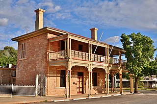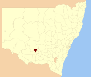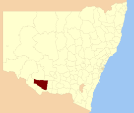
Clarence Valley Council is a local government area in the Northern Rivers region of New South Wales, Australia.

Conargo is a town in the Riverina region of New South Wales, Australia. The town is in the Edward River Council local government area. It is on Billabong Creek, a tributary of the Edward River. The nearest towns are Jerilderie and Deniliquin. At the 2006 census, Conargo had a population of 117 people.

Conargo Shire was a local government area in the Riverina region in southern New South Wales, Australia.

Cabonne Council is a local government area in the Central West region of New South Wales, Australia. The Shire is located adjacent to the Mitchell Highway and the Broken Hill railway line, partly surrounding the City of Orange. The administrative centre is located at Molong.

Central Darling Shire is a local government area in the Far West region of New South Wales, Australia. The Shire is located adjacent to the Barrier Highway. Central Darling Shire was constituted in 1959 and at 53,511 square kilometres (20,661 sq mi), it is the largest incorporated local government area in New South Wales.

Lachlan Shire is a local government area in the Central West region of New South Wales, Australia. The Shire is located adjacent to the Lachlan River, the Lachlan Valley Way and the Broken Hill railway line.

Berrigan Shire is a local government area in the southern Riverina region of New South Wales, Australia. The Shire lies on the New South Wales State border with Victoria formed by the Murray River. The Shire is adjacent to the Newell and Riverina Highways. The Shire is a mainly agricultural region, with dairying, cattle raising, woolgrowing and cropping the main activities. The vast majority of the Shire is irrigated. Tourism is another major activity, concentrated on the river towns of Tocumwal and Barooga.

The City of Albury is a local government area in the Murray region of New South Wales, Australia. The area covers 305.9 square kilometres (118.1 sq mi) to the north of the Murray River. The area extends around 10 to 12 kilometres east and west along the river from the centre of Albury and up to 20 kilometres (12 mi) north. The population of the City of Albury area was 53,767 in June 2018.

The City of Griffith is a local government area in the Riverina region of south-western New South Wales, Australia. The area comprises 1,640 square kilometres (630 sq mi) and is located in the Murrumbidgee Irrigation Area and on Kidman Way.

Singleton Council is a local government area in the Hunter Region of New South Wales, Australia. It is situated adjacent to the New England Highway and the Main North railway line.

Dungog Shire is a local government area in the Hunter region of New South Wales, Australia. The Shire is situated adjacent to the Barrington Tops and consists predominantly of very rugged to hilly country which becomes less rugged from north to south.

Deniliquin Council was a local government area in the Riverina region of south-western New South Wales, Australia. At the date of its abolition, Deniliquin Council was the last rural local government area in New South Wales left consisting only of a rural town.

Coonamble Shire is a local government area in the Orana region of New South Wales, Australia. The Shire is located adjacent to the Castlereagh Highway and the Castlereagh River.

Walgett Shire is a local government area in the Orana region of New South Wales, Australia. The northern boundary of the Shire is located adjacent to the border between New South Wales and Queensland. The town of Walgett is located on the Namoi River, nearby to its junction with the Barwon River and at the junction of the Kamilaroi Highway and the Castlereagh Highway.

Warren Shire is a local government area in the Orana region of New South Wales, Australia. The Shire is located adjacent to the Macquarie River and the Mitchell and Oxley Highways. The use of the area is mainly for wool and cotton growing.

Bourke Shire is a local government area in the Orana region of New South Wales, Australia. The Shire is located adjacent to the Darling River, which is known as the Barwon River upstream from Bourke; and located adjacent to the Mitchell Highway. The northern boundary of the Shire is located adjacent to the border between New South Wales and Queensland. The shire is a wool and beef producing area.

Federation Council is a local government area located in the Murray region of New South Wales, Australia, formed in 2016 from the merger of the Corowa Shire with neighbouring Urana Shire.

Murrumbidgee Council is a local government area in the Riverina region of New South Wales, Australia. This area was formed in 2016 from the merger of the Murrumbidgee Shire and the Jerilderie Shire.

Hilltops Council is a local government area in the South West Slopes region of New South Wales, Australia. This area was formed on 12 May 2016 from the merger of Boorowa Council, Harden Shire and Young Shire. The local government area covers much the same area as the Hilltops wine region.

Cootamundra–Gundagai Regional Council (CGRC) is a local government area located in the Riverina region of New South Wales, Australia. The council was formed on 12 May 2016 through a merger of the Cootamundra Shire and Gundagai Shire Councils. Originally named Gundagai Council, the name was changed to Cootamundra–Gundagai Regional Council on 7 September 2016.


