Bega Valley Shire

Last updated

Bega Valley
New South Wales
Bega LGA NSW.png
Location in New South Wales
Coordinates 36°40′S149°50′E / 36.667°S 149.833°E / -36.667; 149.833
Population35,942 (LGA 2021) [1]
Established1981
Area6,279 km2 (2,424.3 sq mi)
MayorRussell Fitpatrick (Mayor)
Anthony McMahon (CEO)
Council seat Bega [2]
Region South Coast
State electorate(s) Bega
Federal division(s) Eden-Monaro
Bega Valley Shire Council Logo.png
Website Bega Valley
LGAs around Bega Valley:
Snowy Monaro Eurobodalla Tasman Sea
Snowy Monaro Bega Valley Tasman Sea
East Gippsland (Vic) East Gippsland (Vic) Tasman Sea

The Bega Valley Shire is a local government area located adjacent to the south-eastern coastline of New South Wales, Australia. The Shire was formed in 1981 with the amalgamation of the Municipality of Bega, Imlay Shire and Mumbulla Shire, [3] with its name deriving from the town of Bega. The shire is also known as the Sapphire Coast for tourism and marketing purposes. During the 2019–20 Australian bushfire season, the area was devastated by fire, with 448 houses being destroyed by fire [4] and approximately 365,000 hectares burned, which is 58% of the Shire's total land mass. [5]

Contents

The estimated population as at the 2021 census was 35,942. [6]

The current Mayor is Russell Fitzpatrick, an independent who joined the Liberal Party in 2023. [7]

Area

The shire covers 6,040 square kilometres (2,330 sq mi), and includes a coastline of 225 km (140 mi), with 101 beaches and 26 estuaries. Around 78% of the area belongs to various national parks and state forests. The biggest industry is the production of timber, followed by dairy farming and other agriculture. Smaller industries include fishing, oyster harvesting, and tourism. [8] The Biamanga National Park includes important Aboriginal sites. [9]

Towns and localities

The area extends from Bermagui in the north to the Victorian border in the south and includes the towns of Bega, Tathra, Merimbula, Tura Beach, Wolumla, Cobargo, Bemboka, Pambula, Pambula Beach and the former whaling port, tourism hotspot, and major port of Eden.

Smaller localities include:

  • Angledale
  • Bald Hills
  • Barragga Bay
  • Berrambool
  • Black Range
  • Bournda
  • Boydtown
  • Broadwater
  • Brogo
  • Buckajo
  • Burragate
  • Candelo
  • Chinnock
  • Coolagolite
  • Coopers Gully
  • Cuttagee
  • Devils Hole
  • Dignams Creek
  • Doctor George Mountain
  • Edrom
  • Frogs Hollow
  • Greendale
  • Greigs Flat
  • Jellat Jellat
  • Kalaru
  • Kameruka
  • Kanoona
  • Kiah
  • Kingswood
  • Lochiel
  • Millingandi
  • Mirador
  • Mogareeka
  • Mogilla
  • Morans Crossing
  • Mount Darragh
  • Murrah
  • Myrtle Mountain
  • Narrabarba
  • Nelson
  • Nethercote
  • New Buildings
  • Nullica
  • Numbugga
  • Nungatta (part)
  • Nungatta South
  • Pericoe
  • Quaama
  • Reedy Swamp
  • Rocky Hall
  • South Pambula
  • South Wolumla
  • Stony Creek
  • Tanja
  • Tantawangalo
  • Tarraganda
  • Timbillica
  • Toothdale
  • Towamba
  • Verona
  • Wallagoot
  • Wandella
  • Wapengo
  • Wonboyn
  • Wyndham
  • Yellow Pinch
  • Yowrie

Council

Bega Valley Shire Council is composed of nine councillors elected proportionally as one entire ward. All councillors are elected for a fixed four-year term of office. The mayor is elected by the councillors at the first meeting of the council. The most recent election was held on 4 December 2021, and the makeup of the Council is as follows: [10]

PartyCouncillors
Independent 6
Labor 1
Liberal 1
Greens 1
Total9

The current Council, elected in 2021, in order of election, is: [10]

CouncillorPartyNotes
 Helen O’Neil Labor
 Karen Wright Independent
 Russel FitzpatrickLiberal [11] Mayor [12]
 Tony AllenIndependent
 Cathy Griff Greens Deputy Mayor [12]
 Mitch NadinIndependent
 David PorterIndependent
 Liz SeckoldIndependent
 Joy RobinIndependent

Election results

2024

2024 New South Wales local elections: Bega Valley
PartyCandidateVotes%±%
Independent 1. Mitchell Nadin
2. David Porter
3. Peggy Noble
4. Jason Hetherington
5. Morgan Eneberg
Labor 1. Helen O'Neil
2. Simon Daly
3. David Neyle
4. Nicola Collins
Greens 1. Peter Haggar
2. Liane Munro
3. Emma Goward
4. Vivian Harris
5. Jamie Shaw
Independent Clair Mudaliar
Independent Tony Allen
Independent Russell Fitzpatrick
Independent Phillip Drummett
Total formal votes
Informal votes
Turnout

2021

2021 New South Wales local elections: Bega Valley [13]
PartyCandidateVotes%±%
Labor 1. Helen O'Neil (elected)
2. Simon Daly
4,94317.3
Independent Russell Fitzpatrick (elected)2,81813.1
Greens 1. Cathy Griff (elected)
2. Vivian Harris
3. Paula Park
4. Angus Ashcroft
5. Peter Haggar
2,66512.4
Independent Tony Allen (elected)2,59412.1
Independent Karen Wright (elected)2,53911.8
Independent Mitch Nadin (elected)1,2015.6
Independent Joy Robin (elected)1,0805.0
Independent David Porter (elected)1,0034.7
Independent Mike Britten8844.1
Independent Liz Seckhold (elected)8754.1
Independent Nathan O'Donnell8524.0
Independent Joshua Shoobridge6503.0
Independent Neil Bourke5682.6
Total formal votes21,43591.4
Informal votes2,0268.6
Turnout 23,46187.9
Party total votes
Independent 15,06470.3
Labor 4,94317.3
Greens 2,66512.4

Demographics

Selected historical census data for Bega Valley Shire local government area
Census year2011 [14] 2016 [15] [6] 2021
PopulationEstimated residents on census night 31,950Increase2.svg 33,253Increase2.svg 35,942
LGA rank in terms of size within New South Wales 56thDecrease2.svg 57th
% of New South Wales population0.46%Decrease2.svg 0.44%Steady2.svg 0.44%
% of Australian population0.15%Decrease2.svg 0.14%Steady2.svg 0.14%
Cultural and language diversity
Ancestry,
top responses
English 32.5%Decrease2.svg 31.9%Increase2.svg 43.8%
Australian 31.3%Decrease2.svg 30.9%Increase2.svg 40.7
Irish 9.3%Decrease2.svg 9.2%Increase2.svg 13.0%
Scottish 8.4%Decrease2.svg 8.2%Increase2.svg 11.4%
German 3.8%Decrease2.svg 3.7%Increase2.svg 5.1%
Language,
top responses
(other than English)
German 0.6%Decrease2.svg 0.5%Decrease2.svg 0.4%
Dutch 0.3%Decrease2.svg 0.2%
Italian 0.2%Steady2.svg 0.2%
French 0.2%Steady2.svg 0.2%Steady2.svg 0.2%
Thai n/r0.2%Steady2.svg 0.2%
Religious affiliation
Religious affiliation,
top responses
No religion, so described26.7%Increase2.svg 35.1%Increase2.svg 46.9%
Anglican 27.3%Decrease2.svg 21.9%Decrease2.svg 16.4%
Catholic 20.0%Decrease2.svg 17.9%Decrease2.svg 15.1%
Not statedn/r10.4%Decrease2.svg 8.3%
Uniting Church 4.6%Decrease2.svg 3.7%Decrease2.svg 2.7%
Median weekly incomes
Personal incomeMedian weekly personal income$454Increase2.svg $538Increase2.svg $645
% of Australian median income78.7%Increase2.svg 81.3%Increase2.svg 80.1%
Family incomeMedian weekly family income$1,014Increase2.svg $1,242Increase2.svg $1,501
% of Australian median income68.5%Increase2.svg 71.6%Decrease2.svg 70.8%
Household incomeMedian weekly household income$848Increase2.svg $986Increase2.svg $1,200
% of Australian median income68.7%Decrease2.svg 68.6%Increase2.svg 68.7%

See also

Related Research Articles

<span class="mw-page-title-main">Biamanga National Park</span> Protected area in New South Wales, Australia

Biamanga National Park is a protected area in New South Wales, Australia, 408 km (254 mi) south of Sydney and 40 km (25 mi) north of Bega. The park forms part of the Ulladulla to Merimbula Important Bird Area because of its importance for swift parrots.

<span class="mw-page-title-main">Gulaga National Park</span> Protected area in New South Wales, Australia

Gulaga National Park is a national park on the south coast of New South Wales, Australia, about 15 kilometres (9.3 mi) south of Narooma. The park is dominated by Gulaga, also known as Mount Gulaga. The former Wallaga Lake National Park, Goura Nature Reserve, and Mount Dromedary Flora Reserve were combined to form this park in 2001. The park features the southernmost subtropical rainforest in New South Wales.

<span class="mw-page-title-main">The Hills Shire</span> Local government area in New South Wales, Australia

The Hills Shire is a local government area in the Greater Sydney region of Sydney, New South Wales, Australia. The area is north-west of the Sydney central business district, and encompasses 401 square kilometres (155 sq mi) stretching from the M2 Hills Motorway in the south to Wisemans Ferry on the Hawkesbury River in the north. The Hills Shire had a population of 191,876 as of the 2021 census.

<span class="mw-page-title-main">Bega, New South Wales</span> Town in New South Wales, Australia

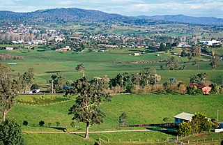
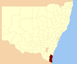
Bega is a town in the south-east of New South Wales, Australia, in the Bega Valley Shire. It is the economic centre for the Bega Valley.

Pambula is a town in Bega Valley Shire on the far south coast of New South Wales, Australia 454 kilometres (282 mi) south of Sydney via the Princes Highway. At the 2016 census, Pambula had a population of 970 people.

<span class="mw-page-title-main">City of Parramatta</span> Local government area in New South Wales, Australia

The City of Parramatta, also known as Parramatta Council, is a local government area located to the west and north-west of Sydney CBD in the Greater Western Sydney region. Parramatta Council is situated between the City of Ryde and Cumberland, where the Cumberland Plain meets the Hornsby Plateau, approximately 25 kilometres (16 mi) west of the Sydney central business district, in New South Wales, Australia. The city occupies an area of 84 square kilometres (32 sq mi) spanning across suburbs in Greater Western Sydney including the Hills District, and a small section of Northern Sydney to the far north east of its area. According to the 2016 census, City of Parramatta had an estimated population of 226,149. The city houses the Parramatta central business district which is one of the key suburban employment destinations for the region of Greater Western Sydney.

<span class="mw-page-title-main">Carrathool Shire</span> Local government area in New South Wales, Australia

The Carrathool Shire is a local government area that borders both the Riverina and Far West regions of New South Wales, Australia. The Shire comprises 18,933 square kilometres (7,310 sq mi) and is located adjacent to the Mid-Western Highway and north of the Sturt Highway.

<span class="mw-page-title-main">Berrigan Shire</span> Local government area in New South Wales, Australia

Berrigan Shire is a local government area in the southern Riverina region of New South Wales, Australia. The Shire lies on the New South Wales State border with Victoria formed by the Murray River. The Shire is adjacent to the Newell and Riverina Highways. The Shire is a mainly agricultural region, with dairying, cattle raising, woolgrowing and cropping the main activities. The vast majority of the Shire is irrigated. Tourism is another major activity, concentrated on the river towns of Tocumwal and Barooga.

<span class="mw-page-title-main">Municipality of Kiama</span> Local government area in New South Wales, Australia

The Municipality of Kiama is a local government area in the Illawarra region of New South Wales, Australia. The area is situated south of Shellharbour and the City of Wollongong and is located adjacent to the Pacific Ocean, the Princes Highway and the South Coast railway line.

<span class="mw-page-title-main">Ballina Shire</span> Local government area in New South Wales, Australia

Ballina Shire is a local government area in the Northern Rivers region of New South Wales, Australia. The Shire was formed on 1 January 1977 by the amalgamation of the Municipality of Ballina and Tintenbar Shire. The Shire is located adjacent to the Tasman Sea and the Pacific Highway. The council seat is located in the town of Ballina. The population of the Ballina Shire area was 46,850 in 2022.

<span class="mw-page-title-main">Junee Shire</span> Local government area in New South Wales, Australia

The Junee Shire is a local government area in the Riverina region of New South Wales, Australia. The Shire comprises an area of 2,030 square kilometres (780 sq mi) and is located adjacent to the Olympic Highway and the Main South railway line. It was formed on 1 January 1981 from the amalgamation of the Municipality of Junee and Illabo Shire resulting from the Local Government Areas Amalgamation Act 1980.

<span class="mw-page-title-main">Hay Shire</span> Local government area in New South Wales, Australia

The Hay Shire is a local government area in the Riverina area of south-western New South Wales, Australia. The Shire comprises 11,326 square kilometres (4,373 sq mi) and is located adjacent to the Sturt, Mid-western and Cobb Highways. The area includes the towns of Hay, Booligal and Maude.

<span class="mw-page-title-main">Wentworth Shire</span> Local government area in New South Wales, Australia

Wentworth Shire is a local government area in the far south-west Riverina region of New South Wales, Australia. This Shire is located adjacent to the Murray and Darling Rivers. The Shire's major roads are the Sturt and the Silver City Highways. The Shire includes the towns of Wentworth, Buronga, Gol Gol, Dareton and Pooncarie. The shire's namesake is explorer and politician William Wentworth.

<span class="mw-page-title-main">Cobar Shire</span> Local government area in New South Wales, Australia

Cobar Shire is a local government area in the Orana region of New South Wales, Australia. The Shire is located in an outback area that is centred around the mining town of Cobar. The Shire is traversed by the Barrier Highway and the Kidman Way. With a total area of 44,065 square kilometres (17,014 sq mi), about two-thirds the size of Tasmania, Cobar Shire is larger than Denmark and 99 other countries and self-governing territories, but its population is under 5000.

Wyndham is a village located 519 km (322 mi) south of Sydney, on the far south coast of New South Wales, Australia in the Bega Valley Shire. At the 2016 census, Wyndham had a population of 386.

Yellow Pinch Dam is a major off-stream ungated rockfill embankment dam across the Yellow Pinch Creek upstream of Merimbula in the South Coast region of New South Wales, Australia. The dam's main purpose is water supply. The impounded reservoir is also called Yellow Pinch Dam.

<span class="mw-page-title-main">Murrumbidgee Council</span> Local government area in New South Wales, Australia

Murrumbidgee Council is a local government area in the Riverina region of New South Wales, Australia. This area was formed in 2016 from the merger of the Murrumbidgee Shire and the Jerilderie Shire.

<span class="mw-page-title-main">Snowy Monaro Regional Council</span> Local government area in New South Wales, Australia

The Snowy Monaro Regional Council is a local government area located in the Snowy Mountains and Monaro regions of New South Wales, Australia. The council was formed on 12 May 2016 through a forced merger of the Bombala, Cooma-Monaro and Snowy River shires.

<i>The Bega Standard and Candelo, Merimbula, Pambula, Eden, Wolumla, and General Advertiser</i> Former newspaper in New South Wales, Australia

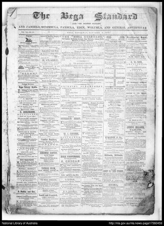
The Bega Standard and Candelo, Merimbula, Pambula, Eden, Wolumla, and General Advertiser, also previously published as Southern Standard, was a weekly, later semiweekly English language newspaper published in Bega, New South Wales, Australia.

<span class="mw-page-title-main">2021 New South Wales local elections</span>

The 2021 New South Wales local elections were held on 4 December 2021 to elect the councils of 121 of the 128 local government areas (LGAs) in New South Wales. Several councils also held mayoral elections and/or referendums.

References

  1. Australian Bureau of Statistics (28 June 2022). "Bega Valley (Local Government Area)". Australian Census 2021 QuickStats. Retrieved 28 June 2022.  OOjs UI icon edit-ltr-progressive.svg
  2. "Bega Valley Shire Council". New South Wales Division of Local Government. Archived from the original on 7 September 2006. Retrieved 14 November 2006.
  3. "Holdings". Bega Valley Genealogy Society. Bega Valley Genealogy Society Inc. Retrieved 21 May 2016.
  4. McKnight, Albert (18 March 2020). "Forty per cent of fire-destroyed homes haven't registered for free clean-up: Bega council". Bega District News. Retrieved 3 September 2021.
  5. McKnight, Albert (29 February 2020). "Bushfire damage count: two-thirds of Far South Coast burnt, eight lives lost" . Illawarra Mercury . Archived from the original on 20 May 2024. Retrieved 3 September 2021.
  6. 1 2 Australian Bureau of Statistics (28 June 2022). "Bega Valley". 2021 Census QuickStats. Retrieved 20 May 2024. OOjs UI icon edit-ltr-progressive.svg
  7. "Bega Valley Mayor endorsed as Liberal candidate in next state election". 24 November 2022.
  8. "About the Bega Valley Shire". About the Shire. Bega Valley Shire Council. n.d. Retrieved 1 April 2018.
  9. "Biamanga Cultural area". NSW National Parks. Retrieved 20 August 2021.
  10. 1 2 "Bega Valley Councillor Election". NSW Electoral Commission. 21 December 2021. Archived from the original on 20 May 2024. Retrieved 18 March 2022. The following candidates were declared elected on 21 December 2021: Helen O'NEIL (ALP) Karen WRIGHT (IND) Russell FITZPATRICK (IND) Tony ALLEN (IND) Cathy GRIFF (GRN) Mitch NADIN (IND) David PORTER (IND) Liz SECKOLD (IND) Joy ROBIN (IND)
  11. Smyth, Ben (24 November 2022). "Bega Valley Mayor endorsed as Liberal candidate in next state election" . Merimbula News Weekly. Archived from the original on 20 May 2024.
  12. 1 2 "Meet your Councillors and Mayor". Bega Valley Shire Council. Bega NSW. 12 January 2022. Archived from the original on 20 May 2024. Retrieved 20 May 2024.
  13. "Bega Valley". ABC News.
  14. Australian Bureau of Statistics (31 October 2012). "Bega Valley (A)". 2011 Census QuickStats. Retrieved 9 July 2017. OOjs UI icon edit-ltr-progressive.svg
  15. Australian Bureau of Statistics (27 June 2017). "Bega Valley (A)". 2016 Census QuickStats. Retrieved 9 July 2017. OOjs UI icon edit-ltr-progressive.svg