
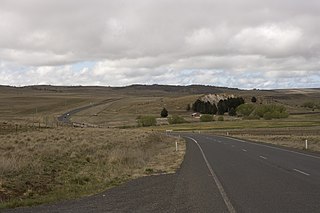
Monaro Highway is a 285-kilometre-long (177 mi) highway in Victoria, New South Wales, and the Australian Capital Territory, in Australia, linking Cann River in Victoria to Canberra in the Australian Capital Territory (ACT) via the Monaro region. From its southern terminus, it follows the nearby Cann River upstream towards the New South Wales border through heavily forested terrain. Within New South Wales (NSW), it makes its way through further forest before reaching the pastures typical of the Monaro. There are multiple towns and villages along the highway, including Bombala, Nimmitabel, and Cooma. The terrain within the Monaro is largely hilly, and there are numerous crossings. The road also parallels the former Bombala railway line in several locations. Within the ACT, the road becomes a high volume roadway and serves the southern suburbs of Canberra. The highway has more recently had a grade-separated dual carriageway extension constructed within Canberra, as part of the Eastern Parkway construction project. It is designated part of route M23, and route A23 within Canberra, and route B23 within Victoria and New South Wales, with a concurrency where it also carries route B72 between the two sections of Snowy Mountains Highway.

The Mitchell River is a perennial river of the East Gippsland catchment, located in the Australian state of Victoria. The unregulated river provides a unique example of riparian ecology, flowing generally south with the catchment area drawing from the steep mountains of the Victorian Alps to enter Lake King, one of the Gippsland Lakes, and then empty into the Bass Strait.
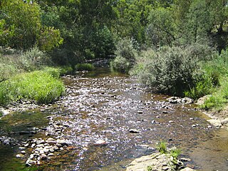
The Cann River is a perennial river located in the East Gippsland region of the Australian state of Victoria.
The Bombala River, a perennial river of the Snowy River catchment, is located in the Monaro region of New South Wales, Australia.
The Suggan Buggan River is a perennial river of the Snowy River catchment, located in the Alpine region of the Australian state of Victoria.
The Bendoc River is a perennial river of the Snowy River catchment, located in the Alpine regions of the states of Victoria and New South Wales, Australia.
The Coolumbooka River, a perennial river of the Snowy River catchment, is located in the Monaro region of New South Wales, Australia.
The Delegate River is a perennial river of the Snowy River catchment, located in the Alpine regions of the states of Victoria and New South Wales, Australia.

The Ingeegoodbee River is a perennial river of the Snowy River catchment, located in the Alpine regions of the states of New South Wales and Victoria, Australia.

The Wallagaraugh River is a perennial river of the Genoa River catchment, with its headwaters located in the South Coast region of New South Wales and its lower reaches located in the East Gippsland region of Victoria, Australia.
The Yeerung River is a perennial river located in the East Gippsland region of the Australian state of Victoria.
Bonang Road is a rural road in south-eastern Australia, running generally south–north. It links the Gippsland region coastal town of Orbost, Victoria and the highland Monaro region town of Bombala, New South Wales.
White Rock River, a perennial river of the Genoa River catchment, is located just south of the Monaro region of New South Wales, Australia.
The Queensborough River is a perennial river of the Snowy River catchment, located in the Alpine regions of the Australian states of Victoria and New South Wales.
The Teal Creek, formerly known as Little River, is a perennial stream of the Genoa River catchment, located in the East Gippsland region of the Australian state of Victoria.
The Cann River East Branch is a perennial river located in the East Gippsland region of the Australian state of Victoria.

The Berrima River, also called the Berrima Creek, is a perennial river of the Snowy River catchment, located in the Alpine region of the Australian states of New South Wales and Victoria.
The Cooma Creek, a mostly–perennial river that is part of the Murrumbidgee catchment within the Murray–Darling basin, is located in the Monaro region of New South Wales, Australia.
Rock Flat Creek is a watercourse that is part of the Murrumbidgee catchment within the Murray–Darling basin. It is located in the Monaro region of New South Wales, Australia.

Colinton is a locality in the Snowy Monaro Region, New South Wales, Australia. At the 2016 census, it had a population of 127. There was once a village and railway station of the same name.
