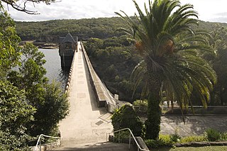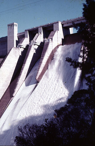
The Wingecarribee River, a perennial river that is part of the Hawkesbury–Nepean catchment, is located in the Southern Highlands region of New South Wales, Australia.

The Upper Nepean Scheme is a series of dams and weirs in the catchments of the Cataract, Cordeaux, Avon and Nepean rivers of New South Wales, Australia. The scheme includes four dams and two weirs, and a gravity-fed canal system that feeds into a large storage reservoir to provide water to the Macarthur and Illawarra regions, the Wollondilly Shire, and metropolitan Sydney. The four dams and associated infrastructure are individually listed on the New South Wales State Heritage Register.
Bargo is a town in the Macarthur Region of Sydney in New South Wales, Australia, in the Wollondilly Shire. It is located approximately halfway between Campbelltown and Bowral, about 100 km south west of the Sydney CBD.

The Parish of Colo is a parish of the County of Camden in the Southern Highlands region of New South Wales. It is centred on the town of Colo Vale, and includes Aylmerton, Willow Vale, Alpine and Yerrinbool. It also includes the northern parts of Mittagong that are north of the Old Hume Highway. The new Hume Highway runs through the parish from south-west to north-east.

The Grose River, a perennial river that is part of the Hawkesbury-Nepean catchment, is located in the Blue Mountains region of New South Wales, Australia.

The Avon River, a perennial river of the Hawkesbury-Nepean catchment, is located in the Southern Highlands and Macarthur districts of New South Wales, Australia.

The Cataract River, a perennial river that is part of the Hawkesbury-Nepean catchment, is located in the Macarthur region of New South Wales, Australia.

The Cordeaux River, a perennial river of the Hawkesbury-Nepean catchment, is located in the Southern Highlands and Macarthur regions of New South Wales, Australia.

The Warragamba River, a river that is part of the Hawkesbury-Nepean catchment, is located in the Macarthur region of New South Wales, Australia.
The Jooriland River, a perennial river that is part of the Hawkesbury-Nepean catchment, is located in the Central Tablelands and Macarthur regions of New South Wales, Australia.
The Mulwaree River, a perennial river that is part of the Hawkesbury-Nepean catchment, is located in the Southern Tablelands region of New South Wales, Australia.
The Paddys River, a perennial river that is part of the Hawkesbury-Nepean catchment, is located in the Southern Highlands region of New South Wales, Australia.
The Tarlo River, a perennial river that is part of the Hawkesbury-Nepean catchment, is located in the Southern Tablelands and Southern Highlands regions of New South Wales, Australia.
The Tonalli River, a perennial river that is part of the Hawkesbury-Nepean catchment, is located in the Blue Mountains region of New South Wales, Australia.

The Wollangambe River, an Australian perennial river that is part of the Hawkesbury–Nepean catchment within the Sydney Basin, is located in the Greater Blue Mountains Area of New South Wales.
The Burke River, a watercourse that is part of the Nepean River catchment, is located in the Southern Highlands of New South Wales, Australia.
The Little River, a perennial river that is part of the Hawkesbury-Nepean catchment, is located in the Southern Highlands region of New South Wales, Australia.
The Little River, a watercourse that is part of the Hawkesbury-Nepean catchment, is located in the Southern Highlands region of New South Wales, Australia.
The Rush Creek, a perennial stream of the Hawkesbury-Nepean catchment, is located in the Outer Metropolitan Sydney region of New South Wales, Australia.
The Webbs Creek, a perennial stream of the Hawkesbury-Nepean catchment, is located in the Outer Metropolitan Sydney region of New South Wales, Australia.


