The Murrumbidgee River is a major tributary of the Murray River within the Murray–Darling basin and the second longest river in Australia. It flows through the Australian state of New South Wales and the Australian Capital Territory, descending 1,500 metres (4,900 ft) over 1,485 kilometres (923 mi), generally in a west-northwesterly direction from the foot of Peppercorn Hill in the Fiery Range of the Snowy Mountains towards its confluence with the Murray River near Boundary Bend.

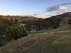
The Yass River, a perennial river that is part of the Murrumbidgee catchment within the Murray–Darling basin, is located in the Southern Tablelands and South Western Slopes districts of New South Wales, Australia.

The Blowering Dam is a major ungated rock fill with clay core embankment dam with concrete chute spillway impounding a reservoir under the same name. It is located on the Tumut River upstream of Tumut in the Snowy Mountains region of New South Wales, Australia. Purposes for the dam include flood mitigation, hydro-power, irrigation, water supply and conservation. The dam is part of the Snowy Mountains Scheme, a vast hydroelectricity and irrigation complex constructed in south-east Australia between 1949 and 1974 and now run by Snowy Hydro.

Eucumbene Dam is a major gated earthfill embankment dam with an overflow ski-jump and bucket spillway with two vertical lift gates across the Eucumbene River in the Snowy Mountains of New South Wales, Australia. The dam's main purpose is for the generation of hydro-power and is one of the sixteen major dams that comprise the Snowy Mountains Scheme, a vast hydroelectricity and irrigation complex constructed in south-east Australia between 1949 and 1974 and now run by Snowy Hydro.

Goodradigbee River, a perennial stream that is part of the Murrumbidgee catchment within the Murray-Darling basin, is located in the Snowy Mountains district of New South Wales, Australia.

Talbingo Dam is a major ungated rock fill with clay core embankment dam with concrete chute spillway across the Tumut River upstream of Talbingo in the Snowy Mountains region of New South Wales, Australia. The impounded reservoir is called Talbingo Reservoir.

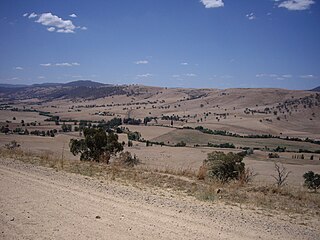
The Tumut River, a perennial stream that is part of the Murrumbidgee catchment within the Murray–Darling basin, is located in the Snowy Mountains and South West Slopes districts of New South Wales, Australia.
Tooma River, a perennial stream that has had some of its flow diverted as a result of the Snowy Mountains Scheme, is part of the Murray catchment within the Murray–Darling basin and is located in the Australian Alpine region of New South Wales, Australia.
The Goorudee Rivulet, a perennial river of the Murrumbidgee catchment of the Murray–Darling basin, is located in the Snowy Mountains region of New South Wales, Australia.
The Peak River, a perennial stream that is part of the Murrumbidgee catchment within the Murray–Darling basin, is located in the Snowy Mountains region of New South Wales, Australia.

The Wyong River is a perennial river that is located in the Central Coast region of New South Wales, Australia.
The Yarrangobilly River is a perennial river of the Murrumbidgee River catchment within the Murray–Darling basin, located in the Snowy Mountains region of New South Wales, Australia.
Doubtful Creek, formerly known as Doubtful River, a watercourse that is part of the Murrumbidgee catchment within the Murray–Darling basin, is located in the Snowy Mountains district of New South Wales, Australia.
Tumbarumba Creek, a watercourse of the Murray catchment within the Murray–Darling basin, is located in the region bordering the Riverina and Australian Alps of New South Wales, Australia.
The Adelong Creek, a perennial river that is part of the Murrumbidgee catchment within the Murray–Darling basin, is located in the South West Slopes, and Riverina regions of New South Wales, Australia.
The Adjungbilly Creek, a mostly–perennial river that is part of the Murrumbidgee catchment within the Murray–Darling basin, is located in the South West Slopes and Riverina regions of New South Wales, Australia.
The Cooma Creek, a mostly–perennial river that is part of the Murrumbidgee catchment within the Murray–Darling basin, is located in the Monaro region of New South Wales, Australia.
The Cooma Back Creek, a mostly–perennial river that is part of the Murrumbidgee catchment within the Murray–Darling basin, is located in the Monaro region of New South Wales, Australia.
The Derringullen Creek, a mostly–perennial river that is part of the Murrumbidgee catchment within the Murray–Darling basin, located in the South West Slopes region of New South Wales, Australia.
The Happy Jacks Creek, a perennial river that is part of the Murrumbidgee catchment within the Murray–Darling basin, is located in the Snowy Mountains region of New South Wales, Australia.