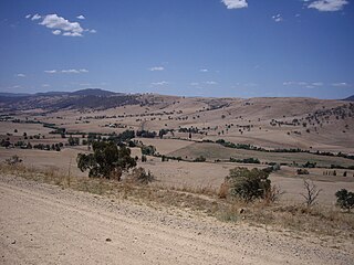
The Snowy Mountains, known informally as "The Snowies", is an IBRA subregion in southern New South Wales, Australia, and is the tallest mountain range in mainland Australia, being part of the continent's Great Dividing Range cordillera system. It makes up the northeastern half of the Australian Alps and contains Australia's five tallest peaks, all of which are above 2,100 m (6,890 ft), including the tallest Mount Kosciuszko, which reaches to a height of 2,228 m (7,310 ft) above sea level. The offshore Tasmanian highlands makes up the only other major alpine region present in the whole of Australia.

The Alpine Way is a 121-kilometre (75 mi) rural road located in the Snowy Mountains region of New South Wales, Australia. The road connects Jindabyne in the east to the New South Wales / Victorian border in the west, crossing the Murray River, near Bringenbrong / Upper Towong. The route does not carry an official shield designation.

Thredbo is a village and ski resort in the Snowy Mountains of New South Wales, Australia. It is approximately 500 kilometres (310 mi) south of Sydney, accessible by the Alpine Way via Cooma, Berridale, and Jindabyne. The village is built in the valley of the Thredbo River, also known as the Crackenback River, at the foot of the Ramshead Range.

Charlotte Pass is a snow resort and village in the Snowy Mountains of New South Wales, Australia. The pass is in the Kosciuszko National Park where the Kosciuszko Road crosses Kangaroo Ridge. Charlotte Pass is the closest village to Mount Kosciuszko, the tallest mountain in Australia.

The Snowy River is a major river in south-eastern Australia. It originates on the slopes of Mount Kosciuszko, Australia's highest mainland peak, draining the eastern slopes of the Snowy Mountains in New South Wales, before flowing through the Alpine National Park and the Snowy River National Park in Victoria and emptying into Bass Strait.

The Eucumbene River, a perennial river of the Snowy River catchment, is located in the Snowy Mountains region of New South Wales, Australia.

Perisher Valley, commonly called Perisher, is a valley formed below Mount Perisher, a mountain that is located in the Snowy Mountains of New South Wales, Australia.

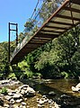
Bullocks Flat is a flat portion of the Thredbo Valley adjacent to the Thredbo River, in the Snowy Mountains region of New South Wales, Australia.

The Ramshead Range, a mountain range that is part of the Snowy Mountains, is located in the Monaro region of New South Wales and the Alpine region of Victoria, Australia.

Jindabyne is a town in south-east New South Wales, Australia that overlooks Lake Jindabyne near the Snowy Mountains, in Snowy Monaro Regional Council. It is a popular holiday destination year round, especially in winter. This is due to its proximity to major ski resort developments within the Kosciuszko National Park, including Thredbo, Perisher and Charlotte Pass.
The Gungarlin River, a perennial river of the Snowy River catchment, is located in the Snowy Mountains region of New South Wales, Australia.
The Bombala River, a perennial river of the Snowy River catchment, is located in the Monaro region of New South Wales, Australia.
Tooma River, a perennial stream that has had some of its flow diverted as a result of the Snowy Mountains Scheme, is part of the Murray catchment within the Murray–Darling basin and is located in the Australian Alpine region of New South Wales, Australia.
The Geehi River, a perennial river of the Murray catchment of the Murray–Darling basin, is located in the Snowy Mountains region of New South Wales, Australia.

The Ingeegoodbee River is a perennial river of the Snowy River catchment, located in the Alpine regions of the states of New South Wales and Victoria, Australia.
The Mowamba River, a perennial river of the Snowy River catchment, is located in the Snowy Mountains region of New South Wales, Australia.
The Pinch River, a perennial river of the Snowy River catchment, is located in the Snowy Mountains region of New South Wales, Australia.
Swampy Plain River, a perennial stream that is part of the Murray catchment within the Murray–Darling basin, is located in the Snowy Mountains bioregion of New South Wales, Australia.
The Burrungubugge River, a perennial river of the Snowy River catchment, is located in the Snowy Mountains region of New South Wales, Australia.

The Little Thredbo River, a perennial river of the Snowy River catchment, is located in the Snowy Mountains region of New South Wales, Australia.