Macintyre River

Last updated

Macintyre
Karaula River [1]
Inverell (2).JPG
Macintyre River, at Inverell, New South Wales
Australia Queensland relief location map.jpg
Red pog.svg
Location of the Macintrye River mouth
in Queensland
EtymologyIn honour of Peter Mcintyre, a pastoralist [1] [2]
Location
Country Australia
State New South Wales, Queensland
Region Northern Tablelands, Darling Downs, North West Slopes
Physical characteristics
Source Great Dividing Range
  locationnear Glencoe, New South Wales
  elevation1,260 m (4,130 ft)
Mouth confluence with the Weir River to form the Barwon River
  location
west of Goondiwindi, Queensland
  coordinates
28°37′17″S149°53′59″E / 28.62139°S 149.89972°E / -28.62139; 149.89972
  elevation
224 m (735 ft)
Length319 km (198 mi)
Basin size49,470 km2 (19,100 sq mi)
Basin features
River system Barwon River catchment,
Murray–Darling basin
Tributaries 
  right Severn River (NSW), Dumaresq River
Reservoir Boggabilla Weir
[3] [4]

The Macintyre River, a perennial river that forms part of the Border Rivers group, is part of the Barwon catchment of the Murray-Darling basin, located in the Northern Tablelands and North West Slopes regions of New South Wales, and the Southern Downs region of Queensland, Australia.

Contents

Part of the course of the river marks the boundary between Queensland and New South Wales.

Course and features

The Macintyre River rises on the western slopes of the Great Dividing Range, west of Guyra and south of Glen Innes, and flows generally northwest and west, joined by twenty-two tributaries, including the Severn River (New South Wales) and Dumaresq River, before reaching its confluence with the Weir River to form the Barwon River, west of Goondiwindi. In 1914, the current Goondiwindi Border Bridge was opened. It replaced a timber structure which was built in 1878. [5] The Macintyre River descends 1,040 metres (3,410 ft) over its 319-kilometre (198 mi) course; [3] passing near the towns of Glen Innes, Inverell, Ashford, Yetman, and Boggabilla. The flow of the river is impounded by Boggabilla Weir.

The Macintyre River, together with Pike Creek, the Mole, Beardy, Severn (Queensland), Severn (New South Wales), and Dumaresq rivers are all part of the Border Rivers group. Originally named the Dumaresq River by Allan Cunningham. The name Macintyre was given by Cunningham to what is now known as the Dumaresq River. Peter Macintyre was the overseer at Segenhoe Station.

Flooding

The Macintyre River is often affected by floods and the town of Goondiwindi is protected by levee banks that can cope with a water level rise of nearly 11 metres (36 ft). During the 2010–2011 Queensland floods the river peaked at 10.64 metres (34.9 ft). [6] [7]

Previous peaks have occurred during 1996, at 10.6 metres (35 ft) and during 1976. [8]

See also

Related Research Articles

<span class="mw-page-title-main">Darling River</span> Major river in Australia

The Darling River is the third-longest river in Australia, measuring 1,472 kilometres (915 mi) from its source in northern New South Wales to its confluence with the Murray River at Wentworth. Including its longest contiguous tributaries it is 2,844 km (1,767 mi) long, making it the longest river system in Australia. The Darling River is the outback's most famous waterway.

The Culgoa River is a river that is part of the Darling catchment within the Murray–Darling basin and is located in South West Queensland.

<span class="mw-page-title-main">Bruxner Highway</span>

Bruxner Highway, and its former western alignment as Bruxner Way, are a 420-kilometre (260 mi) state highway and rural road respectively, located in New South Wales, Australia. The route forms an east–west link across the Northern Tablelands in northern New South Wales, close to the border with Queensland, to the Northern Rivers coast. It was named after Michael Bruxner, NSW Minister for Transport from 1932 to 1941.

<span class="mw-page-title-main">Severn River (New South Wales)</span> River in New South Wales, Australia

The Severn River, a perennial river that forms part of the Border Rivers group, is part of the Macintyre catchment of the Murray–Darling basin, located in the Northern Tablelands and North West Slopes regions of New South Wales, Australia.

<span class="mw-page-title-main">Barwon River (New South Wales)</span> River in New South Wales, Australia

Barwon River, a perennial river that is part of the Murray–Darling basin, is located in the north-west slopes and Orana regions of New South Wales, Australia.

<span class="mw-page-title-main">Boomi, New South Wales</span> Town in New South Wales, Australia

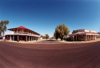
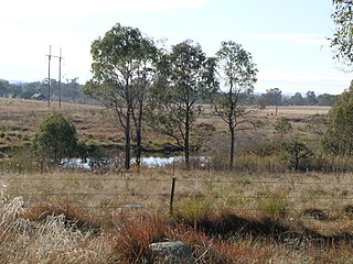
Boomi is a town in north western New South Wales, Australia. The town is in the Moree Plains Shire local government area, 728 kilometres (452 mi) north west of the state capital, Sydney, on the border on the New South Wales side of the MacIntyre River. Boomi is west of the Queensland town of Goondiwindi and north of Moree in New South Wales. At the 2016 census, Boomi and the surrounding farming area had a population of approximately 200.

<span class="mw-page-title-main">Dumaresq River</span> River in Australia

The Dumaresq River ; a perennial stream of the Macintyre catchment within the Murray–Darling basin, is located in the Northern Tablelands and North West Slopes regions of New South Wales and the Darling Downs region of Queensland, Australia.

The Severn River, a perennial river that forms part of the Border Rivers group, is part of the Macintyre catchment of the Murray-Darling basin, located in the Darling Downs region of Queensland, Australia.

<span class="mw-page-title-main">Beardy Waters</span> River in New South Wales, Australia

Beardy Waters, a watercourse and part of the Macintyre catchment within the Murray–Darling basin, is located in the Northern Tablelands region of New South Wales, Australia.

The Mole River, a watercourse that is one of the Border Rivers and part of the Macintyre catchment within the Murray–Darling basin, is located in the Northern Tablelands region of New South Wales, Australia.

The Border Rivers are a group of Australian rivers and the associated region near part of the state border between New South Wales and Queensland.

The Pike Creek, a perennial stream that is one of the Border Rivers and part of the Macintyre catchment within the Murray–Darling basin, is located in the Darling Downs region of Queensland, Australia

<span class="mw-page-title-main">Mehi River</span> River in New South Wales, Australia

The Mehi River is a perennial watercourse that is part of the Barwon catchment within the Murray–Darling basin, located in the Orana district of New South Wales, Australia.

<span class="mw-page-title-main">Moonie River</span> River in Queensland and New South Wales, Australia

The Moonie River (Mooni River) is a river in Shire of Balonne, Queensland and Walgett Shire, New South Wales, both in Australia. It is a perennial river of the Barwon catchment within the Murray–Darling basin.

The Bokhara River, a watercourse that is part of the Barwon catchment within the Murray–Darling basin, is located in the South Downs region of Queensland, flowing downstream into the north–western slopes of New South Wales, Australia. It flows through the lower Balonne floodplain.

The Boomi River, an anabranch of the Barwon River and part of the Macintyre catchment within the Murray–Darling basin, is located in the north–western slopes region of New South Wales, flowing downstream into the South Downs region of Queensland, Australia.

Deepwater River, a mostly perennial stream of the Dumaresq-Macintyre catchment within the Murray–Darling basin, is located in the Northern Tablelands district of New South Wales, Australia.

The Little Weir River, an anabranch of the Barwon River within the Murray–Darling basin, is located in the South Downs district of Queensland and the Orana district of New South Wales, Australia.

<span class="mw-page-title-main">Narran River</span> River in Queensland and New South Wales Australia

Narran River, a watercourse of the Barwon catchment within the Murray–Darling basin, is located in the Southern Downs district of Queensland and Orana district of New South Wales, Australia.

The Weir River, a river that is part of the Border Rivers group and also forms part of the Barwon River catchment in the Murray–Darling basin, is located in the Darling Downs region of Queensland, Australia.

References

  1. 1 2 "Macintyre River". Geographical Names Register (GNR) of NSW. Geographical Names Board of New South Wales . Retrieved 5 February 2013. OOjs UI icon edit-ltr-progressive.svg
  2. "Macintyre River (entry 20424 )". Queensland Place Names. Queensland Government . Retrieved 5 February 2013.
  3. 1 2 "Map of Macintyre River (1)". Bonzle Digital Atlas of Australia. Retrieved 5 February 2013.
  4. "Map of Macintyre River (2)". Bonzle Digital Atlas of Australia. Retrieved 29 December 2015.
  5. "Goondiwindi". Queensland Places. Centre for the Government of Queensland, University of Queensland. Retrieved 7 May 2015.
  6. "Goondiwindi on edge as river nears peak". Australia: ABC News. 14 January 2011. Retrieved 5 February 2013.
  7. "Flood threat eases at Goondiwindi". ABC Southern Queensland. Australia. 16 January 2011. Retrieved 5 February 2013.
  8. "Flood warning for the Weir and Macintyre Rivers". Bureau of Meteorology, Brisbane. Goondiwindi Regional Council. 13 January 2011. Retrieved 5 February 2013.

Commons-logo.svg Media related to Macintyre River at Wikimedia Commons