| Horton | |
|---|---|
| Etymology | In honour of Robert Wilmot Horton [1] |
| Location | |
| Country | Australia |
| State | New South Wales |
| Region | Northern Tablelands (IBRA), New England, North West Slopes |
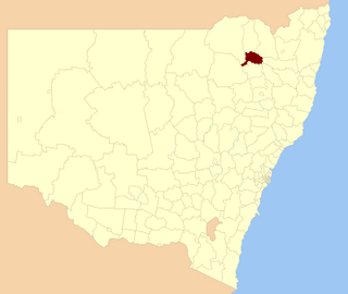
| Municipalities | Gwydir, Moree Plains |
| Physical characteristics | |
| Source | Nandewar Range |
| • location | below Mount Kaputar |
| • elevation | 1,330 m (4,360 ft) |
| Mouth | confluence with the Gwydir River |
• location | between Bingara and Gravesend |
• elevation | 270 m (890 ft) |
| Length | 134 km (83 mi) |
| Basin features | |
| River system | Barwon River, Murray–Darling basin |
| [2] | |
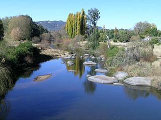
The Horton River, a perennial stream [1] of the Barwon catchment within the Murray-Darling basin, is located in the Northern Tablelands and North West Slopes districts of New South Wales, Australia.
The river rises on the northern slopes of the Nandewar Range, below Mount Kaputar, and flows generally southeast and north, joined by six tributaries before reaching its confluence with the Gwydir River, north west of Bingara; descending 1,060 metres (3,480 ft) over its 134 kilometres (83 mi) course. [2]
The valley of the Horton River is used for grazing and some cropping. It is a sparsely populated area with no significant towns. There is a small village called Upper Horton. The valley is traversed by the Narrabri-Bingara Road. Other nearby towns, outside the valley, are Barraba, Bingara, and Narrabri.
The Horton River is a[ citation needed ] source of floodwater for the Gwydir River and Mehi River and can flood the town Moree.

New England or New England North West is the name given to a generally undefined region in the north of the state of New South Wales, Australia, about 60 kilometres (37 miles) inland, that includes the Northern Tablelands and the North West Slopes regions. The population of the region is 202,160 (2006), with over a quarter of the population being from Tamworth Regional Council.

Gwydir River, a major inland perennial river of the Barwon catchment within the Murray-Darling basin, is located in the Northern Tablelands, North West Slopes, and Orana districts of New South Wales, Australia.

The Newell Highway is a national highway in New South Wales (NSW), Australia. It provides the major road link between southeastern Queensland and Victoria via central NSW and as such carries large amounts of freight. At 1,058 kilometres (657 mi) in length, the Newell is the longest highway in NSW, and passes through fifteen local government areas. The highway is part of Australian national route 39 and was signposted accordingly until 2013. Since then it has been signposted as NSW route A39.

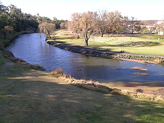
Bingara is a small town on the Gwydir River in Murchison County in the New England region of New South Wales, Australia. Bingara is currently the administrative centre for the Gwydir Shire that was created in 2003. Bingara is one of the few places in Australia where diamonds have been found. The Gwydir River being a main highlight of the town is a main catchment of the Murray-Darling System.

The Namoi River, a major perennial river that is part of the Barwon catchment of the Murray–Darling basin, is located in the Northern Tablelands and North West Slopes districts of New South Wales, Australia.

Peel River, a watercourse that is part of the Namoi catchment within the Murray–Darling basin, is located in the North West Slopes and Plains district of New South Wales, Australia.
Macdonald River, a perennial river that is part of the Namoi catchment within the Murray–Darling basin, is located in the Northern Tablelands district of New South Wales, Australia.
The Macintyre River, a perennial river that forms part of the Border Rivers group, is part of the Barwon catchment of the Murray-Darling basin, located in the Northern Tablelands and North West Slopes regions of New South Wales, and the Southern Downs region of Queensland, Australia.

Gwydir Shire is a local government area located in the New England region of New South Wales, Australia. The northern boundary of the Shire is located adjacent to the border between New South Wales and Queensland.

The Fossickers Way is a series of country roads located in the Northern Tablelands region of New South Wales, Australia that, when joined together, come to form a 379-kilometre (235 mi) scenic and tourist drive. The road's southern terminus is located in Nundle with its northwest terminus in Warialda; thereafter the road joins the Gwydir Highway and heads east to Inverell before reaching its eastern terminus in Glen Innes. The majority of the Fossickers Way is designated as B95.
The North West Slopes region of New South Wales, Australia, refers generally to the area west of the Northern Tablelands, to the north of the Central West region and to the east of the Far West region. The region corresponds generally to the Australian Bureau of Meteorology's forecast area of North West Slopes and Plains. The administrative areas of the region include the city of Tamworth, Gunnedah, Moree, Narrabri and Inverell.

The Nandewar Range, a mountain range that is part of the Great Dividing Range, is located in the Northern Tablelands region of New South Wales, Australia. The range is situated approximately 30 km (19 mi) east of the township of Narrabri.
Manilla River, a perennial stream that is part of the Namoi catchment within the Murray–Darling basin, is located in the Northern Tablelands district of New South Wales, Australia.

Upper Horton is a very small village and surrounding agricultural area located by the Horton River in northern New South Wales, Australia. The community of Upper Horton lies high in the Horton River Valley. It is accessed from the Fossickers Way with the turnoff 13 km north of Barraba and a journey of 19 km to the village.

Mehi River, a watercourse that is part of the Barwon catchment within the Murray–Darling basin, is located in the Orana district of New South Wales, Australia.
Growee River, a perennial river of the Hunter River catchment, is located in the Central Tablelands region of New South Wales, Australia.

Nowendoc River, a perennial river of the Manning River catchment, is located in the Northern Tablelands and Mid North Coast districts of New South Wales, Australia.
Tobins River, a perennial stream of the Hastings River catchment, is located in the Northern Tablelands and Mid North Coast districts of New South Wales, Australia.
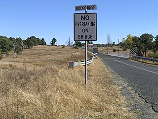
Rocky River, a watercourse of the Gwydir catchment within the Murray–Darling basin, is located in the Northern Tablelands district of New South Wales, Australia.
Bingara Shire was a local government area located in the New England region of New South Wales, Australia, about 150 kilometres (93 mi) north of Tamworth via Fossickers Way. The Shire, administered from the town of Bingara covered an area of 2,853.7 square kilometres (1,101.8 sq mi), and existed as a local government entity from 1906 until 2004, when it was amalgamated with Yallaroi Shire and part of Barraba to form the Gwydir Shire.
Coordinates: 29°45′S150°25′E / 29.750°S 150.417°E
| This New South Wales river or creek related article is a stub. You can help Wikipedia by expanding it. |