
The Darling River is the third-longest river in Australia, measuring 1,472 kilometres (915 mi) from its source in northern New South Wales to its confluence with the Murray River at Wentworth, New South Wales. Including its longest contiguous tributaries it is 2,844 km (1,767 mi) long, making it the longest river system in Australia. The Darling River is the outback's most famous waterway.
The Culgoa River is a river that is part of the Darling catchment within the Murray–Darling basin and is located in South West Queensland.
The Murray–Darling basin is a large geographical area in the interior of southeastern Australia, encompassing the drainage basin of the tributaries of the Murray River, Australia's longest river, and the Darling River, a right tributary of the Murray and Australia's third-longest river. The basin, which includes six of Australia's seven longest rivers and covers around one-seventh of the Australian landmass, is one of the country's most significant agricultural areas providing one-third of Australia's food supply. Located west of the Great Dividing Range, it drains southwestly into the Great Australian Bight and spans most of the states of New South Wales and Victoria, the Australian Capital Territory, and parts of the states of Queensland and South Australia.

The Balonne River, part of the Murray-Darling Basin system, is a short yet significant part of the inland river group of South West Queensland, Australia.
The Macintyre River, a perennial river that forms part of the Border Rivers group, is part of the Barwon catchment of the Murray-Darling basin, located in the Northern Tablelands and North West Slopes regions of New South Wales, and the Southern Downs region of Queensland, Australia.

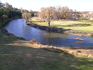
Barwon River, a perennial river that is part of the Murray–Darling basin, is located in the north-west slopes and Orana regions of New South Wales, Australia.

The Paroo River, a series of waterholes, connected in wet weather as a running stream of the Darling catchment within the Murray–Darling basin, is located in the South West region of Queensland and Far West region of New South Wales, Australia. It is the home of the Paarkantji people.

The Warrego River is an intermittent river that is part of the Darling catchment within the Murray–Darling basin, which is located in South West Queensland and in the Orana region of New South Wales, Australia. The Warrego River is the northernmost tributary of the Darling River.

The Dumaresq River ; a perennial stream of the Macintyre catchment within the Murray–Darling basin, is located in the Northern Tablelands and North West Slopes regions of New South Wales and the Darling Downs region of Queensland, Australia.
The Goobang Creek, a perennial stream of the Lachlan sub–catchment, part of the Murrumbidgee catchment of the Murray-Darling basin, is located in the Central West region of New South Wales, Australia.
The Border Rivers are a group of Australian rivers and the associated region near part of the state border between New South Wales and Queensland.
The Pike Creek, a perennial stream that is one of the Border Rivers and part of the Macintyre catchment within the Murray–Darling basin, is located in the Darling Downs region of Queensland, Australia

The Maranoa River, part of the Murray-Darling basin, is a river situated in South West Queensland, Australia.

The Moonie River (Mooni River) is a river in Shire of Balonne, Queensland and Walgett Shire, New South Wales, both in Australia. It is a perennial river of the Barwon catchment within the Murray–Darling basin.
The Bokhara River, a watercourse that is part of the Barwon catchment within the Murray–Darling basin, is located in the South Downs region of Queensland, flowing downstream into the north–western slopes of New South Wales, Australia. It flows through the lower Balonne floodplain.

The Nive River is a river that is part of the Darling catchment within the Murray–Darling basin, is located in the south west region of Queensland, Australia.
The Barmedman Creek, a mostly–perennial river that is part of the Lachlan sub-catchment of the Murrumbidgee catchment within the Murray–Darling basin, is located in the South West Slopes, and Riverina regions of New South Wales, Australia. The Barmedman Creek is only connected to the Murray Darling basin when the Bland Creek, the Lachlan and Murrumbidgee Rivers are in flood.
The Berthong Creek, a mostly–perennial river that is part of the Lachlan sub-catchment of the Murrumbidgee catchment within the Murray–Darling basin, is located in the South West Slopes, and Riverina regions of New South Wales, Australia. The Berthong Creek is only connected to the Murray Darling basin when the Bland Creek, the Lachlan and Murrumbidgee Rivers are in flood.
The Jugiong Creek, a mostly–perennial river that is part of the Murrumbidgee catchment within the Murray–Darling basin, is located in the South West Slopes region of New South Wales, Australia.

The Langlo River, a river that is part of the Murray-Darling basin, is located in South West Queensland, Australia.

