
The Darling River is the third-longest river in Australia, measuring 1,472 kilometres (915 mi) from its source in northern New South Wales to its confluence with the Murray River at Wentworth. Including its longest contiguous tributaries it is 2,844 km (1,767 mi) long, making it the longest river system in Australia. The Darling River is the outback's most famous waterway.
The Culgoa River is a river that is part of the Darling catchment within the Murray–Darling basin and is located in South West Queensland.
The Severn River, a perennial river that forms part of the Border Rivers group, is part of the Macintyre catchment of the Murray–Darling basin, located in the Northern Tablelands and North West Slopes regions of New South Wales, Australia.
The Macintyre River, a perennial river that forms part of the Border Rivers group, is part of the Barwon catchment of the Murray-Darling basin, located in the Northern Tablelands and North West Slopes regions of New South Wales, and the Southern Downs region of Queensland, Australia.

Barwon River, a perennial river that is part of the Murray–Darling basin, is located in the north-west slopes and Orana regions of New South Wales, Australia.

The Dumaresq River ; a perennial stream of the Macintyre catchment within the Murray–Darling basin, is located in the Northern Tablelands and North West Slopes regions of New South Wales and the Darling Downs region of Queensland, Australia.

Glenlyon Dam, also known as Pike Creek Reservoir, is an earth and rockfill dam in Queensland near the border with New South Wales, roughly between Stanthorpe and Texas to the west. From 1972 to 1976, the dam wall was built on Pike Creek, a tributary of the Dumaresq River, 5 km (3.1 mi) upstream from the confluence of the Mole River and the Severn River branching from the Dumaresq. Its impoundment is known as Lake Glenlyon.
Pindari Dam is a minor concrete faced rockfill embankment dam with an ungated uncontrolled rock cut with concrete sill spillway across the Severn River located upstream of the town of Ashford, in the North West Slopes region of New South Wales, Australia. The dam's purpose includes flood mitigation, hydro-power, irrigation, water supply and conservation. The impounded reservoir is called Lake Pindari.

Beardy Waters, a watercourse and part of the Macintyre catchment within the Murray–Darling basin, is located in the Northern Tablelands region of New South Wales, Australia.
The Mole River, a watercourse that is one of the Border Rivers and part of the Macintyre catchment within the Murray–Darling basin, is located in the Northern Tablelands region of New South Wales, Australia.
The Border Rivers are a group of Australian rivers and the associated region near part of the state border between New South Wales and Queensland.
The Pike Creek, a perennial stream that is one of the Border Rivers and part of the Macintyre catchment within the Murray–Darling basin, is located in the Darling Downs region of Queensland, Australia
The Bokhara River, a watercourse that is part of the Barwon catchment within the Murray–Darling basin, is located in the South Downs region of Queensland, flowing downstream into the north–western slopes of New South Wales, Australia. It flows through the lower Balonne floodplain.
The Boomi River, an anabranch of the Barwon River and part of the Macintyre catchment within the Murray–Darling basin, is located in the north–western slopes region of New South Wales, flowing downstream into the South Downs region of Queensland, Australia.
Deepwater River, a mostly perennial stream of the Dumaresq-Macintyre catchment within the Murray–Darling basin, is located in the Northern Tablelands district of New South Wales, Australia.
The Little Weir River, an anabranch of the Barwon River within the Murray–Darling basin, is located in the South Downs district of Queensland and the Orana district of New South Wales, Australia.
Bluff River, a mostly perennial stream of the Dumaresq–Macintyre catchment within the Murray–Darling basin, is located in the Northern Tablelands district of New South Wales, Australia.
The Weir River, a river that is part of the Border Rivers group and also forms part of the Barwon River catchment in the Murray–Darling basin, is located in the Darling Downs region of Queensland, Australia.

Queensland is the north-eastern state of Australia and has land borders with three other Australian states and territories: New South Wales, South Australia and Northern Territory. To the north of Queensland is the Torres Strait separating the Australian mainland from Papua New Guinea. To the east of Queensland is the Coral Sea, part of the Pacific Ocean. There are many islands off the Queensland coast which form part of the state of Queensland.
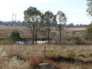
Mingoola is a rural locality in the Southern Downs Region, Queensland, Australia. It is on the Queensland border with New South Wales. In the 2021 census, Mingoola had a population of 14 people.
