Black River (Queensland)

Last updated

Black
Australia Queensland relief location map.jpg
Red pog.svg
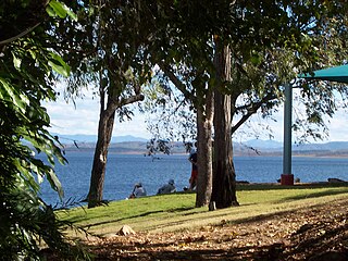
Location of Black River mouth in Queensland
EtymologyJohn Melton Black
Location
Country Australia
State Queensland
Region North Queensland
Physical characteristics
Source Great Dividing Range
  locationwest of Mount Cataract
  coordinates 19°17′09″S146°25′29″E / 19.28583°S 146.42472°E / -19.28583; 146.42472
  elevation84 m (276 ft)
Mouth Coral Sea
  location
Bushland Beach
  coordinates
19°10′48″S146°39′06″E / 19.18000°S 146.65167°E / -19.18000; 146.65167
  elevation
0 m (0 ft)
Length33 km (21 mi)
Basin size306.7 km2 (118.4 sq mi) [1]
Discharge 
  locationNear mouth
  average3.7 m3/s (120 GL/a) [1]
[2]

The Black River is a river in North Queensland, Australia.

The headwaters of the river rise near Ben Lomond East in the Great Dividing Range and flow in a northeasterly direction. The river flows roughly parallel with the Hervey Range Developmental Road past Mount Cataract and Mount Black on the Bohle Plains. The river is crossed by the Bruce Highway near Kulburr and discharges into the Coral Sea between Yabulu and Beach Holm approximately 10 kilometres (6 mi) north west of Townsville.

The river descends 84 metres (276 ft) over its 33-kilometre (21 mi) course. [2] The catchment area occupies 1,060 square kilometres (409 sq mi), including 36 square kilometres (14 sq mi) of riverine wetlands and 10.6 square kilometres (4 sq mi) of estuarine wetlands. [3]

A total of 22 species of fish have been found in the river, including the glassfish, Roman nose Goby, Fly-specked hardyhead, Golden Gudgeon, Jungle Perch, Barramundi, oxeye herring, eastern rainbowfish, spotted scat, and Crescent Perch. [4]

The river is named after John Melton Black who was a pastoralist, merchant and a settler of Townsville. The outer Townsville suburb of Black River is named after the river which flows through northern side of the area. [5]

The Alice River is a tributary of the Black River with a confluence at 19°15′00″S146°37′59″E / 19.25000°S 146.63306°E / -19.25000; 146.63306 (Alice River) . [6] The river is the western boundary of the Townsville suburb of Alice River. [7]

See also

Related Research Articles

<span class="mw-page-title-main">Burdekin River</span> River in Queensland, Australia

The Burdekin River is a river in North and Far North Queensland, Australia. The river rises on the northern slopes of Boulder Mountain at Valley of Lagoons, part of the western slope of the Seaview Range, and flows into the Coral Sea at Upstart Bay over 200 kilometres (124 mi) to the southeast of the source, with a catchment area of approximately 130,000 square kilometres (50,000 sq mi). The Burdekin River is Australia's largest river by (peak) discharge volume.

<span class="mw-page-title-main">Coomera River</span> River in Queensland, Australia

The Coomera River is a perennial river in the South East region of Queensland, Australia. Its catchment lies within the Gold Coast and Scenic Rim Region local government areas and covers an area of 489 square kilometres (189 sq mi).

<span class="mw-page-title-main">Ross River (Queensland)</span> River in Queensland, Australia

The Ross River is a river in North Queensland, Australia. The 49-kilometre (30 mi) long river flows through the city of Townsville and empties into the Coral Sea. It is the major waterway flowing through Townsville and the city's main source of drinking water.

<span class="mw-page-title-main">Boyne River (Central Queensland)</span> River in Queensland, Australia

The Boyne River is a river in Central Queensland, Australia.

<span class="mw-page-title-main">Johnstone River</span> River in Queensland, Australia

The Johnstone River, comprising the North Johnstone River and the South Johnstone River, is a river system in Far North and North Queensland, Australia.

<span class="mw-page-title-main">Bohle River</span> River in Queensland, Australia

The Bohle River is a river in North Queensland, Australia.

The Calvert River is a river in the Northern Territory of Australia.

<span class="mw-page-title-main">Russell River</span> River in Queensland, Australia

The Russell River is a river in Far North Queensland, Australia. The 59-kilometre (37 mi)-long river flows towards the Coral Sea and is located approximately 60 kilometres (37 mi) south of Cairns.

The Settlement Creek is a creek in the Northern Territory and the state of Queensland, Australia.

The Alice River is a river located on the Cape York Peninsula of Far North Queensland, Australia.

The Walsh River is a river located on the Cape York Peninsula of Far North Queensland, Australia.

The Watson River is a river in Far North Queensland, Australia.

The Coleman River is a river on the Cape York Peninsula in Far North Queensland, Australia.

The Embley River is a river in Far North Queensland, Australia.

The Haughton River is a river in North Queensland, Australia.

The Burrum River is a river in the Wide Bay-Burnett region of Queensland, Australia.

The Jackey Jackey Creek, also often called Jacky Jacky Creek, is a creek in the Cape York Peninsula region of Far North Queensland, Australia.

The Elliott River is a river in the Wide Bay–Burnett region of Queensland, Australia.

The Mission River is a river in Far North Queensland, Australia.

The O'Connell River is a river in North Queensland, Australia.

References

  1. 1 2 "East Coastal Watersheds".
  2. 1 2 "Map of Black River, QLD". Bonzle Digital Atlas of Australia. Retrieved 17 June 2015.
  3. "Black drainage basin". WetlandInfo. Queensland Government . Retrieved 17 June 2015.
  4. "Black River catchment". Fish Atlas of North Australia. Retrieved 28 June 2015.
  5. "Black River (entry 44571)". Queensland Place Names. Queensland Government . Retrieved 18 June 2015.
  6. "Alice River – river (entry 323)". Queensland Place Names. Queensland Government . Retrieved 18 June 2016.
  7. "Queensland Globe". State of Queensland . Retrieved 18 June 2016.