Alice River, Queensland

Last updated

Alice River
Townsville,  Queensland
Australia Queensland location map.svg
Red pog.svg
Alice River
Coordinates 19°20′55″S146°37′06″E / 19.3486°S 146.6183°E / -19.3486; 146.6183 (Alice River (centre of suburb)) Coordinates: 19°20′55″S146°37′06″E / 19.3486°S 146.6183°E / -19.3486; 146.6183 (Alice River (centre of suburb))
Population2,425 (2016 census) [1]
 • Density60.93/km2 (157.81/sq mi)
Postcode(s) 4817
Area39.8 km2 (15.4 sq mi)
Time zone AEST (UTC+10:00)
Location
LGA(s) City of Townsville
State electorate(s) Hinchinbrook
Federal division(s) Kennedy
Suburbs around Alice River:
Black River Rangewood Bohle Plains
Hervey Range Alice River Gumlow
Granite Vale Pinnacles Pinnacles

Alice River is an outer suburb in the City of Townsville, Queensland, Australia. [2] In the 2016 census Alice River had a population of 2,425 people. [1]

Contents

It is also known as Rupertswood.

History

The estate is also known as Rupertswood, because the estate was named by the developer who was Sir Rupert Clarke, 3rd Baronet of Rupertswood, after his ancestral home "Rupertswood" at Sunbury, Victoria, Australia. However, Alice River was named by one of the Bell & Reid party in 1865 for a lady of his acquaintance. [3] The suburb along with its neighbour Rangewood, Queensland are up and coming suburbs with numerous housing developments expected in future due to the ample availability of flat develop-able land and close proximity to the Townsville Orbital road and James Cook University. Existing suburbs to the east are almost entirely built out with only some subdivision of smaller parcels and in-fill development possible. [4]

In the 2016 census Alice River had a population of 2,425 people. [1]

Geography

The Hervey Range Developmental Road runs along the northern boundary. [5]

Facilities

There is a shop, an Australia Post mail box, a public phone box, and service station located on Hervey Range Road which is the main road passing the village.

Also, there are tennis courts, a cricket ground, community hall, Scout hall, pony club, playground area, half basketball court and barbecue area which is floodlit at night along with public toilets and Rupertswood Rural Fire Brigade Station. All of these facilities are located in the large central park area which the acreage housing surrounds.

There are wide grassed access ways radiating out from the large park in the centre of the village designed for use by horses as the area was designed for horse enthusiasts and the house blocks are generally over 1-acre (4,000 m2) in area to allow for stables.

The Rupertswood Village consists of around 600 homes. The actual suburb of Alice River is much larger than the Rupertswood village but mainly consists of rural cattle properties.

See also

Related Research Articles

<span class="mw-page-title-main">City of Thuringowa</span> Local government area in Queensland, Australia

The City of Thuringowa was a city and local government area in North Queensland, Australia covering the northern and western parts of what is now Townsville. The suburb of Thuringowa Central is the main business centre in this area.

Hyde Park is a suburb in the City of Townsville, Queensland, Australia. In the 2016 census Hyde Park had a population of 1,387 people.

<span class="mw-page-title-main">Townsville Ring Road</span> Road in Queensland, Australia

The Townsville Ring Road is a motorway in Townsville, Queensland, Australia. The road has been constructed as the new A1/M1 route that bypasses the inner metro area of Townsville. The road was built in 4 stages with the first stage, the Douglas Arterial Road, opened in April 2005 and the most recent section opened in 2017. Stage 5 is commencing construction in late 2020 which includes duplicating the remaining 6-kilometre 2-lane undivided section between Vickers Bridge and Shaw Road in Thuringowa. There is no toll for the use of this motorway.

<span class="mw-page-title-main">Douglas, Queensland</span> Suburb of Townsville, Queensland, Australia

Douglas is a suburb of Townsville in the City of Townsville, Queensland, Australia. In the 2016 census, Douglas had a population of 7,744 people.

<span class="mw-page-title-main">Kirwan, Queensland</span> Suburb of Townsville, Queensland, Australia

Kirwan is a suburb in the City of Townsville, Queensland, Australia. In the 2016 census, Kirwan had a population of 21,418 people.

<span class="mw-page-title-main">Thuringowa Central, Queensland</span> Suburb of Townsville, Queensland, Australia

Thuringowa Central is a suburb of Townsville in the City of Townsville, Queensland, Australia. In the 2016 census Thuringowa Central had a population of 2,023 people.

Condon is a suburb of Townsville in the City of Townsville, Queensland, Australia. In the 2016 census, Condon had a population of 5,779 people.

<span class="mw-page-title-main">Woodstock, Queensland</span> Suburb of City of Townsville, Queensland, Australia

Woodstock is a rural town and locality in the City of Townsville, Queensland, Australia. In the 2016 census, Woodstock had a population of 239 people.

<span class="mw-page-title-main">Kelso, Queensland</span> Suburb of Townsville, Queensland, Australia

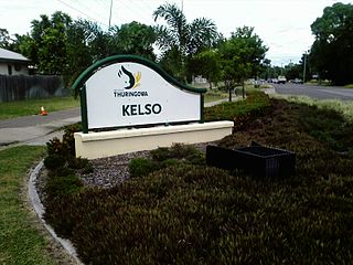
Kelso is a suburb in the City of Townsville, Queensland, Australia. In the 2016 census, Kelso had a population of 10,538 people.

<span class="mw-page-title-main">Suburbs of Thuringowa City</span>

This article is a list of the suburbs that used to make up the City of Thuringowa in Queensland, Australia, before the March 2008 amalgamation, which saw the City of Townsville merge with Thuringowa to form the new city of Townsville. Also listed are the former suburbs that became part of Townsville due to other boundary changes that have taken place over the years. The suburbs are listed below in order of postcode and order of years the boundaries were changed:

<span class="mw-page-title-main">Bluewater, Queensland</span> Town in Queensland, Australia

Bluewater is a town and coastal suburb in the City of Townsville, Queensland, Australia. In the 2016 census the suburb of Bluewater had a population of 1,040 people.

Saunders Beach is a coastal town and suburb of Townsville in the City of Townsville, Queensland, Australia. In the 2016 census, the suburb of Saunders Beach had a population of 409 people.

<span class="mw-page-title-main">Bohle River</span> River in Queensland, Australia

The Bohle River is a river located in North Queensland, Australia.

<span class="mw-page-title-main">Balgal Beach, Queensland</span> Suburb of Townsville, Queensland, Australia

Balgal Beach is a coastal suburb and a beach in the City of Townsville, Queensland, Australia. The town of Balgal is within the locality. In the 2016 census, Balgal Beach had a population of 966 people.

Toomulla is a coastal town and suburb in the City of Townsville, Queensland, Australia. In the 2016 census, Toomulla had a population of 183 people.

Black River is a northern suburb of Townsville in the City of Townsville, Queensland, Australia.. In the 2016 census, Black River had a population of 1,476 people.

<span class="mw-page-title-main">Heatley, Queensland</span> Suburb of Townsville, Queensland, Australia

Heatley is a suburb in the City of Townsville, Queensland, Australia. In the 2016 census, Heatley had a population of 4,038 people.

Granite Vale is a rural locality in the City of Townsville, Queensland, Australia. In the 2016 census, Granite Vale had a population of 0 people.

Rangewood is a suburb of Townsville in the City of Townsville, Queensland, Australia. In the 2016 census, Rangewood had a population of 1,057 people.

Hervey Range Developmental Road is a continuous 125-kilometre (78 mi) road route in the Townsville and Charters Towers local government areas of Queensland, Australia. It is designated as State Route 72. It is a state-controlled regional road.

References

  1. 1 2 3 Australian Bureau of Statistics (27 June 2017). "Alice River (SSC)". 2016 Census QuickStats. Retrieved 20 October 2018. OOjs UI icon edit-ltr-progressive.svg
  2. "Alice River – suburb in City of Townsville (entry 44563)". Queensland Place Names. Queensland Government . Retrieved 29 December 2020.
  3. Thuringowa Past And Present, Page 19.
  4. "Subscribe to the Townsville Bulletin". townsvillebulletin.com.au. Retrieved 14 August 2019.[ verification needed ]
  5. Alice River (Map). OpenStreetMap. 2022. Retrieved 4 February 2023.