Bluewater, Queensland

Last updated

Bluewater
Townsville,  Queensland
Bluewater Queensland.jpg
Ditton Street with Bluewater Drive in the background
Australia Queensland location map.svg
Red pog.svg
Bluewater
Coordinates 19°10′28″S146°33′1″E / 19.17444°S 146.55028°E / -19.17444; 146.55028 Coordinates: 19°10′28″S146°33′1″E / 19.17444°S 146.55028°E / -19.17444; 146.55028
Population1,040 (2016 census)
Postcode(s) 4818
State electorate(s) Thuringowa
Federal Division(s) Herbert
Localities around Bluewater:
Clemant Coral Sea Toolakea
Clemant Bluewater Coral Sea
Saunders Beach
Bluewater Park Lynam Yabulu
Black River

Bluewater is a town and coastal suburb in the City of Townsville, Queensland, Australia. [1] [2] The coastal town of Bluewater Beach is also within the suburb. [3] At the 2016 census, Bluewater recorded a population of 1,040 people. [4]

Contents

Geography

Bluewater is approximately 28 kilometres (17 mi) north-west [5] of Townsville. As its name suggests, the town of Bluewater Beach is on the coast of the Coral Sea, while the town of Bluewater is inland on the Bruce Highway, which passes from south-east to the north-west through the locality. [6]

History

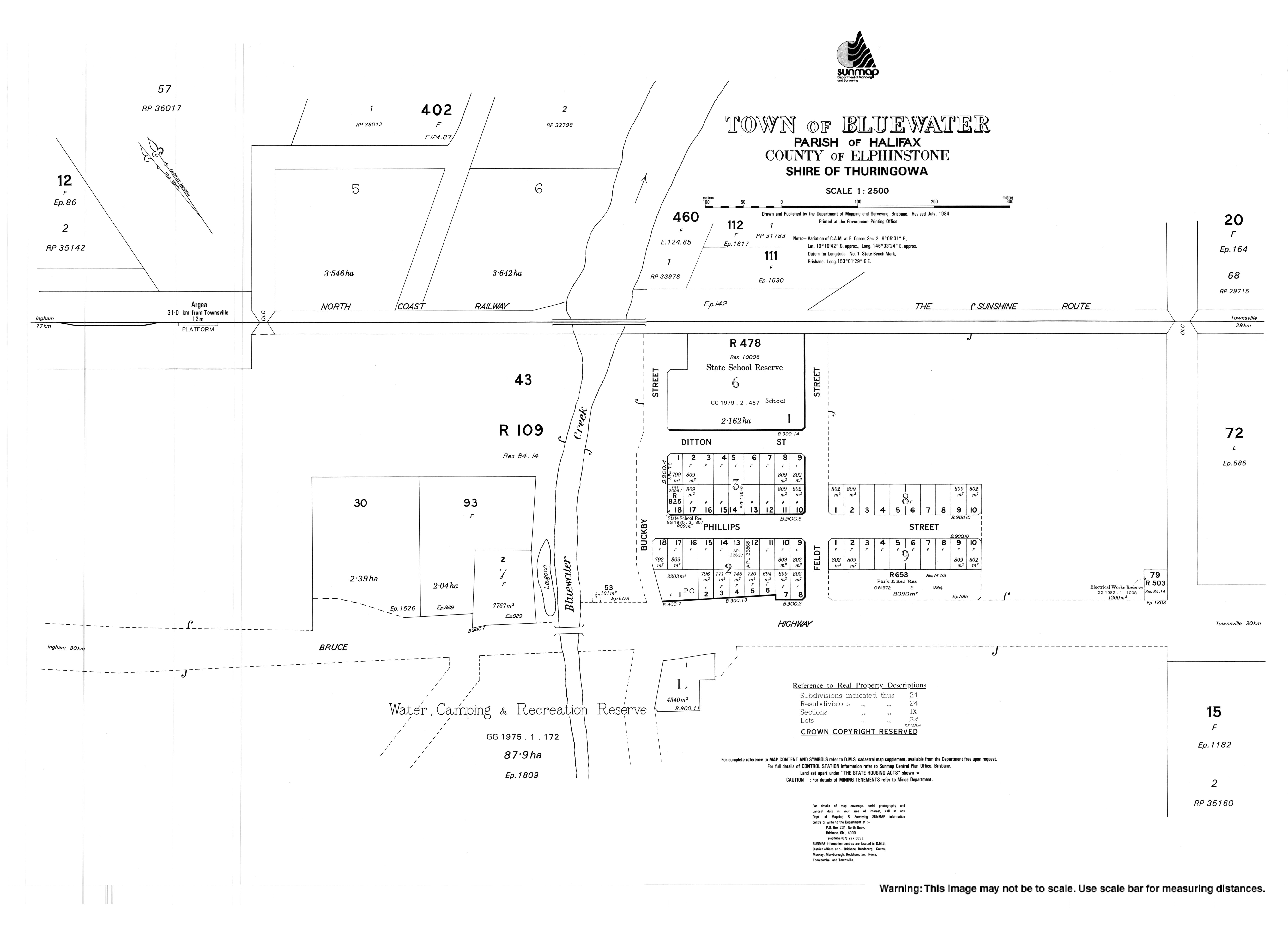
Bluewater is situated in the traditional Nyawigi Aboriginal country. [7] The origin of the suburb name Bluewater is from the adjacent Bluewater Creek that was shown on a district map from 1886. [8]

Bluewater was settled in the late nineteenth century, and was close to the Purono rail siding, constructed in 1919 on the extension of the North Coast railway line from Townsville to Ingham. During World War II, Bluewater became campground to a number of service personnel whose responsibility it was to resist Japanese invasion.

It was not until 1946 that land was first subdivided along Bluewater Beach, followed by subdivisions of Toolakea Beach and the Bluewater Township in the 1950s. [9]

Bluewater Post Office opened by May 1960. [10]

The community was badly flooded on 31 January 2019. [11] The wet weather and consequent flooding was expected to continue for another week. [12]

The suburb is popular with residents who prefer larger lot sizes and is home to a number of properties with hobby farms and horse agistment. It is also home to solar farms. [13]

Facilities

Today, Bluewater is a thriving community containing a number of facilities and attractions. Bluewater Park is a popular tourist destination with designated free campsites, and is located close to the Bluewater Store (currently closed for business), Bluewater Creek, and the newly developed Urban Forest and Fitness Trail. Toolakea and Bluewater Beach are popular recreational areas, and there is a boat ramp facility and waste transfer station towards the end of Bluewater Drive. [14]

Other facilities in the area include a community centre, a Girl Guides training and camping centre, [15] a Scout hall, and Bluewater State School. [16] There is also a Bluewater Caravan Park and Bluewater Medical Practice, however they are both technically located in Purono Park, on the Bruce Highway.

The Townsville City Council operate a mobile library service which visits the Community Centre at Bluewater on Monday afternoons. [17]

Related Research Articles

Townsville City in Queensland, Australia

Townsville is a city on the north-eastern coast of Queensland, Australia. Townsville is Australia's largest urban centre north of the Sunshine Coast, with a population of 180,820 as of June 2018. Considered the unofficial capital of North Queensland by locals, Townsville hosts a significant number of governmental, community and major business administrative offices for the northern half of the state. Part of the larger local government area of the City of Townsville, it is in the dry tropics region of Queensland, adjacent to the central section of the Great Barrier Reef. The city is also a major industrial centre, home to one of the world's largest zinc refineries, a nickel refinery and many other similar activities. As of December 2020, $30M operations to expand the Port of Townsville are underway, which involve channel widening and installation of a 70-tonne Liebherr Super Post Panamax Ship-to-Shore crane, to allow much larger cargo and passenger ships to utilise the port. It is an increasingly important port due to its proximity to Asia and major trading partners such as China.

Mackay, Queensland City in Queensland, Australia

Mackay is a city in the Mackay Region on the eastern or Coral Sea coast of Queensland, Australia. It is located about 970 kilometres (603 mi) north of Brisbane, on the Pioneer River. Mackay is nicknamed the sugar capital of Australia because its region produces more than a third of Australia's sugar. In June 2018, Mackay had a population of 80,148, having decreased slightly at an average annual rate of -0.32% year-on-year over the preceding five years.

City of Thuringowa Local government area in Queensland, Australia

The City of Thuringowa was a city and local government area in North Queensland, Australia covering the northern and western parts of what is now Townsville. The suburb of Thuringowa Central is the main business centre in this area.

Halifax Bay

Halifax Bay is a region located around a bay in the Coral Sea, situated on the Australian coast in Far North Queensland. It is bordered by the town of Ingham to the north, city of Townsville to the south and Great Palm Island off the coast to the east.

Alice River, Queensland Suburb of Townsville, Queensland, Australia

Alice River is a suburb of Townsville in the City of Townsville, Queensland, Australia. It is also known as Rupertswood. At the 2016 census, Alice River had a population of 2,143.

City of Townsville Local government area in Queensland, Australia

The City of Townsville is an Australian local government area (LGA) located in North Queensland, Australia. It encompasses the city of Townsville, together with the surrounding rural areas, to the south are the communities of Alligator Creek, Woodstock and Reid River, and to the north are Northern Beaches and Paluma, and also included is Magnetic Island. In June 2018 the area had a population of 194,072, and is the 28th-largest LGA in Australia. Townsville is considered to be the unofficial capital of North Queensland.

Deeragun, Queensland Suburb of Townsville, Queensland, Australia

Deeragun is an outer western town and suburb of Townsville in the City of Townsville, Queensland, Australia. In the 2016 census, Deeragun had a population of 4,250 people.

Thuringowa Central, Queensland Suburb of Townsville, Queensland, Australia

Thuringowa Central is a suburb of Townsville in the City of Townsville, Queensland, Australia. In 2016 census, the population of Thuringowa Central was 2,023.

Kelso, Queensland Suburb of Townsville, Queensland, Australia

Kelso is a suburb in the City of Townsville, Queensland, Australia. In the 2016 census, Kelso had a population of 10,538 people.

Suburbs of Thuringowa City

This article is a list of the suburbs that used to make up the City of Thuringowa in Queensland, Australia, before the March 2008 amalgamation, which saw the City of Townsville merge with Thuringowa to form the new city of Townsville. Also listed are the former suburbs that became part of Townsville due to other boundary changes that have taken place over the years. The suburbs are listed below in order of postcode and order of years the boundaries were changed:

Saunders Beach, Queensland Suburb of Townsville, Queensland, Australia

Saunders Beach is a coastal town, suburb, and beach of Townsville in the City of Townsville, Queensland, Australia. In the 2016 census, Saunders Beach had a population of 409 people.

Toolakea, Queensland Town in Queensland, Australia

Toolakea is a coastal town and suburb in the City of Townsville, Queensland, Australia. In the 2016 census, Toolakea had a population of 205 people.

Purono Park, Queensland Suburb of Townsville, Queensland, Australia

Purono Park is a small residential suburb situated in between Yabulu and Bluewater, approximately 25 kilometres (16 mi) north of the Townsville and Thuringowa urban centres, in Queensland, Australia. The suburb runs adjacent to Althaus Creek and is accessed via Purono Parkway, which runs north from the Bruce Highway.

Yabulu, Queensland Suburb of Townsville, Queensland, Australia

Yabulu is a town and coastal suburb in the City of Townsville, Queensland, Australia. In the 2016 census, Yabulu had a population of 697 people.

Bluewater Park, Queensland Suburb of Bluewater, Queensland, Australia

Bluewater Park is a suburb of Bluewater in the City of Townsville, Queensland, Australia. In the 2016 census, Bluewater Park had a population of 992 people.

Rollingstone, Queensland Town in Queensland, Australia

Rollingstone is a town and coastal locality in the City of Townsville, Queensland, Australia. As of the 2016 census, the population of Rollingstone was 125.

Balgal Beach, Queensland Suburb of Townsville, Queensland, Australia

Balgal Beach is a coastal suburb and a beach in the City of Townsville, Queensland, Australia. The town of Balgal is within the locality. In the 2016 census, Balgal Beach had a population of 966 people.

Toomulla, Queensland Town in Queensland, Australia

Toomulla is a coastal town and suburb in the City of Townsville, Queensland, Australia. In the 2016 census, Toomulla had a population of 183 people.

CityLibraries Townsville is a public library service serving the City of Townsville, Queensland, Australia. It has three permanent libraries, a mobile library service and a home service. It is operated by Townsville City Council. CityLibraries serves almost 200,000 residents of Townsville and surrounding areas. CityLibraries vision is "Connections for Life" and the mission is "Working with our community to connect people, information, learning and lifestyle".

Heatley, Queensland Suburb of Townsville, Queensland, Australia

Heatley is a suburb in the City of Townsville, Queensland, Australia. In the 2016 census, Heatley had a population of 4,038 people.

References

  1. "Bluewater – town (entry 3301)". Queensland Place Names. Queensland Government . Retrieved 24 June 2017.
  2. "Bluewater – suburb (entry 44573)". Queensland Place Names. Queensland Government . Retrieved 24 June 2017.
  3. "Bluewater Beach – town (entry 3303)". Queensland Place Names. Queensland Government . Retrieved 24 June 2017.
  4. Australian Bureau of Statistics (27 June 2017). "Bluewater". 2016 Census QuickStats. Retrieved 4 February 2019. OOjs UI icon edit-ltr-progressive.svg
  5. Discover Thuringowa - Northern Beaches Archived 19 July 2008 at the Wayback Machine , accessed 9 June 2008.
  6. "Queensland Globe". State of Queensland . Retrieved 24 June 2017.
  7. "Wellbeing of Nywaigi Traditional Owners - Figure 1" . Retrieved 25 June 2020.
  8. "Townsville City Council community profiles Division 1" (PDF). Retrieved 25 June 2020.
  9. Thuringowa Library Heritage Services: A History Of The Bluewater Area Archived 19 July 2008 at the Wayback Machine , accessed 9 June 2008.
  10. Premier Postal History. "Post Office List". Premier Postal Auctions. Retrieved 10 May 2014.
  11. "Bluewater, Far North Queensland, homes flooded after heavy rain". www.news.com.au. Retrieved 3 February 2019.
  12. "Cow Swept Out To Sea, Tractors Washed Away In Wild Townsville Floods". 10 daily. 30 January 2019. Retrieved 3 February 2019.
  13. "Council approves solar farm application in Bluewater". Townsville City Council. Townsville City Council. Retrieved 22 July 2020.
  14. Discover Thuringowa: Northern Beaches Archived 19 July 2008 at the Wayback Machine , accessed 9 June 2008.
  15. Bluewater Training And Camping Centre Archived 15 October 2018 at the Wayback Machine , accessed 9 June 2008.
  16. Bluewater State School Archived 18 July 2008 at the Wayback Machine , accessed 9 June 2008.
  17. "Mobile Library Service" (PDF). Townsville City Council . Archived from the original (PDF) on 29 January 2018. Retrieved 29 January 2018.