
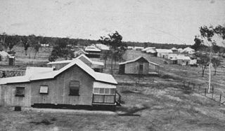
Woodstock is a rural town and locality in the City of Townsville, Queensland, Australia. In the 2021 census, the locality of Woodstock had a population of 270 people.

Paluma is a town in the City of Townsville and a locality split between the City of Townsville and the Charters Towers Region in Queensland, Australia. In the 2021 census, the locality of Paluma had a population of 87 people.

Nome is a rural locality in the City of Townsville, Queensland, Australia. In the 2021 census, Nome had a population of 990 people.

Cape Cleveland is a rural locality in the City of Townsville, Queensland, Australia. In the 2021 census, Cape Cleveland had a population of 128 people.

Mount St John is an industrial suburb of Townsville in the City of Townsville, Queensland, Australia. In the 2021 census, Mount St John had a population of 103 people.
Mount Coolon is a rural town and locality in the Whitsunday Region, Queensland, Australia. In the 2021 census, the locality of Mount Coolon had a population of 172 people.
Majors Creek is a locality split between the City of Townsville and the Shire of Burdekin, Queensland, Australia. In the 2021 census, Majors Creek had a population of 327 people.
Breddan is a rural locality in the Charters Towers Region, Queensland, Australia. In the 2021 census, Breddan had a population of 478 people.
Westmar is a rural locality in the Western Downs Region, Queensland, Australia. In the 2021 census, Westmar had a population of 59 people.

Mount Elliot is a rural locality in the City of Townsville, Queensland, Australia. It contains the mountain of the same name. In the 2021 census, Mount Elliot had "no people or a very low population".

Campaspe is a rural locality in the Charters Towers Region, Queensland, Australia. In the 2021 census, Campaspe had a population of 123 people.

Mingela is a rural town and locality in the Charters Towers Region, Queensland, Australia. In the 2021 census, the locality of Mingela had a population of 14 people.
Seventy Mile is a rural locality in the Charters Towers Region, Queensland, Australia. In the 2021 census, Seventy Mile had a population of 204 people.
Beach Holm is a coastal locality in the City of Townsville, Queensland, Australia. In the 2021 census, Beach Holm had a population of 35 people.

Mount Stuart is a locality in the City of Townsville, Queensland, Australia. In the 2021 census, Mount Stuart had "no people or a very low population".

Barringha is a locality in the City of Townsville, Queensland, Australia. In the 2021 census, Barringha had a population of 61 people.
Granite Vale is a rural locality in the City of Townsville, Queensland, Australia. In the 2021 census, Granite Vale had "no people or a very low population".
Calcium is a rural locality in the City of Townsville, Queensland, Australia. In the 2021 census, Calcium had a population of 12 people.
Lynam is a rural locality in the City of Townsville, Queensland, Australia. In the 2021 census, Lynam had a population of 8 people.
Upper Haughton is a rural locality in the Shire of Burdekin, Queensland, Australia. In the 2021 census, Upper Haughton had a population of 34 people.

