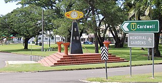
Ayr is a rural town and locality in the Shire of Burdekin, Queensland, Australia. It is the centre of a sugarcane-growing region and the administrative centre for the Burdekin Shire Council. In the 2021 census, the locality of Ayr had a population of 8,603 people.

Ingham is a rural town and locality in the Shire of Hinchinbrook, Queensland, Australia. It is named after William Bairstow Ingham and is the administrative centre for the Shire of Hinchinbrook.

Richmond is a rural town and locality in the Shire of Richmond, Queensland, Australia. In the 2021 census, the locality of Richmond had a population of 578 people.

Home Hill is a rural town and locality in the Shire of Burdekin, Queensland, Australia. In the 2021 census, the locality of Home Hill had a population of 2,876 people.

North Queensland or the Northern Region is the northern part of the Australian state of Queensland that lies just south of Far North Queensland. Queensland is a massive state, larger than many countries, and its tropical northern part has been historically remote and undeveloped, resulting in a distinctive regional character and identity.

Pentland is a rural town and locality in the Charters Towers Region, Queensland, Australia. In the 2021 census, the locality of Pentland had a population of 248 people.

Paluma is a town in the City of Townsville and a locality split between the City of Townsville and the Charters Towers Region in Queensland, Australia. In the 2021 census, the locality of Paluma had a population of 87 people.

Ravenswood is a rural town and locality in the Charters Towers Region, Queensland, Australia. In the 2021 census, the locality of Ravenswood had a population of 297 people.

Rollingstone is a rural town and coastal locality in the City of Townsville, Queensland, Australia. In the 2021 census, the locality of Rollingstone had a population of 133 people.

Hervey Range is a rural locality split between the City of Townsville and the Charters Towers Region, Queensland, Australia. In the 2021 census, Hervey Range had a population of 295 people.

Queenton is an eastern suburb of Charters Towers in the Charters Towers Region, Queensland, Australia. In the 2021 census, Queenton had a population of 1,236 people.
Breddan is a rural locality in the Charters Towers Region, Queensland, Australia. In the 2021 census, Breddan had a population of 478 people.

Feluga is a rural locality in the Cassowary Coast Region, Queensland, Australia. In the 2021 census, Feluga had a population of 306 people.

Broughton is a rural locality in the Charters Towers Region, Queensland, Australia. In the 2021 census, Broughton had a population of 714 people.

McDesme is a rural locality in the Shire of Burdekin, Queensland, Australia. In the 2021 census, McDesme had a population of 254 people.

Mingela is a rural town and locality in the Charters Towers Region, Queensland, Australia. In the 2021 census, the locality of Mingela had a population of 14 people.
Sellheim is a town in the locality of Breddan in the Charters Towers Region, Queensland, Australia.
Toonpan is a rural locality in the City of Townsville, Queensland, Australia. In the 2021 census, Toonpan had a population of 62 people.
Groper Creek is a coastal town and rural locality in the Shire of Burdekin, Queensland, Australia. In the 2021 census, the locality of Groper Creek had a population of 66 people.
Drummondslope is a former rural locality in the Barcaldine Region, Queensland, Australia. In the 2016 census, Drummondslope had a population of 43 people. On 22 November 2019 the Queensland Government decided to amalgamate the localities in the Barcaldine Region, resulting in five expanded localities based on the larger towns: Alpha, Aramac, Barcaldine, Jericho and Muttaburra. Drummondslope was incorporated into Alpha.


