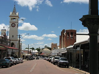
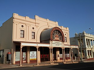
Charters Towers is a rural town in the Charters Towers Region, Queensland, Australia. It is 136 km (85 mi) by road south-west from Townsville on the Flinders Highway. During the last quarter of the 19th century, the town boomed as the rich gold deposits under the city were developed. After becoming uneconomical in the 20th century, profitable mining operations have commenced once again. In the 2016 census, Charters Towers had a population of 8,120 people.

The Shire of Dalrymple was a local government area located in North Queensland, Australia, and surrounded but did not include the town of Charters Towers, at which its council and administrative centre was based. It covered an area of 68,324.5 square kilometres (26,380.2 sq mi), and existed as a local government entity from 1879 until 2008, when it amalgamated with the separate City of Charters Towers to form the Charters Towers Region.

The City of Charters Towers was a local government area in North Queensland, Australia, consisting of the centre and suburbs of the town of Charters Towers. Established in 1877, it was entirely surrounded by the Shire of Dalrymple, with which it amalgamated in 2008 to form the Charters Towers Region.

Paluma is a town in the City of Townsville and a locality split between the City of Townsville and the Charters Towers Region in Queensland, Australia. In the 2016 census, the locality of Paluma had a population of 68 people.

Ravenswood is a rural town and locality in the Charters Towers Region, Queensland, Australia. In the 2016 census, the locality of Ravenswood had a population of 255 people.

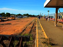
Charters Towers railway station is at Queenton, Charters Towers, Queensland, Australia. It is on the Great Northern line at Charters Towers, 134 kilometres (83 mi) west of Townsville in North Queensland, Australia.
Hervey Range is a rural locality split between the City of Townsville and the Charters Towers Region, Queensland, Australia. In the 2016 census Hervey Range had a population of 279 people.
The Shire of Queenton was a local government area located in North Queensland, Australia. It was located to the south of Charters Towers and existed from 1902 to 1916.
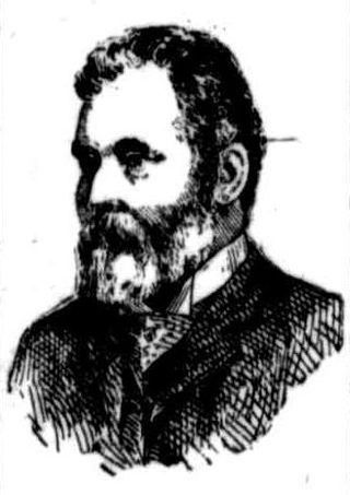
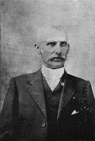
Hugh Mosman was a mine owner and politician in Queensland, Australia. He discovered gold in Charters Towers. He was a Member of the Queensland Legislative Council.
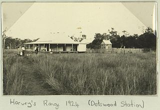
Dotswood is a rural locality in the Charters Towers Region, Queensland, Australia. In the 2016 census Dotswood had a population of 101 people.
Charters Towers City is the central suburb and central business district of the town of Charters Towers in the Charters Towers Region, Queensland, Australia. In the 2016 census, Charters Towers City had a population of 2,134 people.
Grand Secret is a suburb in the Charters Towers Region, Queensland, Australia. In the 2016 census Grand Secret had a population of 168 people.

Towers Hill is a suburb of Charters Towers in the Charters Towers Region, Queensland, Australia. In the 2016 census Towers Hill had a population of 218 people.
Millchester is a rural residential town and suburb in the Charters Towers Region, Queensland, Australia. In the 2016 census, the suburb of Millchester had a population of 543 people.
Columbia is a rural locality in the Charters Towers Region, Queensland, Australia. In the 2016 census Columbia had a population of 101 people.

Campaspe is a rural locality in the Charters Towers Region, Queensland, Australia. In the 2021 census, Campaspe had a population of 123 people.

Broughton is a rural locality in the Charters Towers Region, Queensland, Australia. In the 2016 census, Broughton had a population of 726 people.

Mingela is a rural town and locality in the Charters Towers Region, Queensland, Australia. In the 2021 census, the locality of Mingela had a population of 14 people.
Seventy Mile is a rural locality in the Charters Towers Region, Queensland, Australia. In the 2021 census, Seventy Mile had a population of 204 people.
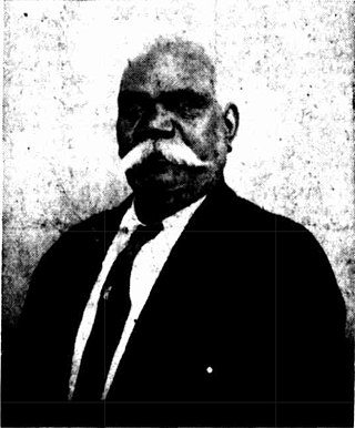
John Joseph (Jupiter) Mosman (1861-1945) was an Aboriginal Australian prospector, one of the group of four who discovered gold at Charters Towers, Queensland, Australia. It became one of the premier goldfields of Australia, yielding £23,000,000 worth of gold. Mosman is credited with having found the first gold-bearing stone.