
Greenvale is a rural town and locality in the Charters Towers Region, Queensland, Australia. In the 2021 census, the locality of Greenvale had a population of 192 people.

Inkerman is a rural town and locality in the Shire of Burdekin, Queensland, Australia. In the 2021 census, the locality of Inkerman had a population of 119 people.

Paluma is a town in the City of Townsville and a locality split between the City of Townsville and the Charters Towers Region in Queensland, Australia. In the 2021 census, the locality of Paluma had a population of 87 people.

Ravenswood is a rural town and locality in the Charters Towers Region, Queensland, Australia. In the 2021 census, the locality of Ravenswood had a population of 297 people.
North Toowoomba is a suburban locality in Toowoomba in the Toowoomba Region, Queensland, Australia. In the 2021 census, North Toowoomba had a population of 3,332 people.

Garradunga is a rural locality in the Cassowary Coast Region, Queensland, Australia. In the 2021 census, Garradunga had a population of 170 people.

Purga is a rural locality in the City of Ipswich, Queensland, Australia. In the 2021 census, Purga had a population of 561 people.
Hervey Range is a rural locality split between the City of Townsville and the Charters Towers Region, Queensland, Australia. In the 2021 census, Hervey Range had a population of 295 people.

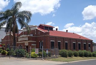
Queenton is an eastern suburb of Charters Towers in the Charters Towers Region, Queensland, Australia. In the 2021 census, Queenton had a population of 1,236 people.
Valley Of Lagoons is a rural locality in the Charters Towers Region, Queensland, Australia. In the 2021 census, Valley Of Lagoons had a population of 39 people.

Lakefield is a coastal locality in the Shire of Cook, Queensland, Australia. In the 2021 census, Lakefield had a population of 21 people.
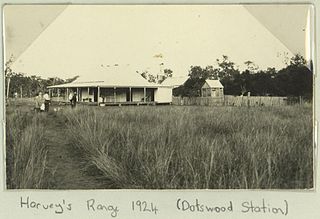
Dotswood is a rural locality in the Charters Towers Region, Queensland, Australia. In the 2021 census, Dotswood had a population of 83 people.
Breddan is a rural locality in the Charters Towers Region, Queensland, Australia. In the 2021 census, Breddan had a population of 478 people.
Belyando is a rural locality in the Isaac Region, Queensland, Australia. In the 2021 census, Belyando had a population of 307 people.
Homestead is a rural town and locality in the Charters Towers Region, Queensland, Australia. In the 2021 census, the locality of Homestead had a population of 38 people.

Campaspe is a rural locality in the Charters Towers Region, Queensland, Australia. In the 2021 census, Campaspe had a population of 123 people.

Broughton is a rural locality in the Charters Towers Region, Queensland, Australia. In the 2021 census, Broughton had a population of 714 people.

Mingela is a rural town and locality in the Charters Towers Region, Queensland, Australia. In the 2021 census, the locality of Mingela had a population of 14 people.
Swans Lagoon is a rural locality in the Shire of Burdekin, Queensland, Australia. In the 2021 census, Swans Lagoon had a population of 12 people.

Cromarty is a rural locality in the Shire of Burdekin, Queensland, Australia. In the 2021 census, Cromarty had a population of 43 people.
