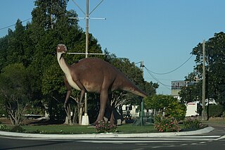
Hughenden is a rural town and locality in the Flinders Shire, Queensland, Australia. In the 2021 census, the locality of Hughenden had a population of 1,113 people.

Lakeland is a rural town and locality in the Shire of Cook, Queensland, Australia. In the 2021 census, the locality of Lakeland had a population of 333 people.

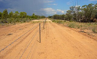
The Shire of Flinders is a local government area in north-western Queensland, Australia.

Inkerman is a rural town and locality in the Shire of Burdekin, Queensland, Australia. In the 2021 census, the locality of Inkerman had a population of 119 people.
Adavale is a rural town and locality in the Shire of Quilpie, Queensland, Australia. In the 2021 census, the locality of Adavale had a population of 72 people.

Prairie is a rural town and locality in the Flinders Shire, Queensland, Australia. In the 2021 census, the locality of Prairie had a population of 116 people.

Torrens Creek is a rural town and locality in the Shire of Flinders, Queensland, Australia. In the 2021 census, the locality of Torrens Creek had a population of 46 people.

Einasleigh is a rural town and a locality in the Shire of Etheridge, Queensland, Australia. In the 2021 census, the locality of Einasleigh had a population of 87 people.

Undullah is a rural locality split between the City of Logan and the Scenic Rim Region, Queensland, Australia. In the 2021 census, Undullah had a population of 24 people.
Camboon is a rural locality in the Shire of Banana, Queensland, Australia. In the 2021 census, Camboon had a population of 76 people.

Lawn Hill is an outback locality split between the Shire of Burke and the City of Mount Isa in Queensland, Australia. The locality is on the Queensland border with the Northern Territory. In the 2021 census, Lawn Hill had a population of 63 people.

Dutton River is a rural locality in the Flinders Shire, Queensland, Australia. In the 2021 census, Dutton River had a population of 66 people.

Chewko is a rural locality in the Shire of Mareeba, Queensland, Australia. In the 2021 census, Chewko had a population of 213 people.
Tangorin is a rural town and locality in the Flinders Shire, Queensland, Australia. In the 2021 census, the locality of Tangorin had a population of 47 people.
Ulogie is a rural locality in the Shire of Banana, Queensland, Australia. In the 2021 census, Ulogie had a population of 31 people.
Desailly is a rural locality in the Shire of Mareeba, Queensland, Australia. In the 2021 census, Desailly had "no people or a very low population".

Wooroonooran is an undeveloped locality split among the Cairns Region, the Cassowary Coast Region and the Tablelands Region in Queensland, Australia. In the 2021 census, Wooroonooran had "no people or a very low population".

Mulgrave is a rural locality in the Shire of Burdekin, Queensland, Australia. In the 2021 census, Mulgrave had a population of 19 people.

Lyndhurst is a rural locality in the Shire of Etheridge, Queensland, Australia. In the 2021 census, Lyndhurst had a population of 11 people.

Amber is a rural locality in the Shire of Mareeba, Queensland, Australia. In the 2021 census, Amber had "no people or a very low population".


