Shire of Flinders (Queensland)

Last updated

Shire of Flinders
Queensland
Flinders LGA Qld.png
Location within Queensland
Population1,499 (2018) [1]
 • Density0.03638/km2 (0.09423/sq mi)
Established1882
Area41,200 km2 (15,907.4 sq mi) [1]
MayorJane McNamara
Council seat Hughenden
Region North West Queensland
State electorate(s) Traeger
Federal division(s) Kennedy
Shire of Flinders Logo.jpg
Website Shire of Flinders
LGAs around Shire of Flinders:
Etheridge Etheridge Charters Towers
Richmond Shire of Flinders Charters Towers
Winton Barcaldine Charters Towers

The Shire of Flinders is a local government area in north-western Queensland, Australia.

Contents

It covers an area of 41,200 square kilometres (15,907.4 sq mi), [1] and has existed as a local government entity since 1882. The Shire, named for the Flinders River, is predominantly a grazing area with cattle in the north of the shire and mixed grazing to the south in the black soil area.

History

Jirandali (also known as Yirandali, Warungu, Yirandhali) is an Australian Aboriginal language of North-West Queensland, particularly the Hughenden area. The language region includes the local government area of the Shire of Flinders, including Dutton River, Flinders River, Mount Sturgeon, Caledonia, Richmond, Corfield, Winton, Torrens, Tower Hill, Landsborough Creek, Lammermoor Station, Hughenden, and Tangorin. [2]

Map of Hughenden Division and adjacent local government areas, March 1902 Hughenden Division, March 1902.jpg
Map of Hughenden Division and adjacent local government areas, March 1902

The Hughenden Division was established on 20 July 1882 under the Divisional Boards Act 1879. [3] On 20 April 1887, the Borough of Hughenden was constituted separately as a municipality for the emerging town of Hughenden. [4]

On 31 March 1903, the Hughenden Division became the Shire of Hughenden and the Borough of Hughenden became the Town of Hughenden under the Local Authorities Act 1902. [5] On 5 September of the same year, the Shire of Hughenden was renamed Shire of Flinders. [6]

The western part of the Shire was separately incorporated as the Shire of Wyangarie (later Shire of Richmond) on 23 October 1915. On 1 January 1930, part of the Shire of Flinders was annexed to the Shire of Dalrymple. [7]

In 1958, the Town of Hughenden amalgamated with the Shire of Flinders. [5] [8]

Prior to 19 November 2021, the town of Marathon was within the locality of Stamford. However, this arrangement caused confusion, so on 19 November 2021, a new locality of Marathon was created around the town, excising the land from the localities of Dutton River and Stamford. [9] [10] [11]

Towns and localities

The Shire of Flinders includes the following settlements:

Amenities

The Flinders Shire Council operate the Flinders Shire Library at 39 Gray Street, Hughenden. [12]

Population

YearPopulation
19333,426
19473,310
19543,293
19613,953
19663,716
19713,019
19762,875
19812,740
19862,804
19912,491
19962,232
20012,191
20061,792
20111791
20161,536

Chairmen and mayors

Related Research Articles

<span class="mw-page-title-main">Blackbraes National Park</span> Protected area in Queensland, Australia

Blackbraes is a national park in Shire of Etheridge of Far North Queensland, Australia.

<span class="mw-page-title-main">Hughenden, Queensland</span> Town in Queensland, Australia

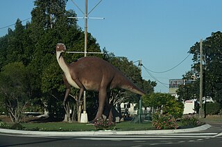
Hughenden is a rural town and locality in the Flinders Shire, Queensland, Australia. In the 2016 census, the locality of Hughenden had a population of 1,136 people.

<span class="mw-page-title-main">Flinders Highway, Queensland</span> Highway in Queensland, Australia

The Flinders Highway is a highway that crosses Queensland east to west, from Townsville on the Pacific coast to Cloncurry. The road continues as the Barkly Highway from Cloncurry to the Northern Territory border at Camooweal and beyond. The Flinders Highway passes a number of small outback towns and typical outback landscape predominates towards the inland. It was known as National Route 78 before Queensland began to convert to the alphanumeric system being adopted in Australia and is now designated as A6. The highway is also known as Overlanders Way. Its entire length is part of the National Land Transport Network.

<span class="mw-page-title-main">Flinders River</span> River in Queensland, Australia

The Flinders River is the longest river in Queensland, Australia, at approximately 1,004 kilometres (624 mi). It was named in honour of the explorer Matthew Flinders. The catchment is sparsely populated and mostly undeveloped. The Flinders rises on the western slopes of the Great Dividing Range in North West Queensland and flows generally north-west through the Gulf Country, across a large, flat clay pan, before entering the Gulf of Carpentaria.

<span class="mw-page-title-main">Richmond, Queensland</span> Town in Queensland, Australia

Richmond is a rural town and locality in the Shire of Richmond, Queensland, Australia. In the 2016 census, the locality of Richmond had a population of 648 people.

<span class="mw-page-title-main">Shire of Richmond</span> Local government area in Queensland, Australia

The Shire of Richmond is a local government area in north western Queensland, Australia.

<span class="mw-page-title-main">Shire of Cook</span> Local government area in Queensland, Australia

The Shire of Cook is a local government area in Far North Queensland, Australia. The Shire covers most of the eastern and central parts of Cape York Peninsula, the most northerly section of the Australian mainland.

<span class="mw-page-title-main">Barcaldine Region</span> Local government area in Queensland, Australia

The Barcaldine Region is a local government area in Central West Queensland, Australia. Established in 2008, it was preceded by three previous local government areas which had existed for over a century.

<span class="mw-page-title-main">Central Highlands Region</span> Local government area in Queensland, Australia

Central Highlands Region is a local government area in Queensland, Australia.

<span class="mw-page-title-main">Gulf Country</span> Region in Queensland, Australia

The Gulf Country is the region of woodland and savanna grassland surrounding the Gulf of Carpentaria in north western Queensland and eastern Northern Territory on the north coast of Australia. The region is also called the Gulf Savannah. It contains large reserves of zinc, lead and silver. The Gulf Country is crossed by the Savannah Way highway.

<span class="mw-page-title-main">Prairie, Queensland</span> Town in Queensland, Australia

Prairie is a rural town and locality in the Flinders Shire, Queensland, Australia. In the 2016 census the locality of Prairie had a population of 143 people.

<span class="mw-page-title-main">Torrens Creek</span> Town in Queensland, Australia

Torrens Creek is a rural town and locality in the Shire of Flinders, Queensland, Australia. In the 2016 census the locality of Torrens Creek had a population of 70 people.

<span class="mw-page-title-main">Stamford, Queensland</span> Town in Queensland, Australia

Stamford is a rural town and locality in the Shire of Flinders, Queensland, Australia. In the 2016 census, the locality of Stamford had a population of 43 people.

<span class="mw-page-title-main">Corfield, Queensland</span> Town in Queensland, Australia

Corfield is a town and locality in the Shire of Winton in north-western Queensland, Australia. In the 2016 census, Corfield had a population of 183 people.

<span class="mw-page-title-main">Town of Hughenden</span>

The Town of Hughenden is a former local government area in North Queensland, Australia.

Dutton River is a rural locality in the Flinders Shire, Queensland, Australia. In the 2016 census, Dutton River had a population of 33 people.

Tangorin is a rural town and locality in the Flinders Shire, Queensland, Australia. In the 2016 census the locality of Tangorin had a population of 58 people.

<span class="mw-page-title-main">Porcupine, Queensland</span> Suburb of Shire of Flinders, Queensland, Australia

Porcupine is a locality in the Shire of Finders, Queensland, Australia. In the 2016 census, Porcupine had a population of 49 people.

Marathon is a rural town and locality in the Flinders Shire, Queensland, Australia. Although the town has existed since circa 1916, the locality was created in November 2021.

Hughenden–Muttaburra–Aramac–Barcaldine Road is a continuous 359-kilometre (223 mi) road route in the Flinders and Barcaldine local government areas of Queensland, Australia. It is designated as State Route 19. It has three official names, Hughenden–Muttaburra Road, Muttaburra–Aramac Road, and Barcaldine–Aramac Road. Each component is a state-controlled district road, rated as a local road of regional significance (LRRS).

References

  1. 1 2 3 "3218.0 – Regional Population Growth, Australia, 2017-18: Population Estimates by Local Government Area (ASGS 2018), 2017 to 2018". Australian Bureau of Statistics. Australian Bureau of Statistics. 27 March 2019. Retrieved 25 October 2019. Estimated resident population, 30 June 2018.
  2. CC BY icon-80x15.png This Wikipedia article incorporates CC-BY-4.0 licensed text from: "Guugu Yimithirr". Queensland Aboriginal and Torres Strait Islander languages map. State Library of Queensland . Retrieved 28 January 2020.
  3. "Proclamation [Hughenden Division]". Queensland Government Gazette . 22 July 1882. p. 31:201.
  4. "Current News". The Queenslander . 7 May 1887. p. 725. Retrieved 11 September 2013 via National Library of Australia.
  5. 1 2 "Agency ID 2251, Hughenden Town Council". Queensland State Archives . Retrieved 11 September 2013.
  6. "Agency ID 887, Flinders Shire". Queensland State Archives . Retrieved 11 September 2013.
  7. "Order in Council". Queensland Government Gazette . 21 December 1929. p. 133:2125.
  8. Flinders Shire Council (2008). "History of Council". Archived from the original on 10 April 2013. Retrieved 30 October 2009.
  9. "Recent place name decisions: Job number 16-073: Marathon". Queensland Government. 19 November 2021. Archived from the original on 23 April 2020. Retrieved 7 February 2022.
  10. "Proposed locality boundaries and names: Marathon, Flinders Shire" (PDF). Queensland Government. 15 May 2020. Archived (PDF) from the original on 7 February 2022. Retrieved 7 February 2022.
  11. "Decision: Locality names and boundaries, Shire of Flinders" (PDF). Queensland Government. 19 November 2021. Archived (PDF) from the original on 7 February 2022. Retrieved 7 February 2022.
  12. "Flinders Shire Council". Public Libraries Connect. State Library of Queensland. 20 September 2017. Archived from the original on 5 February 2018. Retrieved 6 February 2018.
  13. Consolidated Index to Queensland Government Gazette 1859-1919. Queensland Family History Society. 2004. ISBN   1-876613-79-3.
  14. Pugh, Theophilus Parsons (1927). Pugh's Almanac for 1927 . Retrieved 13 June 2014.
  15. "2008 Flinders Shire - Mayoral Election - Election Summary". results.ecq.qld.gov.au. Retrieved 4 December 2017.
  16. "2012 Flinders Shire - Mayoral Election - Election Summary". Electoral Commission of Queensland. Archived from the original on 12 June 2017. Retrieved 12 June 2017.
  17. "2016 Flinders Shire Council - Mayoral Election - Election Summary". Electoral Commission of Queensland. Archived from the original on 12 June 2017. Retrieved 12 June 2017.

Coordinates: 20°50′34″S144°12′02″E / 20.84278°S 144.20056°E / -20.84278; 144.20056