Central Highlands Region

Last updated

Central Highlands Region
Queensland
Central highlands LGA Qld 2008.png
Location within Queensland
Coordinates 23°31′20″S148°09′42″E / 23.52222°S 148.16167°E / -23.52222; 148.16167 (Central Highlands Region)
Population28,645 (2018) [1]
 • Density0.478741/km2 (1.23993/sq mi)
Established2008
Area59,834 km2 (23,102.0 sq mi) [1]
MayorKerry Hayes
Council seat Emerald
State electorate(s) Gregory
Federal division(s) Flynn
Central Highlands Regional Council logo 2017.png
Website Central Highlands Region
LGAs around Central Highlands Region:
Isaac Rockhampton Rockhampton
Barcaldine Central Highlands Region Banana
Blackall-Tambo
Murweh
Maranoa Western Downs

Central Highlands Region is a local government area in Queensland, Australia.

Contents

History

Wadja (also known as Wadjigu, Wadya, Wadjainngo, Mandalgu, and Wadjigun) is an Australian Aboriginal language in Central Queensland. The language region includes the local government areas of the Aboriginal Shire of Woorabinda and Central Highlands Region, including the Blackdown Tableland, the Comet River, and the Expedition Range, and the towns of Woorabinda, Springsure and Rolleston. [2]

Yambina (also known as Jambina and Jambeena) is an Australian Aboriginal language of Central Queensland. Its traditional language region is the local government area of Central Highlands Region, including Peak Downs, Logan Creek, south to Avon Downs, east to Denham Range and Logan Downs, west to Elgin Downs and at Solferino. [3]

Yetimarala (also known as Jetimarala, Yetimaralla, and Bayali) is an Australian Aboriginal language of Central Queensland. Its traditional language region is within the local government areas of Central Highlands Region, on the Boomer Range and Broadsound Range and the Fitzroy River, Killarney Station, Mackenzie River and Isaac River. [4]

The Central Highlands Region was created in March 2008 as a result of the report of the Local Government Reform Commission released in July 2007. The new local government area, located in Central Queensland, contains the entire areas of four previous local government areas:

Legislation introduced into the Queensland Parliament gave the name of the new region as Central Highlands. [5] The report recommended that the new local government area should not be divided into wards and should elect eight councillors and a mayor. The Central Highlands Region has an area of 59,834 square kilometres (23,102 sq mi), [1] contained an estimated resident population in 2018 of 28,645 [1] and has an estimated operating budget of A$66 million.[ when? ]

On 17 April 2020, the Queensland Government re-drew the boundaries of localities within the Region by: [6] [7] [8]

As a consequence of these changes, Lake Maraboon is now entirely within the north-west of Gindie and the boundary between Lochington and Minerva/Gindie more closely follows the course of the Nogoa River. [9]

Towns and localities

The Central Highlands Region includes the following settlements:

Notes:

1 – partially shared with Isaac Region (former Belyando Shire)

Libraries

The Central Highlands Region operates public libraries at Bauhinia, Blackwater, Capella, Dingo, Duaringa, Emerald, Rubyvale (The Gemfields), Rolleston, Springsure and Tieri. [10]

Mayors

Related Research Articles

<span class="mw-page-title-main">The Gemfields</span> Suburb of Central Highlands Region, Queensland, Australia

The Gemfields is a former locality in the Central Highlands Region, Queensland, Australia. In the 2016 census, The Gemfields had a population of 1,449 people.

<span class="mw-page-title-main">Rubyvale, Queensland</span> Suburb of Central Highlands Region, Queensland, Australia

Rubyvale is a rural town and locality in the Central Highlands Region, Queensland, Australia. In the 2016 census, the town of Rubyvale had a population of 640 people.

Willows Gemfields is a rural town in the locality of Willows in the Central Highlands Region of Queensland, Australia. In the 2016 census, Willows Gemfields had a population of 114 people.

Sapphire Central is a rural locality in the Central Highlands Region, Queensland, Australia. The town of Sapphire is within the locality. Sapphires are mined extensively in the area. At the 2021 census, the locality had a population of 1214 people.

<span class="mw-page-title-main">Emerald, Queensland</span> Town in Queensland, Australia

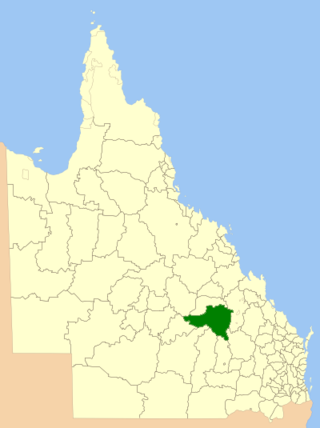
Emerald is a rural town and locality in the Central Highlands Region, Queensland, Australia. In the 2021 census, the locality of Emerald had a population of 14,906 people.

<span class="mw-page-title-main">Central Queensland</span> Region in Queensland, Australia

Central Queensland is an imprecisely-defined geographical division of Queensland that centres on the eastern coast, around the Tropic of Capricorn. Its major regional centre is Rockhampton. The region extends from the Capricorn Coast west to the Central Highlands at Emerald, north to the Mackay Regional Council southern boundary, and south to Gladstone. The region is also known as Capricornia. It is one of Australia's main coal exporting regions.

<span class="mw-page-title-main">Anakie Siding, Queensland</span> Town in central Queensland, Australia

Anakie Siding is a rural locality in the Central Highlands Region, Queensland, Australia. It is a sapphire mining area. In 2021 census, the locality of Anakie Siding had a population of 155 people.

<span class="mw-page-title-main">Rolleston, Queensland</span> Town in Queensland, Australia

Rolleston is a rural town and locality in the Central Highlands Region, Queensland, Australia. In the 2016 census, the locality of Rolleston had a population of 309 people.

<span class="mw-page-title-main">Springsure</span> Town in Queensland, Australia

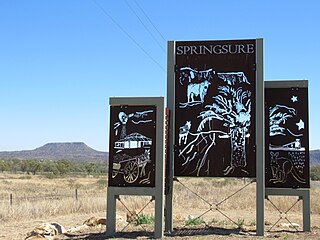
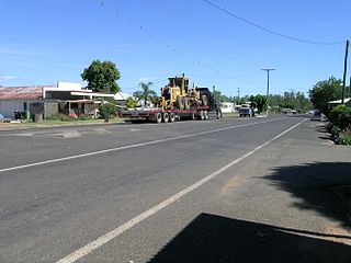
Springsure is a rural town and locality in the Central Highlands Region, Queensland, Australia. In the 2021 census, the locality of Springsure had a population of 950 people.

<span class="mw-page-title-main">Shire of Peak Downs</span> Local government area in Queensland, Australia

The Shire of Peak Downs was a local government area in the Central Highlands of Queensland, Australia, 320 km west of both Rockhampton and Mackay. On 15 March 2008 the shires of Duaringa, Emerald, Bauhinia and Peak Downs were amalgamated to form the Central Highlands Region.

<span class="mw-page-title-main">Shire of Bauhinia</span> Local government area in Queensland, Australia

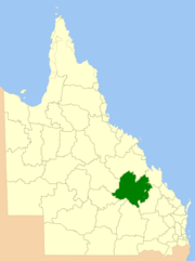
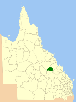
The Shire of Bauhinia was a local government area in Central Queensland, Queensland, Australia. The Shire, administered from the town of Springsure, covered an area of 23,649.6 square kilometres (9,131.2 sq mi), and existed as a local government entity from 1879 until 2008, when it was amalgamated with the Shires of Duaringa, Emerald and Peak Downs to form the Central Highlands Region.

<span class="mw-page-title-main">Barcaldine Region</span> Local government area in Queensland, Australia

The Barcaldine Region is a local government area in Central West Queensland, Australia. Established in 2008, it was preceded by three previous local government areas which had existed for over a century.

<span class="mw-page-title-main">Northern Peninsula Area Region</span> Local government area in Queensland, Australia

The Northern Peninsula Area Region is a local government area in Far North Queensland, Australia, covering areas on the northwestern coast of Cape York Peninsula. It was created in March 2008 out of three Aboriginal Shires and two autonomous Island Councils during a period of statewide local government reform. In June 2018, the area had a population of 3,069.

<span class="mw-page-title-main">Aboriginal Shire of Woorabinda</span> Local government area in Queensland, Australia

The Aboriginal Shire of Woorabinda is a local government area in Central Queensland, Australia.

<span class="mw-page-title-main">Gindie</span> Suburb of Central Highlands Region, Queensland, Australia

Gindie is a rural locality in the Central Highlands Region, Queensland, Australia. In the 2021 census, Gindie had a population of 232 people.

Lochington is a rural locality in the Central Highlands Region, Queensland, Australia. At the 2021 census, Lochington had a population of 128 people.

<span class="mw-page-title-main">Argyll, Queensland</span> Suburb of Central Highlands Region, Queensland, Australia

Argyll is a rural locality in the Central Highlands Region, Queensland, Australia. At the 2021 census, Argyll had a population of 25 people,

<span class="mw-page-title-main">Willows, Queensland</span> Suburb of Central Highlands Region, Queensland, Australia

Willows is a rural locality in the Central Highlands Region, Queensland, Australia. In the 2016 census, Willows had a population of 144 people.

Cona Creek is a locality in the Central Highlands Region, Queensland, Australia. At the 2021 census, Cona Creek had a population of 57 people.

Minerva is a rural locality in the Central Highlands Region, Queensland, Australia. At the 2021 census, Minerva had a population of 55 people.

References

  1. 1 2 3 4 "3218.0 – Regional Population Growth, Australia, 2017-18: Population Estimates by Local Government Area (ASGS 2018), 2017 to 2018". Australian Bureau of Statistics. 27 March 2019. Retrieved 25 October 2019. Estimated resident population, 30 June 2018.
  2. CC BY icon-80x15.png This Wikipedia article incorporates CC-BY-4.0 licensed text from: "Wadja". Queensland Aboriginal and Torres Strait Islander languages map. State Library of Queensland . Retrieved 5 February 2020.
  3. CC BY icon-80x15.png This Wikipedia article incorporates CC-BY-4.0 licensed text from: "Yambina". Queensland Aboriginal and Torres Strait Islander languages map. State Library of Queensland . Retrieved 30 January 2020.
  4. CC BY icon-80x15.png This Wikipedia article incorporates CC-BY-4.0 licensed text from: "Yetimarala". Queensland Aboriginal and Torres Strait Islander languages map. State Library of Queensland . Retrieved 30 January 2020.
  5. "Local Government Reform Bill" (PDF). State of Queensland. 2007. Archived (PDF) from the original on 5 September 2007. Retrieved 9 September 2007.
  6. "Recent place name decisions: Job number 18-115: The Gemfields". Queensland Government. 17 April 2020. Archived from the original on 17 July 2020. Retrieved 17 July 2020.
  7. "Proposed Locality Boundaries and Names: Anakie Siding, Argyll, Emerald, Gindie, Lochington, Minerva, Rubyvale and Sapphire Central" (PDF). Queensland Government. 2019. Archived (PDF) from the original on 17 July 2020. Retrieved 17 July 2020.
  8. "Locality Boundaries and Names: Anakie Siding, Argyll, Emerald, Gindie, Lochington, Minerva, Rubyvale and Sapphire Central" (PDF). Queensland Government. 17 April 2020. Archived (PDF) from the original on 17 July 2020. Retrieved 17 July 2020.
  9. "Queensland Globe". State of Queensland . Retrieved 17 July 2020.
  10. "Locations". Central Highlands Regional Council . Archived from the original on 31 January 2018. Retrieved 31 January 2018.
  11. "2008 Central Highlands Regional Council – Mayoral Election – Election Summary". results.ecq.qld.gov.au. Archived from the original on 29 March 2016. Retrieved 4 December 2017.
  12. "2012 Central Highlands Regional Council – Mayoral Election – Election Summary". results.ecq.qld.gov.au. Archived from the original on 1 April 2018. Retrieved 4 December 2017.
  13. "2016 Central Highlands Regional Council – Mayoral Election – Election Summary". results.ecq.qld.gov.au. Archived from the original on 27 March 2018. Retrieved 4 December 2017.
  14. "2020 Local Government Elections: Saturday, 28 March 2020". Electoral Commission of Queensland. 2020. Retrieved 16 June 2020.[ dead link ]
  15. Offord, Geordi (28 March 2024). "Janice Moriarty declared mayor of Central Highlands Regional Council". The Morning Bulletin. Retrieved 29 March 2024. Central Highlands Regional Council has its first female mayor since it was established in 2008 after Janice Moriarty was officially declared the winner by the Electoral Commission Queensland on Thursday.