Crinum, Queensland

Last updated

Map all coordinates using: OpenStreetMap  
Download coordinates as: KML
Crinum
Queensland
Australia Queensland location map.svg
Red pog.svg
Crinum
Coordinates 23°12′13″S148°16′06″E / 23.2036°S 148.2683°E / -23.2036; 148.2683 (Crinum (centre of locality))
Population86 (2021 census) [1]
 • Density0.1713/km2 (0.4436/sq mi)
Postcode(s) 4723
Area502.1 km2 (193.9 sq mi)
Time zone AEST (UTC+10:00)
Location
LGA(s) Central Highlands Region
State electorate(s) Gregory
Federal division(s) Flynn
Suburbs around Crinum:
Belcong Belcong Lilyvale
Chirnside Crinum Lilyvale
Gordonstone Wyuna Wyuna

Crinum is a rural locality in the Central Highlands Region, Queensland, Australia. [2] At the 2021 census, Crinum had a population of 86 people. [1]

Contents

Geography

The Kestrel coal mine is located in the locality ( 23°15′27″S148°18′02″E / 23.2574°S 148.3006°E / -23.2574; 148.3006 (Kestrel coal mine) ). It produced both thermal and coking coal. The mine has an estimated 50 to 100 megatonnes of coal. [3] It is part of the Kestrel coal reserve which spreads across Crinum and extends into neighbouring Lilyvale, Wyuna and Gordonstone, which has an estimated 100 to 500 megatonnes of coal. [3]

Although there are a number of the mines in the area, the predominant land use is grazing and cropping. [3]

History

Gregory Mine State School opened on 10 July 1978 but closed on 14 December 1979. [4]

Following the dismissal of a group of mine workers from the Gordonstone Coal Mine (later renamed by Rio Tinto to Kestral Coal Mine), the workers maintained a protest line from early October 1997 to August 1999, becoming Australia's longest running black coal labour dispute. In 1998 they erected a monument to the protest (the Lilyvale Stand Monument). [5]

In the 2016 census, Crinum had a population of 86 people. [6]

Heritage listings

Lilyvale Stand Monument, 2009 Lilyvale Stand Monument (2009).jpg
Lilyvale Stand Monument, 2009

Crinum has a number of heritage-listed sites, including:

Education

There are no schools in Crinum. The nearest primary schools are Capella State School in Capella to the north-west and Emerald North State School in Emerald to the south. The nearest secondary schools are Capella State High School in Capella and Emerald State High School in Emerald. [3]

Related Research Articles

The Gemfields Suburb of Central Highlands Region, Queensland, Australia

The Gemfields is a former locality in the Central Highlands Region, Queensland, Australia. In the 2016 census, The Gemfields had a population of 1,449 people.

Rubyvale, Queensland Suburb of Central Highlands Region, Queensland, Australia

Rubyvale is a rural town and locality in the Central Highlands Region, Queensland, Australia. In the 2016 census, the town of Rubyvale had a population of 640 people.

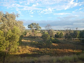
Sapphire Central is a rural locality in the Central Highlands Region, Queensland, Australia. The town of Sapphire is within the locality. Sapphires are mined extensively in the area. At the 2021 census, the locality had a population of 1214 people.

Emerald, Queensland Town in Queensland, Australia

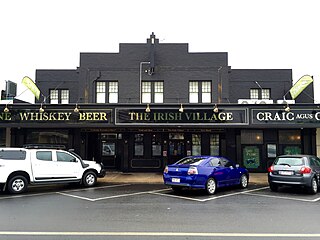
Emerald is a rural town and locality in the Central Highlands Region, Queensland, Australia. The locality had a population of 14,904 people at the 2021 census.

Clermont, Queensland Town in Queensland, Australia

Clermont is a rural town and locality in the Isaac Region, Queensland, Australia. At the 2021 census, the locality of Clermont had a population of 2952 people.

Rolleston, Queensland Town in Queensland, Australia

Rolleston is a rural town and locality in the Central Highlands Region, Queensland, Australia. In the 2016 census, the locality of Rolleston had a population of 309 people.

Springsure Town in Queensland, Australia

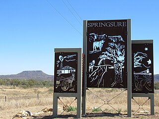
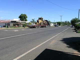
Springsure is a town and a locality in the Central Highlands Region, Queensland, Australia. It is 66 kilometres (41 mi) south of Emerald on the Gregory Highway. It is the southern terminus of the Gregory Highway and the northern terminus of the Dawson Highway. It is 765 kilometres (475 mi) northwest of Brisbane. At the 2021 census, Springsure had a population of 950 people.

Capella, Queensland Town in Queensland, Australia

Capella is a rural town and locality in the Central Highlands Region, Queensland, Australia. At the 2021 census the locality of Capella had a population of 974 people.

Shire of Peak Downs Local government area in Queensland, Australia

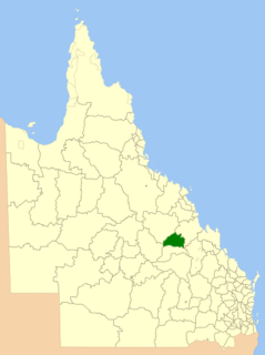
The Shire of Peak Downs was a local government area in the Central Highlands of Queensland, Australia, 320 km west of both Rockhampton and Mackay. On 15 March 2008 the shires of Duaringa, Emerald, Bauhinia and Peak Downs were amalgamated to form the Central Highlands Region.

Tieri Town in Queensland, Australia

Tieri is a small mining town and locality in the Central Highlands Region, Queensland, Australia. Established in 1983, the town like nearby Middlemount and Dysart, is a service centre for local coal mines. In the 2016 census, Tieri had a population of 1,129 people.

Lilyvale may refer to:

Mackenzie River is a locality in the Isaac Region, Queensland, Australia. In the 2016 census, Mackenzie River had a population of 71 people.

Comet, Queensland Town in Queensland, Australia

Comet is a historical rich rural town and locality in the Central Highlands Region, Queensland, Australia. In the 2016 census, the locality of Comet had a population of 498 people.

Kestrel coal mine Mine in Queensland, Australia

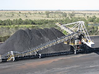
The Kestrel Coal Mine is an underground coal mine located in the Bowen Basin at Crinum, 51 km northeast of Emerald in Central Queensland, Australia. The mine has coal reserves amounting to 158 million tonnes of coking coal, one of the largest coal reserves in Asia and the world. The mine has an annual production capacity of 4 million tonnes of coal. Both hard/semi hard coking coal and thermal coal is mined.

Gindie Suburb of Central Highlands Region, Queensland, Australia

Gindie is a rural locality in the Central Highlands Region, Queensland, Australia. At the 2021 census, Gindie had a population of 232 people.

Lilyvale Stand Monument Historic site in Queensland, Australia

Lilyvale Stand Monument is a heritage-listed memorial at Lilyvale Road, Crinum, Central Highlands Region, Queensland, Australia. It was built in 1998. It was added to the Queensland Heritage Register on 2 April 2004.

Argyll, Queensland Suburb of Central Highlands Region, Queensland, Australia

Argyll is a rural locality in the Central Highlands Region, Queensland, Australia. At the 2021 census, Argyll had a population of 25 people,

Hibernia is a rural locality in the Central Highlands Region, Queensland, Australia. At the 2021 census, Hibernia had a population of 82 people.

Fork Lagoons is a rural locality in the Central Highlands Region, Queensland, Australia. At the 2021 census, Fork Lagoons had a population of 33 people.

Gordonstone is a rural locality in the Central Highlands Region, Queensland, Australia. At the 2021 census, Gordonstone had a population of 32 people.

References

  1. 1 2 "2021 Crinum, Census All persons QuickStats | Australian Bureau of Statistics". www.abs.gov.au. Retrieved 28 June 2022.
  2. "Crinum – locality in Central Highlands Region (entry 46945)". Queensland Place Names. Queensland Government . Retrieved 18 September 2020.
  3. 1 2 3 4 "Queensland Globe". State of Queensland . Retrieved 7 October 2020.
  4. Queensland Family History Society (2010), Queensland schools past and present (Version 1.01 ed.), Queensland Family History Society, ISBN   978-1-921171-26-0
  5. "Lilyvale Stand Monument (entry 602167)". Queensland Heritage Register . Queensland Heritage Council. Retrieved 1 August 2014.
  6. Australian Bureau of Statistics (27 June 2017). "Crinum (SSC)". 2016 Census QuickStats. Retrieved 20 October 2018. OOjs UI icon edit-ltr-progressive.svg
  7. "Lilyvale Stand Monument (entry 602167)". Queensland Heritage Register . Queensland Heritage Council. Retrieved 7 July 2013.

Commons-logo.svg Media related to Crinum, Queensland at Wikimedia Commons