Consuelo, Queensland

Last updated

Consuelo
Queensland
Australia Queensland location map.svg
Red pog.svg
Consuelo
Coordinates 24°42′23″S148°19′33″E / 24.7063°S 148.3258°E / -24.7063; 148.3258 (Consuelo (centre of locality))
Population35 (2021 census) [1]
 • Density0.02092/km2 (0.0542/sq mi)
Postcode(s) 4702
Area1,672.9 km2 (645.9 sq mi)
Time zone AEST (UTC+10:00)
Location
LGA(s) Central Highlands Region
State electorate(s) Gregory
Federal division(s) Flynn
Suburbs around Consuelo:
Wealwandangie Albinia Rolleston
Wealwandangie Consuelo Coorumbene
Carnarvon Park Rewan Arcadia Valley

Consuelo is a rural locality in the Central Highlands Region, Queensland, Australia. [2] In the 2021 census, Consuelo had a population of 35 people. [1]

Contents

Geography

The Carnarvon Highway enters the locality from the north-east (Rolleston) and exits to the south (Rewan). [3]

There are two sections of Mount Pleasant State Forest in the north and north-east of the locality. [4] Apart from these protected areas, the predominant land use is grazing on native vegetation with a small amount of crop growing in the north-east of the locality. [4]

Consuelo has the following mountains, mostly in the west of the locality (from north to south):

with two in the east of the locality (from north to south):

Demographics

In the 2016 census, Consuelo had a population of 35 people. [18]

In the 2021 census, Consuelo had a population of 35 people. [1]

Education

There are no schools in Consuelo. The nearest government primary school is Rolleston State School in neighbouring Rolleston to the north-east; however, students from some parts of Consuelo would be too distant for a daily commute to this school. There are no secondary schools nearby. The alternatives are distance education and boarding school. [19]

Related Research Articles

<span class="mw-page-title-main">Rolleston, Queensland</span> Town in Queensland, Australia

Rolleston is a rural town and locality in the Central Highlands Region, Queensland, Australia. In the 2021 census, the locality of Rolleston had a population of 132 people.

<span class="mw-page-title-main">Springsure</span> Town in Queensland, Australia

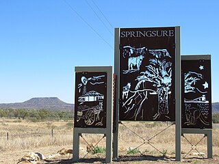
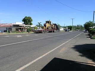
Springsure is a rural town and locality in the Central Highlands Region, Queensland, Australia. In the 2021 census, the locality of Springsure had a population of 950 people.

<span class="mw-page-title-main">Mount Britton, Queensland</span> Suburb of Isaac Region, Queensland, Australia

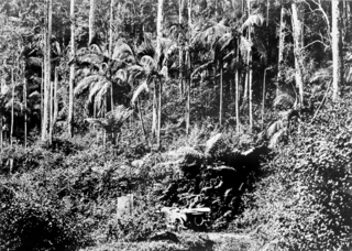
Mount Britton is a rural locality in the Isaac Region, Queensland, Australia. It contains the abandoned gold rush town of Mount Britton in the former Nebo Shire. In the 2021 census, Mount Britton had a population of 4 people.

<span class="mw-page-title-main">Comet, Queensland</span> Town in Queensland, Australia

Comet is a historically-rich rural town and locality in the Central Highlands Region, Queensland, Australia. In the 2021 census, the locality of Comet had a population of 360 people.

Arcadia Valley is a rural locality in the Central Highlands Region, Queensland, Australia. In the 2021 census, Arcadia Valley had a population of 141 people.

<span class="mw-page-title-main">Felton, Queensland</span> Suburb of Toowoomba Region, Queensland, Australia

Felton is a rural locality in the Toowoomba Region, Queensland, Australia. In the 2021 census, Felton had a population of 267 people.

<span class="mw-page-title-main">Cairdbeign, Queensland</span> Suburb of Central Highlands Region, Queensland, Australia

Cairdbeign is a rural locality in the Central Highlands Region, Queensland, Australia. In the 2021 census, Cairdbeign had a population of 70 people.

Yalboroo is a rural town and locality in the Mackay Region, Queensland, Australia. In the 2021 census, the locality of Yalboroo had a population of 146 people.

Upper Warrego is a rural locality in the Shire of Murweh, Queensland, Australia. In the 2021 census, Upper Warrego had a population of 38 people.

<span class="mw-page-title-main">Orion, Queensland</span> Suburb of Central Highlands Region, Queensland, Australia

Orion is a rural locality in the Central Highlands Region, Queensland, Australia. In the 2021 census, Orion had a population of 87 people.

<span class="mw-page-title-main">Palmtree, Queensland</span> Suburb of Toowoomba Region, Queensland, Australia

Palmtree is a rural locality in the Toowoomba Region, Queensland, Australia. In the 2021 census, Palmtree had a population of 80 people.

<span class="mw-page-title-main">Cape Conway, Queensland</span> Suburb of Whitsunday Region, Queensland, Australia

Cape Conway is a coastal locality in the Whitsunday Region, Queensland, Australia. In the 2021 census, Cape Conway had "no people or a very low population".

<span class="mw-page-title-main">Wooroonooran, Queensland</span> Suburb of Cairns Region, Queensland, Australia

Wooroonooran is an undeveloped locality split among the Cairns Region, the Cassowary Coast Region and the Tablelands Region in Queensland, Australia. In the 2021 census, Wooroonooran had "no people or a very low population".

Albinia is a rural locality in the Central Highlands Region, Queensland, Australia. In the 2021 census, Albinia had a population of 165 people.

<span class="mw-page-title-main">Eungella Hinterland, Queensland</span> Suburb of Mackay Region, Queensland, Australia

Eungella Hinterland is a rural locality in the Mackay Region, Queensland, Australia. In the 2021 census, Eungella Hinterland had "no people or a very low population".

Minerva is a rural locality in the Central Highlands Region, Queensland, Australia. In the 2021 census, Minerva had a population of 55 people.

<span class="mw-page-title-main">Rewan, Queensland</span> Suburb of Central Highlands Region, Queensland, Australia

Rewan is a rural locality in the Central Highlands Region, Queensland, Australia. In the 2021 census, Rewan had a population of 49 people.

Hail Creek is a rural locality in the Isaac Region, Queensland, Australia. In the 2021 census, Hail Creek had a population of 179 people.

Mount Moffatt is a rural locality in the Maranoa Region, Queensland, Australia. In the 2021 census, Mount Moffatt had a population of 14 people.

Mount Howe is a rural locality in the Maranoa Region, Queensland, Australia. In the 2021 census, Mount Howe had a population of 20 people.

References

  1. 1 2 3 Australian Bureau of Statistics (28 June 2022). "Consuelo (SAL)". 2021 Census QuickStats. Retrieved 28 February 2023. OOjs UI icon edit-ltr-progressive.svg
  2. "Consuelo – locality in Central Highlands Region (entry 46940)". Queensland Place Names. Queensland Government . Retrieved 25 October 2019.
  3. "Layers: Locality; Road and rail; Railways; Railway stations". Queensland Globe. Queensland Government. Archived from the original on 19 December 2017. Retrieved 23 January 2025.
  4. 1 2 "Layers: Locality; Protected areas and forests; Land use; Sugarcane areas". Queensland Globe. Queensland Government. Archived from the original on 19 December 2017. Retrieved 23 January 2025.
  5. 1 2 3 4 5 6 7 8 9 10 11 12 "Mountain peaks and capes - Queensland". Queensland Open Data. Queensland Government. 12 November 2020. Archived from the original on 25 November 2020. Retrieved 25 November 2020.
  6. "Mount Sugarloaf – mountain in Central Highlands Region (entry 32781)". Queensland Place Names. Queensland Government . Retrieved 25 November 2020.
  7. "Mount Ogg – mountain in Central Highlands Region (entry 25234)". Queensland Place Names. Queensland Government . Retrieved 25 November 2020.
  8. "Mount Lane – mountain in Central Highlands Region (entry 18939)". Queensland Place Names. Queensland Government . Retrieved 25 November 2020.
  9. "Pinnacle Mountain – mountain in Central Highlands Region (entry 26937)". Queensland Place Names. Queensland Government . Retrieved 25 November 2020.
  10. "Pins Head – mountain in Central Highlands Region (entry 26952)". Queensland Place Names. Queensland Government . Retrieved 25 November 2020.
  11. "Mount Styx – mountain in Central Highlands Region (entry 32719)". Queensland Place Names. Queensland Government . Retrieved 25 November 2020.
  12. "Mount Acheron – mountain in Central Highlands Region (entry 74)". Queensland Place Names. Queensland Government . Retrieved 25 November 2020.
  13. "Mount Charon – mountain in Central Highlands Region (entry 6939)". Queensland Place Names. Queensland Government . Retrieved 25 November 2020.
  14. "Mount Cerberus – mountain in Central Highlands Region (entry 6798)". Queensland Place Names. Queensland Government . Retrieved 25 November 2020.
  15. "The Steeple – mountain in Central Highlands Region (entry 34141)". Queensland Place Names. Queensland Government . Retrieved 25 November 2020.
  16. "Mount Panorama – mountain in Central Highlands Region (entry 26014)". Queensland Place Names. Queensland Government . Retrieved 25 November 2020.
  17. "Mount Ceres – mountain in Central Highlands Region (entry 6799)". Queensland Place Names. Queensland Government . Retrieved 25 November 2020.
  18. Australian Bureau of Statistics (27 June 2017). "Consuelo (SSC)". 2016 Census QuickStats. Retrieved 20 October 2018. OOjs UI icon edit-ltr-progressive.svg
  19. "Layers: Locality; Schools and school catchments". Queensland Globe. Queensland Government. Archived from the original on 19 December 2017. Retrieved 23 January 2025.