
The Gemfields is a former locality in the Central Highlands Region, Queensland, Australia. In the 2016 census, The Gemfields had a population of 1,449 people.

Rubyvale is a rural town and locality in the Central Highlands Region, Queensland, Australia. In the 2016 census, the town of Rubyvale had a population of 640 people.
Sapphire Central is a rural locality in the Central Highlands Region, Queensland, Australia. The town of Sapphire is within the locality. Sapphires are mined extensively in the area. At the 2021 census, the locality had a population of 1214 people.
Rolleston is a rural town and locality in the Central Highlands Region, Queensland, Australia. In the 2016 census, the locality of Rolleston had a population of 309 people.

Capella is a rural town and locality in the Central Highlands Region, Queensland, Australia. At the 2021 census the locality of Capella had a population of 974 people.

Tieri is a small mining town and rural locality in the Central Highlands Region, Queensland, Australia. Established in 1983, the town is a service centre for local coal mines, similar to nearby Middlemount and Dysart,
Mackenzie River is a locality in the Isaac Region, Queensland, Australia. In the 2021 census, Mackenzie River had a population of 84 people.
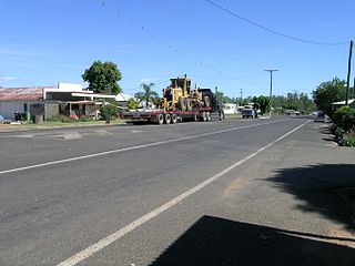
Comet is a historically-rich rural town and locality in the Central Highlands Region, Queensland, Australia. In the 2016 census, the locality of Comet had a population of 498 people.

Ebenezer is a rural locality in the City of Ipswich, Queensland, Australia. In the 2016 census, Ebenezer had a population of 315 people.

Munbilla is a rural town and locality in the Scenic Rim Region, Queensland, Australia. In the 2016 census, the locality of Munbilla had a population of 100 people.
Gindie is a rural locality in the Central Highlands Region, Queensland, Australia. In the 2021 census, Gindie had a population of 232 people.
Billa Billa is a rural locality in the Goondiwindi Region, Queensland, Australia. In the 2021 census, Billa Billa had a population of 111 people.
Crinum is a rural locality in the Central Highlands Region, Queensland, Australia. In the 2021 census, Crinum had a population of 86 people.
Hampden is a rural locality in the Mackay Region, Queensland, Australia. In the 2021 census, Hampden had a population of 598 people.

Willows is a rural locality in the Central Highlands Region, Queensland, Australia. In the 2016 census, Willows had a population of 144 people.

Crediton is a rural locality in the Mackay Region, Queensland, Australia. In the 2021 census, Crediton had a population of 109 people.
Swans Lagoon is a rural locality in the Shire of Burdekin, Queensland, Australia. In the 2021 census, Swans Lagoon had a population of 12 people.
Albinia is a rural locality in the Central Highlands Region, Queensland, Australia. In the 2021 census, Albinia had a population of 165 people.
Hibernia is a rural locality in the Central Highlands Region, Queensland, Australia. In the 2021 census, Hibernia had a population of 82 people.
Fork Lagoons is a rural locality in the Central Highlands Region, Queensland, Australia.
