
The Gemfields is a former locality in the Central Highlands Region, Queensland, Australia. In the 2016 census, The Gemfields had a population of 1,449 people.
Sapphire Central is a rural locality in the Central Highlands Region, Queensland, Australia. The town of Sapphire is within the locality. Sapphires are mined extensively in the area. At the 2021 census, the locality had a population of 1214 people.
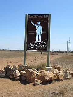
Blackwater is a rural town and locality in the Central Highlands Region, Queensland, Australia. In the 2021 census, Blackwater had a population of 4,702 people.
Emerald is a rural town and locality in the Central Highlands Region, Queensland, Australia. The locality had a population of 14,904 people at the 2021 census.

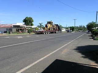
Clermont is a rural town and locality in the Isaac Region, Queensland, Australia. At the 2021 census, the locality of Clermont had a population of 2952 people.

Anakie Siding is a rural locality in the Central Highlands Region, Queensland, Australia. The town of Anakie is within the locality. It is a sapphire mining area.
Rolleston is a rural town and locality in the Central Highlands Region, Queensland, Australia. In the 2016 census, the locality of Rolleston had a population of 309 people.
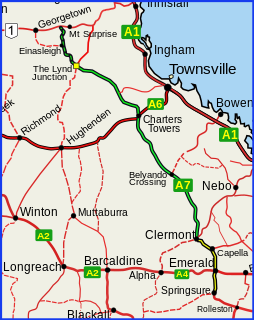
The Gregory Highway is a state highway in Queensland, Australia that serves the major coal-mining centres of Central Queensland. The highway was named after Augustus Gregory, an early explorer.
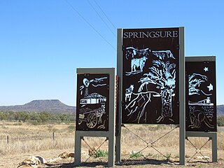
Springsure is a town and a locality in the Central Highlands Region, Queensland, Australia. It is 66 kilometres (41 mi) south of Emerald on the Gregory Highway. It is the southern terminus of the Gregory Highway and the northern terminus of the Dawson Highway. It is 765 kilometres (475 mi) northwest of Brisbane. At the 2021 census, Springsure had a population of 950 people.

Capella is a rural town and locality in the Central Highlands Region, Queensland, Australia. At the 2021 census the locality of Capella had a population of 974 people.

Alpha is a rural town and a locality in the Barcaldine Region, Queensland, Australia. At the 2021 census, the locality had a population of 559 people.

Jericho is a rural town and locality in the Barcaldine Region, Queensland, Australia. At the 2021 census, Jericho had a population of 229 people.

Collinsville is a rural town and locality in the Whitsunday Region, Queensland, Australia. In the 2016 census, Collinsville had a population of 1,248 people.

Calen is a rural town and coastal locality in the Mackay Region, Queensland, Australia. In the 2016 census, the locality of Calen had a population of 390 people.

Howard is a rural town and locality in the Fraser Coast Region, Queensland, Australia. In the 2016 census, Howard had a population of 1,359 people. It is located 284 kilometres (176 mi) north of Brisbane and 37 kilometres (23 mi) west of Hervey Bay.
Comet is a historical rich rural town and locality in the Central Highlands Region, Queensland, Australia. In the 2016 census, the locality of Comet had a population of 498 people.
Elimbah is a rural town and locality in the Moreton Bay Region, Queensland, Australia. In the 2016 census, the locality of Elimbah had a population of 3,963 people.

Torbanlea is a rural town and locality in the Fraser Coast Region, Queensland, Australia. In the 2016 census the locality of Torbanlea had a population of 791 people.
Gindie is a rural locality in the Central Highlands Region, Queensland, Australia. At the 2021 census, Gindie had a population of 232 people.
Gordonstone is a rural locality in the Central Highlands Region, Queensland, Australia. At the 2021 census, Gordonstone had a population of 32 people.
