Goowarra, Queensland

Last updated

Goowarra
Queensland
Goowarra1.jpg
Sign at Goowarra, 2017
Australia Queensland location map.svg
Red pog.svg
Goowarra
Coordinates 23°32′50″S149°29′17″E / 23.5472°S 149.4880°E / -23.5472; 149.4880 (Goowarra (centre of locality))
Population27 (2021 census) [1]
 • Density0.0654/km2 (0.1694/sq mi)
Postcode(s) 4702
Area412.9 km2 (159.4 sq mi)
Time zone AEST (UTC+10:00)
Location
LGA(s) Central Highlands Region
State electorate(s) Gregory
Federal division(s) Flynn
Suburbs around Goowarra:
Mackenzie Balcomba Balcomba
Dingo Goowarra Duaringa
Dingo Wallaroo Wallaroo

Goowarra is a rural locality in the Central Highlands Region, Queensland, Australia. [2] In the 2021 census, Goowarra had a population of 27 people. [1]

Contents

Geography

The Capricorn Highway passes through the locality from the south-east (Wallaroo) to the south-west (Dingo). The Central Western railway line also passes through the locality to the immediate north of the highway, with the locality being served once being served by the now-abandoned Goowarra railway station ( 23°39′35″S149°24′38″E / 23.6598°S 149.4105°E / -23.6598; 149.4105 ). [3] [4]

The predominant land use is grazing on native vegetation. [3]

History

Bridgewater Creek bridge on the Capricorn Highway at Goowarra, 2017 Goowarra2.jpg
Bridgewater Creek bridge on the Capricorn Highway at Goowarra, 2017

Bridgewater Provisional School opened on 1900. In 1901 it was renamed Goowarra Provisional School. On 1 January 1909 it became Goowarra State School. It had a number of temporary closures due to low student numbers before closing permanently in 1924. [5]

Mourindilla Provisional School opened on 1921 but closed circa 1924. [6] Mourindilla is a pastoral property in the north of the locality ( 23°24′23″S149°30′48″E / 23.4065°S 149.5132°E / -23.4065; 149.5132 (Mourindilla pastoral property) ).

Demographics

In the 2016 census, Goowarra had a population of 19 people. [7]

In the 2021 census, Goowarra had a population of 27 people. [1]

Education

There are no schools in Goowarra. The nearest primary school is Dingo State School in neighbouring Dingo to the west. The nearest secondary school is Blackwater State High School in Blackwater to the west. [3]

Related Research Articles

<span class="mw-page-title-main">The Gemfields</span> Suburb of Central Highlands Region, Queensland, Australia

The Gemfields is a former locality in the Central Highlands Region, Queensland, Australia. In the 2016 census, The Gemfields had a population of 1,449 people.

Mackenzie River is a locality in the Isaac Region, Queensland, Australia. In the 2021 census, Mackenzie River had a population of 84 people.

<span class="mw-page-title-main">Dingo, Queensland</span> Town in Queensland, Australia

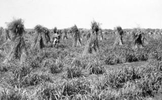
Dingo is a rural town and locality in the Central Highlands Region, Queensland, Australia. In the 2016 census, the locality of Dingo had a population of 340 people.

<span class="mw-page-title-main">Traveston</span> Suburb of Gympie Region, Queensland, Australia

Traveston is a rural town and locality in the Gympie Region, Queensland, Australia. In the 2016 census the locality of Traveston had a population of 480 people.

<span class="mw-page-title-main">Gindie</span> Suburb of Central Highlands Region, Queensland, Australia

Gindie is a rural locality in the Central Highlands Region, Queensland, Australia. In the 2021 census, Gindie had a population of 232 people.

South Talwood is a rural locality in the Goondiwindi Region, Queensland, Australia. It is on the border of Queensland and New South Wales. It is 107 kilometres (66 mi) west of Goondiwindi. In the 2021 census, South Talwood had a population of 101 people.

<span class="mw-page-title-main">Talwood, Queensland</span> Town in Queensland, Australia

Talwood is a town in the rural locality of North Talwood in Goondiwindi Region, Queensland, Australia.

Ilbilbie is a rural town and coastal locality in the Isaac Region, Queensland, Australia. In the 2016 census, the locality of Ilbilbie had a population of 349 people.

Hannaford is a rural locality in the Western Downs Region, Queensland, Australia. In the 2021 census, Hannaford had a population of 135 people.

Wallumbilla North is a rural locality in the Maranoa Region, Queensland, Australia. In the 2016 census, Wallumbilla North had a population of 147 people.

Pickanjinnie is a rural locality in the Maranoa Region, Queensland, Australia. In the 2016 census, Pickanjinnie had a population of 49 people.

Alsace is a rural locality in the Central Highlands Region, Queensland, Australia. In the 2021 census, Alsace had a population of 11 people.

<span class="mw-page-title-main">Boolburra</span> Town in Queensland, Australia

Boolburra is a rural town and locality in the Central Highlands Region, Queensland, Australia. In the 2021 census, the locality of Boolburra had a population of 34 people.

Etna Creek is a rural locality in the Livingstone Shire, Queensland, Australia. In the 2021 census, Etna Creek had a population of 1,029 people.

<span class="mw-page-title-main">Warkon</span> Suburb of Maranoa Region, Queensland, Australia

Warkon is a rural locality in the Maranoa Region, Queensland, Australia. In the 2016 census, Warkon had a population of 33 people.

Irvingdale is a locality split between the Toowoomba Region and the Western Downs Region, both in Queensland, Australia. In the 2021 census, Irvingdale had a population of 163 people.

Yenda is a rural locality in the North Burnett Region, Queensland, Australia. In the 2021 census, Yenda had a population of 16 people.

Rosenthal Heights is a mixed-use locality in the Southern Downs Region, Queensland, Australia. In the 2021 census, Rosenthal Heights had a population of 2,664 people.

Bingegang is a rural locality in the Central Highlands Region, Queensland, Australia. In the 2021 census, Bingegang had a population of 17 people.

<span class="mw-page-title-main">Noorindoo, Queensland</span> Suburb of Maranoa Region, Queensland, Australia

Noorindoo is a rural locality in the Maranoa Region, Queensland, Australia. In the 2021 census, Noorindoo had a population of 71 people.

References

  1. 1 2 3 Australian Bureau of Statistics (28 June 2022). "Goowarra (SAL)". 2021 Census QuickStats. Retrieved 28 February 2023. OOjs UI icon edit-ltr-progressive.svg
  2. "Goowarra – locality in Central Highlands Region (entry 46954)". Queensland Place Names. Queensland Government . Retrieved 18 September 2020.
  3. 1 2 3 "Queensland Globe". State of Queensland . Retrieved 6 October 2020.
  4. "Railway stations and sidings - Queensland". Queensland Open Data. Queensland Government. 27 August 2020. Archived from the original on 5 October 2020. Retrieved 5 October 2020.
  5. Queensland Family History Society (2010), Queensland schools past and present (Version 1.01 ed.), Queensland Family History Society, ISBN   978-1-921171-26-0
  6. Queensland Family History Society (2010), Queensland schools past and present (Version 1.01 ed.), Queensland Family History Society, ISBN   978-1-921171-26-0
  7. Australian Bureau of Statistics (27 June 2017). "Goowarra (SSC)". 2016 Census QuickStats. Retrieved 20 October 2018. OOjs UI icon edit-ltr-progressive.svg