Cairdbeign, Queensland

Last updated

Cairdbeign
Queensland
Australia Queensland location map.svg
Red pog.svg
Cairdbeign
Coordinates 24°17′00″S148°08′23″E / 24.2833°S 148.1397°E / -24.2833; 148.1397 (Cairdbeign (centre of locality)) Coordinates: 24°17′00″S148°08′23″E / 24.2833°S 148.1397°E / -24.2833; 148.1397 (Cairdbeign (centre of locality))
Population85 (2016 census) [1]
 • Density0.2243/km2 (0.581/sq mi)
Postcode(s) 4722
Area379.0 km2 (146.3 sq mi)
Time zone AEST (UTC+10:00)
LGA(s) Central Highlands Region
State electorate(s) Gregory
Federal Division(s) Flynn
Suburbs around Cairdbeign:
Springsure Orion Orion
Cona Creek Cairdbeign Orion
Wealwandangie Wealwandangie Albinia

Cairdbeign is a rural locality in the Central Highlands Region, Queensland, Australia. [2] In the 2016 census, Cairdbeign had a population of 85 people. [1]

Contents

Geography

There are a number of mountains in the locality:

History

In the 2016 census, Cairdbeign had a population of 85 people. [1]

Heritage listings

Old Rainworth Stone Store, 2005 Old Rainworth Stone Store, 2005.jpg
Old Rainworth Stone Store, 2005

Cairdbeign has a number of heritage-listed sites, including:

Related Research Articles

Sapphire Central, Queensland Suburb of Central Highlands Region, Queensland, Australia

Sapphire Central is a rural locality in the Central Highlands Region, Queensland, Australia. The town of Sapphire is within the locality. Sapphires are mined extensively in the area. At the 2016 census, the town of Sapphire had a population of 572 people.

Stanthorpe, Queensland Town in Queensland, Australia

Stanthorpe is a rural town and locality in the Southern Downs Region, Queensland, Australia. In the 2016 census, Stanthorpe had a population of 5,406 people.

Springsure Town in Queensland, Australia

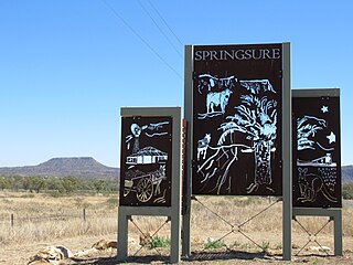
Springsure is a town and a locality in the Central Highlands Region, Queensland, Australia. It is 66 kilometres (41 mi) south of Emerald on the Gregory Highway. It is the southern terminus of the Gregory Highway and the northern terminus of the Dawson Highway. It is 765 kilometres (475 mi) northwest of Brisbane. In the 2016 census, Springsure had a population of 1,103 people.

Mount Coolum, Queensland Suburb of Sunshine Coast, Queensland, Australia

Mount Coolum is a coastal suburb and a mountain within that suburb in the Sunshine Coast Region, Queensland, Australia. In the 2016 census, Mount Coolum had a population of 4,265 people.

Finch Hatton, Queensland Town in Queensland, Australia

Finch Hatton is a town and locality in the Mackay Region, Queensland, Australia. At the 2016 census, Finch Hatton had a population of 232.

Mount Irving, Queensland Suburb of Toowoomba Region, Queensland, Australia

Mount Irving is a rural locality in the Toowoomba Region, Queensland, Australia. In the 2016 census, Mount Irving had a population of 15 people.

Hazeldean, Queensland Suburb of Somerset Region, Queensland, Australia

Hazeldean is a rural locality in the Somerset Region, Queensland, Australia. In the 2016 census, Hazeldean had a population of 262 people.

Mount Jukes, Queensland Suburb of Mackay Region, Queensland, Australia

Mount Jukes is a mountain and surrounding coastal rural locality north of Mackay in the Mackay Region, Queensland, Australia. In the 2016 census, Mount Jukes had a population of 394 people.

Old Rainworth Stone Store

Old Rainworth Stone Store is a heritage-listed storehouse and now museum at Wealwandangie Road, Cairdbeign, 10 kilometres (6.2 mi) south of the town of Springsure, Central Highlands Region, Queensland, Australia. It was built in 1862 by George Goldring. It is also known as Old Rainworth Fort and Rainworth Head Station Store. It was added to the Queensland Heritage Register on 21 October 1992.

Thornton, Queensland Suburb of Lockyer Valley Region, Queensland, Australia

Thornton is a rural locality in the Lockyer Valley Region, Queensland, Australia. In the 2016 census, Thornton had a population of 201 people.

Nandowrie, Queensland Suburb of Central Highlands Region, Queensland, Australia

Nandowrie is a rural locality in the Central Highlands Region, Queensland, Australia. In the 2016 census, Nandowrie had a population of 45 people.

Townson, Queensland Suburb of Lockyer Valley Region, Queensland, Australia

Townson is a rural locality in the Lockyer Valley Region, Queensland, Australia. In the 2016 census, Townson had a population of 38 people.

Mount Rooper, Queensland Suburb of Whitsunday Region, Queensland, Australia

Mount Rooper is a coastal locality in the Whitsunday Region, Queensland, Australia. In the 2016 census, Mount Rooper had no population.

Calcium, Queensland Suburb of City of Townsville, Queensland, Australia

Calcium is a rural locality in the City of Townsville, Queensland, Australia. In the 2016 census, Calcium had a population of 21 people.

Albinia, Queensland Suburb of Central Highlands Region, Queensland, Australia

Albinia is a locality in the Central Highlands Region, Queensland, Australia. In the 2016 census, Albinia had a population of 112 people.

Mount Mackay, Queensland Suburb of Cassowary Coast Region, Queensland, Australia

Mount Mackay is a locality in the Cassowary Coast Region, Queensland, Australia. In the 2016 census, Mount Mackay had a population of 0 people.

Toondahra, Queensland Suburb of North Burnett Region, Queensland, Australia

Toondahra is a rural locality in the North Burnett Region, Queensland, Australia. In the 2016 census, Toondahra had a population of 8 people.

Fork Lagoons, Queensland Suburb of Central Highlands Region, Queensland, Australia

Fork Lagoons is a rural locality in the Central Highlands Region, Queensland, Australia. In the 2016 census, Fork Lagoons had a population of 0 people.

Kunwarara, Queensland Suburb of Livingstone Shire, Queensland, Australia

Kunwarara is a rural locality in the Livingstone Shire, Queensland, Australia. In the 2016 census, Kunwarara had a population of 71 people.

Mount Moffatt, Queensland Suburb of Maranoa Region, Queensland, Australia

Mount Moffatt is a rural locality in the Maranoa Region, Queensland, Australia. In the 2016 census, Mount Moffatt had a population of 0 people.

References

  1. 1 2 3 Australian Bureau of Statistics (27 June 2017). "Cairdbeign (SSC)". 2016 Census QuickStats. Retrieved 20 October 2018. OOjs UI icon edit-ltr-progressive.svg
  2. "Cairdbeign - locality in Central Highlands Region (entry 46923)". Queensland Place Names. Queensland Government . Retrieved 18 September 2020.
  3. "Mount Cassillis - mountain in Central Highlands Regional (entry 6424)". Queensland Place Names. Queensland Government . Retrieved 18 September 2020.
  4. "Mount Sirius - mountain in Central Highlands Regional (entry 30916)". Queensland Place Names. Queensland Government . Retrieved 18 September 2020.
  5. "Rainworth Hill - hill in Central Highlands Regional (entry 27945)". Queensland Place Names. Queensland Government . Retrieved 18 September 2020.
  6. "Old Rainworth Stone Store (entry 600026)". Queensland Heritage Register . Queensland Heritage Council. Retrieved 7 July 2013.

Commons-logo.svg Media related to Cairdbeign, Queensland at Wikimedia Commons