Willows, Queensland

Last updated

Map all coordinates using: OpenStreetMap  
Download coordinates as: KML
Willows
Queensland
Dia 0383.jpg
Train on the Central Western line near Bogantungan, September 1989
Australia Queensland location map.svg
Red pog.svg
Willows
Coordinates 23°34′26″S147°24′58″E / 23.5738°S 147.4161°E / -23.5738; 147.4161 (Willows (centre of locality)) Coordinates: 23°34′26″S147°24′58″E / 23.5738°S 147.4161°E / -23.5738; 147.4161 (Willows (centre of locality))
Population144 (2016 census) [1]
 • Density0.1190/km2 (0.3083/sq mi)
Postcode(s) 4702
Area1,209.8 km2 (467.1 sq mi)
Time zone AEST (UTC+10:00)
Location
LGA(s) Central Highlands Region
State electorate(s) Gregory
Federal division(s)
Suburbs around Willows:
Peak Vale Argyll Rubyvale
Alpha Willows Anakie Siding
Alpha Lochington Lochington

Willows is a rural locality in the Central Highlands Region, Queensland, Australia. [2] In the 2016 census, Willows had a population of 144 people. [1]

Contents

Geography

The town of Bogantungan is within the west of the locality ( 23°39′S147°17′E / 23.65°S 147.29°E / -23.65; 147.29 (Bogantungan, Queensland) ). [3]

The town of Willows Gemfields is the centre of the locality ( 23°44′S147°32′E / 23.74°S 147.54°E / -23.74; 147.54 (Willows Gemfields) ). [4]

The town of Withersfield is within the east of locality ( 23°34′44″S147°33′44″E / 23.5789°S 147.5622°E / -23.5789; 147.5622 (Withersfield, Queensland) ). [5]

The Central Western railway enters the locality from the east (Anakie Siding/Lochington), passes through the town of Bogantungan, and exits to the west (Alpha). The locality is served by the following stations (from west to east):

History

In October 1880, 105 town lots were offered for sale in the Town of Withersfield. [7]

Bogantungan State School opened on 19 March 1883. It closed on 11 August 1972. [8] It was on Jackson Street ( 23°39′00″S147°17′15″E / 23.6501°S 147.2875°E / -23.6501; 147.2875 (Bogantungan State School (former)) ). [9] [10]

Withersfield Provisional School opened circa 1886 but closed the same year. A new Withersfield State School opened in 1920. On Saturday 9 December 1922, the school burned down after a school picnic and dance evening the previous day. [11] [12] The school closed circa 1942. [8] It was located north of the town of Withersfield on a 5-acre-2-rood-11-perch (2.25 ha) site at approx 23°34′33″S147°33′51″E / 23.5757°S 147.5643°E / -23.5757; 147.5643 (Withersfield State School (former)) . [13] [14] Nothing remains of the town today. [5] [15]

In the 2016 census, Willows had a population of 144 people. [1]

Education

There are no schools in Willows. The nearest government primary schools are Anakie State School in neighbouring Anakie Siding to the east, Lochington State School in neighbouring Lochington to the south, and Alpha State School in neighbouring Alpha to the west. [10] The nearest government secondary schools are Alpha State School (to Year 10) and Emerald State High School (to Year 12) in Emerald to the east. However, these secondary schools may be too distant for daily commuting with distance education and boarding schools as other options. [10]

Related Research Articles

<span class="mw-page-title-main">The Gemfields</span> Suburb of Central Highlands Region, Queensland, Australia

The Gemfields is a former locality in the Central Highlands Region, Queensland, Australia. In the 2016 census, The Gemfields had a population of 1,449 people.

<span class="mw-page-title-main">Rubyvale, Queensland</span> Suburb of Central Highlands Region, Queensland, Australia

Rubyvale is a rural town and locality in the Central Highlands Region, Queensland, Australia. In the 2016 census, the town of Rubyvale had a population of 640 people.

Willows Gemfields is a rural town in the locality of Willows in the Central Highlands Region, Queensland, Australia. In the 2016 census, Willows Gemfields had a population of 114 people.

Sapphire Central is a rural locality in the Central Highlands Region, Queensland, Australia. The town of Sapphire is within the locality. Sapphires are mined extensively in the area. At the 2021 census, the locality had a population of 1214 people.

<span class="mw-page-title-main">Emerald, Queensland</span> Town in Queensland, Australia

Emerald is a rural town and locality in the Central Highlands Region, Queensland, Australia. In the 2021 census, the locality of Emerald had a population of 14,906 people.

<span class="mw-page-title-main">Bogantungan</span> Town in Queensland, Australia

Bogantungan is a rural town in the locality of Willows in the Central Highlands Region, Queensland, Australia.

<span class="mw-page-title-main">Ayr, Queensland</span> Town in Queensland, Australia

Ayr is a rural town and locality in the Shire of Burdekin, Queensland, Australia. It is the centre of a sugarcane-growing region and the administrative centre for the Burdekin Shire Council. In the 2016 census, the locality of Ayr had a population of 8,738 people.

<span class="mw-page-title-main">Anakie Siding, Queensland</span> Small town in central Queensland, Australia

Anakie Siding is a rural locality in the Central Highlands Region, Queensland, Australia. The town of Anakie is within the locality. It is a sapphire mining area. In 2021 census, the locality of Anakie Siding had a population of 155 people.

<span class="mw-page-title-main">Jericho, Queensland</span> Town in Queensland, Australia

Jericho is a rural town and locality in the Barcaldine Region, Queensland, Australia. In the 2021 census, the locality of Jericho had a population of 229 people.

<span class="mw-page-title-main">Central Highlands Region</span> Local government area in Queensland, Australia

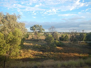
Central Highlands Region is a local government area in Queensland, Australia.

<span class="mw-page-title-main">Comet, Queensland</span> Town in Queensland, Australia

Comet is a historical rich rural town and locality in the Central Highlands Region, Queensland, Australia. In the 2016 census, the locality of Comet had a population of 498 people.

<span class="mw-page-title-main">Dingo, Queensland</span> Town in Queensland, Australia

Dingo is a rural town and locality in the Central Highlands Region, Queensland, Australia. In the 2016 census, the locality of Dingo had a population of 340 people.

<span class="mw-page-title-main">Gindie</span> Suburb of Central Highlands Region, Queensland, Australia

Gindie is a rural locality in the Central Highlands Region, Queensland, Australia. In the 2021 census, Gindie had a population of 232 people.

Lochington is a rural locality in the Central Highlands Region, Queensland, Australia. At the 2021 census, Lochington had a population of 128 people.

<span class="mw-page-title-main">The Summit, Queensland</span> Town in Queensland, Australia

The Summit is a rural town and locality in the Southern Downs Region, Queensland, Australia. In the 2016 census, the locality of The Summit had a population of 409 people.

<span class="mw-page-title-main">Argyll, Queensland</span> Suburb of Central Highlands Region, Queensland, Australia

Argyll is a rural locality in the Central Highlands Region, Queensland, Australia. At the 2021 census, Argyll had a population of 25 people,

Port Wine is a former rural locality in the Barcaldine Region, Queensland, Australia. In the 2016 census, Port Wine had a population of 27 people.

Sedgeford is a former rural locality in the Barcaldine Region, Queensland, Australia. In the 2016 census, Sedgeford had a population of 0 people.

Minerva is a rural locality in the Central Highlands Region, Queensland, Australia. At the 2021 census, Minerva had a population of 55 people.

Fork Lagoons is a rural locality in the Central Highlands Region, Queensland, Australia. At the 2021 census, Fork Lagoons had a population of 33 people.

References

  1. 1 2 3 Australian Bureau of Statistics (27 June 2017). "Willows (SSC)". 2016 Census QuickStats. Retrieved 20 October 2018. OOjs UI icon edit-ltr-progressive.svg
  2. "Willows – locality in Central Highlands Region (entry 46984)". Queensland Place Names. Queensland Government . Retrieved 25 October 2019.
  3. "Bogantungan – town (entry 3430)". Queensland Place Names. Queensland Government . Retrieved 24 June 2017.
  4. "Willlows Gemfields – population centre in the Central Highlands (entry 37569)". Queensland Place Names. Queensland Government . Retrieved 26 October 2019.
  5. 1 2 "Withersfield – population centre in the Central Highlands Region (entry 37777)". Queensland Place Names. Queensland Government . Retrieved 2 March 2023.
  6. 1 2 3 4 "Railway stations and sidings - Queensland". Queensland Open Data. Queensland Government. 2 October 2020. Archived from the original on 5 October 2020. Retrieved 5 October 2020.
  7. "Advertising". Morning Bulletin . Vol. XXVI, no. 3940. Queensland, Australia. 19 October 1880. p. 3. Retrieved 3 March 2023 via National Library of Australia.
  8. 1 2 Queensland Family History Society (2010), Queensland schools past and present (Version 1.01 ed.), Queensland Family History Society, ISBN   978-1-921171-26-0
  9. "Town of Bogantungan" (Map). Queensland Government. 1971. Archived from the original on 14 January 2020. Retrieved 22 July 2022.
  10. 1 2 3 "Queensland Globe". State of Queensland . Retrieved 22 July 2022.
  11. "STATE SCHOOL DESTROYED". The Brisbane Courier . No. 20, 249. Queensland, Australia. 14 December 1922. p. 11. Archived from the original on 22 July 2022. Retrieved 22 July 2022 via National Library of Australia.
  12. "SCHOOL DESTROYED BY FIRE". Daily Standard . No. 3103. Queensland, Australia. 14 December 1922. p. 4 (SECOND EDITION). Archived from the original on 22 July 2022. Retrieved 22 July 2022 via National Library of Australia.
  13. "Anakie" (Map). Queensland Government. 1953. Retrieved 3 March 2023.
  14. "EDUCATION DEPARTMENT ANNOUNCEMENTS". The Brisbane Courier . No. 20, 220. Queensland, Australia. 10 November 1922. p. 4. Retrieved 3 March 2023 via National Library of Australia.
  15. Google (3 March 2023). "Withersfield" (Map). Google Maps . Google. Retrieved 3 March 2023.