Peak Vale, Queensland

Last updated

Peak Vale
Queensland
Australia Queensland location map.svg
Red pog.svg
Peak Vale
Coordinates 23°06′21″S147°08′53″E / 23.1058°S 147.1480°E / -23.1058; 147.1480 (Peak Vale (centre of locality))
Population39 (2016 census) [1]
 • Density0.0477/km2 (0.1237/sq mi)
Postcode(s) 4721
Area816.8 km2 (315.4 sq mi) [2]
Time zone AEST (UTC+10:00)
LGA(s)
State electorate(s)
Federal division(s)
Suburbs around Peak Vale:
Clermont Clermont Theresa Creek
Quetta Peak Vale Argyll
Alpha Willows Willows

Peak Vale is a rural locality split between the Isaac Region and the Central Highlands Region, Queensland, Australia. [3] [4] In the 2016 census, Peak Vale had a population of 39 people, but its boundaries were altered subsequently and its population was not separately reported in the 2021 census.

Contents

Geography

The locality is bounded to the west by the Drummond Range. [2]

There are a number of named peaks in the locality (from north to south):

The Carbine State Forest is in the north of the locality. Apart from that protected area, the land use is predominantly grazing on native vegetation in most of the locality, but in the southern more mountainous part of the locality, there is no active land use. [2]

History

On 17 May 2019, it was decided to discontinue the locality of Mistake Creek and absorb its land into the neighbouring localities of Clermont, Laglan, Frankfield and Peak Vale and to extend Peak Vale into the Central Highlands Region by altering the boundaries of Argyll. [9] [10] [11] [2]

Demographics

In the 2016 census, Peak Vale had a population of 39 people. [1]

In the 2021 census, the population of Peak Vale was not separately reported, but included within the reporting of the population of neighbouring Clermont and Alpha. [12] [13]

Education

There are no schools in Peak Vale. Students living in the north of Peak Vale would be able to attend Clermont State School and Clermont State High School in neighbouring Clermont to the north. However, those schools would be too distant for a daily commute for students living in the southern parts of the locality. The other options are distance education and boarding school. [14]

Related Research Articles

<span class="mw-page-title-main">The Gemfields</span> Suburb of Central Highlands Region, Queensland, Australia

The Gemfields is a former locality in the Central Highlands Region, Queensland, Australia. In the 2016 census, The Gemfields had a population of 1,449 people.

<span class="mw-page-title-main">Rubyvale, Queensland</span> Suburb of Central Highlands Region, Queensland, Australia

Rubyvale is a rural town and locality in the Central Highlands Region, Queensland, Australia. In the 2016 census, the town of Rubyvale had a population of 640 people.

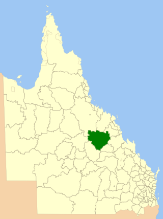
Sapphire Central is a rural locality in the Central Highlands Region, Queensland, Australia. The town of Sapphire is within the locality. Sapphires are mined extensively in the area. At the 2021 census, the locality had a population of 1214 people.

<span class="mw-page-title-main">Central Queensland</span> Region in Queensland, Australia

Central Queensland is an imprecisely-defined geographical division of Queensland that centres on the eastern coast, around the Tropic of Capricorn. Its major regional centre is Rockhampton. The region extends from the Capricorn Coast west to the Central Highlands at Emerald, north to the Mackay Regional Council southern boundary, and south to Gladstone. The region is also known as Capricornia. It is one of Australia's main coal exporting regions.

<span class="mw-page-title-main">Clermont, Queensland</span> Town in Queensland, Australia

Clermont is a rural town and locality in the Isaac Region, Queensland, Australia. At the 2021 census, the locality of Clermont had a population of 2952 people.

<span class="mw-page-title-main">Shire of Belyando</span> Local government area in Queensland, Australia

The Shire of Belyando was a local government area in Central Queensland, Australia. The Shire, administered from the town of Clermont, covered an area of 30,281.3 square kilometres (11,691.7 sq mi), and existed as a local government entity from 1879 until 2008, when it was amalgamated with the Shires of Broadsound and Nebo to form the Isaac Region.

<span class="mw-page-title-main">Central Highlands Region</span> Local government area in Queensland, Australia

Central Highlands Region is a local government area in Queensland, Australia.

Mount Rascal is a rural locality in the Toowoomba Region, Queensland, Australia. In the 2021 census, Mount Rascal had a population of 393 people.

Lochington is a rural locality in the Central Highlands Region, Queensland, Australia. At the 2021 census, Lochington had a population of 128 people.

Mistake Creek is a former rural locality in Isaac Region, Queensland, Australia. In the 2016 census, Mistake Creek had a population of 38 people.

<span class="mw-page-title-main">Argyll, Queensland</span> Suburb of Central Highlands Region, Queensland, Australia

Argyll is a rural locality in the Central Highlands Region, Queensland, Australia. At the 2021 census, Argyll had a population of 25 people,

Albinia is a locality in the Central Highlands Region, Queensland, Australia. In the 2016 census, Albinia had a population of 112 people.

Quetta is a rural locality in the Isaac Region, Queensland, Australia.

Minerva is a rural locality in the Central Highlands Region, Queensland, Australia. At the 2021 census, Minerva had a population of 55 people.

Mantuan Downs is a rural locality in the Central Highlands Region, Queensland, Australia. In the 2016 census Mantuan Downs had a population of 31 people.

Cheeseborough is a rural locality in the Central Highlands Region, Queensland, Australia.

Frankfield is a rural locality in the Isaac Region, Queensland, Australia. In the 2021 census, Frankfield had a population of 100 people.

Laglan is a rural locality in the Isaac Region, Queensland, Australia. In the 2016 census Laglan had a population of 3 people, but its boundaries have subsequently changed.

<span class="mw-page-title-main">Gemini Mountains, Queensland</span> Suburb of Isaac Region, Queensland, Australia

Gemini Mountains is a rural locality in the Isaac Region, Queensland, Australia. At the 2021 census, Gemini Mountains had a population of 65 people.

<span class="mw-page-title-main">Forestvale, Queensland</span> Suburb of Maranoa Region, Queensland, Australia

Forestvale is a rural locality in the Maranoa Region, Queensland, Australia. In the 2021 census, Forestvale had a population of 47 people.

References

  1. 1 2 Australian Bureau of Statistics (27 June 2017). "Peak Vale (SSC)". 2016 Census QuickStats. Retrieved 20 October 2018. OOjs UI icon edit-ltr-progressive.svg
  2. 1 2 3 4 "Queensland Globe". State of Queensland . Retrieved 27 December 2023.
  3. "Peak Vale – locality in Isaac Region (entry 50386)". Queensland Place Names. Queensland Government . Retrieved 27 October 2019.
  4. "Peak Vale – locality in the Central Highland Region (entry 50389)". Queensland Place Names. Queensland Government . Retrieved 27 October 2019.
  5. 1 2 3 "Mountain peaks and capes - Queensland". Queensland Open Data. Queensland Government. 12 November 2020. Archived from the original on 25 November 2020. Retrieved 25 November 2020.
  6. "Chinaman Peak – mountain in Central Highlands Region (entry 7121)". Queensland Place Names. Queensland Government . Retrieved 25 November 2020.
  7. "Mount Zig Zag – mountain in Central Highlands Region (entry 38847)". Queensland Place Names. Queensland Government . Retrieved 25 November 2020.
  8. "Mount Tabletop – mountain in Central Highlands Region (entry 33097)". Queensland Place Names. Queensland Government . Retrieved 25 November 2020.
  9. "Recent place name decisions". Queensland Government . 14 June 2019. Archived from the original on 7 July 2019. Retrieved 27 October 2019.{{cite web}}: CS1 maint: unfit URL (link)
  10. "Proposed Locality Boundaries and Names of Isaac Regional Council: Clermont, Laglan, Frankfield and Peak Vale, Central Highlands Regional Council: Argyll and Peak Vale" (PDF). Department of Natural Resources, Mines and Energy. Queensland Government. 23 November 2018. Archived (PDF) from the original on 27 October 2019. Retrieved 27 October 2019.
  11. "Locality Boundaries and Names of Isaac Regional Council: Clermont, Laglan, Frankfield and Peak Vale, Central Highlands Regional Council: Argyll and Peak Vale" (PDF). Department of Natural Resources, Mines and Energy. Queensland Government. 17 May 2019. Archived from the original (PDF) on 28 July 2019. Retrieved 27 October 2019.
  12. Australian Bureau of Statistics (28 June 2022). "Clermont (SAL)". 2021 Census QuickStats. Retrieved 26 December 2023. OOjs UI icon edit-ltr-progressive.svg
  13. Australian Bureau of Statistics (28 June 2022). "Alpha (SAL)". 2021 Census QuickStats. Retrieved 26 December 2023. OOjs UI icon edit-ltr-progressive.svg
  14. "Layers: Locality; Schools and school catchments". Queensland Globe. Queensland Government . Retrieved 27 December 2023.